
-
 470 Hits
-
 0% Score
-
 0 Votes
|
|
Route |
|---|---|
|
|
49.69289°N / 19.01590°E |
|
|
Download GPX » View Route on Map |
|
|
Hiking |
|
|
Fall |
|
|
Half a day |
|
|
Low |
|
|
Overview
Skrzyczne mountain reaches 1257 metres and it's the highest peak of Silesian Beskids in southern Poland. It's beautiful out there :)
Near its peak, there's a mountain hut where you can order a hot meal, beverages and spend a night. It tends to be crowded, so when it's sunny, be ready for long queues.
Hiking trails leading to Skrzyczne are easy, no previous experience is needed.
Getting There
Trail's head is at Lipowa Ostre village (near Szczyrk or Żywiec towns). The easiest way to get there is by car or hitchhike. There's a parking lot near the trailhead.
Route Description
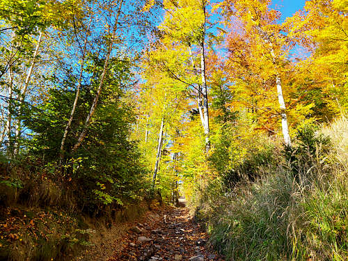
There are multiple options to get to Skrzyczne. I hiked all of them but chose to describe the most picturesque trail - the yellow trail starting at Lipowa Ostre Malinowska Skała. At first, you'll hike on an asphalt road in the forest but it quickly turns into a dirt trail.
Ascent is easy, just about 800 metres. The trail is technically easy to hike, wide and safe, with no exposure whatsoever.
On your way, you'll pass one of the most beautiful places in Silesian Beskids - Malinowska Skała (1152 m).
Essential Gear
Hiking boots.
External Links
https://weekendowka.pl/skrzyczne-szlaki-trasa/