gimpilator's Snowfield Peak Group Video
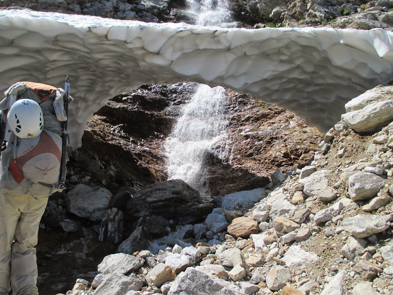
Day 1: Getting to Neve Col
I know it's a season late to post it but now I can truly say this was the best trip I have been on this year.
Fletcher and gimpilator already have a
wonderful trip report on
nwhikers.net but I thought I should put one up here. All photography is by my partners. Inspired by
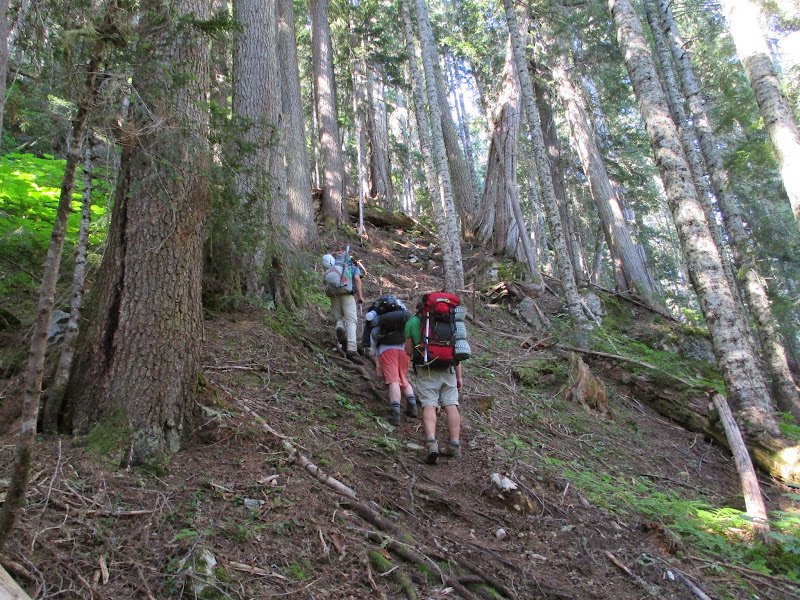
Steph Abegg's 2012 trip with her sister, gimpilator began collaborating with Fletcher, me and my brother Josh about peakbagging around Snowfield Peak in August. We left Lynnwood well before sunrise and, after stopping by Marblemount for permits, arrived at Colonial Creek campground at about 6:40 am. Oops! Then we realized we passed the trail head and back tracked down the road to the gravel turn off with a small sign by a waterfall marking the Pyramid Lake Trail. Before leaving we each weighed each others' packs to see who's was heaviest and I am both proud and ashamed to claim victory. The first couple miles up to the lake went by in an energetic blur, not that we were moving fast but excitement for what was to come made the sweat fest go by quickly. Josh had many things to say about his Peru trip that filled the air up to Pyramid Lake.
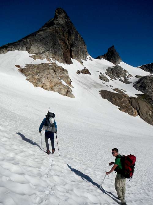
 Pyramid Lake Pyramid Lake |  Pyramid Peak Pyramid Peak |  Steep trail Steep trail |
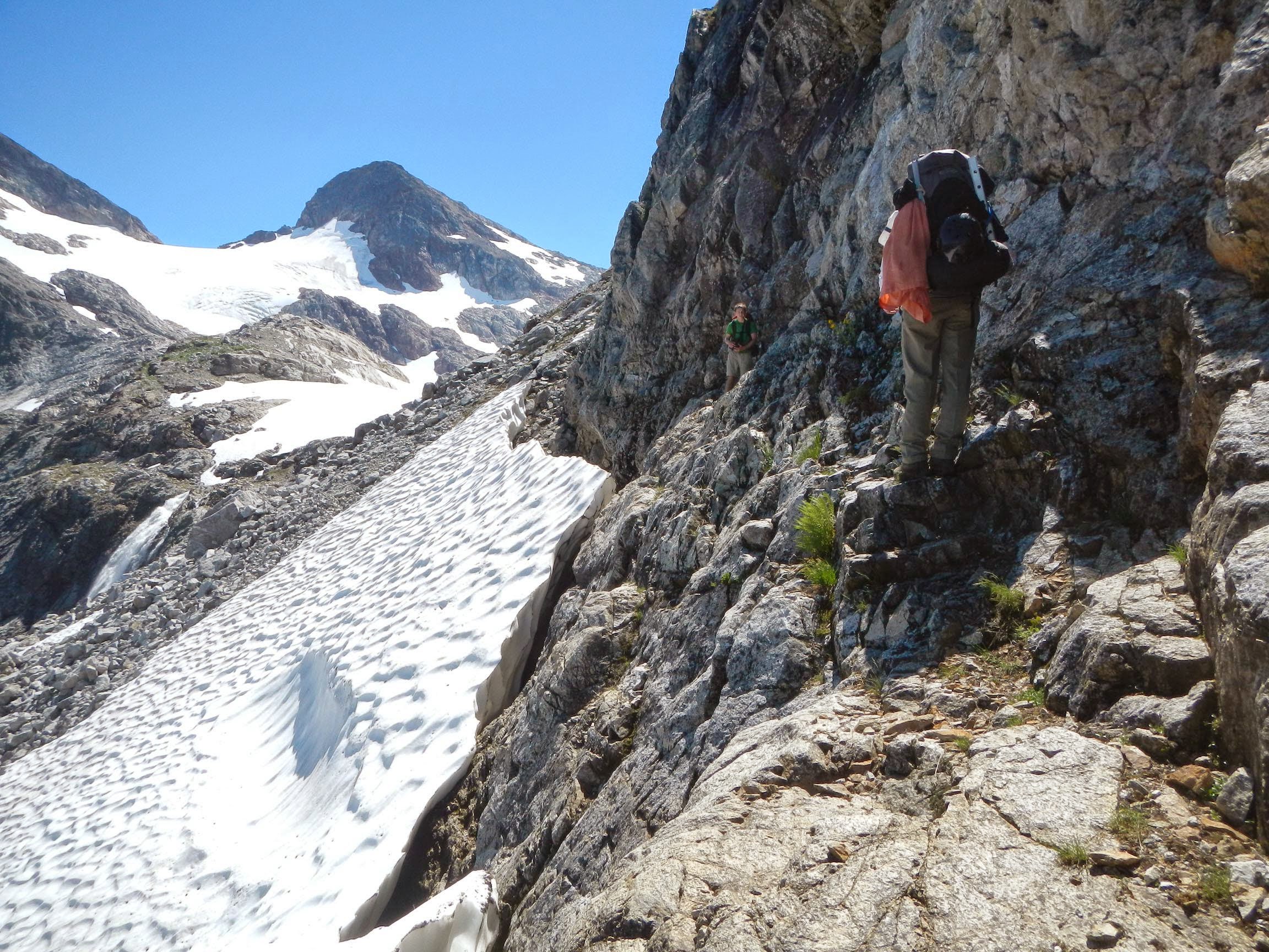
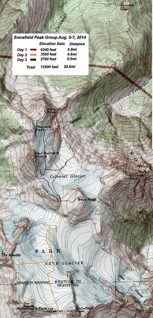
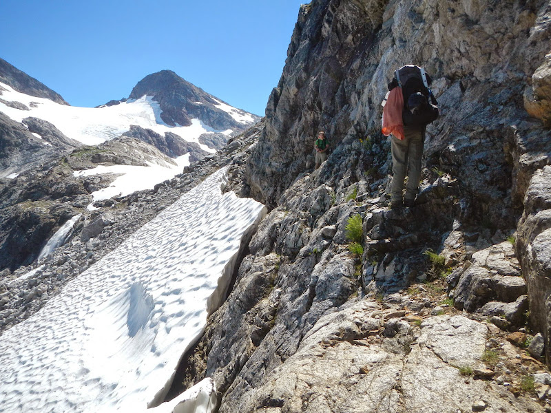
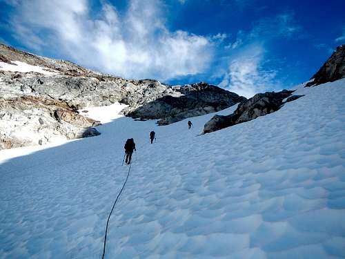
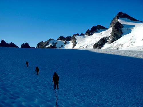
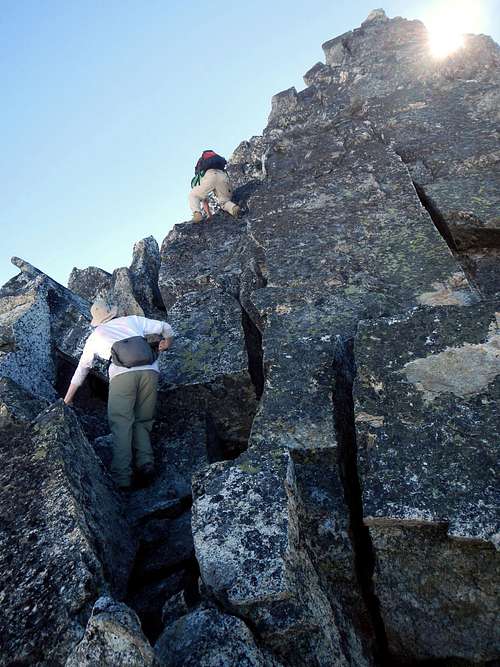
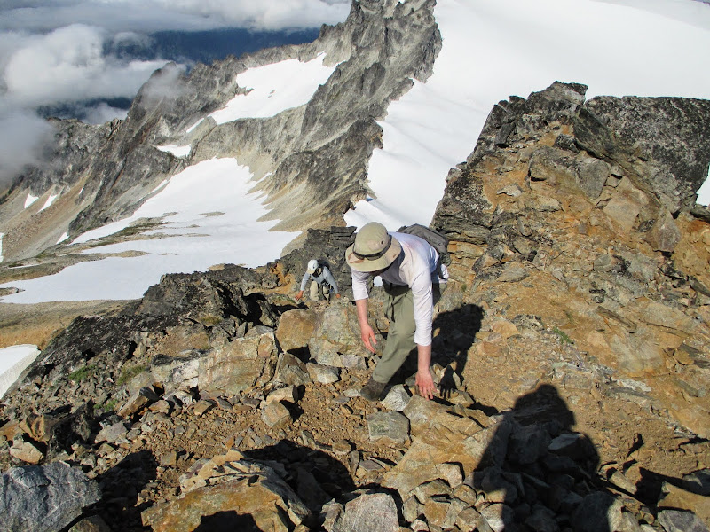
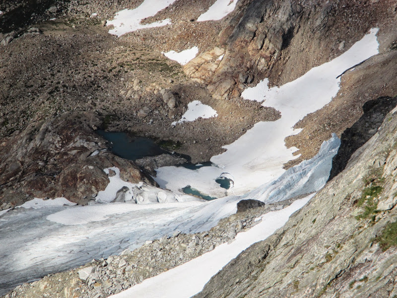
![Snowfield Group Tour Route]() Snowfield Group Tour Route Snowfield Group Tour Route | On the Northern shore of the lake we lost the trail and improvised for a few hundred feet until we found it again. I was struggling with my load and noticed the fitness gap between myself and my partners. Josh got way ahead, exuberantly recalling his Alpamayo adventure with a gleeful and blasting voice while I sucked wind making the disparity obnoxious. Ignoring it I managed to find some peace and keep pace. Near tree line the ridge eased up by a repeater remnant on a large rock where we could see Colonial Peak, Ruby and Stetattle Ridge. On the other side of some tarns was a small scree pile with cages left by a group researching the pika population which seemed pretty cool. From there were brief 20-30' sections of class 3 on the trail. I was a little off-put doing veggie belays with a heavy pack. The trail traversed the ridge at about 5,000' and our group split: me and gimpilator with Josh and Fletcher ahead. The heat began to pick up and slowed us down a little. We took a few small water breaks then caught up for lunch on a rock with a great view of our route.
After getting going again I fell behind but wasn't too worried since I knew we'd meet at the glacier above. I followed the rocky ridge West until I was at the base of Pyramid Peak's cliffs. Way down below, the trail left the ridge on the South and I could see them coming back up a snow/scree field that joined the route I was taking to the terminus of the Colonial Glacier. Josh had ran back up to the ridge and I waved at him. He started heading down so I assume he saw me. I traversed some loose talus below Pyramid to more solid rock and sat down to dry my socks. I was so glad not to have regained all that elevation from the drop they took and don't quite get why the trail goes that way. Erosion factors?
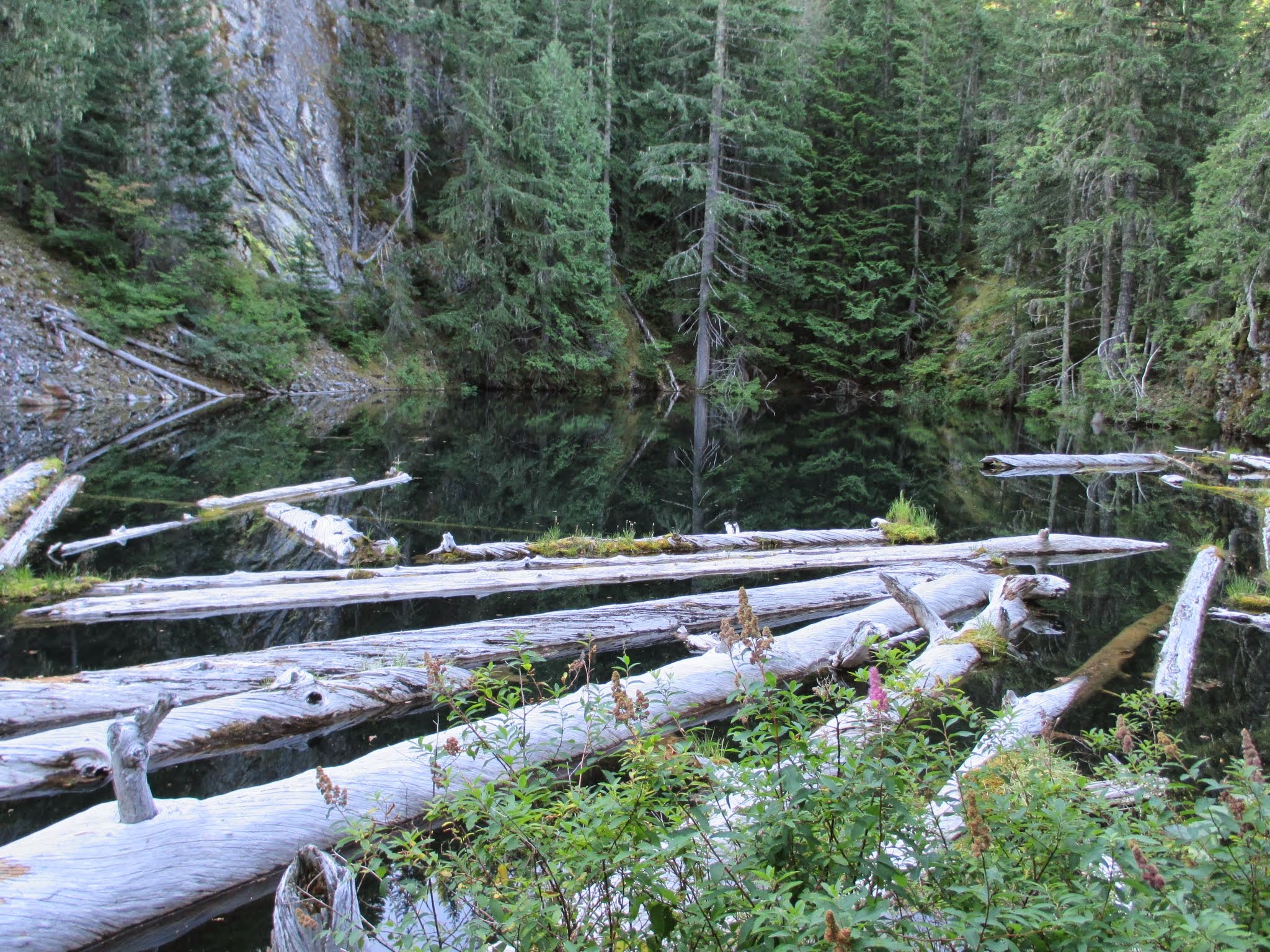
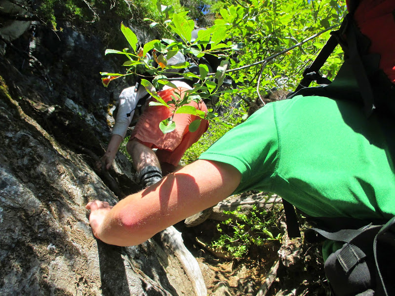
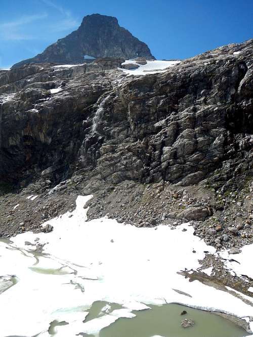
Reunited a few minutes later we walked through a snow cave and traversed some crumbly class 3 ledges where the snow had pulled away from Pyramid Peak's cliffs. Josh dropped his camera lens and crawled down into the crack to grab it which had me impressed. We made steady progress towards the Colonial Glacier and all arrived within a few minutes of each other at its new lake-like terminus. Some years you can walk across it but today was not going to work. Many waterfalls shot over cliffs from Paul Bunyan's Stump and Pinnacle peaks above.
|  Brushy class 3 on the trail Brushy class 3 on the trail
 Colonial from the ridge Colonial from the ridge
 Pika Cages Pika Cages |
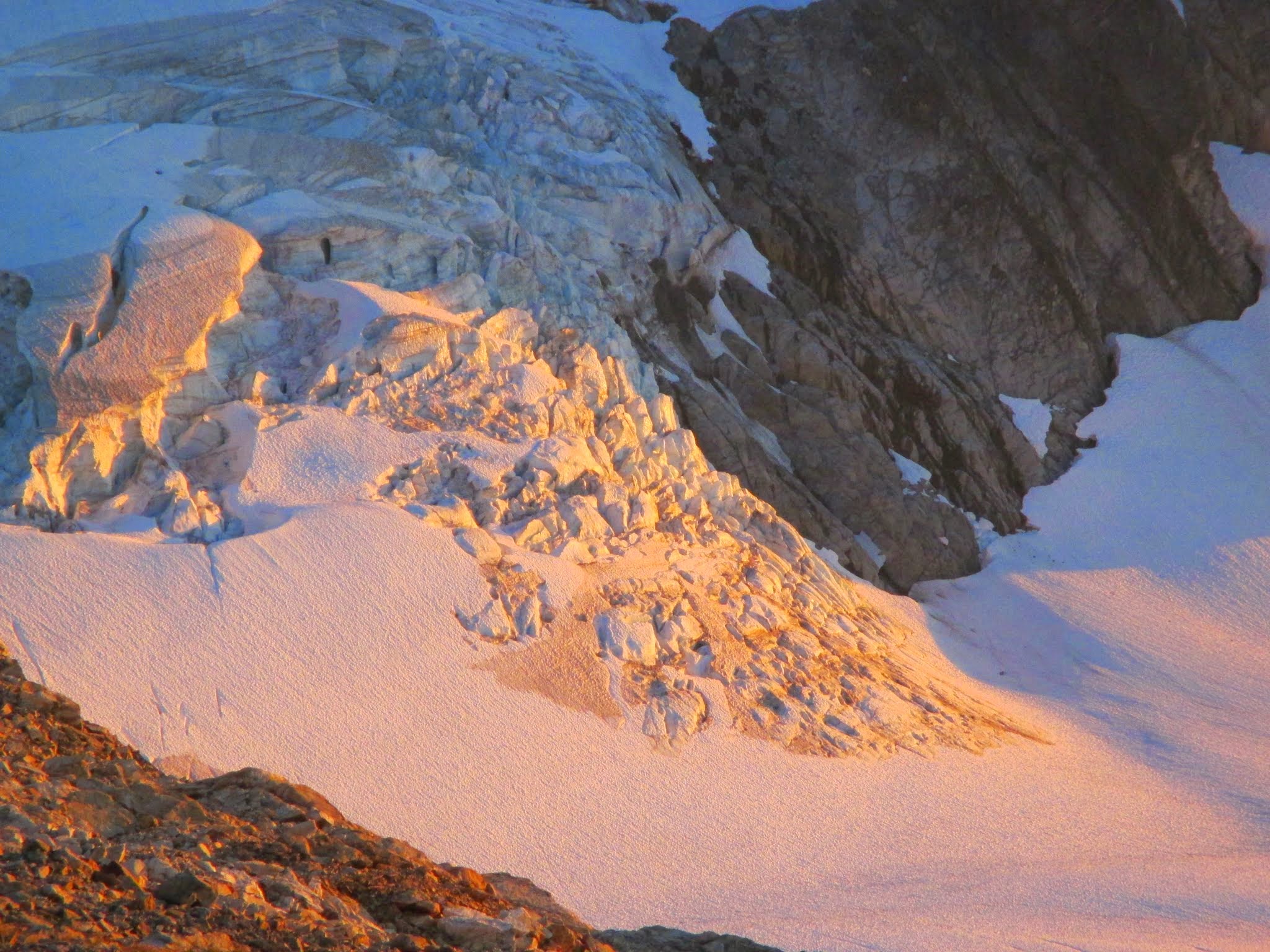
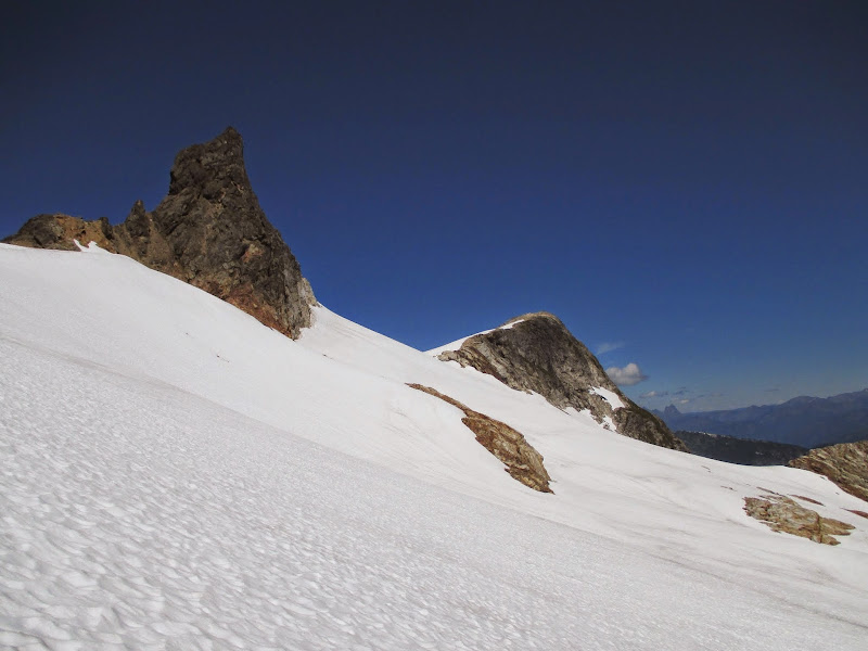
|  Above the Moat c. gimpilator Above the Moat c. gimpilator | ![Neve Peak]() Neve Peak Neve Peak |
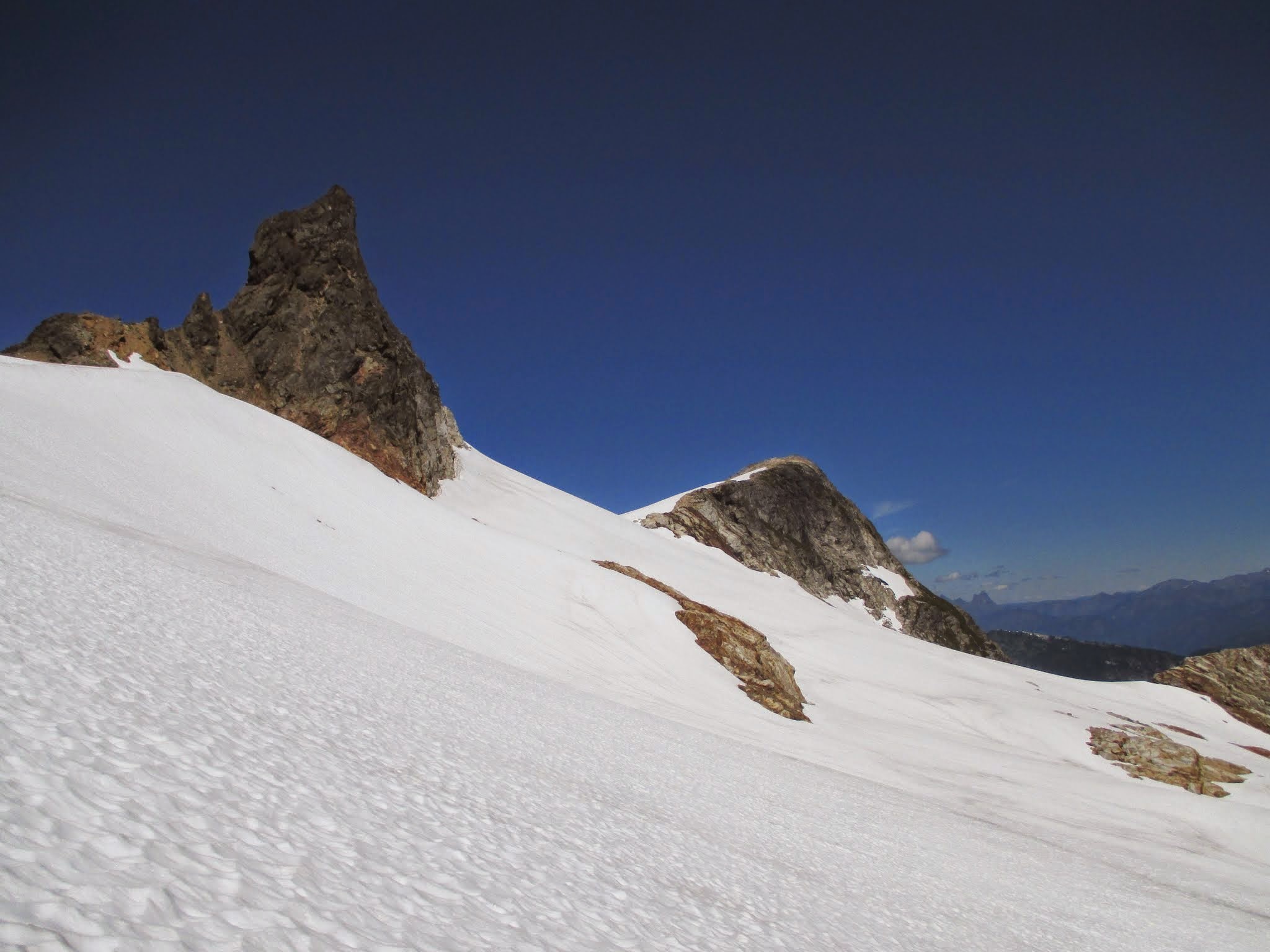
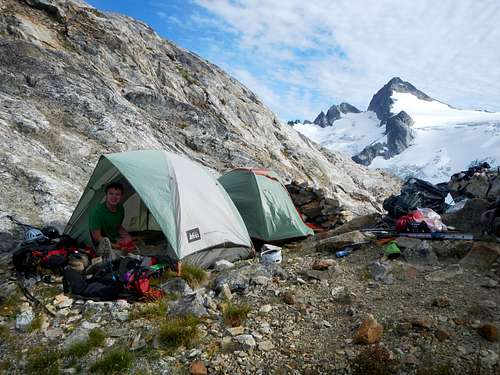
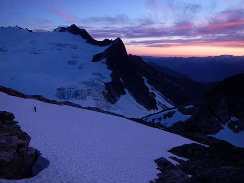
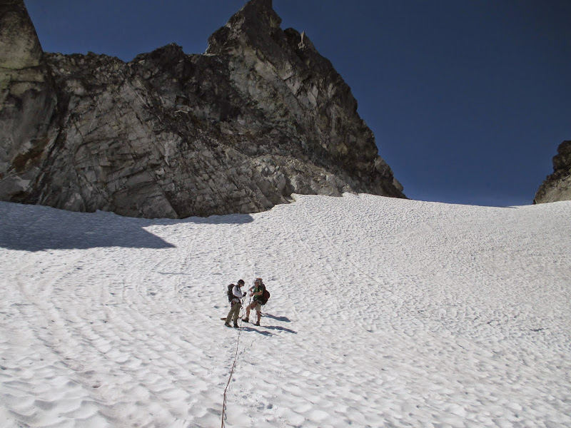
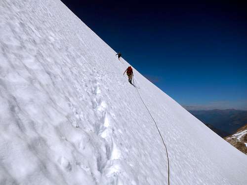
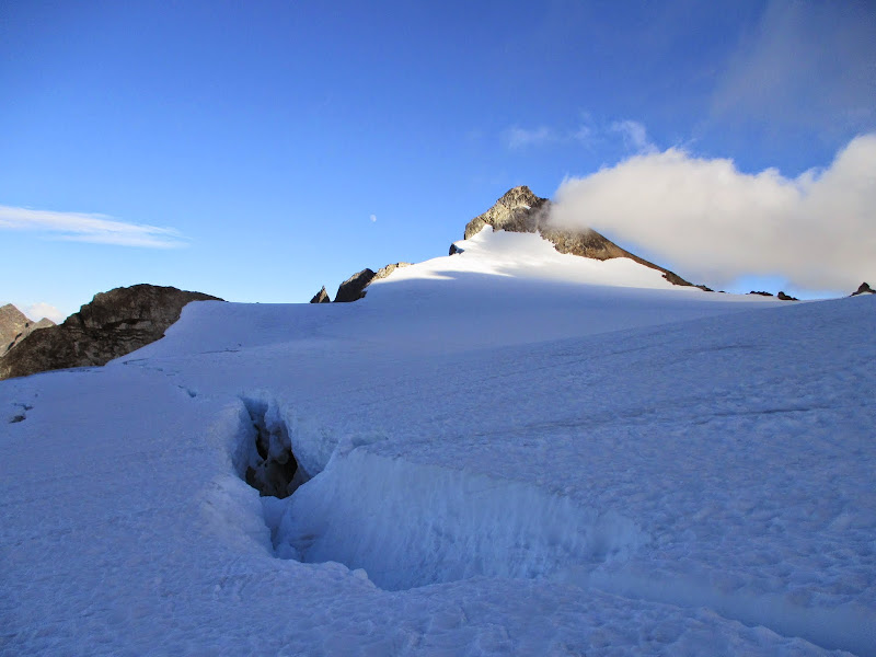
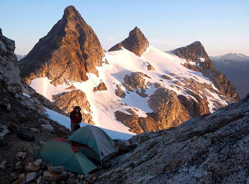
Detouring onto a rib of rock that forms the old Colonial Glacier moraine was necessary to bypass the lake this late in the year. We all got going at the same time but when we got onto the rib heavy gusts of wind gave me difficulty steadying myself. It was at this point that everyone stopped and assessed whether I could continue. I knew I could make it but just not at their pace so they generously decided to take on pieces of my group gear. Josh took my tent, Adam the stove and Fletcher something else. Thank you guys! Now we traveled evenly. We roped up at a rock where the glacier looked tame. Fletcher led the way to the col avoiding several crevasse fields. We collapsed at the smallest two tent bivy I've seen this year, dropped our rope gear and discussed whether or not to go for Neve. I wasn't sure how I'd manage the next day so I was like, "Heck yeah I want that peak!" After a quick supper for me and Josh, we packed pretty light, tossed some rocks on our tents and followed Fletcher to Neve's summit.
 looking back looking back | 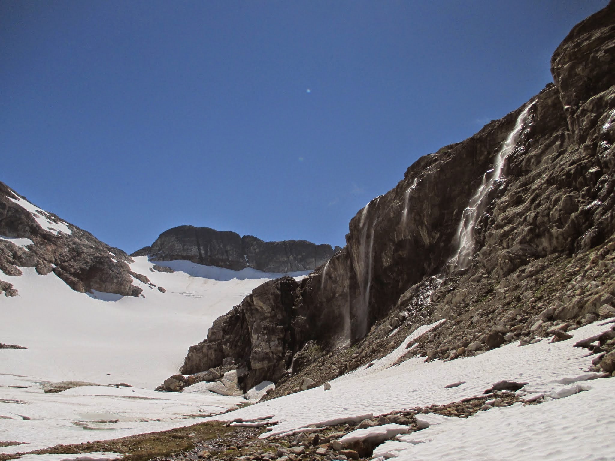 waterfalls waterfalls | 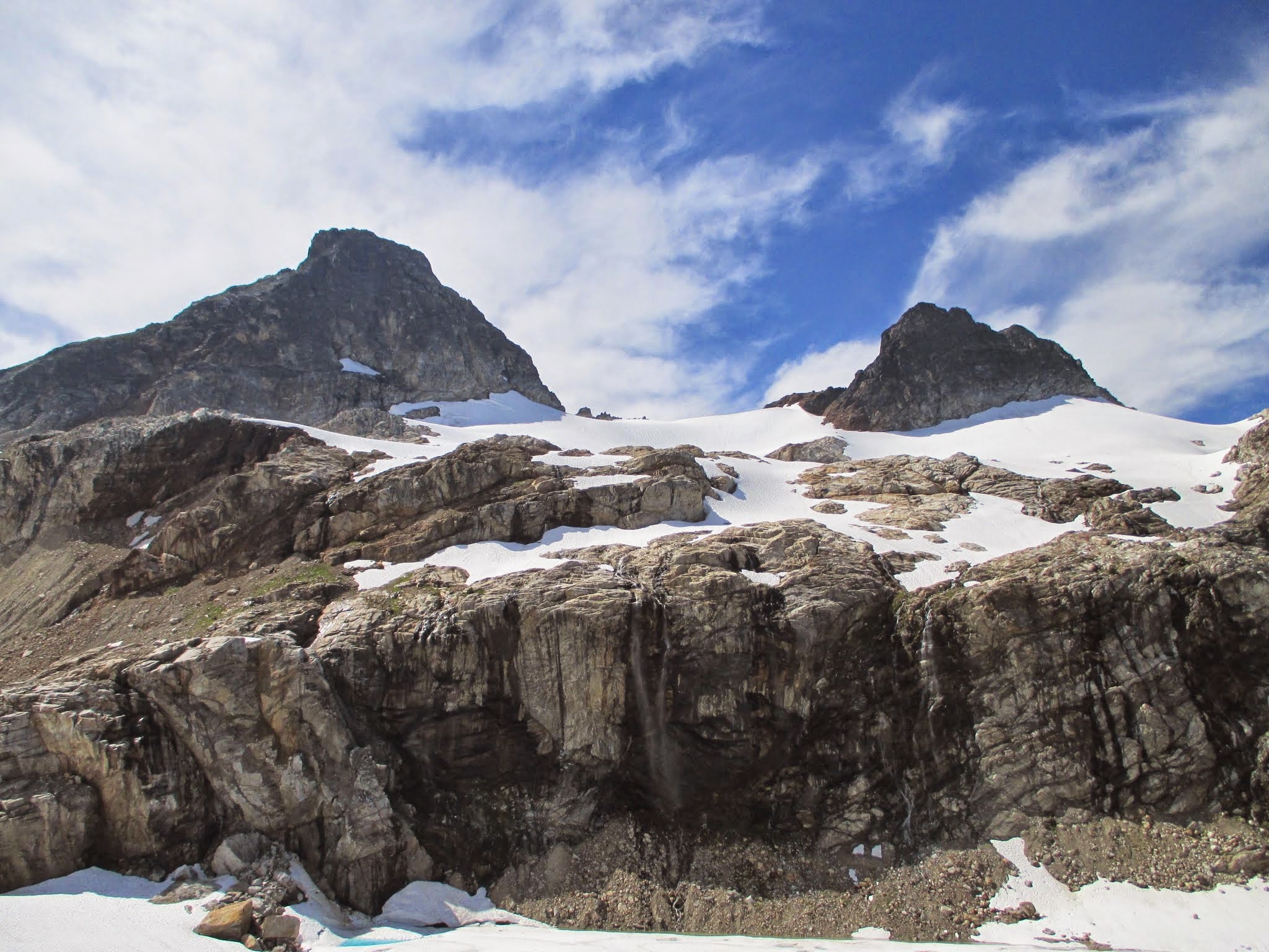 PBS and Pinnacle PBS and Pinnacle | 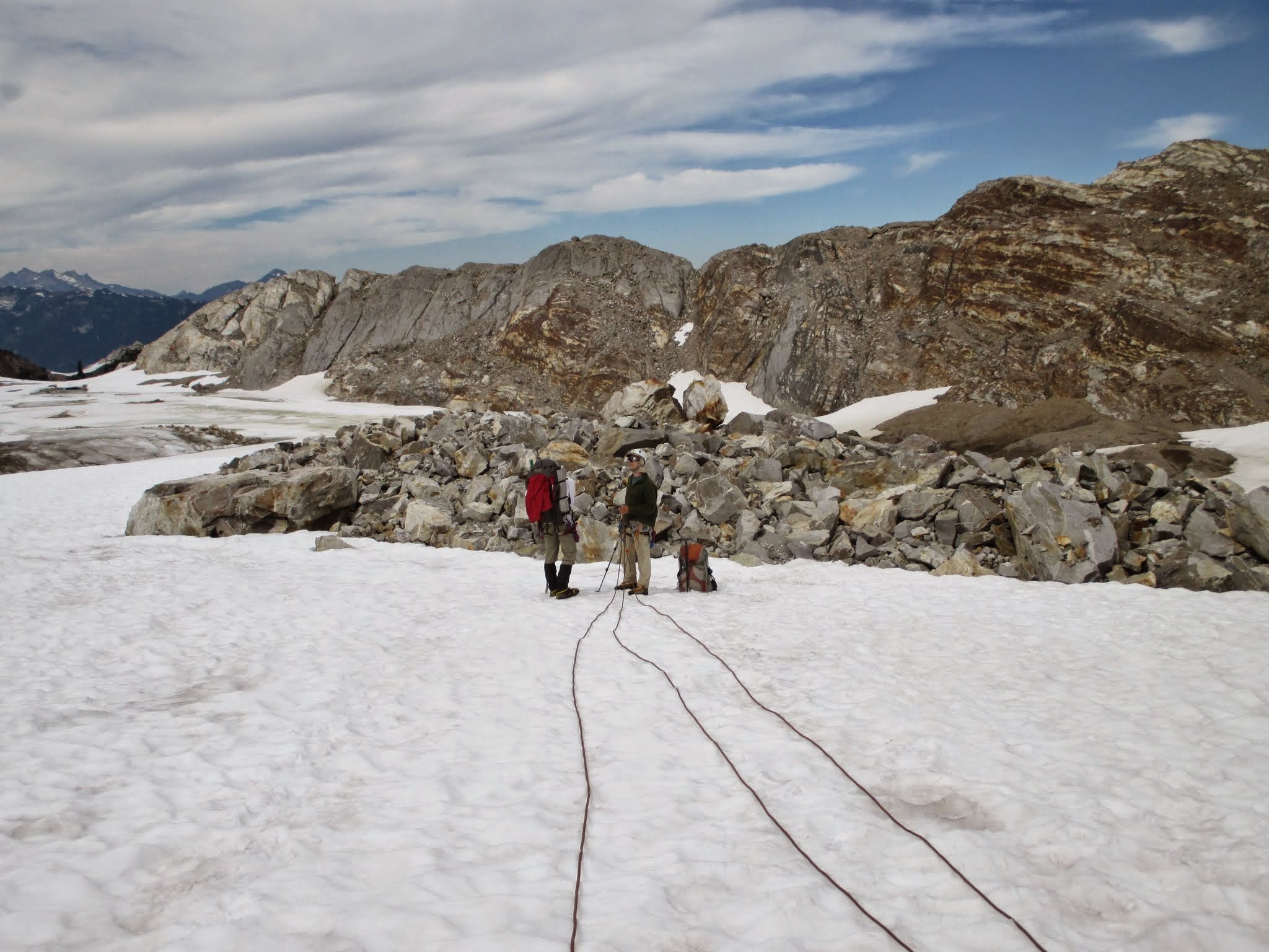 roping up roping up |
![Waterfall Cliffs]() Waterfall Cliffs Waterfall Cliffs | ![Nearing Neve Col]() Nearing Neve Col Nearing Neve Col | 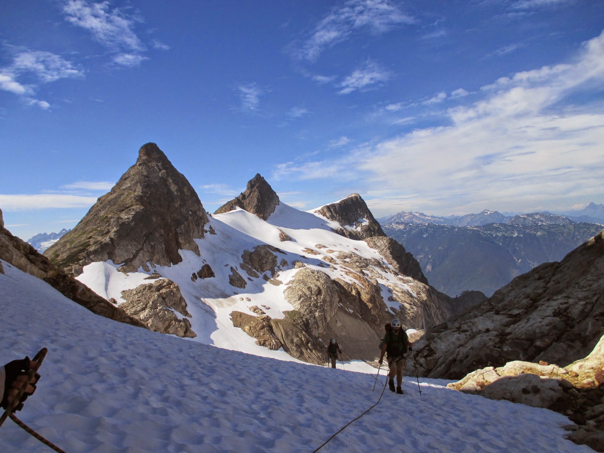 arriving at the col arriving at the col |
 wow wow | ![Neve Col Tents]() Neve Col Tents Neve Col Tents |
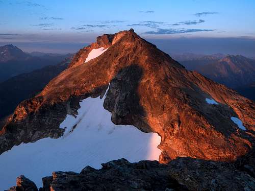
Neve Peak and Alpenglow
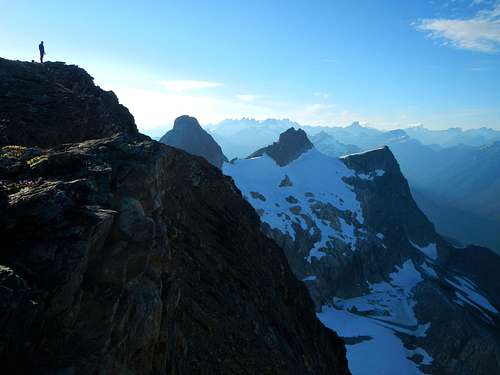
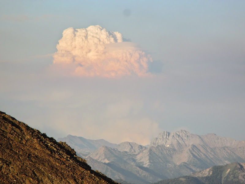
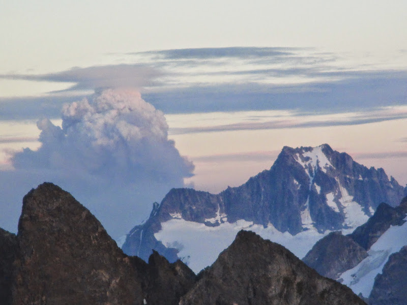
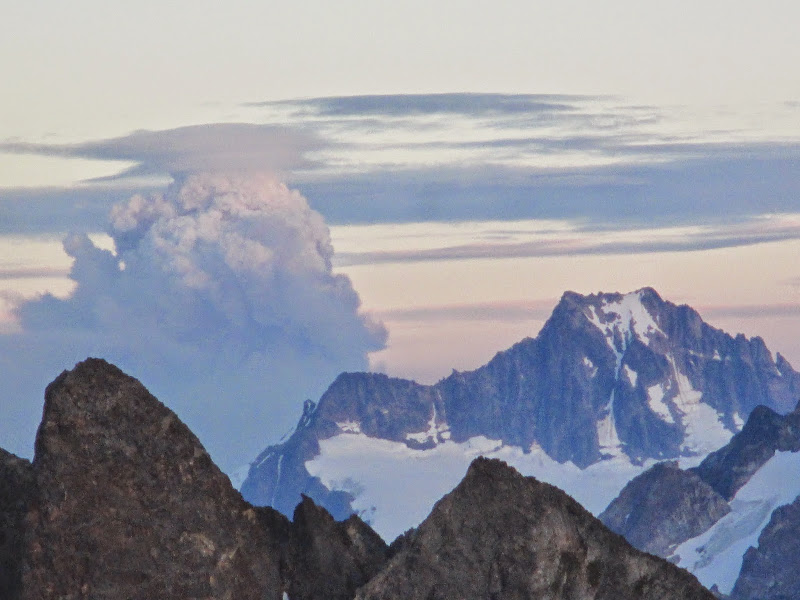
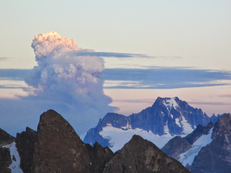
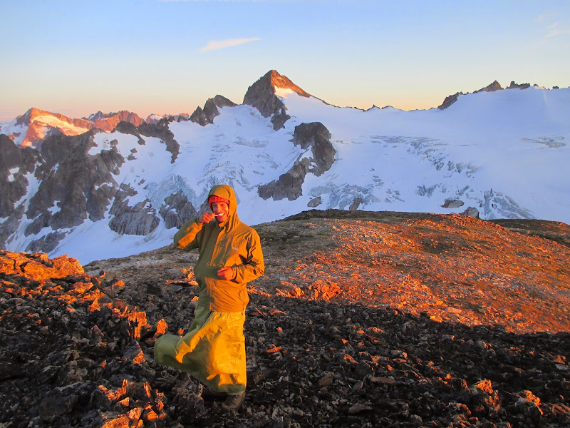
What a gorgeous view! Fletcher and gimpilator made supper while Josh and I tinkered with my Paul Bunyan costume in prep for the "Stump" on day three. Josh had not had much sleep the previous night so he went back down to the tents for early shut-eye. The rest of us stayed for what we knew was going to be an awesome sunset and it did not disappoint. I just wish Josh could have seen it. We all kept watching to the East as some of the largest fires in the state's history sprung new columns of smoke reminiscent of apocalyptic clouds that conjured atomic holocaust. Gimpilator donned a tarp skirt when the wind picked up and decided to brush his teeth making for a hilarious alpenglow shot. Eventually the show began to wear away and we clambered down back to camp where chores were done before sleep.
![Neve Summit]() Neve Summit Neve Summit | ![Mantis Peak and Distal Phlananx]() Mantis Peak and Distal Phalanx Mantis Peak and Distal Phalanx | 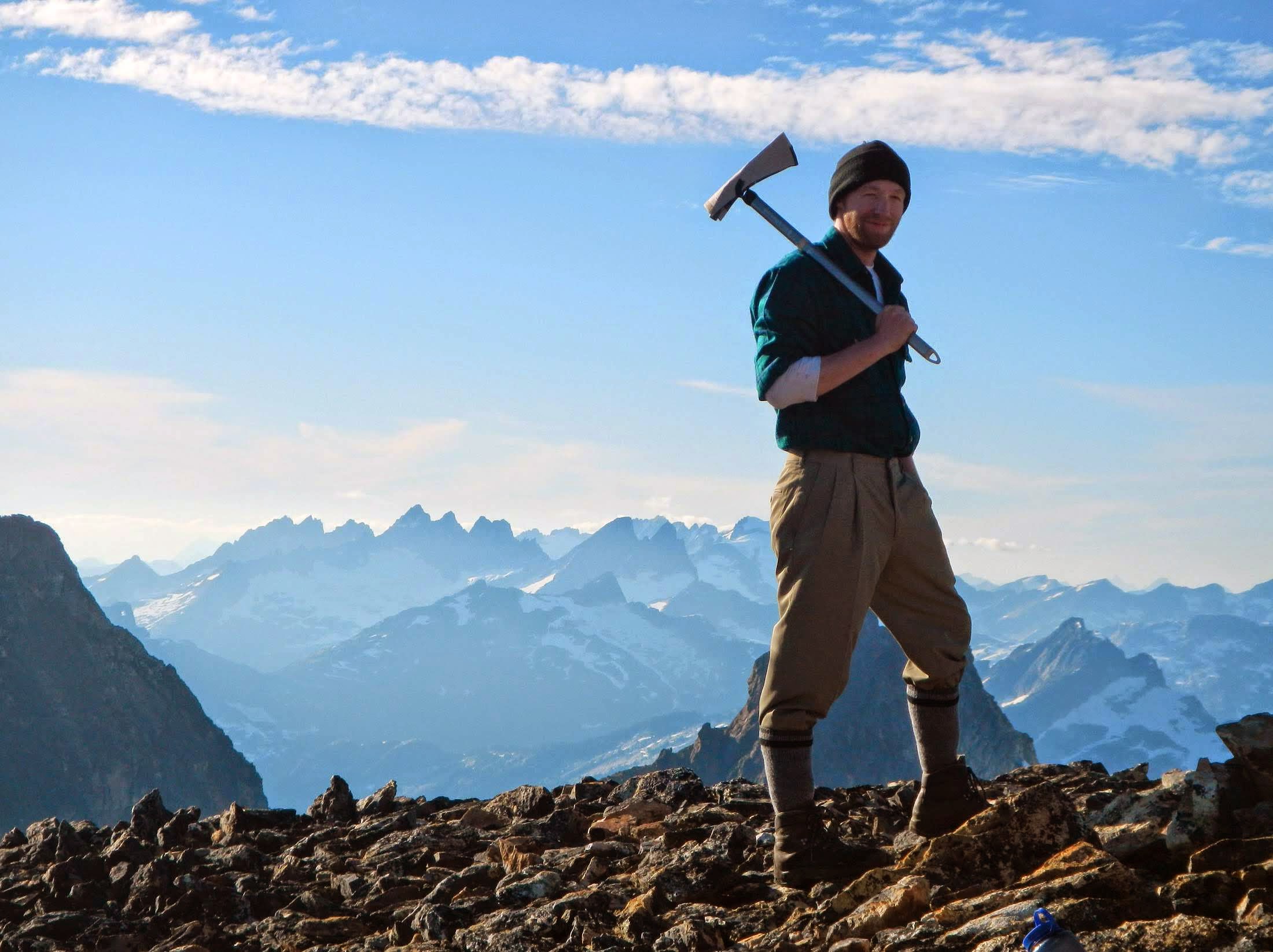 Paul Bunyan impersonator Paul Bunyan impersonator |
 woah woah | 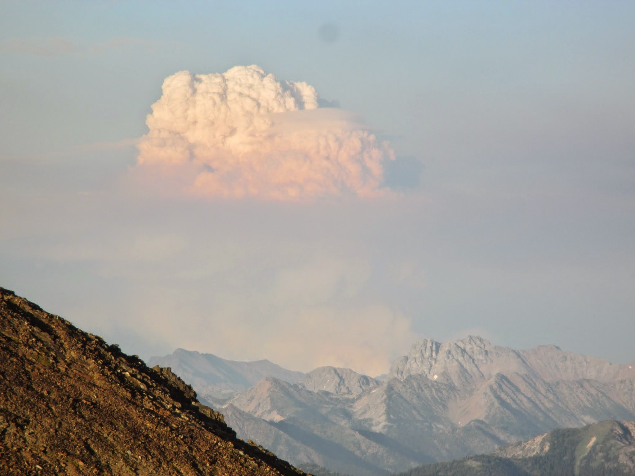 mushroom cloud mushroom cloud |  1st minute 1st minute |  2nd minute 2nd minute |  3rd minute 3rd minute |
 Neve icefall closeup Neve icefall closeup |  gimpilator brushes his teeth gimpilator brushes his teeth | 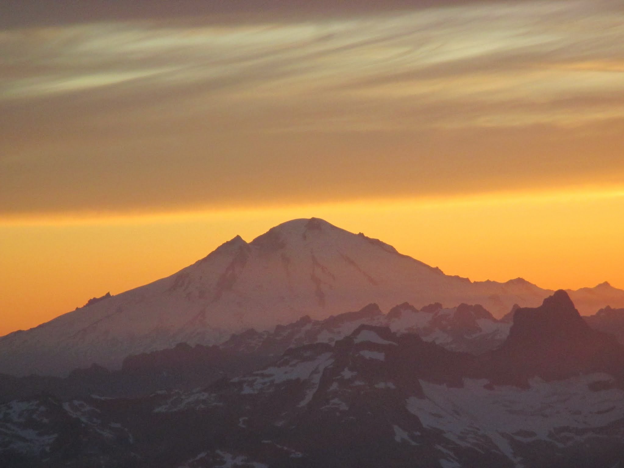 Baker Baker |
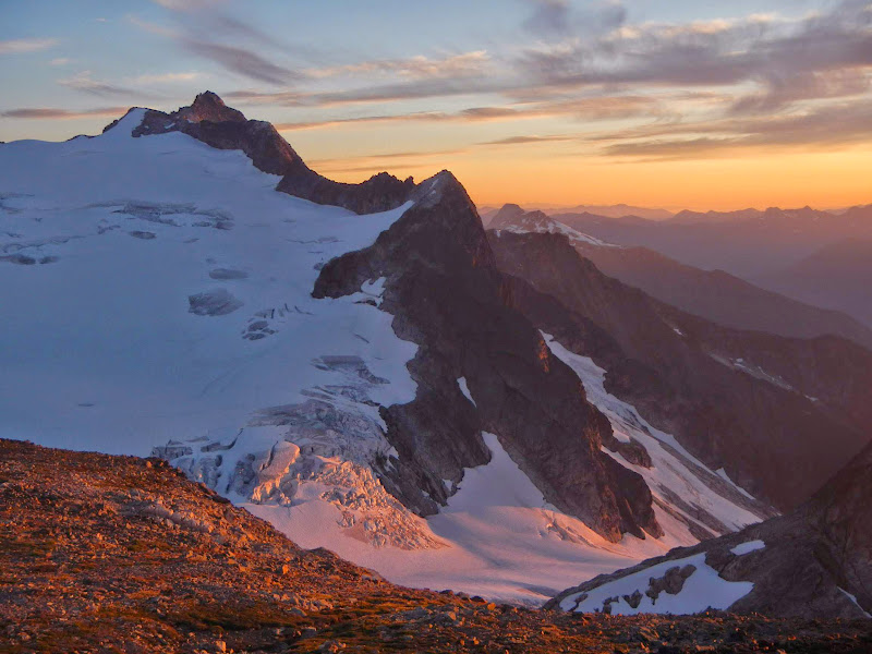
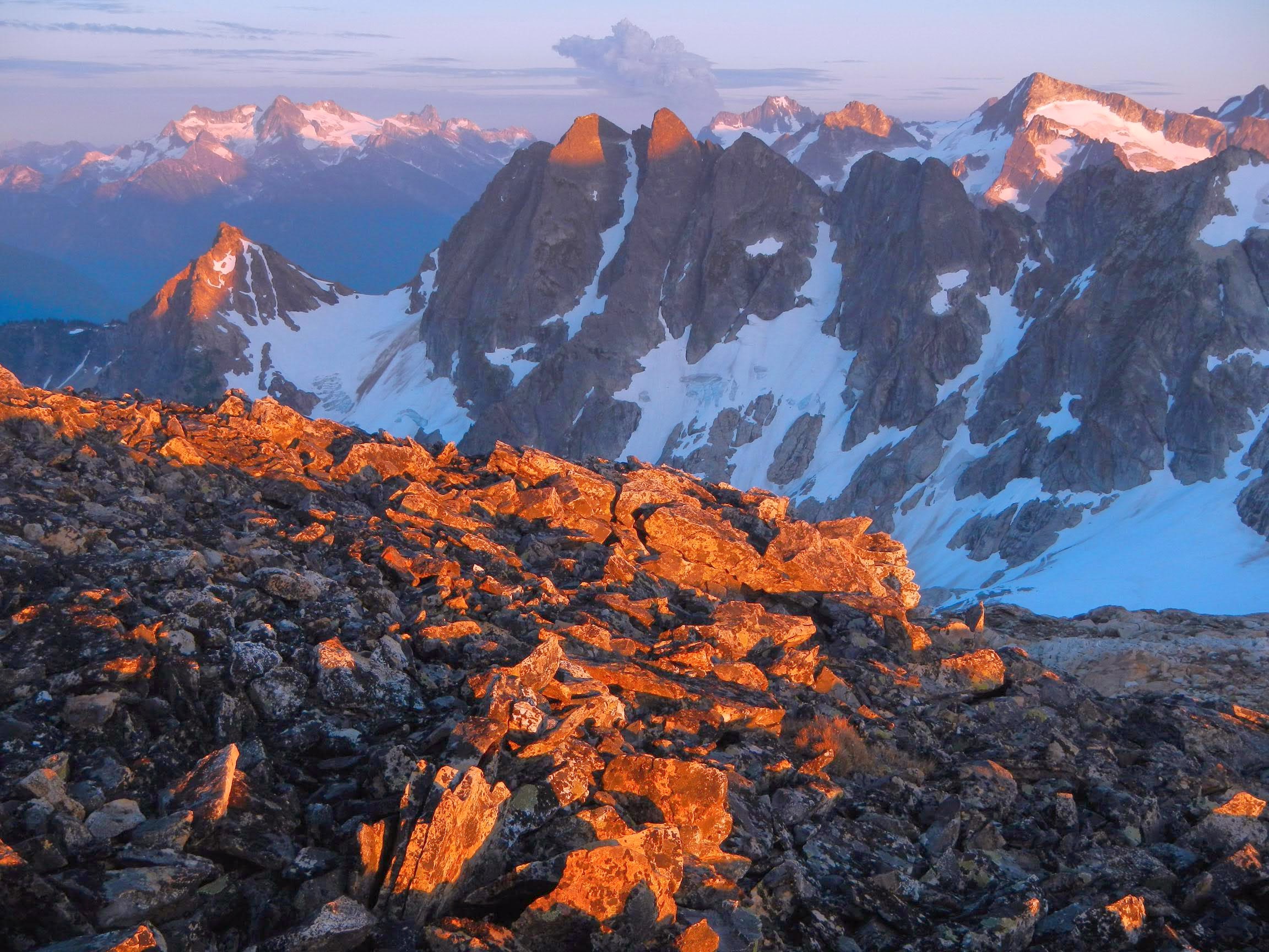 Alpenglow on Mantis to Distal Phalanx. Logan, Buckner, Tricouni and Primus in background.
 Neve Glacier sunset Neve Glacier sunset | 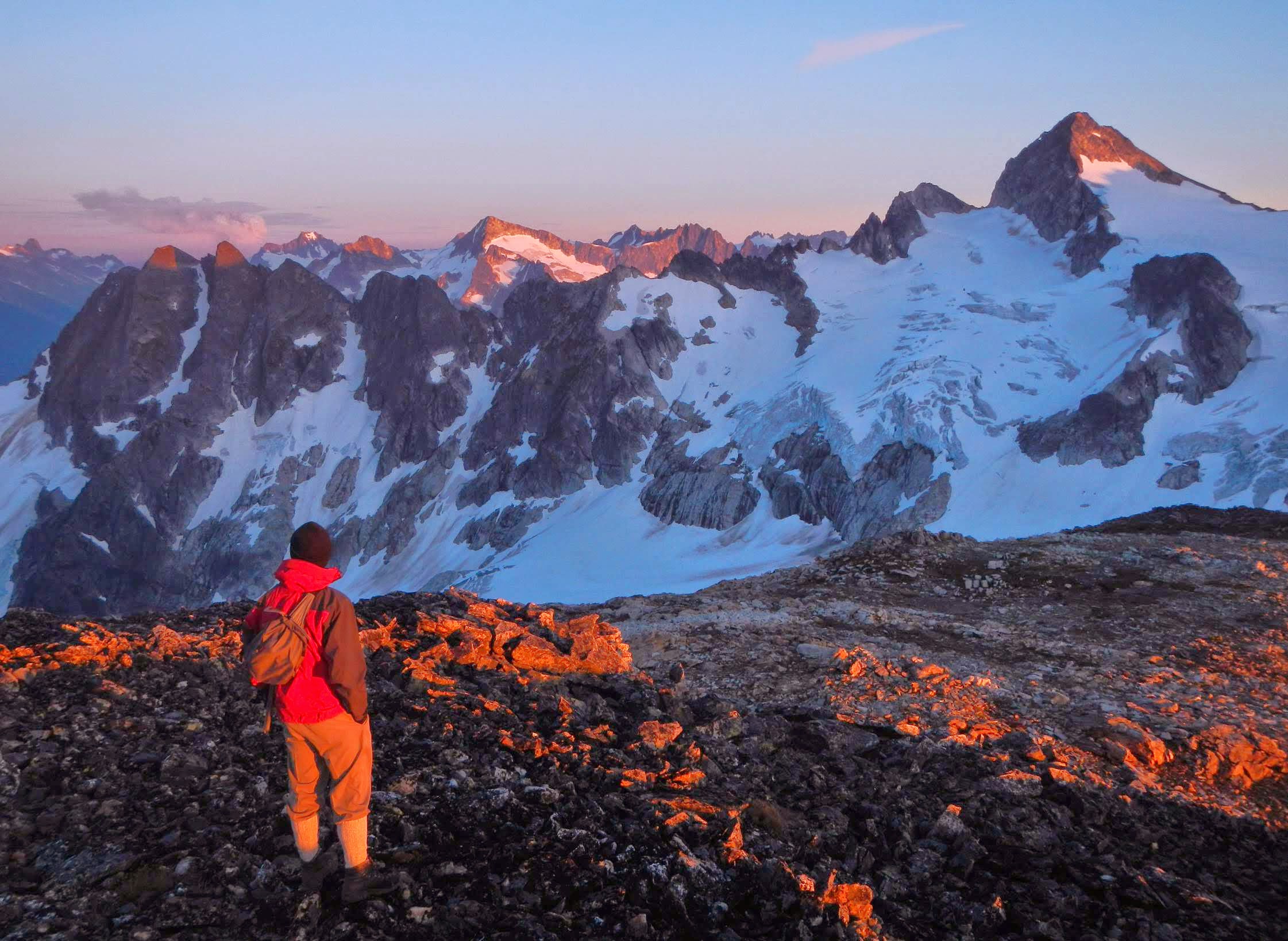 alpen gaze alpen gaze |
![Pickets Evening]() Pickets Evening Pickets Evening | ![Colonial Alpenglow]() Colonial Alpenglow Colonial Alpenglow | |
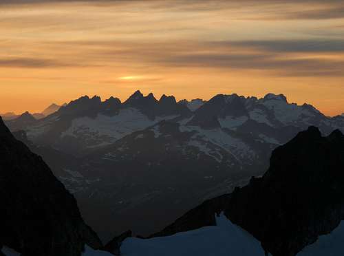
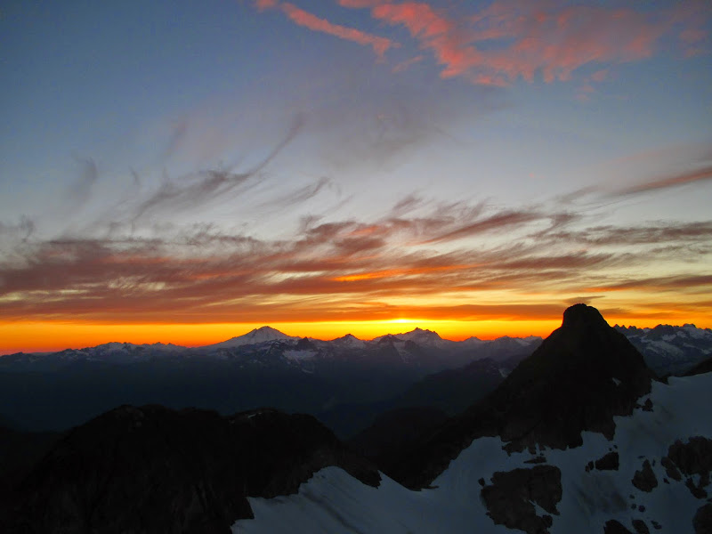
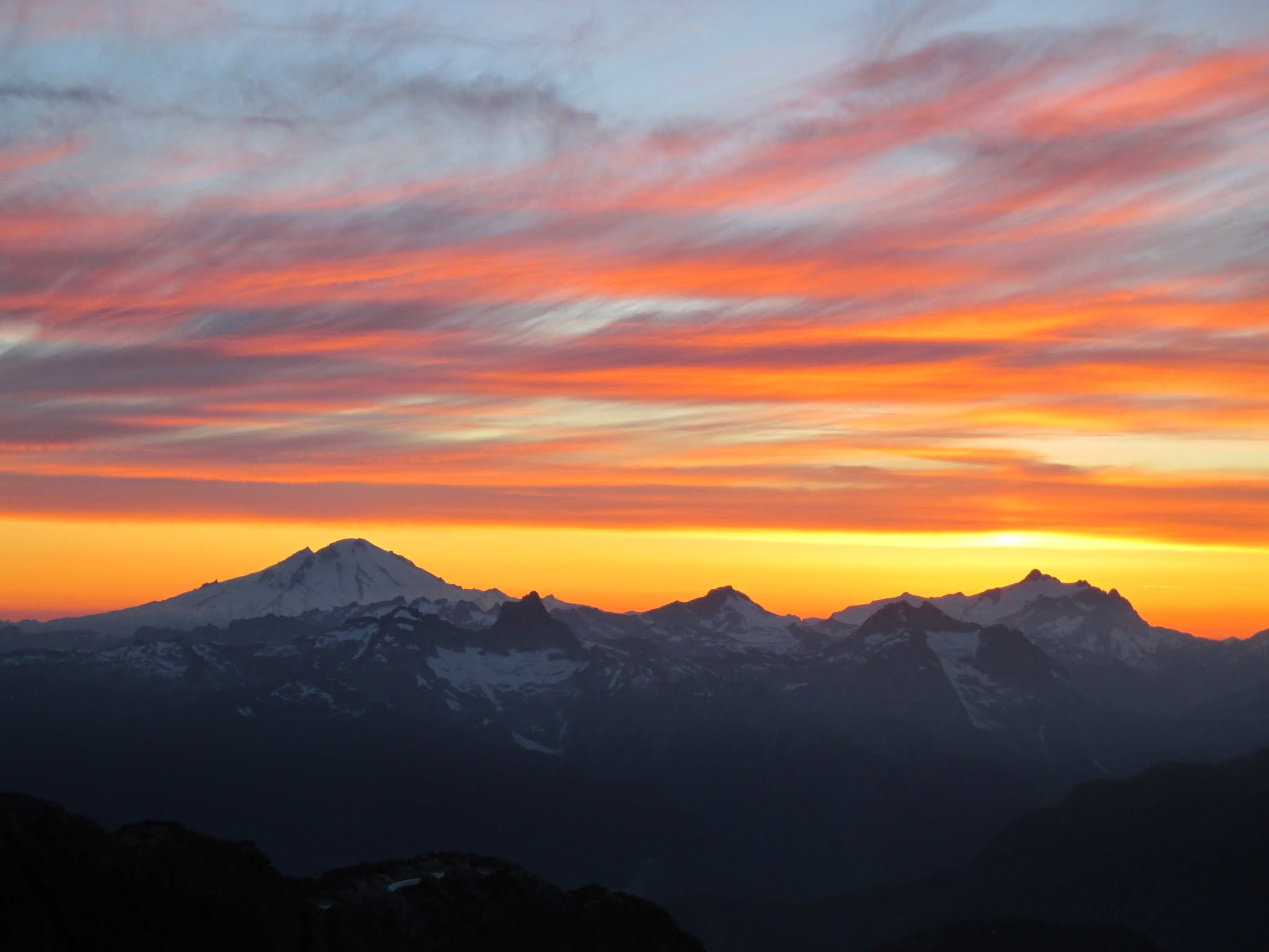 Baker and Shuksan sunset from Neve
![Neve Glacier Sunset]() Neve Glacier Sunset Neve Glacier Sunset | ![Snowfield At Night]() Snowfield At Night Snowfield At Night |
Day 2: Snowfield Peak, Horseman's Pack and The Needle
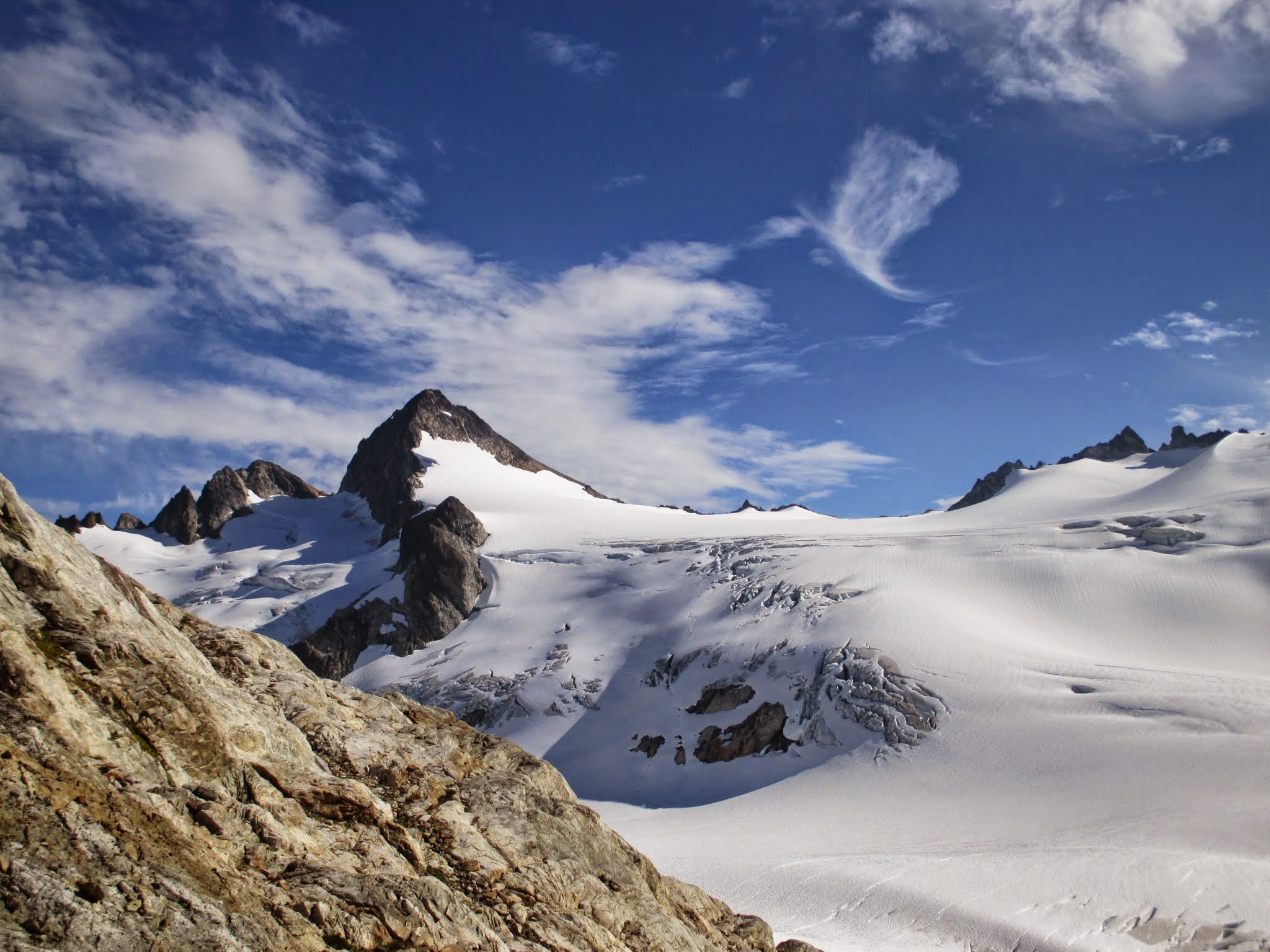
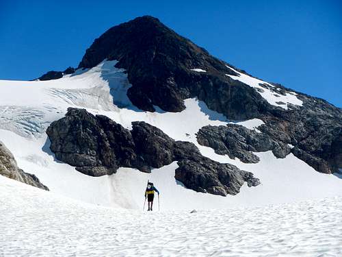
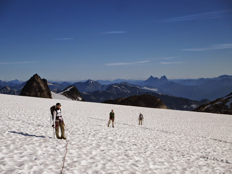
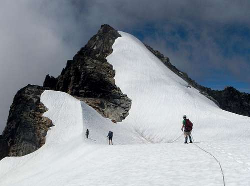
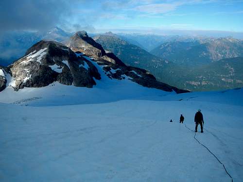
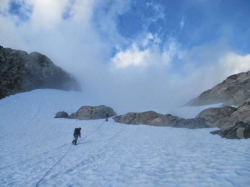
The next morning we gobbled our breakfast and headed down a snowfinger to the Neve Glacier to rope up. We started out in the shade and after some sunscreen we passed into the light and Fletcher lead up the least crevassed slopes of the glacier. Higher up more peaks came into view and gimpilator would have the nerdiest debate with Josh about which one is which in the Pickets. The travel was pretty straight forward. Once it flattened out, Fletcher pulled out a portable radio and we got to enjoy Gimme Shelter for our march music to Snowfield's summit scramble. When we arrived at where the ice pulls away from the rock he scored a small container of sunscreen that we passed around. At least we are assuming the white liquid contained therein was sunscreen. We may never know.
![Neve Glacier Crossing]() Neve Glacier Crossing Neve Glacier Crossing | 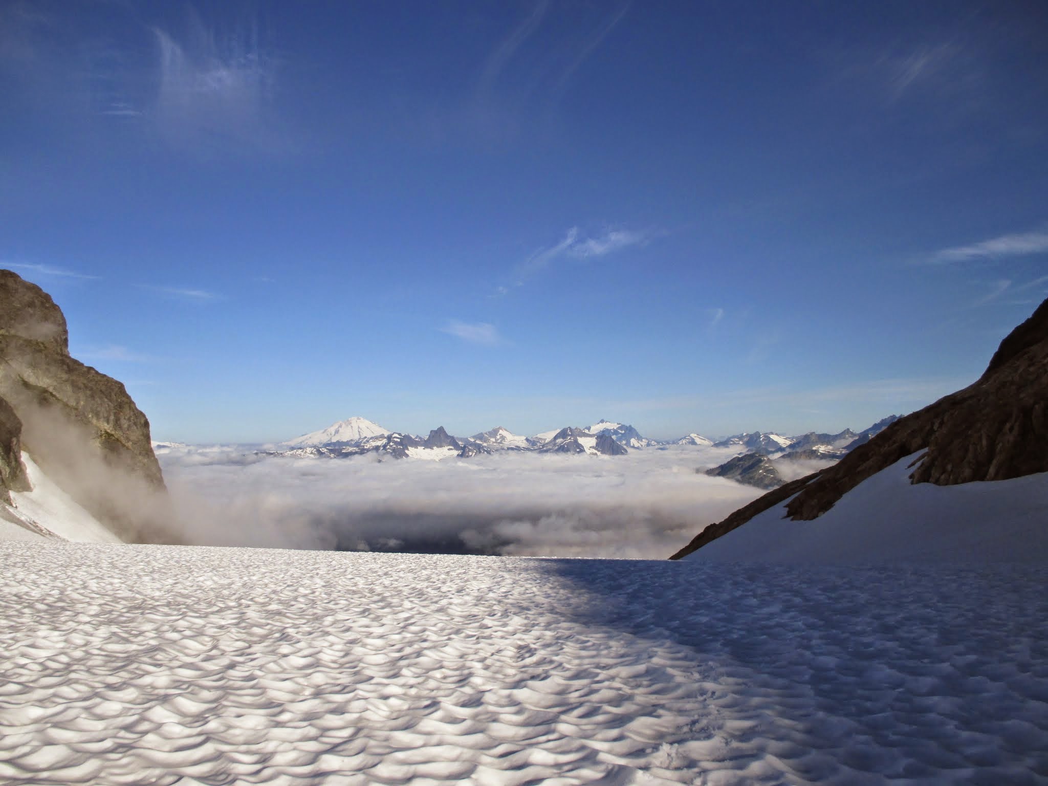 Baker morning Baker morning |
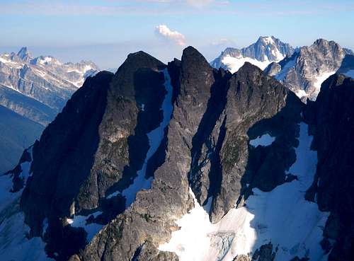
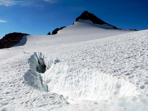
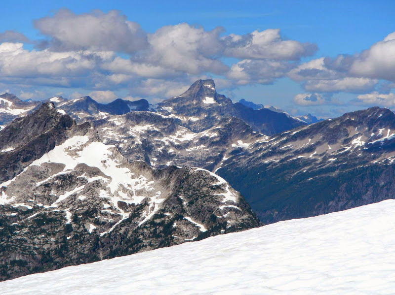
![Crevasse Below Snowfield]() Crevasse Below Snowfield Crevasse Below Snowfield | 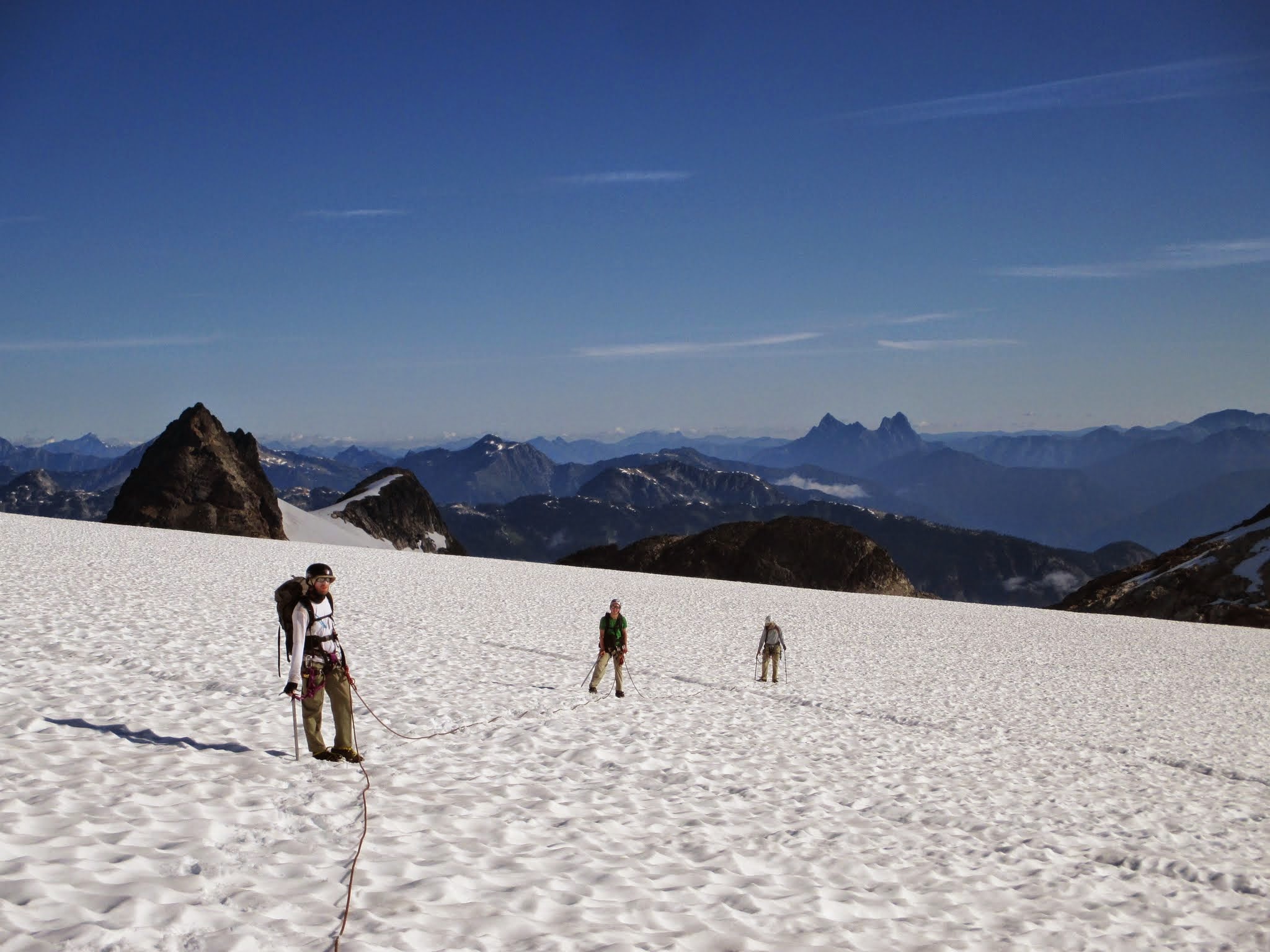 the Team with Hozomeen (Fletcher) the Team with Hozomeen (Fletcher) | ![Eldorado and Dorado Needle]() Eldorado and Dorado Needle Eldorado and Dorado Needle |
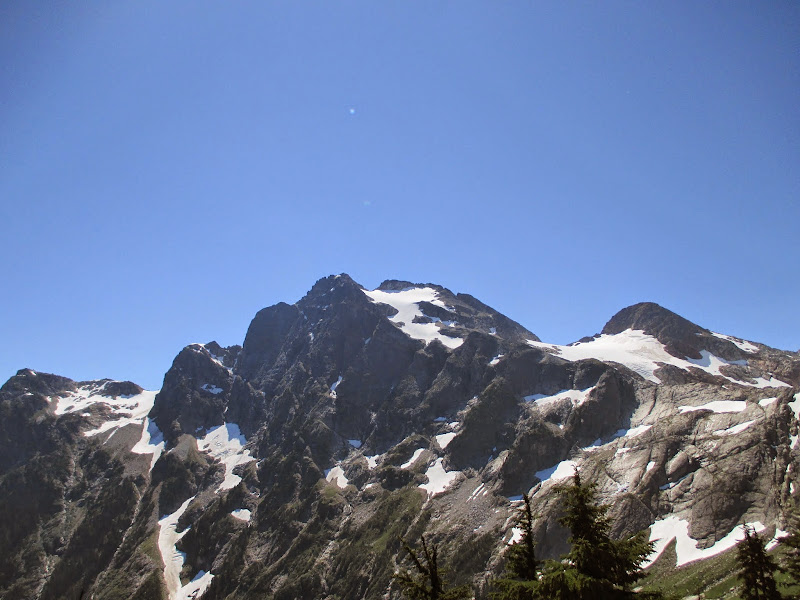
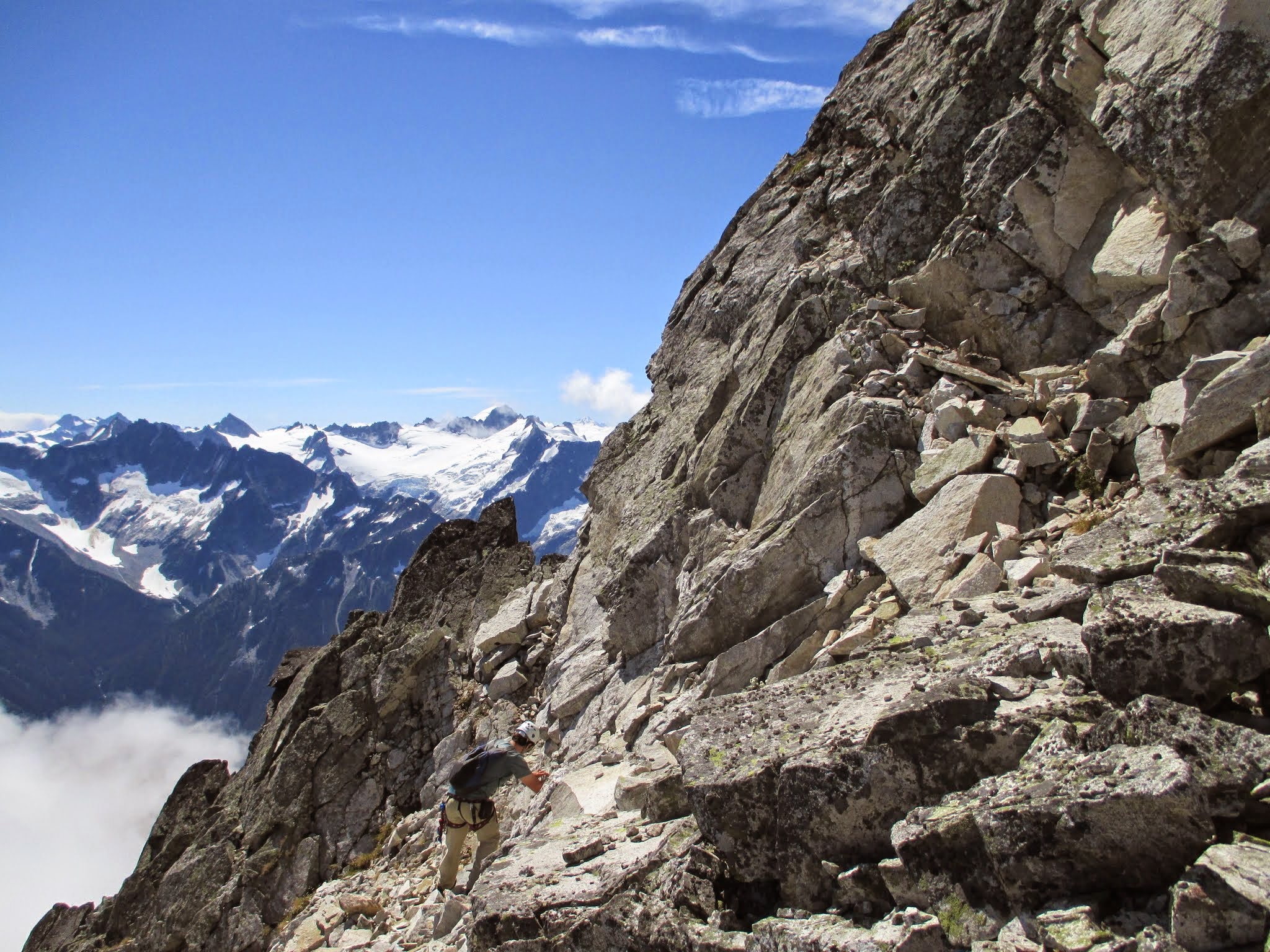
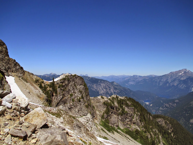
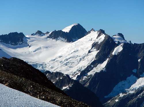
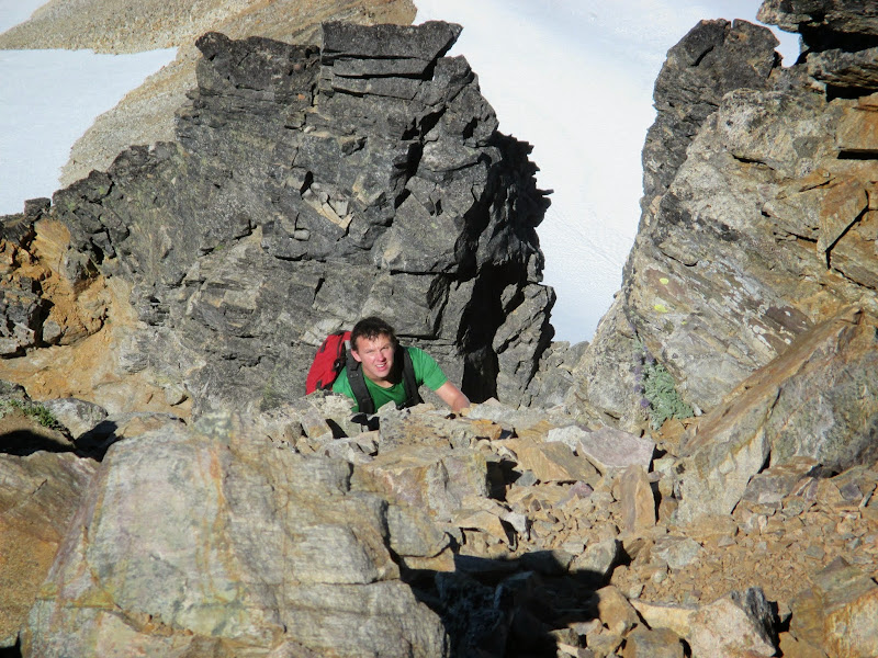
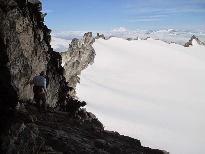
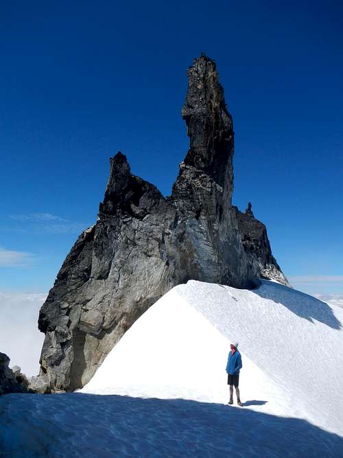
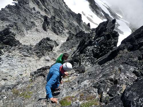
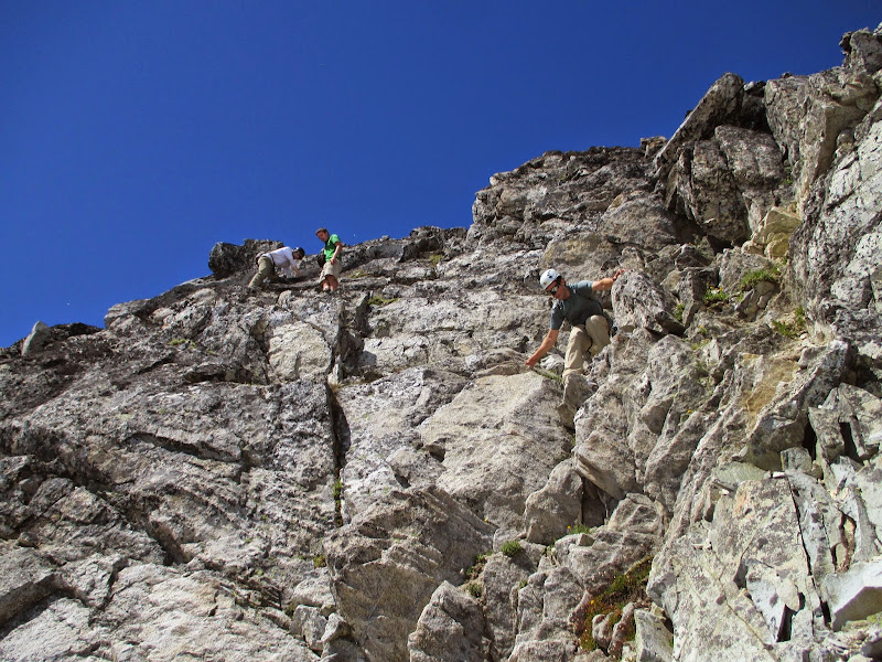
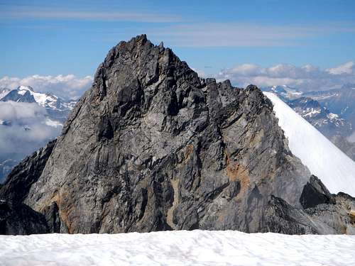
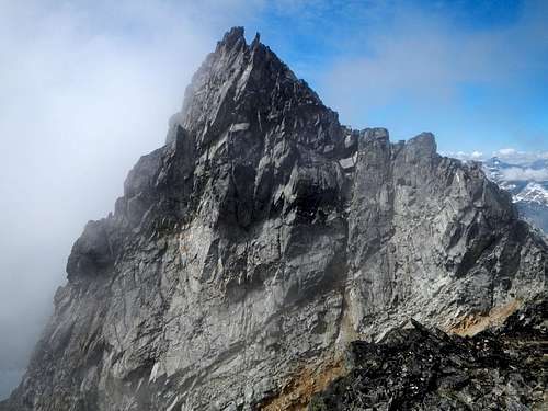
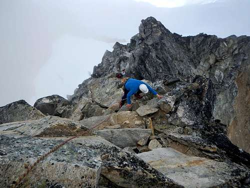
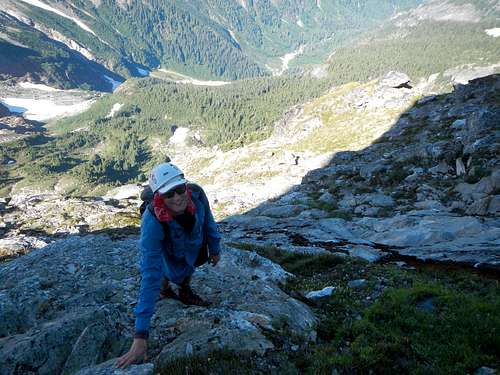
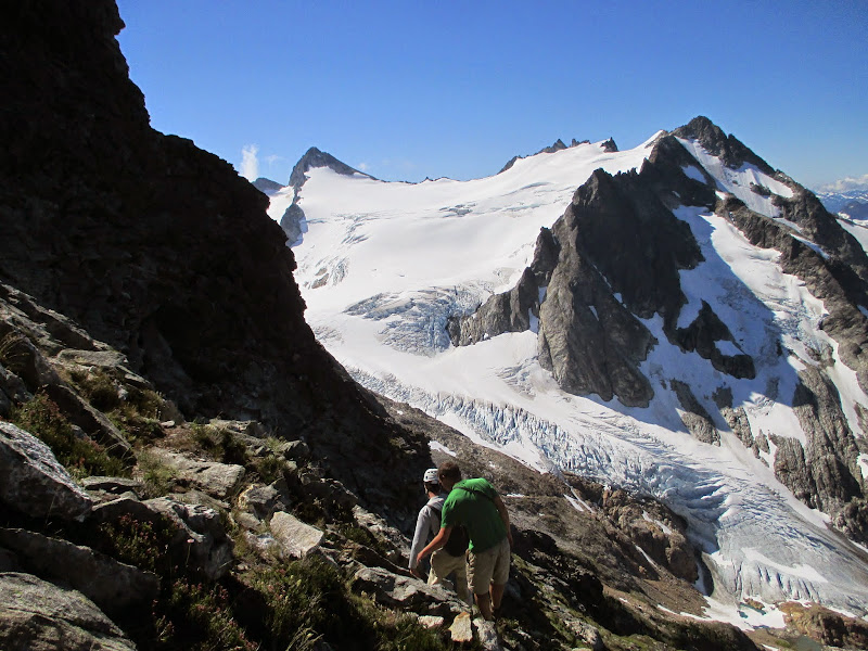
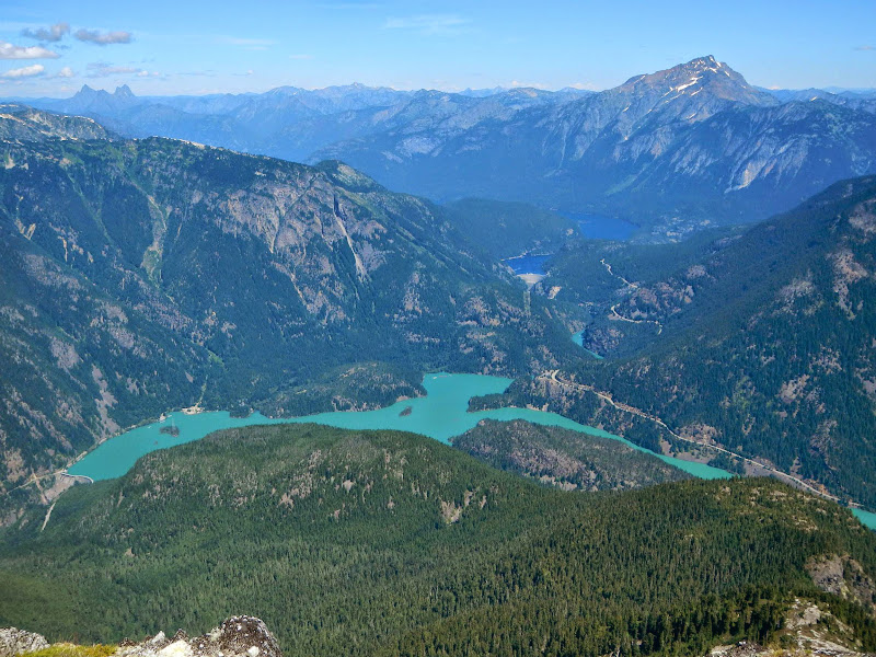
From here the trail was well beaten in and gained half the way to the summit before the scrambling started. Then it was mostly class 2 boulder hopping until we reached a steep pinnacle. Josh and gimpilator kept going up but it was becoming class 4 which was above the stated route description. Also, this appeared to be the spot where we descend 60 feet, cross a gully to the left and continue on its far side. Fletcher led to the left while Josh enjoyed his detour and they met us quickly on the correct route. From here it was real solid rock and I was actually enjoying the scrambling. Josh was probably bored since it wasn't life threatening but he survived the trip to the summit and did not die of boredom. We were all disappointed that there was no summit register to be found on any of the possible high- points. Clouds blew in from the south and partially obscured the view of the Eldorado Ice-cap. We still managed to enjoy the view and after a snack headed back down the fun rock and ledges to our gear back at the glacier.
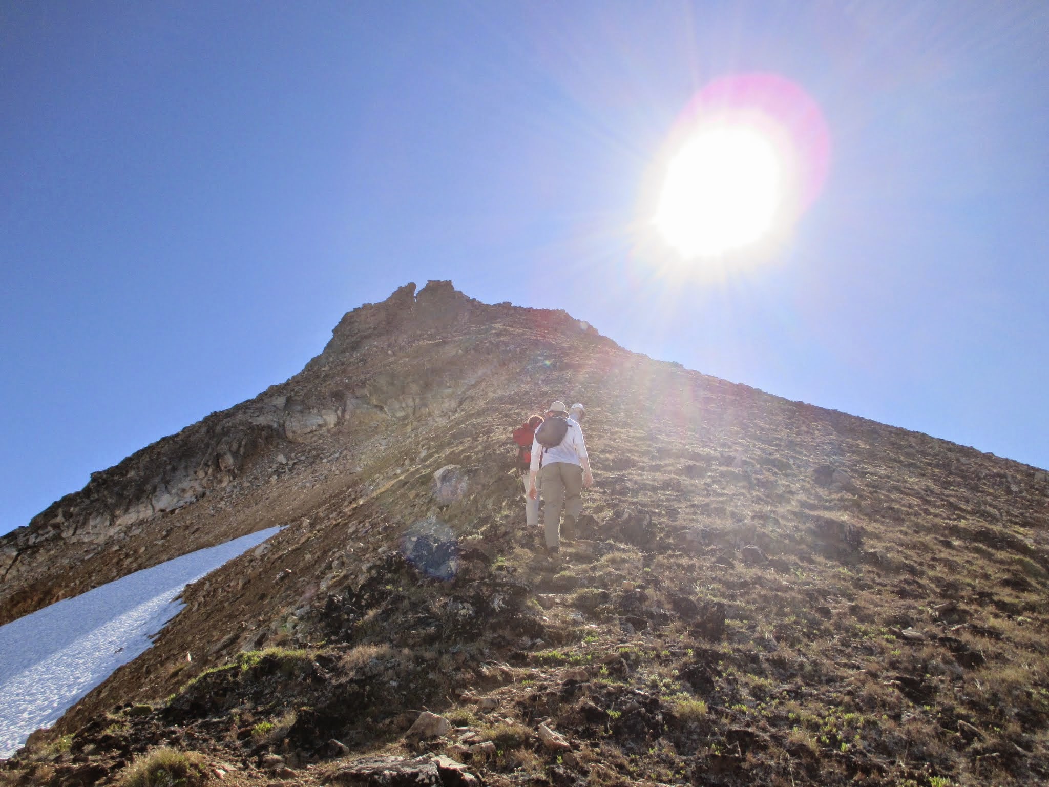 climbing into the sun (Fletcher) climbing into the sun (Fletcher) | ![Snowfield Scramble]() Snowfield Scramble Snowfield Scramble |  Josh on a ledge (Fletcher) Josh on a ledge (Fletcher) |
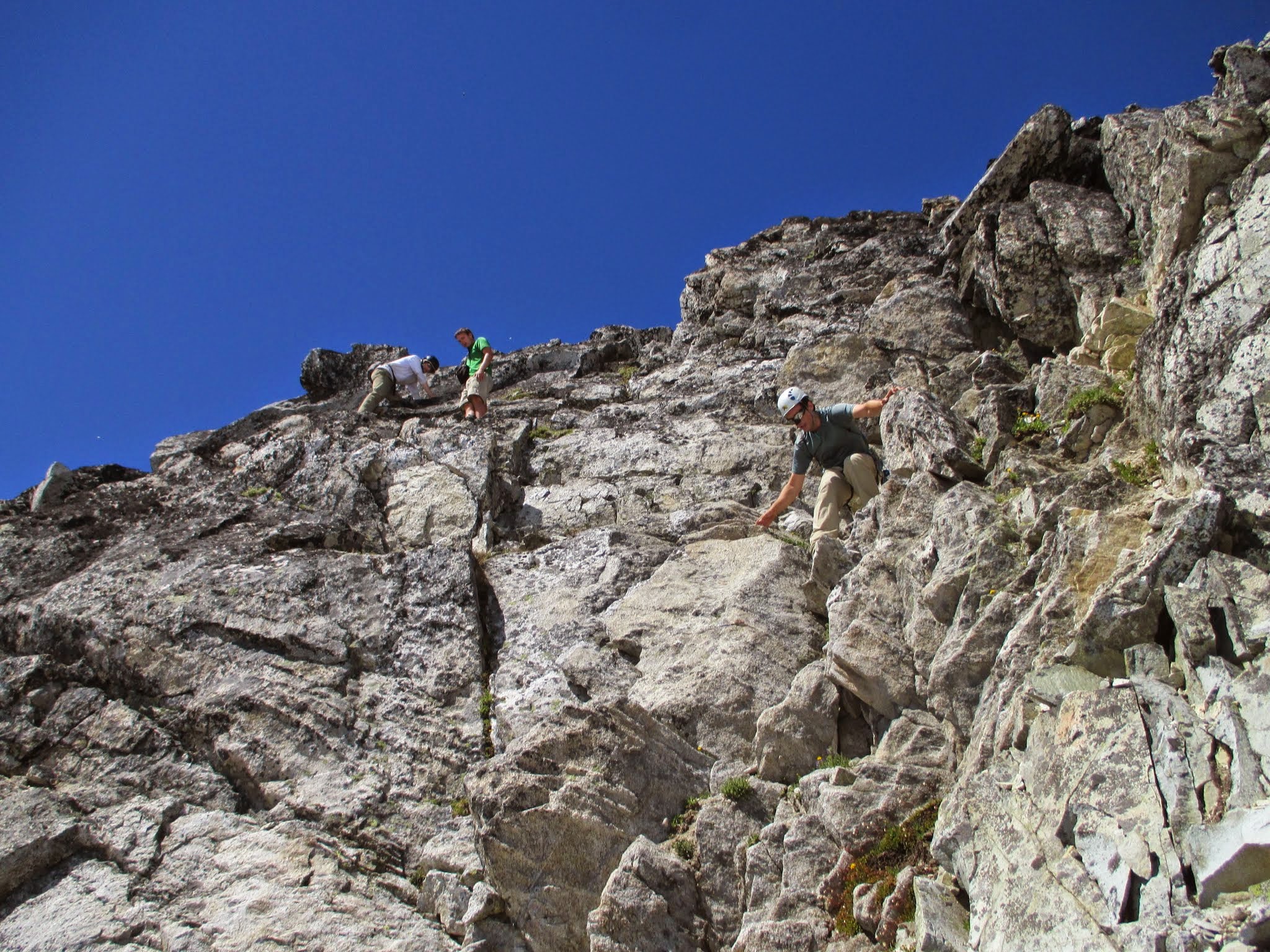
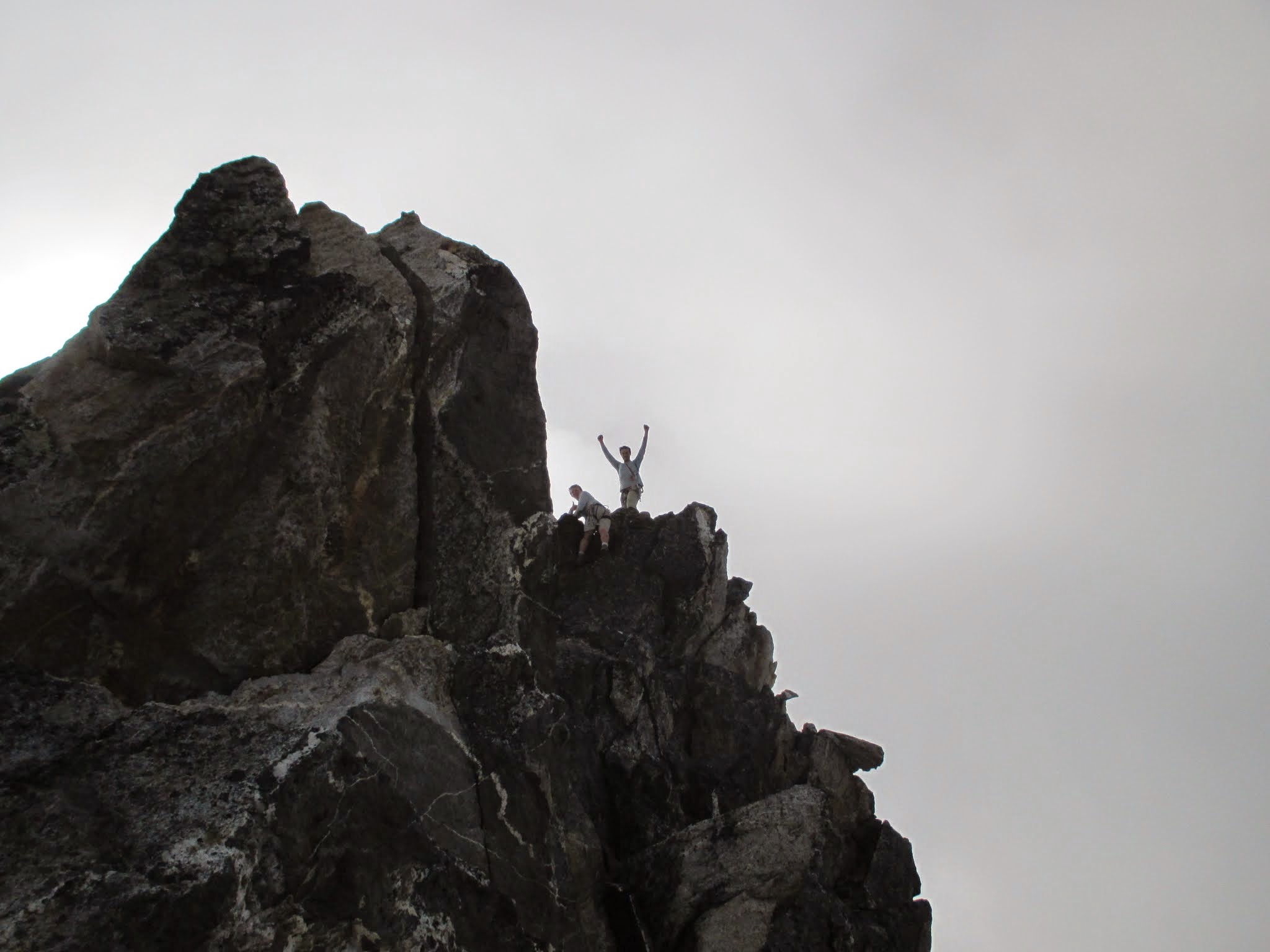
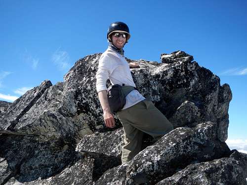
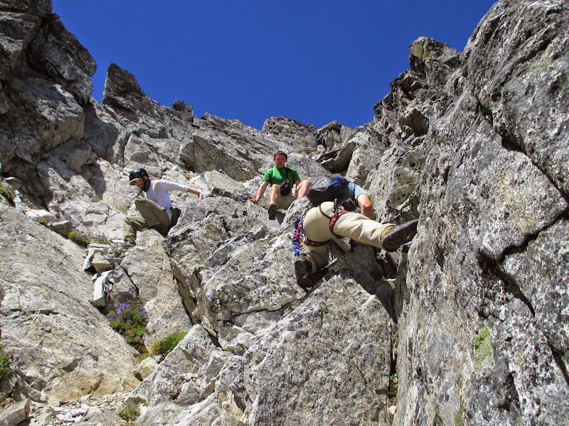
Gimpilator led now and took us to Horseman's Pack which didn't seem like much from a distance but as we approached became more recognizable as a summit. We dropped packs again and Josh went ahead to scout the route. The first bit had us traverse significantly loose rock and we all took note by spreading out. Gimpilator set off a huge boulder that rolled over Josh's backpack and luckily none of his gear got squashed because of its position relative to the ice. I was last to go and following the others' footprints I arrived at the base of a gully on the other side of the peak noticing that Josh had already made the top. It looked like class 4 to me but Josh kept saying, "It's class 3 you just have to find the right route." Unfortunately for me most of those easier moves led to exposed terrain on gravely shelves so I just took my time on the solid class 4 stuff and summited right after gimpilator. The summit was a very exposed rock that we just touched. Fletcher flew through the moves quick and documented the scene very well. I'm sure that if he wasn't recovering from a recently healed clavicle he would've been much faster. Going back down was a bit trickier for me but not too stressful.
![Horsemans Pack and The Horseman]() Horsemans Pack and The Horseman Horsemans Pack and The Horseman |  At the base of Horsemans Pack (Fletcher) At the base of Horsemans Pack (Fletcher) | ![Below The Horseman]() Below The Horseman Below The Horseman |
 traverse here (Fletcher) traverse here (Fletcher) | ![Horsemans Scramble]() Horsemans Scramble Horsemans Scramble |  the gully (Fletcher) the gully (Fletcher) |  gimpilator (Fletcher) gimpilator (Fletcher) | ![Michael On The Summit]() Michael On The Summit Michael On The Summit |
 steep class 3 (Fletcher) steep class 3 (Fletcher) |  downclimbing (Fletcher) downclimbing (Fletcher) |
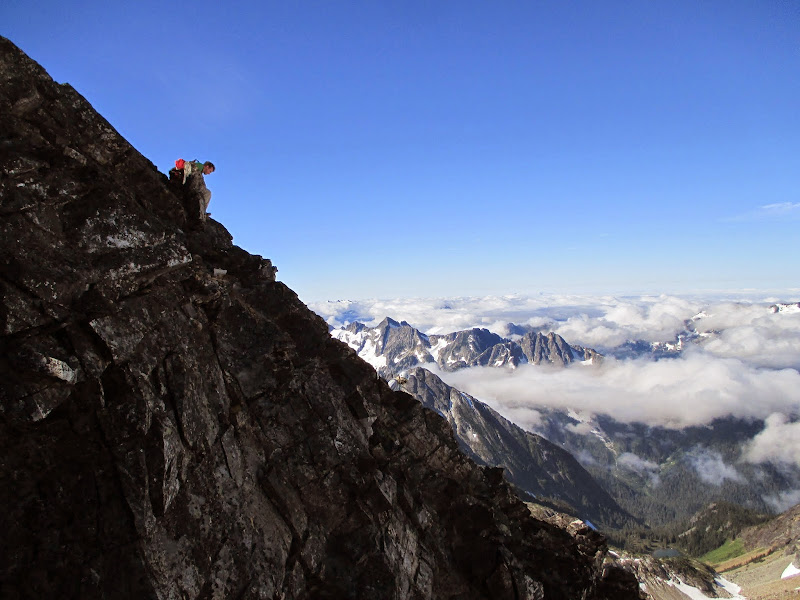
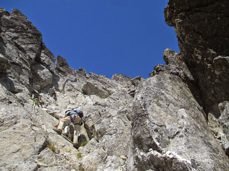
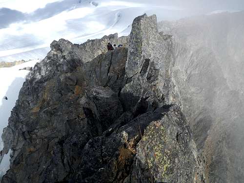
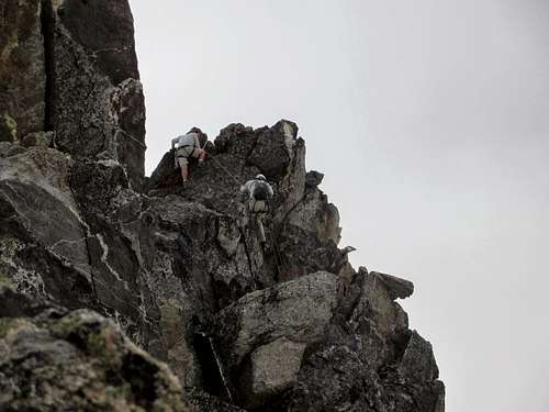
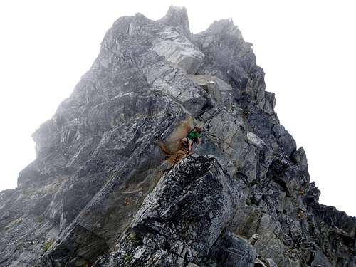
Back at our packs Josh and I enjoyed our luxurious lettuce, cream cheese and cold cut submarine sandwiches with some guacamole and chips much to the watchful eye of our team. We looked at the Horseman and breifly discussed John Roper's 82' ascent of the 5.7 face. The overhanging side we were presented with seemed intimidating and we packed up with me leading towards the Needle on the West end of the glacier. We ended up traversing a steep snowslope that we had seen from Neve's summit and I had hoped to avoid it. The sun made kicking steps a slippery tedious business and after a couple minor ice-ax arrests my left boot developed a tear making me worry about the rest of the trip. Eventually we all agreed to just go straight up and I was greeted to a flat plateau that we could have been on the entire time. Big face palm there. After everyone had belayed each other up, I continued following watermelon snow that led to the base of a snowy arete starting the route to the Needle. From here we dropped some gear, climbed the arete bypassing a deep bergshrund and began the final bit over to the Needle. Clouds rolled in making the scene spooky.
![Steep Traverse]() Steep Traverse Steep Traverse | 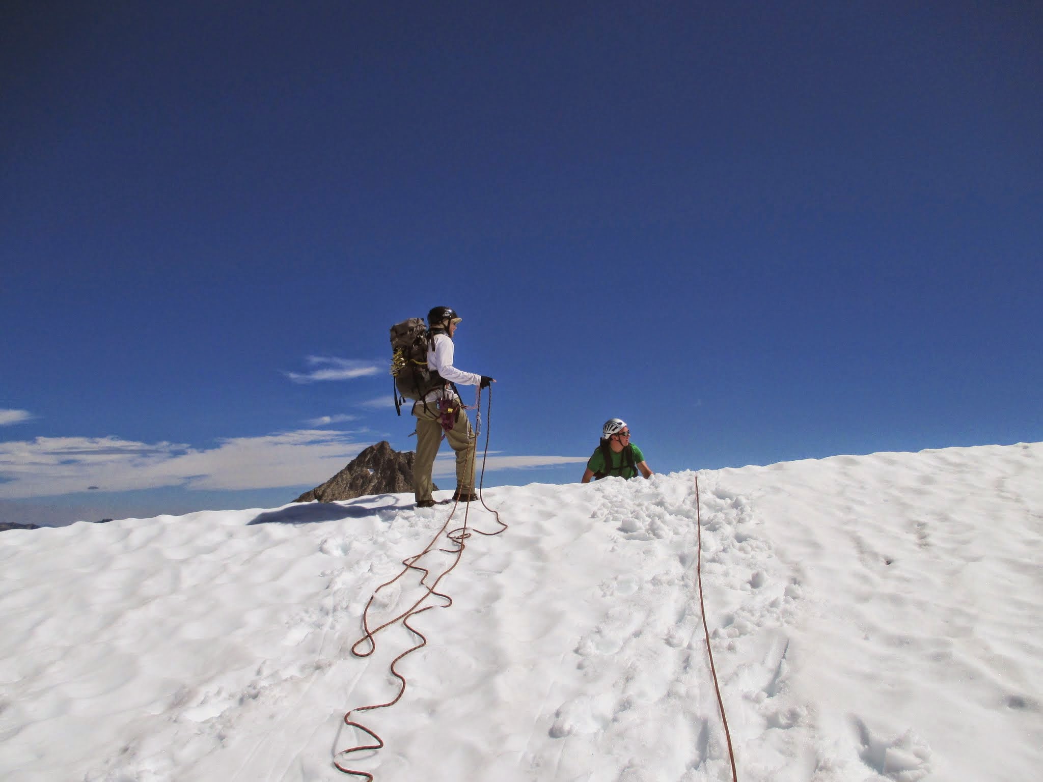 Josh tops out (Fletcher) Josh tops out (Fletcher) | ![The Needle South Face]() The Needle South Face The Needle South Face |
![Approaching The Needle]() Approaching The Needle Approaching The Needle | ![The Needle]() The Needle The Needle |
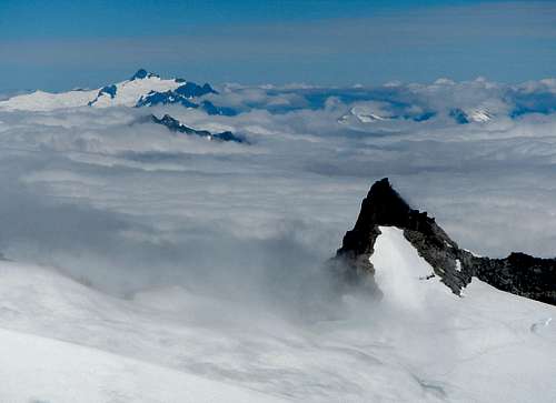
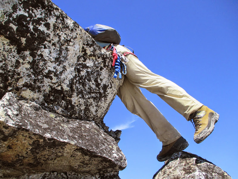
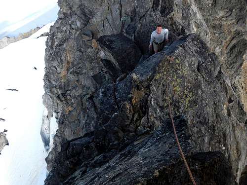
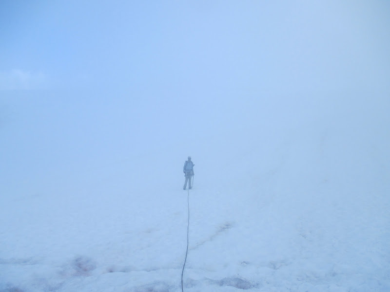
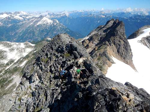
Gimpilator set up belays then he and Josh went ahead. Fletcher and I prussiked up the rope behind and I began to get nervous on steep class 3/4 steps with exposure on all sides. Wet boots and shaky nerves at the bottom of the second pitch dictated that I didn't think I could make it since he discussed the possibility of rappelling to some very scary looking ledges for the return route. I waited with Fletcher (who could normally climb it no problem) watching gimpilator then Josh go up very vertical looking rock and finishing with a chaval to an exposed perch. The rappel went fine and their return route was way easier than I had thought making me regret not giving it a go. We all moved quickly to our rope where the clouds moved in across the glacier threatening to put us in a white-out as the moon rose over Snowfield. Josh led us down in a speedy fashion as visibility was reducing until we reached some criss-crossing crevasses at the glacier's low point and got boxed in with about 50 feet of sight distance. Cool heads prevailed and we reversed our route a little then completed a large arc and kept snug against the glacier's border with Neve Peak until we found the thin snow finger back to camp.
![The Needle Pitch 1]() The Needle Pitch 1 The Needle Pitch 1 | ![The Needle Pitch 2]() The Needle Pitch 2 The Needle Pitch 2 | ![The Needle Summit Ridge]() The Needle Summit Ridge The Needle Summit Ridge |
 victory (Fletcher) victory (Fletcher) |  glacier below (Fletcher) glacier below (Fletcher) | ![The Needle Rappel]() The Needle Rappel The Needle Rappel | ![The Needle Scramble]() The Needle Scramble The Needle Scramble | ![Descending From The Needle]() Descending The Neve Descending The Neve |
 Same Snowfield crevasse (Fletcher) Same Snowfield crevasse (Fletcher) | 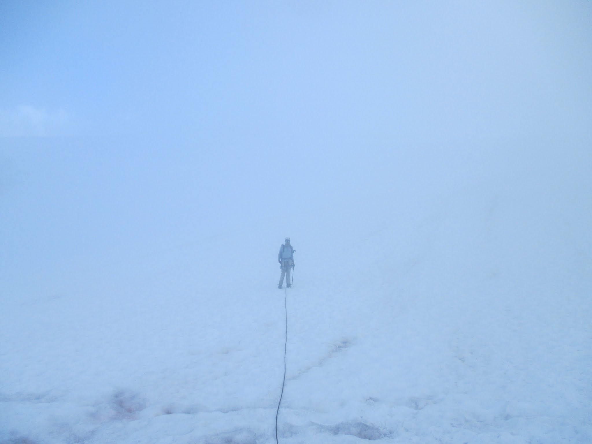 nearly whiteout (Fletcher)
 |  almost back to camp almost back to camp | 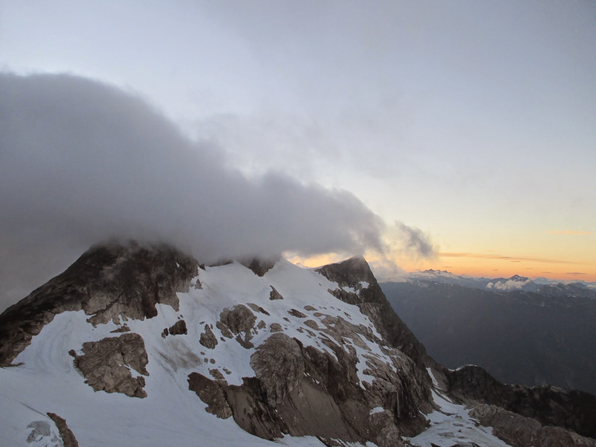 bunyan group bunyan group |
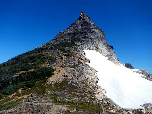
Day 3: Paul Bunyan's Stump and Pyramid Peak
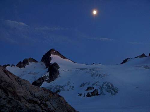
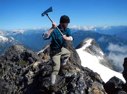
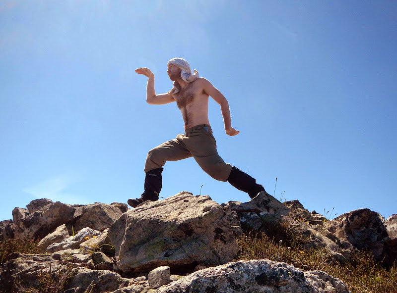
That night we enjoyed a great feast and Fletcher went back up Neve for the scenery. We refilled water again for the next day and briefly rented out space in our tent to gimpilator in exchange for food and conversation. The moon shone through the clouds and windy damp air had me wondering if the weather would change. Sleep came swiftly with dreams of a far off variety. Awaking the next morning I was glad to see it had cleared and surprised to see everyone sleeping in given the scope of our day. Josh and I ate the last of our precious donuts while gimpilator wore his sleeping bag like a down vest. We reluctantly broke down camp from this beautiful vantage point and began moving towards Paul Bunyan's Stump on frozen snow. I strategically had already dressed as Paul Bunyan so that when we dropped gear at the base of the peak I wouldn't have to bring anything with me. The cool thing about the costume was it actually works mountaineering.
![Neve Col Camp]() Neve Col Camp Neve Col Camp | ![Traversing Colonial Glacier]() Traversing Colonial Glacier Traversing Colonial Glacier | ![The South Face]() The South Face The South Face |
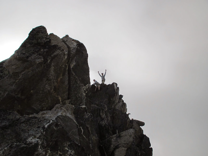
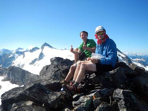
The Stump did seem intimidating and I questioned its class 3 rating until we got higher. Sure enough there were plenty of options that were easy if you looked for them. We spiraled left around the Stump's West side as we slowly gained placing feet in dirt patches between heather and rock steps. It seemed sort of like a trail and had a few small cairns to mark the way. The final summit blocks were like jenga blocks and care had to be taken not to disrupt the rock. I set up for the comical Bunyan shot by duct taping my ice-ax. The view was fantastic and most of us thought it was the best from the trip. Scrambling down went too quickly and we arrived at our packs before mid-day.
![West Face Exposure]() West Face Exposure West Face Exposure | ![Summit Ridge]() Summit Ridge Summit Ridge | ![PBS Summit]() PBS Summit PBS Summit | ![Paul Bunyan]() Paul Bunyan
Paul Bunyan |
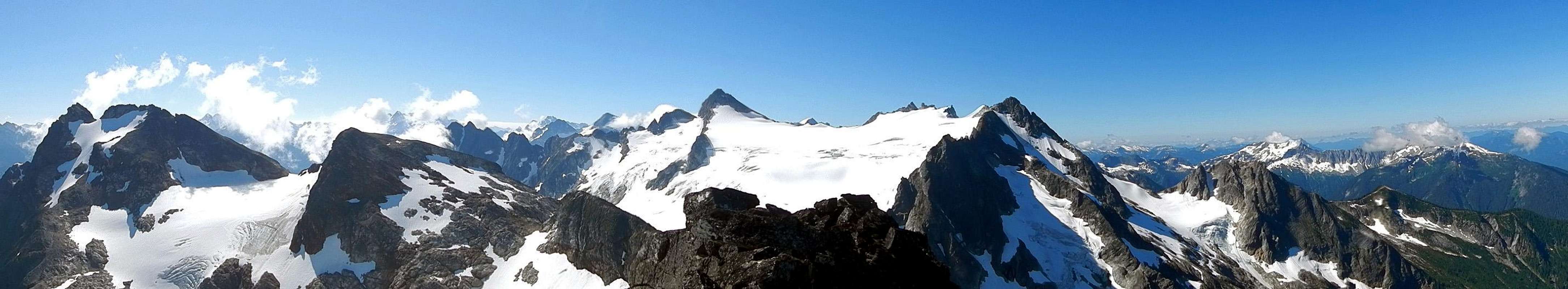
![undefined]() PBS Summit Panorama
PBS Summit Panorama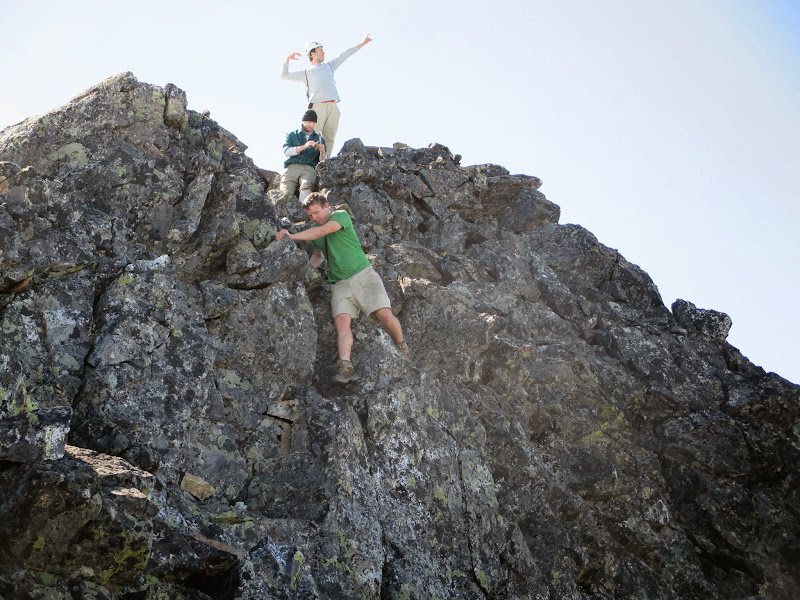 often imitated never duplicated often imitated never duplicated |  descent with views descent with views |
Biting flies kept us from lingering so we continued North along a snow filled basin towards Pyramid Peak. A few false starts and we dropped some gear on a rock to make the last summit easier. I started to fall behind everyone, probably fatigued from the whole trip. I cut a slightly different path to catch up avoiding a steep snowy traverse in my questionable boots. Upon gaining the ridge it was surprising that the snow I had been on all that time was actually a glacier as we had to pass a small crevassed water-ice section. Back together on the summit we ate the last of our food and donated spare lettuce to gimpilator. When we got to the core it took its final trip over the edge of the East cliff taken by the wind. Great view of Stetattle Ridge, Diablo, Ruby and well everything. Gimpilator had us pose for a panorama and then his was the last camera to die.
 headed to pyramid headed to pyramid |  Luna's pull Luna's pull | 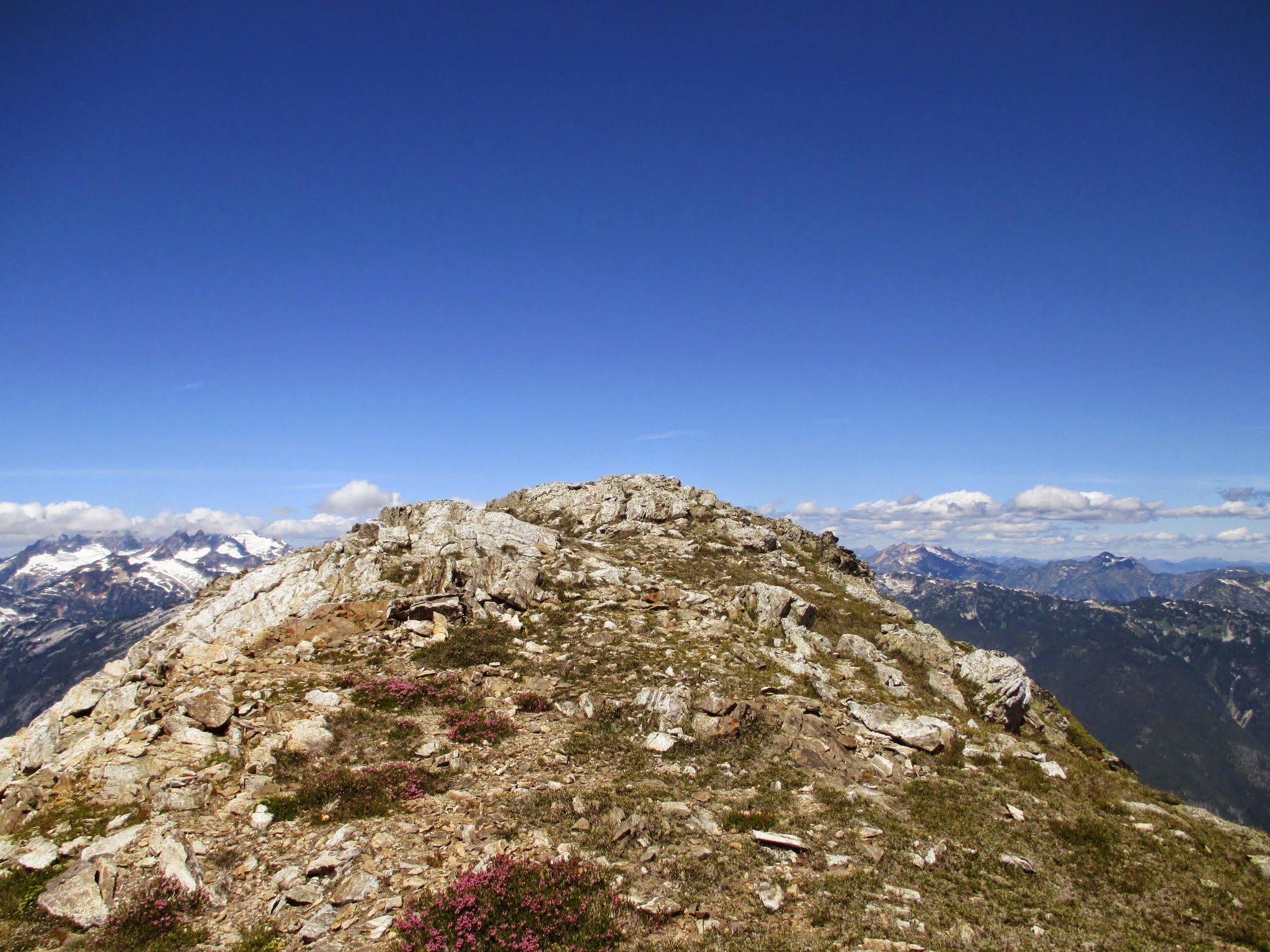 pyramid summit pyramid summit | 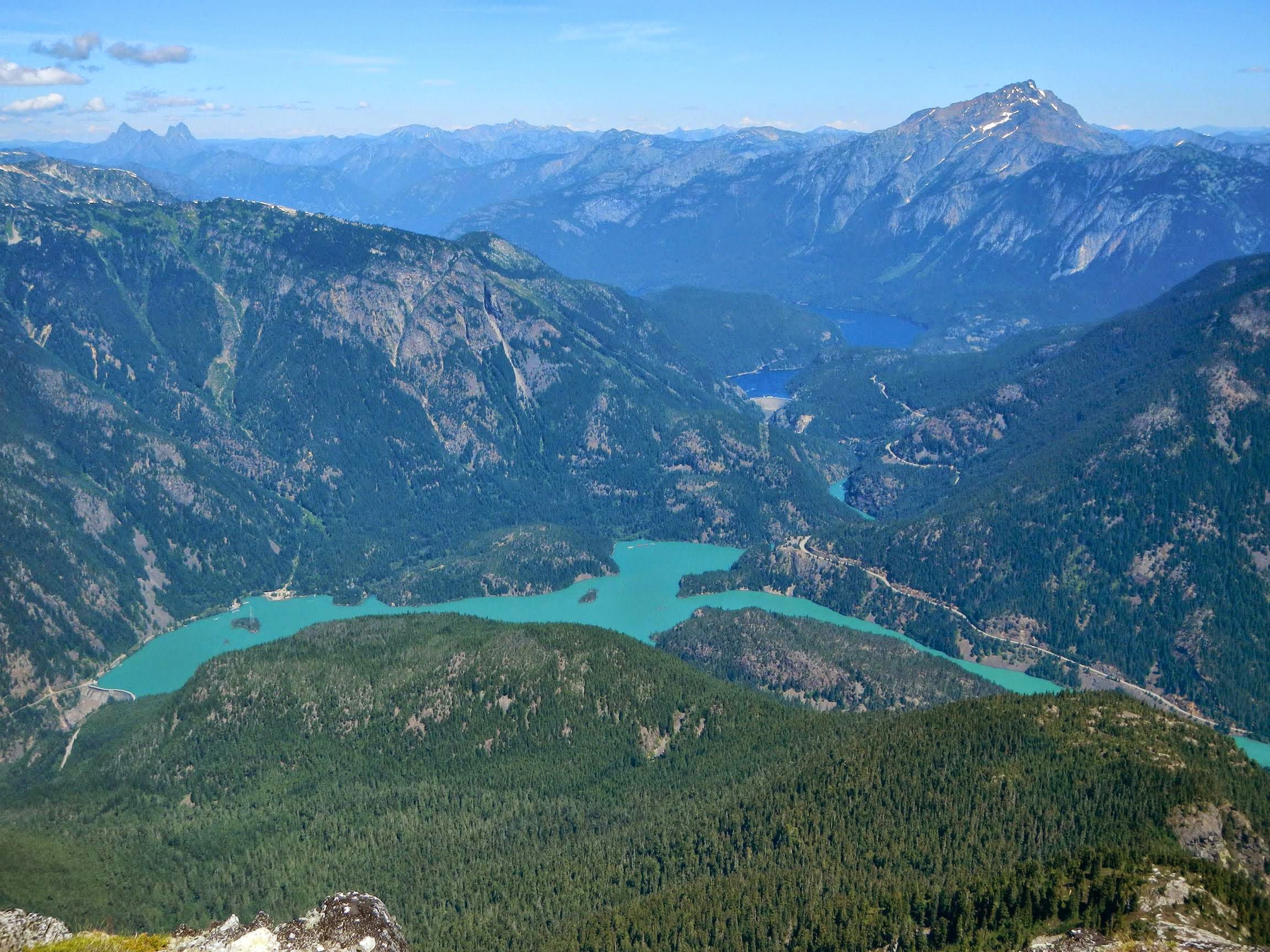 Diablo and Jack Diablo and Jack | 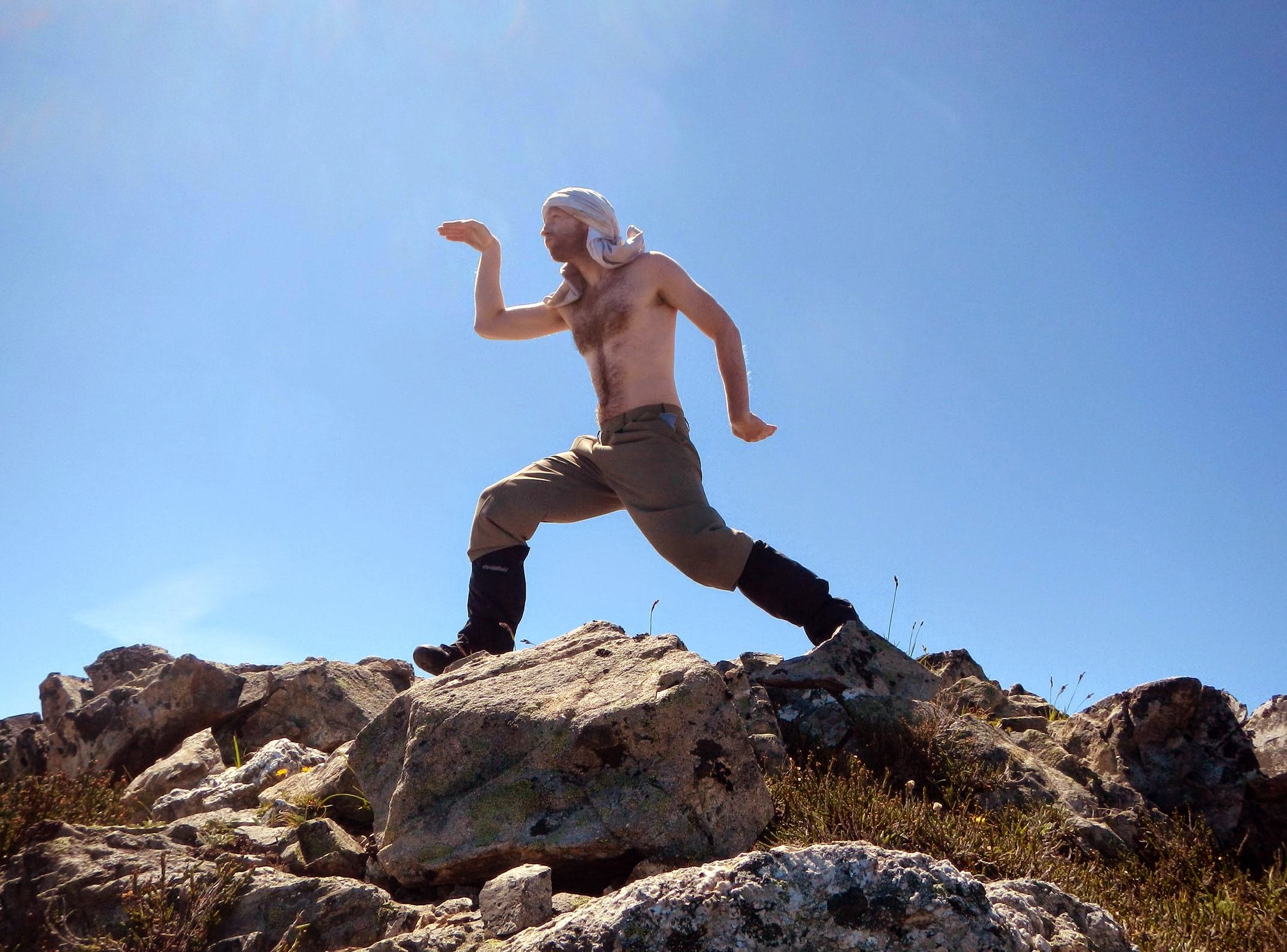 Egyptian on pyramid Egyptian on pyramid |
![undefined]() Pyramid Peak Panorama
Pyramid Peak PanoramaOur Return Home
We all had an unofficial race back to the Colonial glacier trying to out-run daylight. It was a fun charge in energy but I stupidly ran through too much of it becoming quite drained by the time we got back to the windy rocky rib at the moraine. I admit I fell behind and Josh was worried for me but I knew we'd get back down fine. We bypassed below the snow-cave on the way out. At the scree-field we split into two groups. Josh and gimpilator took the route I went on the way in and I took theirs. Both of us regretted it since they didn't find my exact route and I detested the ridiculously steep and exposed trail that gained elevation for no reason. We all met up at a rock we had a couple days prior and from there it was a death-march back to Pyramid Lake. We got separated a little and I found the correct way around Pyramid Lake, alone until I caught them at the car. I was maybe 10 minutes behind. Laying down was all I could do for the next half hour while people sorted their gear. The sun started to sink low and a visitor stopped his car to ask if anyone wanted some bear spray. Cool deal! We figured it'd come in handy. We thanked them after hearing their Canada story and made our way back home to Chipotle and rest. Thanks gimpilator for a great time out!


Comments
Post a Comment