A Big Arrow to Vegas - December 21st, 2012
I had enough vacation days to fly back to Massachusetts for either Thanksgiving or Christmas, but not both. Having already made two trips in mid October and early November for a good friend’s bachelor party, I was leaning towards pacing myself and going back for Christmas, but the fact that my high school 10 year reunion was on Thanksgiving tipped the scales for an earlier trip back, and that weekend I enjoyed a nice long respite from the craziness of Utah. My last night home I tried my best to steel myself mentally for the prospect of not likely returning home for another 8-9 months (which proved to be the case), and the bleak thought of a long winter in the barren wasteland of what passed for civilization in SLC was terribly depressing. As all things Christmas began dominating all my peripheries I found myself more and more homesick with the prospect of spending the holiday away from home for two years in a row dawned closer and closer. Driving home on a dark late night on the empty reaches of desert between Baker, NV and Delta UT (after climbing Dutch John Mountain with the famous Dennis Poulin) the only station I could toggle on the radio was the NPR; while listening to some B-list actor read a Christmas themed short story taking place in New England and specifically Western Mass, where I had once gone to school and where the subject of the story was frequenting the same roads and cafes that I was also intimately familiar with, I came to the realization that Christmas to me would always be signified by the cold, dark, and winding tree-lined roads of New England and the bustling streets of Boston…and not the high desert.
Nevertheless going home was not an option, and with Christmas Eve off from work as well I did have a four day weekend, so I began brainstorming places to go where I could set up shop and get some peaks in while having enough of a nightlife to distract me from the homesickness. Ely and Reno were options, as was Moab, though the latter didn’t really have too many P2K’s in the area for me to pursue. The idea of going to Vegas, however, began to grow more and more on my mind; it made logical sense…there would be distractions, plenty of peaks nearby, and if I couldn’t be home for Christmas, why not go somewhere where no one, from the tourists to the bartenders to the bouncers and VIP hosts, were home either; where mostly everyone present had made a choice to choose the Sin City over being home for the holidays.
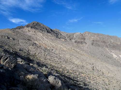
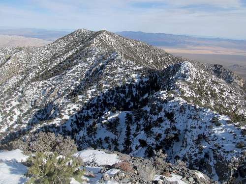
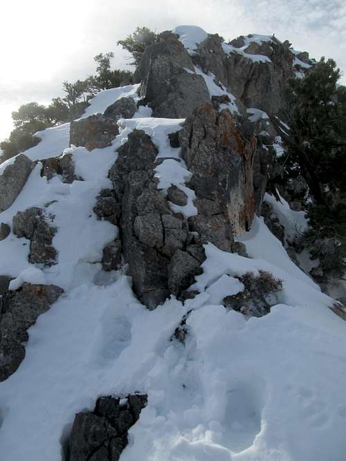
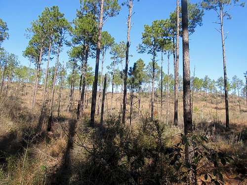
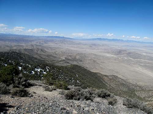
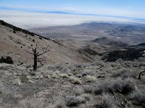
As the weather began shaping up for the long weekend I worked a prior Sunday and wrapped up all my work during the week so that I got the okay to take Friday off as well. My plan was to make the drive down, get the Arrow Canyon Range Highpoint, and cruise into the city in time to watch the Bowl game going on that night. I got a late start, however, and took my time on the drive down, checking out some of the small (and desolate) towns on I-15 along the way and, before I knew it, by the time I pulled up US-93 towards the Arrow Canyon Range I was already flirting with last fringes of the early afternoon. Despite the route description here on SP as well as my own due diligence on Google Earth I had trouble figuring out which one of the nondescript peaks to the right was the one I wanted to climb; I knew I needed to target a certain wash, but there were two that both looked like the right one, and both seemed to offer a similar traverse to a peak that could be the Highpoint (also known locally as Big Arrow). I pulled up pictures to try and match up with the peak that was in front of me now, and despite only being maybe 45% sure I was at the right place, I decided to make a go for it before I ran out of daylight (and missed out on the bowl game too, mind you).
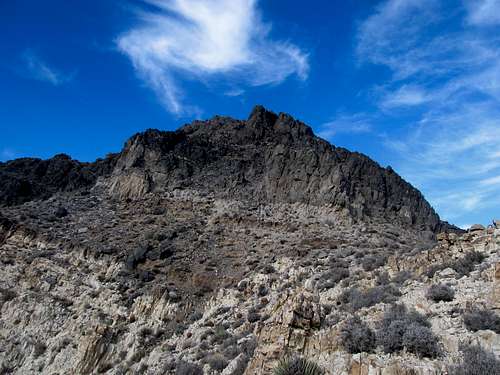
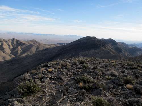
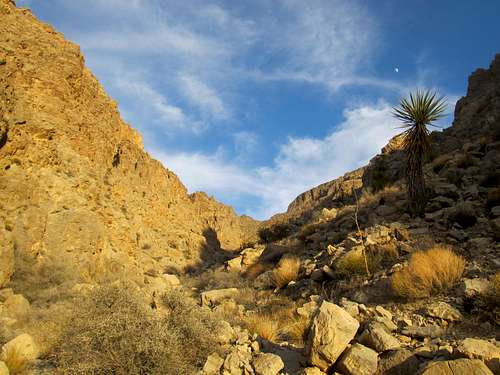
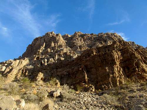
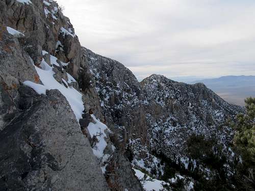
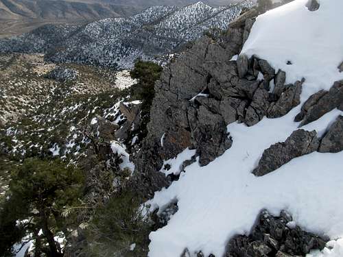
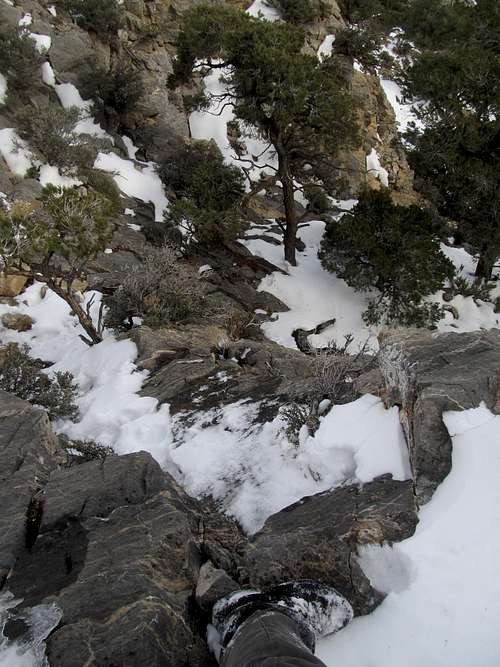
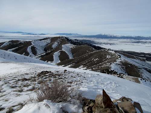
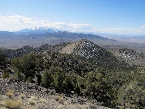
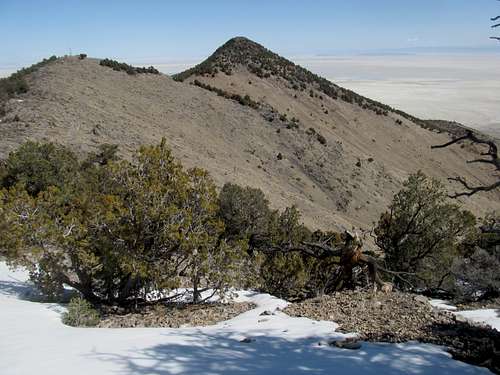
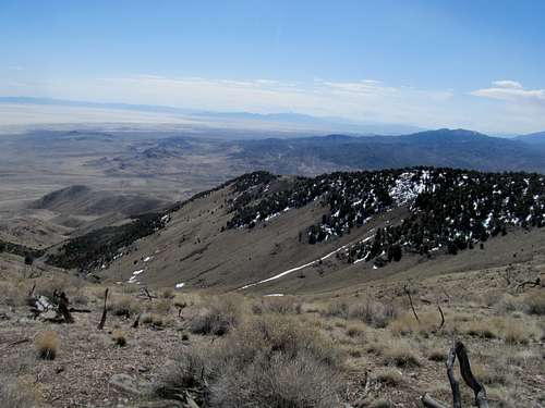
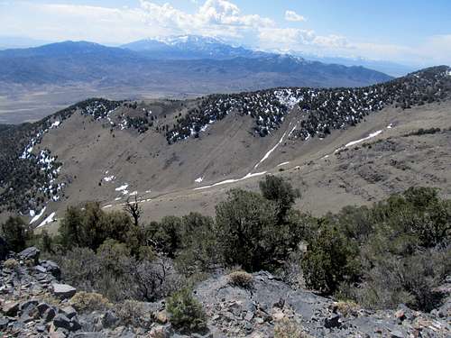
I made it up quickly enough across the desert from the highway and started up the wash. The footing was pretty decent, with lots of nice and blocky boulders serving as erosion’s hand crafted stair steps, and I soon made the saddle. I turned left and saw the peak ahead of me. It looked right, with its bands of black rock guarding the summit, as did the subpeak behind to the south, so now I was, perhaps, 55% sure I was on top of the right peak. I headed north up the terrain, easy for now, for the band of black rocks ahead.
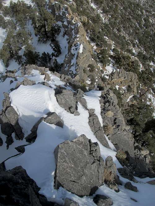
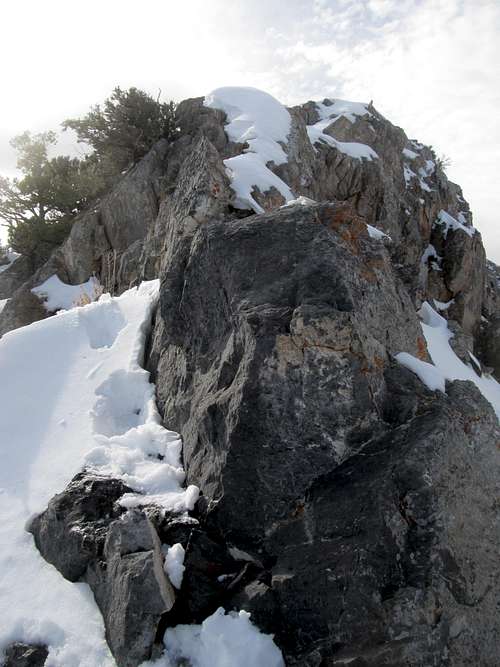
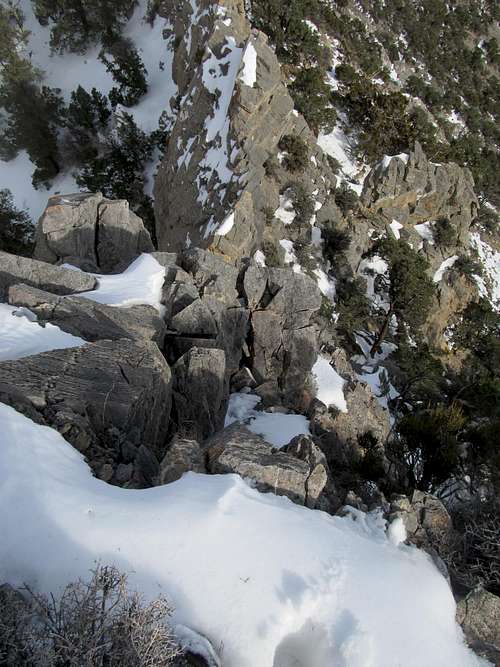
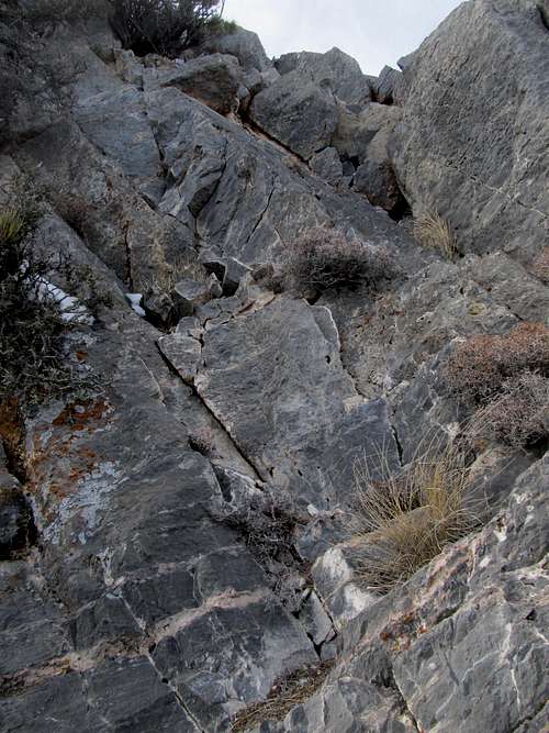
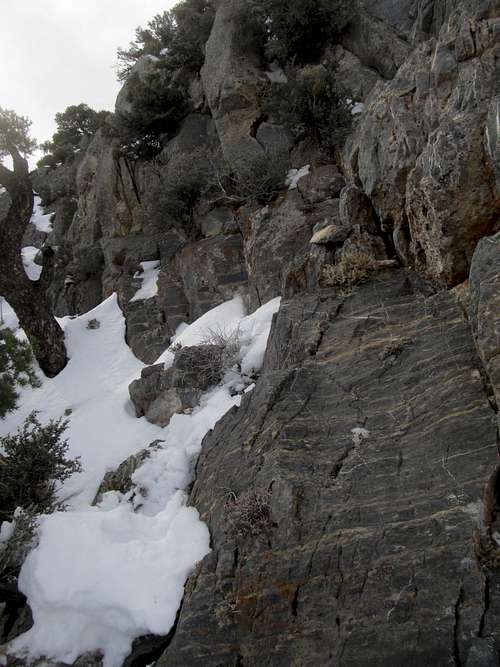
I knew, as long as I was on the right peak, that there was easier terrain to the right, but the black rocks looked more direct and kinda fun. A cold breeze blew through just as I found myself traversing under the shadow of the rocks, and I shivered, a bit surprised at being so cold outside sunny Las Vegas. The scrambling here was somewhat loose and somewhat exposed at a few spots…the quality of the rock was sharp, cold and ashy all at once…not as fun as I had thought it would be. Traversing right after I had already ascended would be loose, annoying and just as sketchy, so I picked my spots to climb through the black band of rocks and onto the false summit.
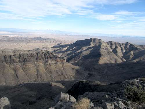
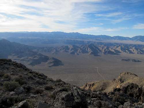
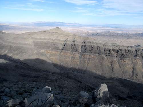
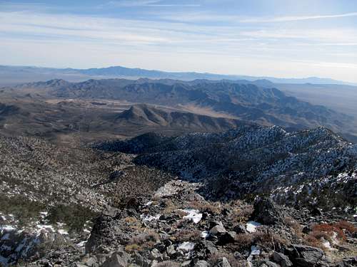
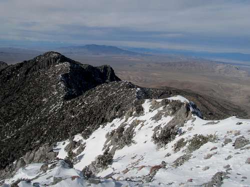
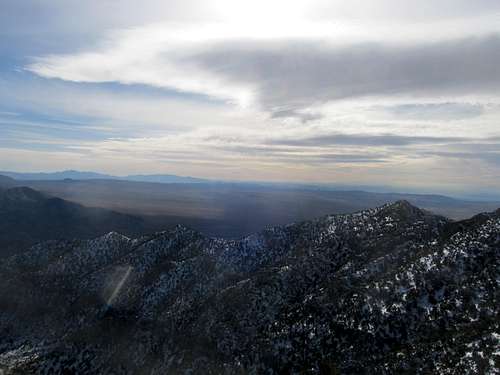
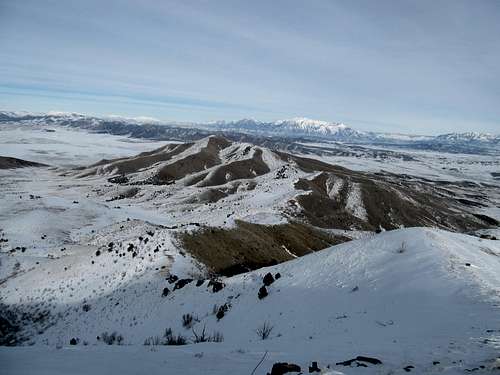
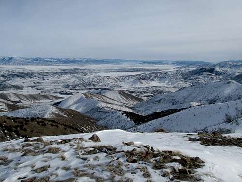
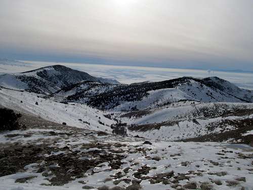
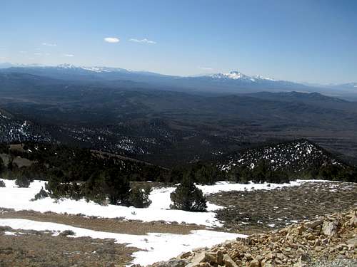
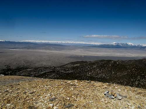
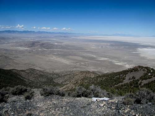
The true summit was a short distance away to the north, and I admired the views around to the Sheep Range as well as the surprisingly scenic canyon to the east, now illuminated by the rays of the fading sun.
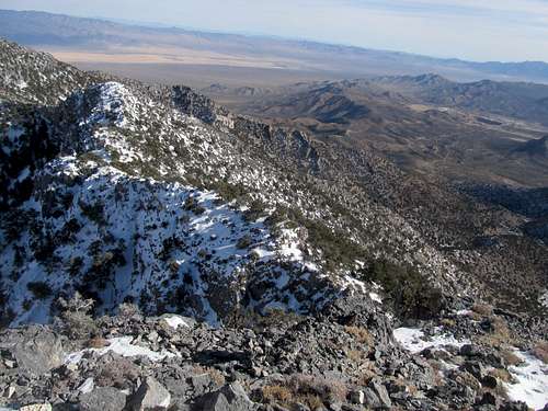
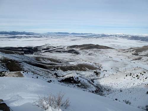
I opted for the looser but class 2 chute to descend and sidehilled back to the saddle; it was annoying, but better than downclimbing the black rocks. It was getting late and cold, but I was less worried about running out of daylight than I was of missing out on the start of the bowl game (one that would prove fairly unmemorable in hindsight).
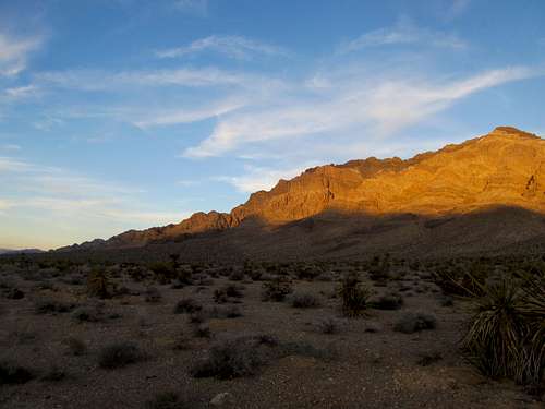
The main drainage was fun to descend, block by block, and I found myself warmer with the sun shining in my face and the canyon walls sheltering me from the wind. I made it to the car with the last bits of sunlight fading behind the Sheep Range, making for a brilliant evening alpenglow upon the peak I had just ascended.
I made it to Vegas, having gotten the right peak at the cost of missing out on the first quarter and a half of the bowl game and a giant tear in one of my favorite shirts to climb in (torn when it got caught in one of the jagged edges of the black rocks, of course)…not a bad way to begin my Christmas Vacation. Unbeknownst to me though the rest of the trip would not likely go so smoothly.
Stark Raving Clark - December 23rd, 2012
Saturday I lazed around, watching the bowl game between Boise State and Washington play out only a few miles away, and had myself a pretty good night at the lounges and bars of the Mandalay Bay. Sunday’s plan was Clark Peak across the border in California; seeing that it was a P4K as well as the highest peak of the Mojave interior it was high on my list, enough so that I was willing to miss out on the Pats game to climb it (they were playing Jacksonville though, so can you blame me?) Despite being still pretty banged up from the previous night I felt good, and on my way out I grabbed for my breakfast a tomato and mozzarella salad from the Starbucks stand at the Excalibur (yes, slumming it indeed in Vegas. Don’t judge). Alas, that would be the downfall of the rest of my vacation.
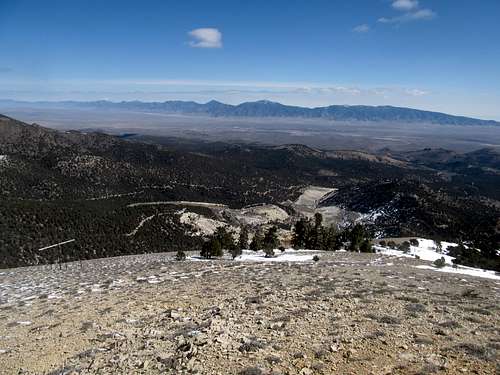
I got Clark in though, but not before some pretty perilous moments. The drive down to the border was quick, and I had saved enough of the directions around the factory off the exit to find my way as close as possible without too many false starts. Most of the dirt roads were fine for the Camry except for one steep section downhill into a small ravine on the way in. I knew the final mile plus to the 4WD trailhead was not doable for a Camry, so as I approached closer to the peak I took a wider road branching left. It turns out the other fork, which was rougher looking, was the main road, but it mattered little as I parked shortly after the turnoff and, as I beelined directly for the approach canyon, meeting up shortly with the same road.
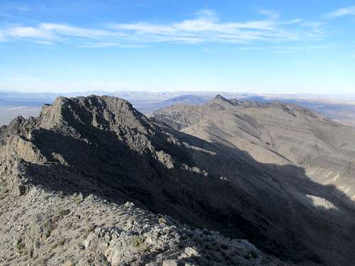
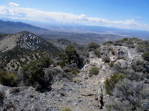
From the picnic area I opted to ascend the ridge on the right based on reports about its terrain was preferable. It was a pleasant walk, and as I ascended I shifted left to aim for the obvious line of cliffs that I knew was part of the standard route. The terrain got a little steeper and looser as I neared the cliff band, and some spots were interspersed with snow. I followed the cliff band all the way to the right and the ridge crest, where the alternate knife edge traverse route started, trying to locate the crux. There were a few candidates but I wasn’t 100% sure on any of them, and I went back and forth a few times before settling upon the right break in the cliffs.
The “crux” was easy to negotiate; the top of the move was on a slippery, slightly downsloping ledge but otherwise there were little difficulties, especially seeing that it was snow free. I thought that the hard part was over, but oh I was so wrong.
There was no obvious route to the top from where I stood above the cliff band. I ascended to the ridge crest directly from where I was, but the only option here was a cold, icy, snowy and exposed traverse too. Oh, and did I mention it was cold and windy up here, the incoming clouds having swallowed up the sun that had been out hours earlier? I retreated, looking for places further up to the left to gain the ridge, but all required some serious scrambling on slick, snow covered rock. I considered my choices; retreat was not an option, seeing how oh so close I was to the peak. None of the trip reports I had read reported difficulties above the supposed crux though, so what was I not seeing here? The only answer seemed to be that either the easier options were covered up by the snow, or that the snow had made what would’ve been an easy scramble in dry conditions look like something fairly hazardous.
I finally decided to just go for the ridge. After making a few moves I reached a point where I had already stopped and turned back from a few times when reconning the area a few minutes later; the difficulty was a rather high step up a slick and smooth vertical boulder band, with no good footholds other than the tree that was sticking rather obtrusively in the middle of the chimney the rock formed with the neighboring one. I used my boots to brush off as much snow as I could from the rock, then, ascended it. The foothold wasn’t great, but it held while I found some handholds further up and I managed to drag my fat ass to the next ledge. There were more moves to follow ascending the ridge, but while the snow and exposure unnerved me at times none of the moves was worse than that initial one up.
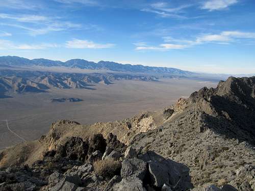
I soon crested above the steepest sections and was dismayed to find the summit still a ways off. I trudged grudgingly and slowly through the snow to finally arrive at the top, where the cloud cover and an obvious cold front blowing in made the day seem later than it actually was. Pictures, then a descent I was quite nervous about.
Each major downclimb step was taken carefully, facing inward, and while my anxiety levels were high, the ridge descent ended up being easier than I expected.
The downclimb through the traditional class 3 crux was no problem either, a relief since it was dry, and I made quick progress down the steep slopes, opting to descend the drainage directly on the way down through some dry falls. I had a little bit of trouble locating my car but otherwise happy with the summit in hand and ready for another night in Vegas.
If I could sober up enough the next two mornings I had in mind maybe Perkins or Wilson for Monday and Virgin on the drive back Christmas Day. Alas it was not to be. Already as I pulled back into Vegas I was feeling fatigued, so I took a nap. But a few extra hours of sleep doesn’t ward off severe food poisoning from the mozzarella salad I had ate that morning (pretty sure it was that, as I hadn’t eaten a lot in the 24 hours prior, and it certainly wasn’t from granola bars consumed on the mountain), and I spent the rest of my vacation sleeping, recovering, and trying not to die in a hotel room by myself from dehydration. Ironically, in bed and watching a SportsCentury feature on Larry Bird on Christmas Eve, I felt the very same homesickness I had come to Vegas to avoid. (Lesson learned, fork out the few extra bucks to stay in a better place like the Mirage, Cosmo, or Venetian). I tried to salvage something out of the trip by driving up West Mountain near St. George, but instead just got my Camry stuck in the snow.
Driskillin' It - January 19th, 2013
With Bowl Season and the NFL Playoffs in full gear the next few weeks I was distracted and that was fine, since the winter found me in various stages of incapacitation. It was this was truly my winter of back trouble where I threw it out on three separate occasions, the first in mid December, which by the time I went to Vegas I was just starting to recover from, but I quickly re-aggravated it trying to dig the Camry out of the snow on West Mountain. Some ill-advised heavy lifting at the gym left me in worse shape, but what was worse was that I was experience bad hip pain for the first time. Back pain I was used to and could deal with, because it usually goes away, but what if the hip problems lingered?
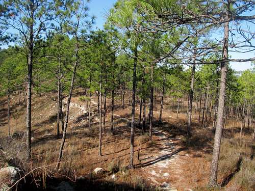
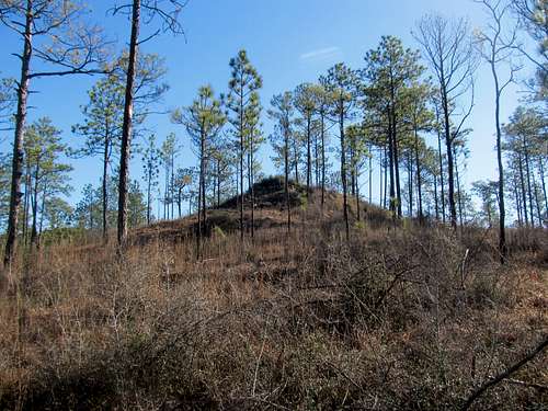
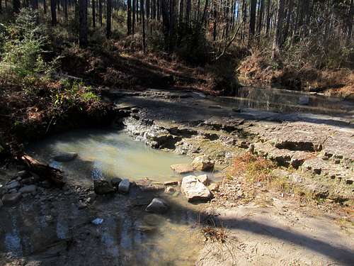
The next time I found a summit was in Louisiana. I had a company conference in Shreveport in late January, and I flew in a day early on a Saturday to get Driskill Mountain and check out the nearby area. Driskill was my first destination, and using the directions from SP I managed to navigate the backroads of the “high” bayous of northern Louisiana to find my way to the somewhat ramshackle trailhead.
The hike was pleasant, even slightly chilly at times, and the occasional views were an unexpected treat. I spent the rest of the day driving around and paying homage to some of the minor 1-A football stadiums nearby, paying tribute to places where legendary quarterbacks such as Terry Bradshaw and Bubby Brister played their college ball.
The next day I drove south, doing a quick hike in Kisatchie National Forest before heading back to Shreveport to partake in the start of the company conference (as well as try and catch kickoff for the NFC Conference Championship). Along the way I passed through some interesting plantation country as well as the cool little town of Natchitoches, which apparently his the northernmost outpost of Cajun culture in the state.
All in all it was a nice respite from both the bitter Utah cold as well as the dry desert and while it was nice to get away from SLC too, Shreveport, Monroe, and most of the area seemed pretty dumpy despite the fact that we had a good time treating a company conference in Shreveport like we were partying in Vegas to the extent that we could.
Racing Daylight on Champlin - February 2nd, 2013
A few weeks later I finally decided that my back was healthy enough, so it was high time to try and get a prominence peak again, and what better opportunity than to take advantage of the Saturday before the Superbowl. The weather forecast was sunny, which was good, but I got off to a late start on my way down towards Champlin Peak, which was bad. Under normal circumstances the peak is cake but when the dirt approach road is snowed in in winter it adds another 4.5 miles or so of road walking each way. It was already around noon when I surveyed the long road walk ahead of me and the peak looming far into the distance when I realized I didn’t bring enough water for the trip. Thus, a drive back to a general store in Nephi 25 miles or so away. Now I doubted if I would have enough daylight to get this peak done. As I drove back west I noticed on the map that the main highway passes not too far from the peak’s southern flanks…what if such a route would provide quicker access than the road walk from the north? I approached and saw a paved turnoff a few miles before the power plant that stood almost due south of the peak. I decided to follow it to see how close to the mountain it would lead, and even though it only led a little ways to a quarry (and before that where the road froze over and not too much closer to the peak) I decided to make a beeline to a summit that didn’t look that far away. My starting time was past 1 PM and with the snow cover being fairly light, I opted not to bring snowshoes. The latter wasn’t a mistake, but my judgment of how far the peak was wasn’t exactly spot on.
The ascent was pretty easy at first, going throw flat terrain, crossing a fence, and then eventually following a drainage in the general direction towards the peak ahead. There was a hill lining the left side of the drainage and after awhile I ascended it, thinking it would connect to one of Champlin’s main ridges. It didn’t, instead revealing the drainage rose to small pass then dropped into a vast open meadow I would have to cross before reaching another drainage closer to Champlin. First I had to descend the gain I had unnecessarily climbed.
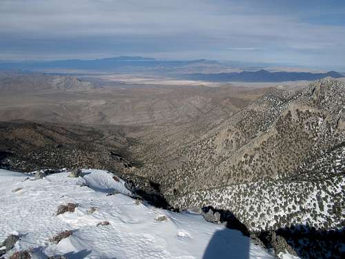
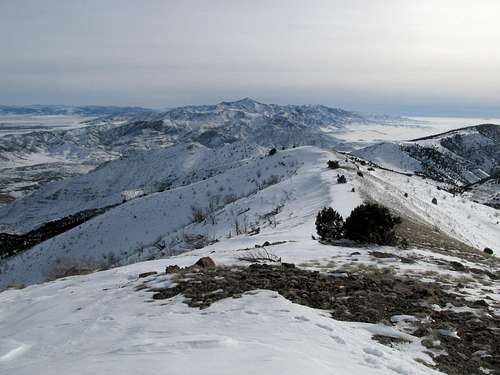
I eventually made it into the next drainage, surrounded by higher walls and at the head of the canyon to the right some surprisingly impressive cliffs. I decided to ascend the ridge to my left, which proved to be steep and surprisingly difficult on my lungs, especially in those sections where the snow’s consistency was similar to scree (except cold). I crested on some solid consolidated snow thinking I was pretty much at the summit, but to my chagrin it still eluded me, a longish seeming traverse away and hundreds of feet above. Under normal summer circumstances this would have been cake, but it was winter, cold, I was tired, my back and hips were bothering me, and most importantly, I worried about running out of sunlight. That last factor weighed on my mind as I decided whether or not to go for the summit. Of course I had to. The terrain got easier along some dry sections on the ridge before a last steep climb up nice crunchy snow to the summit. Views were great and it wasn’t too windy. Fool Creek loomed impressively across a barren landscape to the south, while Nebo gleamed in the afternoon sunlight, but I had little time to tarry around up top.
I made the summit around 3:30 and figured I had maybe two hours of daylight left. I cruised down the ridge and descended the steep slope back into the drainage below, wary of the small cliff bands that dotted the ridge sides and making a point to avoid a very large cliff across the way. Then it was what seemed like a very long walk back to the small pass, what with my aching hips and a slope that slowly ascended along the way.
I fast walked as fast as I could as the shadows crept further and further around my peripheries, and I hoped to be able to at least find the fence I had crossed on the way up before it got dark. I ended up barely beating the sunset, despite the last hundred feet or so of uphills and circling around, trying to find my car. I was freezing and beyond fatigued by the time I pulled into a Wendy’s at Nephi, teeth chattering involuntarily all along the way. The entire drive back to Salt Lake seemed a blur, and I was sure I was going to be sick, since that had happened the last time I drove in what seemed to be a complete mental daze. But I was fine, watched a crappy Superbowl, continued to rehab my back while swearing my next time out would be in warmer weather.
Jolly Dolly Varden - March 24th, 2013
I was true to my words, and my next outings ended up being in sunny and relatively warm Zion. But no peaks, and again I was feeling the OCD itch to get summits as mid March approached. St. Patty’s Day weekend was a long overdue warm spell in Utah (80’s in Moab I think) but alas I had to Manhattan into the cold and rain (but also good times with old friends and tickets to the last ever Big East Semi-Finals!!!) The next weekend I felt even more full tilt to take advantage of another sunny, but cold, weekend but…March Madness…and what a great tournament it had been already (we’ll always remember ye, Florida Gulf Coast aka Dunk City). So I figured Dolly Varden would do for a quick Sunday outing, and I could catch some of the games in Wendover on the way back.
Again a late start. The roads to Dolly Varden wasn’t a problem for my Camry, and despite some slightly snowy areas I was able to make it to the mine gates. The walk up to the summit along the road was mostly uneventful, with parts gravel and parts snow.
Views were good, but it was windy and cold on top, so I hurried it back down to the car to catch a few games in Wendover.
On a sad note, this would be the very last outing my poor, faithful Camry would accompany on. Later that week I found out that getting it to pass inspection at the end of the month would require about a grand of fix up on some emissions related stuff. I decided that instead of putting money into a twelve year old car I might as well get the 4WD vehicle I needed. Thus by the end of the week I was driving a 4Runner, but not without regrets. The poor Camry had served me well, through thick and thin, gotten summits on its own accord, and endured some roads well beyond what should have been its limits. I felt no trivial amount of sadness knowing I had brought her all the way out west only to see her die (or more likely, see the sleazy Toyota dealership sell her at a good markup).
Going Dutch - March 30th, 2013
I ended up driving to get Dutch Mountain in the west desert the next day, a peak that, ironically, I could have reached in the Camry. I parked at the pass and made my way towards Woodman Peak, the summit you have to go over and around before you’re within sniping distance of Dutch Mountain. I ascended through the open terrain along the left (western) flanks, getting higher and higher, until I figured I was within striking distance of the summit and decided to make a quick sidetrip to the top. It was a steep few hundred feet but worth it. Then it was on down to the ridge connecting Woodman and Dutch, which included traversing around some small cliff bands that I made a note to avoid on the trip back. On the other hand it was nice and shaded, and it was such a good feeling to feel the relief of shade on a warm day (rather than just be cold period).
I made it to the ridge top and was dismayed at how far away the summit seemed. The traverse over was long but pretty scenic, with views of the desert all around. There were a few ribs that featured some scrambling, though they could’ve been avoided with some moderate sidehilling. All in all it was a satisfying summit, with surprisingly unique views being situated in the middle of the salt flats.
Then the scenic traverse back around and over the summit ridge:
I decided to descent down into the basin west of the Dutch/Woodman connecting ridge before sidehilling around the west side of Woodman again on the way back to the car.
The lower basin was surprisingly lush with the new spring grass unique to desert areas such as this, and the regain back over Woodman’s flanks wasn’t too bad. Like the week before I made it back to Wendover to catch once more some basketball games.


Comments
Post a Comment