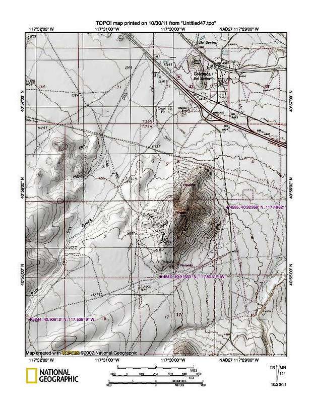
I've placed waypoints at the key road junctions. The one at elevation 4595 turns off the main gravelled road and angles to the southwest.
Waypoints are in lat/long nad 27
4595 - jct turn 40.92958 117.48621
The next turnoff, at elevation 4840 is to the left onto a rough looking track that is the road you want (unless you don't have high clearance)
4840 - left 40.91633 117.50317
On this rough track, you will pass under a power line and want to take the road
at elevation 5244. This road will lead you up to the aspen grove where we made
our trailhead.
5244 - left 40.90812 117.53619


