
-
 3208 Hits
-
 75.61% Score
-
 6 Votes
|
|
Route |
|---|---|
|
|
43.74840°N / 109.9567°W |
|
|
Mountaineering, Scrambling |
|
|
Half a day |
|
|
Class 4 |
|
|
Overview
For a lot of people, this route will probably fall into the "You must be out of your f---ing mind!" category. It's very steep and very loose, and some parts are exposed. While the general way up is obvious, good route-finding skills are going to be necessary at times unless there is a lot of snow in the couloir and you stick to that. Melted out, the couloir is a loose scramble, but I did notice one obstacle that appeared to go at Class 5. But that was from below and I didn't check it out closely; I did not use the couloir proper until I was about halfway down the route.
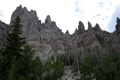
Unless there is plenty of snow present and you want to try this as a snow climb or unless you are going to have a go at scrambling up the melted-out couloir, I do not recommend this as an ascent route. The steepness and looseness of the route will exhaust and frustrate you. But it is a fast descent route and incredibly scenic, for it takes you through an amazing area of breccia spires and hoodoos (most of which have never been climbed) and directly beneath the huge cliffs on the mountain's south face. In my opinion, it is far more scenic than the standard route is, so if you're up for some adventure, consider this route for at least one leg of your trip.
This route converges with the standard route near the summit.
Just a point of clarity-- there are several couloirs on this mountain that are popular with ski mountaineers. Three well-known ones on this face of the peak are Chockstone Dog Leg, Bottleneck Classic, and the Diagonal. The couloir this route covers is not one of those. For information about skiing those couloirs and others on the mountain, it is easy to find trip reports online.
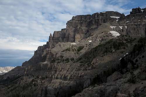
The Main Pinnacle Butte
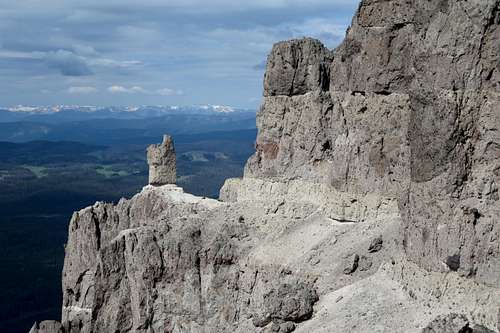 Scenery en Route | 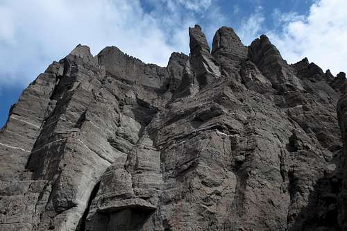 Scenery en Route |
Getting There
About 7 miles east of Togwotee Pass on U.S. 26/287 northwest of Dubois, turn onto the road for Brooks Lake and follow this good unpaved road for about 3.5 mi to a signed parking area for the Pinnacles Trail. This road is passable for passenger cars.Route Description
RT distance is around 7 miles. Elevation gain is approximately 2600'; most of it occurs over only 2 miles, though.
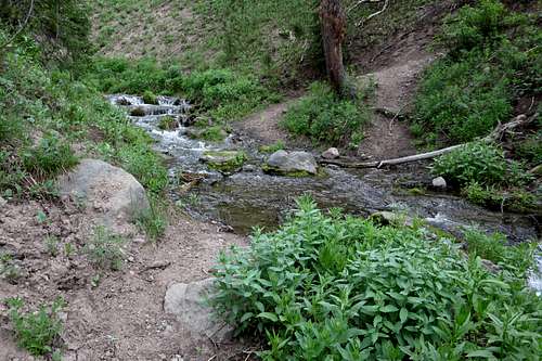
About 1-1.5 miles from the trailhead, the trail crosses a stream. Leave the trail after crossing this stream. It is about 5 minutes after you pass a pond and marshy area on your right and it is the third drainage you cross after leaving the trailhead. Even in August, I have seen a healthy flow here, so this spot should not be difficult to notice.
The drainage does not lead to the route itself. Instead, ascend along the banks on the right side to more-level ground. Eventually find a faint drainage. Follow it up the mountain as the drainage becomes wider and more apparent. This is the drainage that becomes the route up the peak.
The drainage does not lead to the route itself. Instead, ascend along the banks on the right side to more-level ground. Eventually find a faint drainage. Follow it up the mountain as the drainage becomes wider and more apparent. This is the drainage that becomes the route up the peak.
Leave the trail at this drainage.
Soon this drainage starts heading steeply up the mountain, and the route alternates between horribly loose scree and Class 3-4 scrambling. If you stay in the couloir itself as you ascend but run into conditions that are too difficult, get out your route-finding skills to work around obstacles; use the right side of the couloir.
Now the work begins.
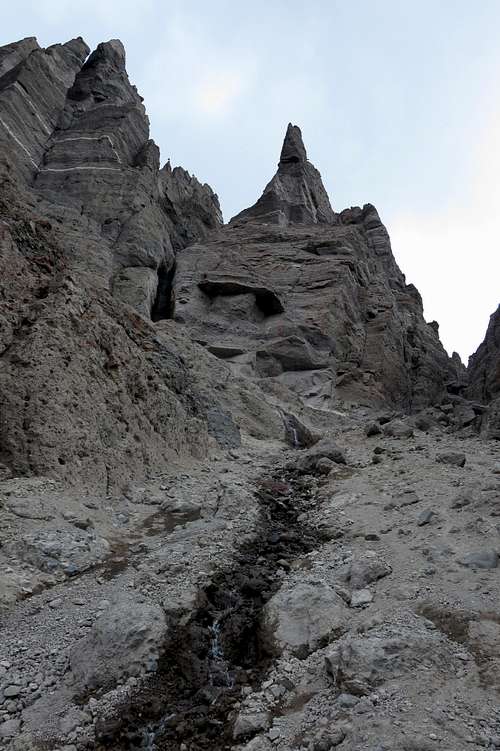
Into the Couloir
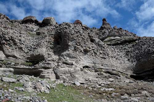
Finally, you top out on a ridge. This is the southeast ridge, the standard route up the peak. Head left up slopes toward the cliff bands beneath the summit. There are three short cliff bands (10-15') that go at Class 4 each. The picture below shows one of them. It's said you can hunt around and find Class 3, but the exposure isn't bad on these pitches, so why bother?
Just make sure you carefully test every hold before fully engaging. The rock here is decent by Absaroka standards, but it is still breccia, known for its portability.
Just make sure you carefully test every hold before fully engaging. The rock here is decent by Absaroka standards, but it is still breccia, known for its portability.
Class 4 Stuff
After the last cliff band, the summit is just steps away.
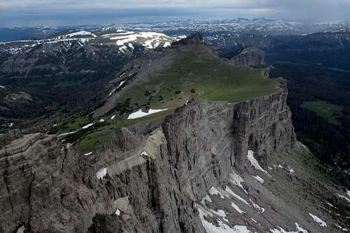
Summit View

Summit View
Essential Gear
Helmet, even if alone. Bighorn sheep live here and often knock rocks loose.To descend this route, you don't need rope and rappelling gear, but it's not a bad idea to have some just in case you get off-route or can't find the workaround one of the times you cliff out. A 30m rope should do. Use extreme caution building anchors, as the rock here is not that trustworthy.