-
 29936 Hits
-
 90.39% Score
-
 32 Votes
|
|
Area/Range |
|---|---|
|
|
44.12560°N / 109.6346°W |
|
|
Ice Climbing |
|
|
Spring, Fall, Winter |
|
|
7500 ft / 2286 m |
|
|
Overview
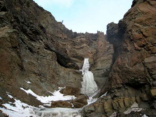
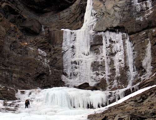
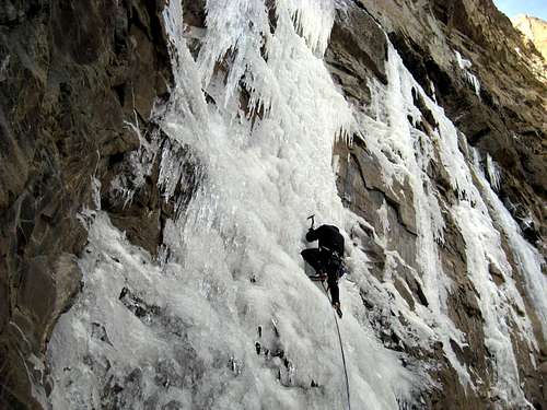
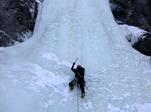
About 35 miles southwest of the unlikely town of Cody, Wyoming, in the southern Absaroka mountains, is an area sporting the highest concentration of frozen waterfall ice routes in the continental US. Among ice climbers, this place used to be a best-kept secret however the word has spread. It is said that if you can climb well here, you can climb well anywhere. There really isn't point in going unless someone in your party can lead WI4's solidly.
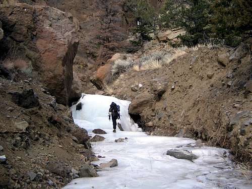
Roadside ice, short approaches and toproping are not what you will find in the South Fork area. Approaches tend to be relatively long with possible river fords and abundent elevation gain. This isn't the best place to take beginners. The classic long routes here mostly follow creek drainages where you might climb a pitch or two, then walk up snow in the drainage to the base of another pitch. Interspersed there might be sections of WI2-ish ice bouldering which you may or may not want to rope up for.
Descents tend to involve a mix of down-climbing and rappelling off bolts, slung trees, and v-threads. Definitely know how to make a v-thread and bring extra v-thread material and slings/rings to reinforce tree anchors. Be mindful that bolts have been known to shear off in summer storms which will sometimes rage down these creek drainages. Some routes have walk-offs, but these are few and far between. The area is remote, and the nearest help is a long way off, so self-sufficiency here is important.
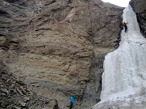
The rock is a mix between layers of volcanic conglomerate not unlike that found in the Pinnacles of central California, and a sandstone/shale units. All in all, the rock is not good! Locals say that rock gear is not of much use here, perhaps just bring a selection of pitons however most routes protect fine with ice screws unless you're going after one of the hard mixed lines. "Kitty Litter" seems to be the popular nomenclature for the rock quality here.
Getting There
From the town of Cody drive west towards Yellowstone passing by the Sierra Trading Post and turn left on South Fork Road (State Highway 291) just after passing the Wal-Mart. There is a sign so it's impossible to miss. Drive about 45 minutes towards the southwest on this road which passes along the south of the reservoir, then ascends a bench above and to the south side of the river before descending and crossing to the north side of the river. Shortly after the bridge, you will come across the first drainages that contain ice on both sides of the valley. The pavement ends about 32 miles from town, and becomes unpaved gravel. High clearance isn't necessary, though in some very snowy/icy conditions 4WD might be useful. Cody is served by the Cody-Yellowstone Regional Airport.
Guidebook
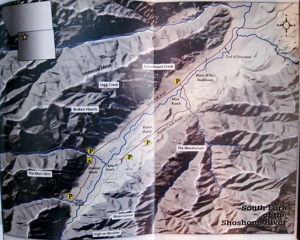
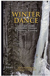
The definitive guidebook to the area is Winter Dance : Select Ice Climbs in Southern Montana & Northern Wyoming, Joe Josephson, First Ascent Press, 2004. The book has a map of the South Fork area, approach notes, first ascent stories, and lots of great photos. The old guide / map is noted for having some pretty serious sandbags which is mostly corrected in Winter Dance. It's a cool piece of history though with some of the most vague route descriptions I have ever seen. It's argued that ratings in the WI3 to WI3+ range are still a bit stiff so be prepared. Actually, the entire area still has an old-school atmosphere and all the routes are stiff. As an example, the first 3 pitches of Broken Hearts are rated WI 3 and are all in the 80-85 degree steepness range. Some WI 4 pitches here are plumb vertical!
Major Routes
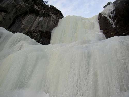
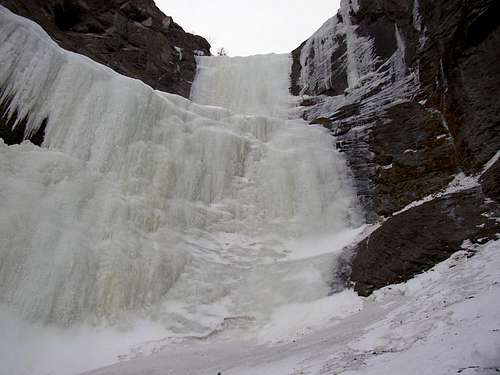
Below is a table of the main routes in the South Fork area ordered by difficulty. All these routes are great and worthy of whatever approach it may have. Now there are certainly probably 10 times as many routes in the South Fork area than what is listed here so I have only listed the classics. If you're looking to avoid the crowds, dive into the more obscure drainages or stick to the south side of the valley where there are fewer moderate routes.
| Name | Photo | Rating | Area | Brief Description |
| Smoked Turkey | WI 3 | Deer Creek | A nice, 3 pitch moderate route with an hour long approach up Cabin Creek then up a side drainage to the base of the first pitch. Each pitch is about 20-30 meters high offering one of the best moderates at Cody however the avalanche danger is very high. | |
| Stringer | WI 3 | Legg Creek | This route has one of the shortest approaches in the region. Hike north into the small drainage just right (east) of Legg Creek. Since this route faces south, it's often sun baked but is the best beginner route and completely bolted making rappels easy. Expect company. The first pitch is the only worthwhile pitch but the route offers two more easy pitches above. | |
| The Main Vein | WI 3+ | Cabin Creek | Park a mile past the Deer Creek Campground and hike up the drainage. The route faces south and the first pitch sees a lot of sun. You will be able to see the route from the road. Shortly before the base of the route, scramble right up scree, then traverse back left on a Class 4 ledge to the base. 3-4 pitches of easier ice makes this route great for beginners however the approach is pretty long. | |
| Smooth Emerald Milkshake | WI 4 | Deer Creek | This is the best moderate ice climb in Wyoming. Hike up the Deer Creek Trail until the Bitches Brew drainage then descend to the creek. This will require a short rappel and Deer Creek must be frozen. Cross it and start up the route which dumps right into Deer Creek. 800 feet of ice up to WI 4 makes this an awesome, long route however the approach will take 2-3 hours. Beware that the avalanche danger in this drainage is bad. | |
| Schoolhouse Route | WI 4 | Schoolhouse Creek | Start at the Ishawooa Mesa TH and hike up the first major drainage next to Schoolhouse Spire (north side of valley). This sustained, three pitch route is one of the most popular routes due to its accessibility and consistent good ice. | |
| Cabin Fever | WI 4 | Cabin Creek | Park at the end of the road and hike up Cabin Creek to the first major drainage on the right. Hike to a big amphitheater and the base of the route. Approach takes 40-50 minutes and Cabin Creek needs to be frozen. The 60 meter pitch is a beautiful line. | |
| High on Boulder | WI 4 | South Side - Majo Ranch | This awesome route is one of the widest, thickest flows in the area. Park at the end of the road and cross the South Fork (hope its frozen!) Hike 45 minutes up the drainage just south of Mean Green. Three pitches of WI 3-4 takes you to the base of The Pillar of Pain WI 5 route. This is probably the best and one of the only moderates on the south side of the river. | |
| Too Cold to Fire | WI 4 | Deer Creek | Park at Deer Creek Campground and hike up Deer Creek (needs to be frozen) to a deep chimney on the right. This route consists of big ice steps and bulges separated by ledges for 60-70 meters. | |
| Sendero Iluminoso | WI 4 | South Side - Hunter Creek Road | Park at the Bench Parking area, which is 3.8 miles down the Hunter Creek Road. Hike up a trail heading left and continue up to the Upper Bench. This approach is long and confusing. Bring lots of beta. The route ascends a narrow ribbon of ice for 60 meters to a fixed anchor on the right. Higher pitches are rarely done. | |
| Hostile Takeover | WI 4+ | Triptych Creek | Two major drainages past Legg Creek on the north side of the valley is Triptych Creek. Hike up this drainage for a quarter mile and take its first left fork. This two pitch route doesn't always form as the first pitch doesn't typically touch the ground. If it does, climb the WI 4+ curtain to bolts and continue to the easier second pitch. If it doesn't touch, it's an M7 climb as well! | |
| Mean Green | WI 5 | South Side - Majo Ranch | Park at the end of the South Fork Road. Hike around the ranch, cross the South Fork (needs to be frozen) and hike up the drainage directly across the ranch. The first 4 pitches are the meat of the climb with the 4th being the WI 5 crux. | |
| Broken Hearts | WI 5 | Broken Hearts | Park along the South Fork Road between Triptych Creek and Deer Creek. The Broken Hearts drainage and the first two pitches are clearly seen from the road. Hike north up the drainage to the base. The first four pitches are WI 3 with the fifth pitch being WI 5. The last two pitches rarely form and are WI 6. This is probably the most classic route in the South Fork and also has one of the shortest approaches. | |
| Bitches Brew | WI 5+ | Deer Creek | Hike up the Deer Creek Trail and cross the creek for the Slogger Route. Hike up the drainage to the base. You'll know you are in the correct drainage as it's about 500 feet downstream of Smooth Emerald Milkshake across Deer Creek. This climb boasts five pitches with the third being the WI 5+ money pitch consisting of a very steep pillar. The other pitches are all WI 3. |
Camping
This area is located mostly within the Shoshone National Forest's Washakie Wilderness.
Dispersed camping regulations may apply outside of established campsites (which are likely to be closed in winter). The Deer Creek Campground can be used year-round.
Washakie Ranger District Ruth Esperance, District Ranger 333 East Main St Lander, WY 82520-3499 phone: 307.332.5460 fax: 307.578.1204
If you're looking for lodging in Cody, a good place to go is the Robin's Nest B&B.
Wildlife Concerns
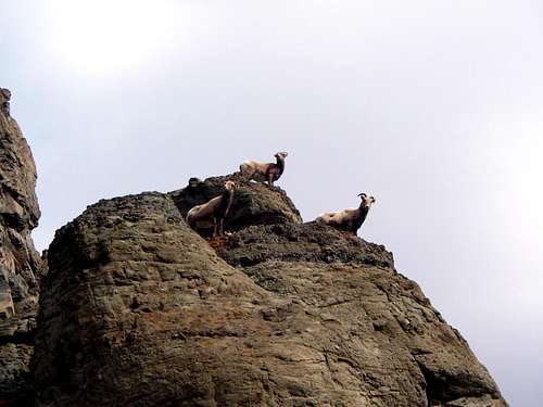
Bighorn Sheep - Upon entering the South Fork area you will see signs that say "Don't Stress the Sheep". This area is a crucial winter range for bighorn sheep. Stay as far clear of them as possible, don't spook them, be quiet around them. They may seem unaffected and nonchalant, but if they look frightened or nervous, walk away. These sheep can be literally "frightened to death". Also be careful about hiking below then as they are very good at knocking rocks down on you!
Grizzly Bears - During early and late season (October, November, March, April) it is said that you may see grizzlies in the area. Make plenty of noise on the approach, and carry bear spray. Don't leave lots of extra food in your pack at the base of climbs or leave food scraps around.
Access Note - Ice climbers should be aware that if wildlife concerns arise, access may be limited by the USFS.
External Links
South Fork Ice Climbing Festival
ColdFear.com - Aaron Mulkey's Cody ice climbing site









MichaelJ - Mar 9, 2008 10:32 pm - Hasn't voted
Staying in CodyI highly recommend Robin's Nest B&B down the block from Bison Willie's. Robin offers a killer weekly rate that's cheaper for a single person than the Bison dorm and for two people it's even cheaper still. You can use the kitchen as well. I may never leave. http://www.robinsnestcody.com/