
|
|
Route |
|---|---|
|
|
44.31960°N / 112.7499°W |
|
|
Steep Hike |
|
|
Half a day |
|
|
Class 2 |
|
|
Approach
Heart Mountain is accessible from ID-22, 18 miles west of Dubois, Idaho, exit 167 on I-15. Take the signed Warm Springs Road north, about 1.5 miles west of the Thermocal Mines facility. (Directions from Howe to the west.)
After entering the National Forest boundary, roads are generally deeply rutted and high clearance vehicles are recommended unless you have mastered the art of rut straddling in sedans. From ID-22 to South Ridge.
Route Description
Pass through the gate at the end of Crooked Creek Road, head to the left of the rock outcropping above the parking area, and head up the ridge.
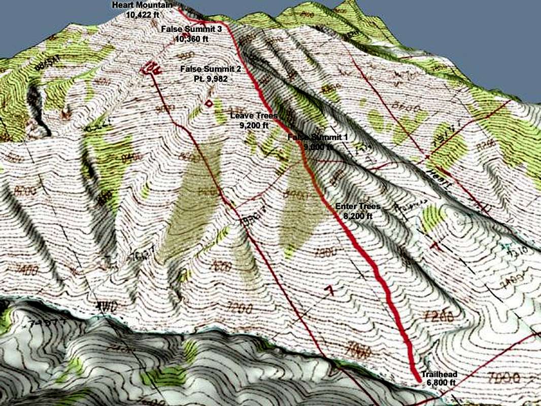
This route is characterized by false summits. You ascend 3,600 in 2 miles, so it is also steep.
Essential Gear
Day hiking gear and water. There are no facilities at the trailhead.
Miscellaneous Info
If you have information about this route that doesn't pertain to any of the other sections, please add it here.