|
|
Route |
|---|---|
|
|
52.82273°N / 3.98383°W |
|
|
Trad Climbing |
|
|
Spring, Summer, Fall |
|
|
Most of a day |
|
|
Severe |
|
|
6 |
|
|
Overview
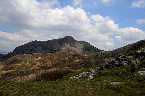
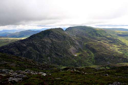
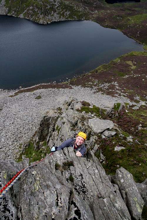
| Snowdonia is an amazing place to climb, the combination of great routes and beautiful scenery making it one of Britain's most popular destinations. Most flock to the area's titular northern mountains, which are home to Snowdonia's best known routes. This does however have a downside, especially in high summer when hikers, climbers and tourists all descend on the area, turning it into something of a circus. The Rhinogydd on the other hand are something else altogether. Even on bank holidays they remain a place of tranquility, particularly if you visit one of their more inaccessible areas. Rhinog Fach is not the remotest of the Rhinogydd's peaks, but in Snowdonia terms, it might as well be in another country. Furthermore, Rhinog Fach is home to what is arguably Wales' most underrated and least climbed classic route - it's South Ridge (Severe). This 170 metre route is the Rhinogydd's first recorded rock climb, having been climbed in 1935 by a small party, who declared it to be the only rock climb between Cadair Idris and Snowdon. Much has changed since then, but the South Ridge continues to be one of the area's best and most exciting excursions, taking a pure line up one of Snowdonia's most beautiful mountains. FA: S. Styles and G. Garrard (1935). |
Getting There
|
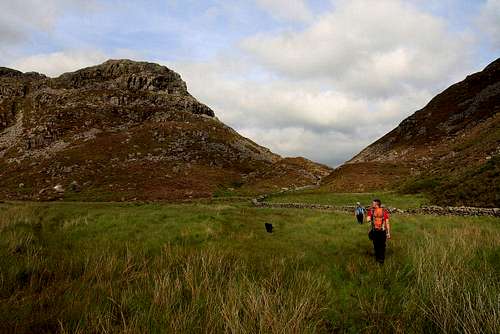
Although it takes a little longer to get there by car, the quickest and most interesting approach to the South Ridge is via Cwm Nantcol and Bwlch Drws-Ardudwy, which means the best car park is located at Maes-Garnedd (SH 641 269). This can be reached easily from the A496, which runs along the coast from Llanulltyd near Dolgellau in the south, to Blaenau Ffestiniog in the north. Walk into Bwlch Drws-Ardudwy along a small footpath crossing several drystone walls. After about 2km a small footpath shoots off to the right (SH 657 278), crossing a small stream and then a drystone wall; take it and climb steeply into Cwm Hosan. There are many small paths crisscrossing each other here, keep to the one that runs up the centre of the valley. After about 1km this will bring you to Llyn Hywel (SH 662 267), which lies just under Rhinog Fach's South Ridge. Walk along the lake's shore to where Rhinog Fach's scree slope reaches it. You will now be just under the South Ridge's lowest point. Leave the lake shore here and ascend the scree to the foot of the ridge. The route starts just on its left hand side. The ridge can also be reached from the small car park at Graigddu-Isaf (SH 680 300) on the eastern side of the Rhinogydd, which can be reached from the junction (SH 711 307) just south of Bronaber on the A470. It is a less interesting and satisfying approach than the one described, but it is easier to reach by car, particularly if you are traveling from the north. |

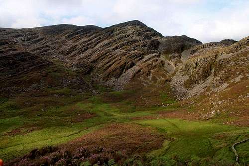
Rhinog Fawr (left) and Rhinog Fach (right) (Photo by Nanuls)
Route Description
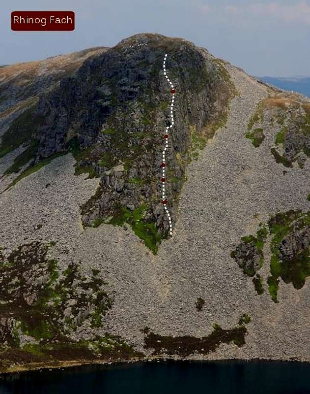 South Ridge of Rhinog Fach Pitch 2 (13m): Climb easily to an obvious cracked block. Ascend the block and a short wall and belay on a ledge above. Pitch 3 (8m): To the left of a corner crack is a steep rib which forms a short, sharp pitch. Climb the rib to another ledge. Pitch 4 (45m): Easy scrambling up the ridge brings you to a a broad level area. Pitch 5 (40m): Climb up and right under an obvious overhang to a grassy ledge and then move across the top of a gully to reach a projecting flat ledge in a great position. Continue up the right-hand side of a steep rib to easier ground above. Pitch 6 (50m): Scramble with increasing ease until the ridge peters out. You are now but a short walk from Rhinog Fach's summit. Descend by walking off south to the col between Rhinog Fach and Y Llethr. From here you can walk easily down to Llyn Hywel and your starting point. |
Essential Gear
| The route is six pitches long and takes a variety of gear from small to large wires, hexes and a variety of cams. Double ropes would prove useful in avoiding rope drag although a single rope would probably do. If climbing with a single rope just be sure you're packing a few extra slings as you will need to extend your runners. |
Maps
|
| Navigation Maps Ordnance Survey 1:25k Explorer Series OL 18 Harlech, Porthmadog & Bala/Y Bala Ordnance Survey 1:50k Landranger Series 124 Porthmadog & Dolgellau Harvey Map Services 1:25k Rhinogs/Rhinogydd Harvey Map Services/BMC 1:40k Snowdonia South Road Maps |
Guidebooks
|


External Links
| Government Bodies and Official Organisations Snowdonia National Park Authority Association of National Park Authorities Royal Commission on Ancient & Historical Monuments in Wales Hiking, Climbing and Mountaineering Organisations and Companies British Mountaineering Council Plas y Brenin National Mountain Centre Weather Tourist Information North Wales Tourism Partnership Local Information from Gwynedd.com Local Information from Snowdonia Wales Net Travel Welsh Public Transport Information Accommodation Youth Hostel Association in Wales Maps and Guidebooks Cordee Travel and Adventure Sports Bookshop Wildlife and Conservation |