
-
 5008 Hits
-
 74.92% Score
-
 5 Votes
|
|
Route |
|---|---|
|
|
48.71180°N / 121.2002°W |
|
|
Mountaineering |
|
|
One to two days |
|
|
Class 4 |
|
|
Overview
A steep hike, gaining almost 6,000 feet. Begin in steep, trackless (at least in 1985) forest at 1100 feet, then break into steep, open slopes after a few thousand feet. The climb finishes along an almost-level ridge above a tall, steep face.
I can only guess at the difficulty of the rock and number of pitches, if any. I've only been on the peak on a January weekend when good snow conditions may have made the steeper rock sections easier than they would have been if bare. I'll gladly accept input from others who have been on Davis in Summer conditions.
Getting There
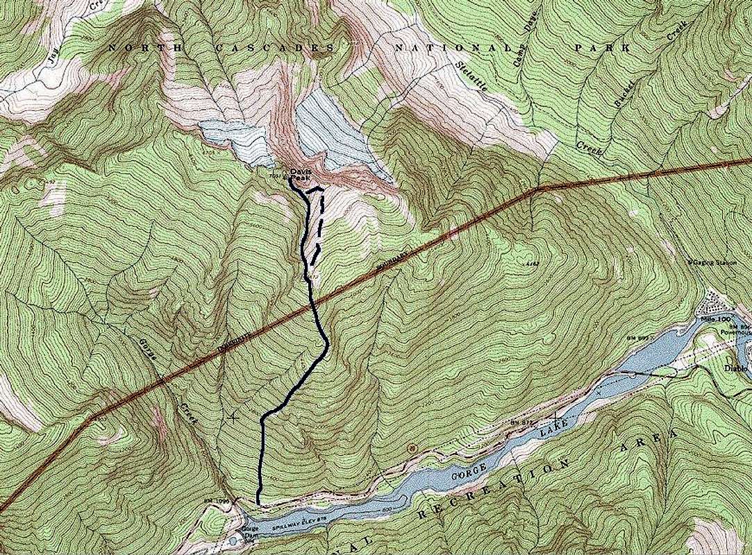
The route begins by stepping off the North Cascades Highway into the woods. See the Getting There section of the Davis Peak main page for directions.Route Description
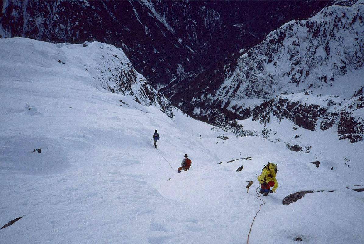
From the E parking lot described in the Davis Peak page Getting There section, walk a few feet E, cross the highway, and find the easiest place to start uphill into the woods. It's a pretty sustained, steep slope (gains about 1800 feet in the first half-mile and continues like that), forested with the smaller evergreens typical for rocky, S-facing slopes here, with an understory of salal and other brush. We did it in winter to minimize the bushwacking. There is no trail that I know of, and numerous rock outcrops make navigation important. We made it up without ever having to backtrack, due partly to careful map study by my partners, partly to blind luck.
An
altimeter might improve your chances. If you start near the curve
here,
hike due N to 2800 feet / 850m elevation, then turn to the NE and
ascend to the point at 4920+ feet / 1500m. Go straight uphill at
about 340 degrees True to Point 5872 / 1790m, where the S ridge will
be obvious.
|
|
|
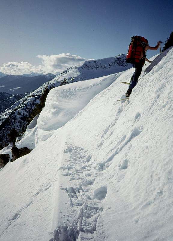
We took a variation on the route from the notch. We weren't impressed with it, but here it is: from our camp in the saddle we dropped E into the basin under the E side of the S ridge. We traversed up and N as far as we could go, then turned W and climbed beside the edge of that Cliff. Luckily, we couldn't see much of it past the cornices. The problem with this variation – at least that January – was the short step we had to climb at the turn from N to W. It was only about 10 feet / 3m, and looked easy, but everybody ahead of me was taking way too long getting past it. One of those situations where, from the end of the line, I thought, “What the #$%^& is taking them so long?!” Then, when I arrived at it, I found the holds all wrong and the cracks iced-in and asked myself, “How the #$%^& did they climb this thing?” We all made it, using ice axe belays, and continued up.
|
|
|
|
|---|---|---|
|
|
|
|


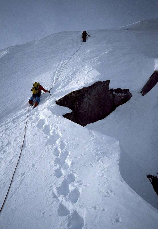
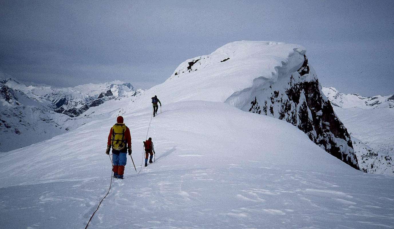
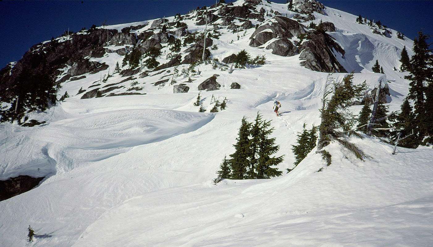
Past that step, the next rope-length or so was steep, exposed snow, followed by an easy cruise to the summit along broad, wide-open ridge. The kind of thing where you want to walk sideways and soak up the views all around – except for that cornice on the right. This aerial photo from John Scurlock shows, in its lower-left quadrant, our route up below the cliff, the climb up steep snow at the edge of the NE face to the summit ridge, and the more direct descent down the summit ridge.
 On
the return we hiked straight down the S ridge and off the step that
drops into the saddle and our camp. That step had looked formidably
steep from camp – hence the variation – but we descended
it easily on the return. It's as steep and exposed as it looks on the
map, but had all the ledges we needed to get down.
On
the return we hiked straight down the S ridge and off the step that
drops into the saddle and our camp. That step had looked formidably
steep from camp – hence the variation – but we descended
it easily on the return. It's as steep and exposed as it looks on the
map, but had all the ledges we needed to get down.
Note: Fred Beckey's guidebook advises that from the 5720+ foot saddle you “climb 200 ft of slab to the sharp ridge leading to the summit.” Winter conditions may have made the climb easier for us, giving us good step-kicking snow above the saddle. The broad, almost level ridge crest pictured above was the top of the largest cornices I've been around; in Summer it may be a scramble among rocks with steep drops on both sides. If you've been on Davis in spring or summer, please advise the rest of us about what's under the snow.
Essential Gear
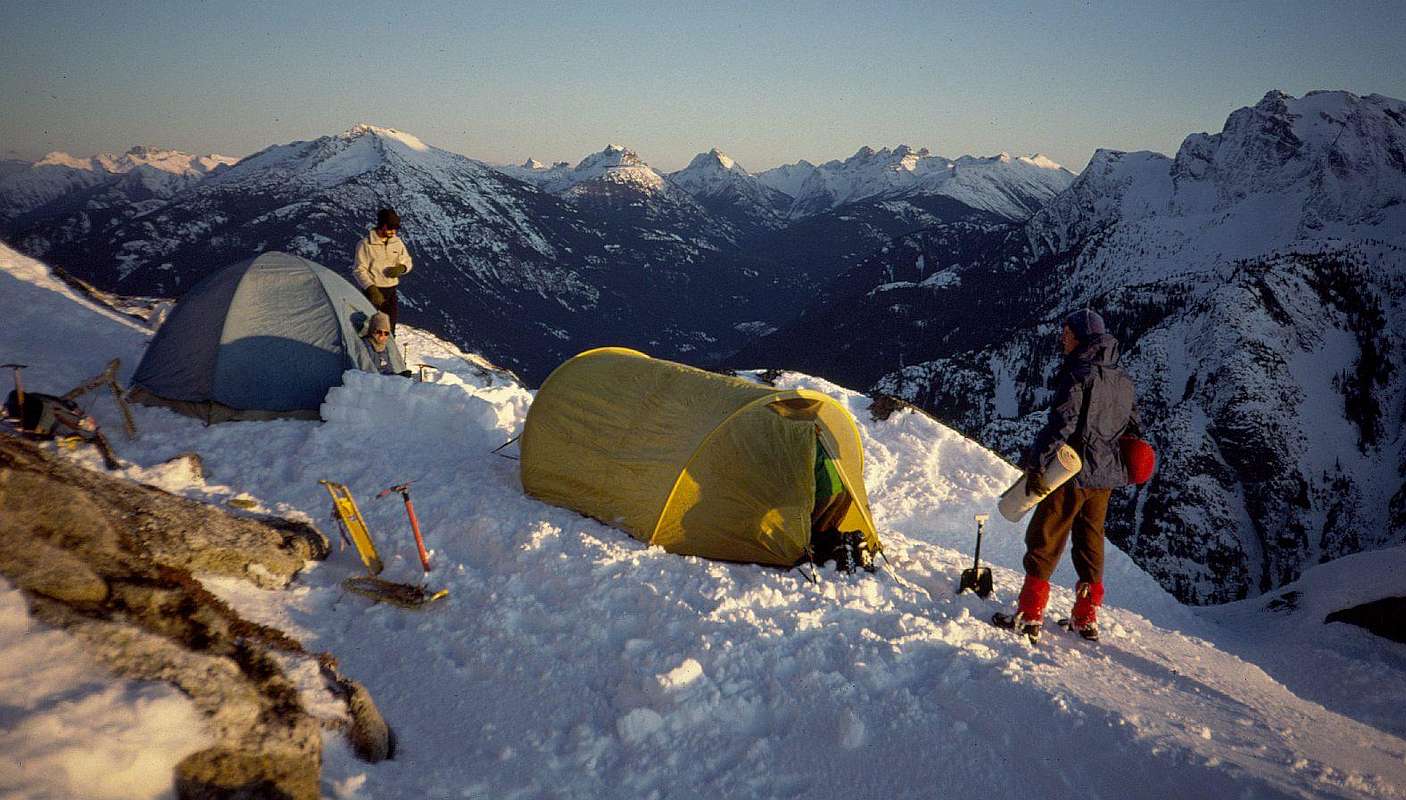
In winter we carried and used snowshoes to our camp at the 5720+ foot saddle. We left our snowshoes in camp for the summit climb. We were roped for much of the trip beyond the saddle. We carried no rock protection or ice screws, using just occasional ice axe belays. We encountered severe cold, down to -22F / -30C.Spring or summer conditions may or may not require some rock protection above the saddle - I haven't been there in those conditions.