Spade Lake (Mount Hinman Attempt) 2013-9-27
The plan was to hike in towards Spade Lake on Thursday night and set up camp somewhere between the trailhead and Waptus Lake, then move camp to Spade Lake and explore the area on Friday, allowing for an alpine start on Mount Hinman on Saturday, and then a leisurely return past Deep Lake and Cathedral Rock on Sunday and Monday. I usually avoid scheduling summit bids more than a week in advance whenever possible, but 4 days would help relieve some of the pressure from our 13+ mile approach, so we each took a long weekend from work.
We pulled up to Tuquala Meadows Trailhead just after 10 pm Thursday and chose to sleep in the truck to avoid breaking down camp in the rain the next morning. We awoke at 3 and started up the trail later than planned at 4:45 under clear starry skies.

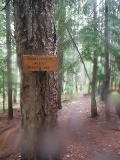
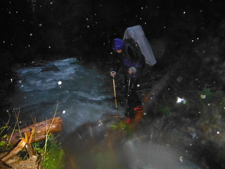
From the Cathedral Rock Trail 1345 we took the first left onto Trail Creek Trail, losing 1500' over 5.5 miles down to Waptus River. The footbridge is currently out, and we briefly considered going off trail to avoid fording the river just to cross right back over a mile later. In the end we choose to grin and bear it, after all both bridges couldn't be out could they? Of course they were, and to top it off light rain began to fall as we started our second crossing.
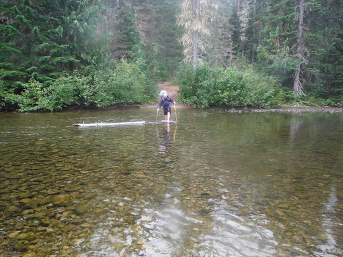
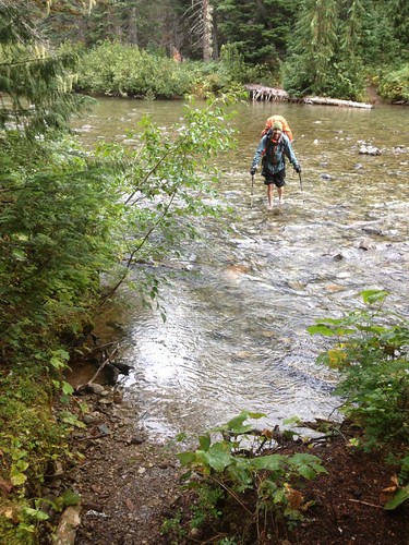
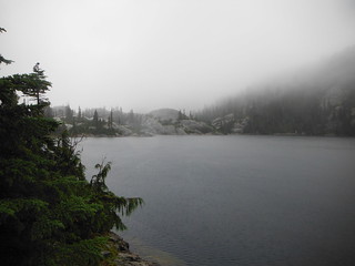
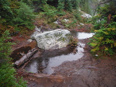
A huge, flat campground sits to the East of Waptus Lake. We rested on the shore and imagined what Bears Breast Mountain might look like through the clouds across the lake. The rain steadily increased as we continued on toward Spade Lake. I realized that I had dropped my beanie shortly after crossing the PCT, and when I returned to grab it I met two backpackers who had started in Mexico. They were also in a hurry to make camp and get out of the rain, and we said goodbye after a short chat.

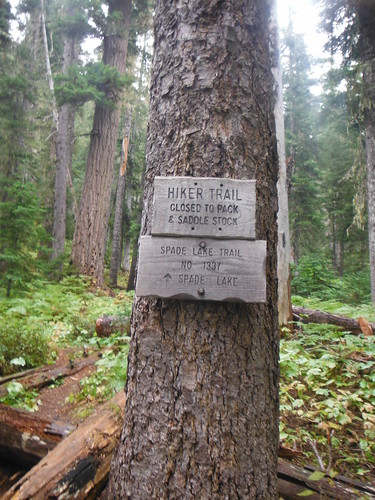
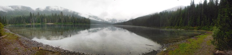
I expected the trail to Spade Lake to be overgrown and poorly maintained, but nothing could have prepared us for the slog we were in store for. We climbed over and under dozens of downed trees while getting rained on by surrounding vegetation as well as the clouds above. 2000' and what felt like a lot more than 3.4 miles later we were looking at Spade Lake. FYI, the Green Trails Maps shows the trail climbing directly up the mountainside, and then staying mostly level for the last 2 miles - this is not accurate.
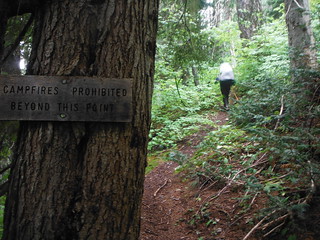
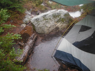
We passed several decent campsites, but settled on the last one where the trail stopped on a rock outcropping on the SW shore. We chose the dryest of three tent pads and set up a tarp for more coverage so we could hang up some soaking wet gear. After a hot meal we hit the hay well before 8 o'clock, hoping for better weather to accommodate an alpine start on Mount Hinman.
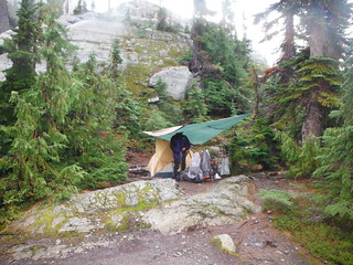

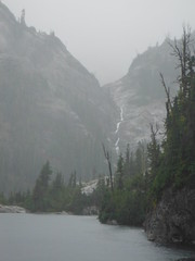
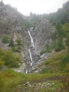
I awoke several times to the sound of pounding rain. Stars were visible in the sky and some of the rocky ground was dry when I stepped out around 1 a.m. And then an hour later snow was piling up on our tarp. I awoke at 5 with my head in a puddle and woke Colin up to assess the situation. The tent spot we chose the night before had become a pond. We played triage with all of the gear in the tent and got some hot breakfast going while scouting for a better spot. It turned out what we had was as good as it would get, so we discussed our options while rain continued to pour around us. Snow was sticking to some of the rock a few hundred feet above us near Venus Lake, and it was looking like the weather we had hoped for would not be coming.
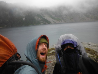
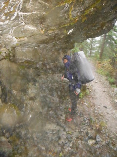
We decided to pack up and start back, leaving open the possibility of camping at Deep Lake a little over half way back to the truck. Our packs had each gained more water weight than they had lost in food and although it was disappointing to abandon the summit goal so early on, by the time we were through with the soaking wet bushwhackdown to the PCT, a dry bed and some heat sounded too good to ignore.
We returned via the PCT to the Cathedral Rock Trail, adding 2 miles but saving about 1500 feet of elevation gain. About a mile before Deep Lake we took a long break under a rock overhang 6 feet wide and 2 feet deep. We changed into dry socks and hung out our rain gear for about an hour before bidding farewell to our temporary sanctuary from the rain.
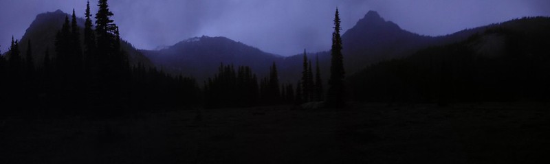
Above Deep Lake the sun was nearly set when we passed through an open meadow from which we could see the silhouettes of Cathedral Rock, Mount Daniels, and The Citadel. Once over the ridge the final 5 miles downhill flew by. We drove away from the still empty trailhead on Saturday night at 9:30 and the rain was all but gone when we made it back to I-90. We consoled ourselves by assuming that it was still pouring in the mountains, and that we had made the right choice by abandoning the trip when we did. I guess we will never know for sure.
13 miles, 5300' elevation in
15 miles, 4200' elevation back
My Blog
Comments
No comments posted yet.
