-
 7522 Hits
-
 74.01% Score
-
 4 Votes
|
|
Route |
|---|---|
|
|
46.44890°N / 13.81900°E |
|
|
Download GPX » View Route on Map |
|
|
Hiking, Mountaineering |
|
|
Summer, Fall |
|
|
Most of a day |
|
|
Walk-up |
|
|
Rating the Route (By Hiking Standards)
0. General: From cca 960 m to 2472 m, exposition S. Marked path, easy climb (protected by steel cable and pegs). Take good shoes and enough water with you. Also poles can be useful.
1. Effort: cca 1600 m (from the parking place in Pišnica valley. 5 h.
2. Power: 2 - Easy.
3. Psyche: 3 - Medium.
4. Orientation: 2 - Easy.
Approach
The route starts at Koča v Krnici (hut), 1113 m. See the parent page how to get there.
Route Description
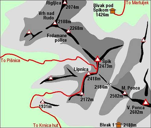
From Koča v Krnici (hut) you follow the signpost and the marked path towards the east. Through the forrest you soon reach the Gruntovnica ravine. On the altitude of some 1350 m our marked path exits the ravine on the left (northern) side, goes through pine-bushes and up on the broad screes below Gamsova špica, 1955 m. This sharp peak stands so unbeatable, that the path crosses the slopes far towards the left (direction NW) and only when reaching nice larch woods it turns again around the corner. Now the western grassy slopes of Gamsova špica are awaiting us. We quickly gain altitude and the scenery gets more and more wide and opened.
From behind Gamsova špica we continue towards the NE, allways over grassy slopes to the broad shoulder of Lipnica, 2418 m. Some summit rocks of Lipnica are steep and passages there are protected by steel cables and pegs. The panorama is very fine, as towards the SE the whole Škrlatica massif stands in front of us.
From the summit of Lipnica we see the summit of Špik very close. Still, we need to descend a little into the notch, dividing both summits, and from there we scramble by the rocky southern slopes to the highest point of Špik. The handsome guy is ours!


