
-
 14839 Hits
-
 83.69% Score
-
 17 Votes
|
|
Mountain/Rock |
|---|---|
|
|
48.31722°N / 121.07157°W |
|
|
Hiking, Mountaineering, Trad Climbing, Ice Climbing, Mixed, Scrambling |
|
|
Spring, Summer, Fall, Winter |
|
|
8264 ft / 2519 m |
|
|
Overview
Spire Point is located within the Glacier Peak Wilderness just to the north of Glacier Peak. It is accessed via the Ptarmigan Traverse between White Rock Lakes and Cub Lake. This peak has a very small summit with room for only one person at a time and has many good routes. Situated at the head of the Dana Glacier which flanks its east side, Spire Point is within the deepest mountain wilderness areas in the state and requires at least a day to approach. Few people climb this peak due to its remoteness and difficulty. Even most parties along the Ptarmigan Traverse omit this climb making it that much more spectacular. Views of Dome Peak, Glacier Peak and much of the traverse are easily seen on a clear day. Just don't get the higher east summit confused with the much harder, but lower west summit. Spire Point will surely fulfill your alpine fix.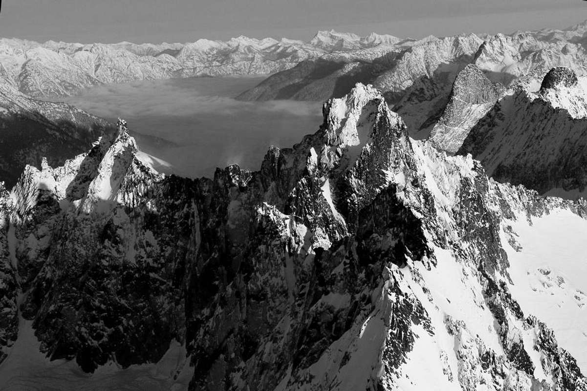
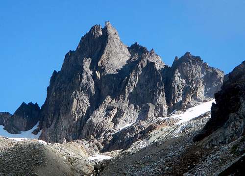
 Spire Point
 |  Some towers to the north
 |  Spire Point
 |
Getting There
Getting to Spire Point is half the fun! As of 2012, the Suiattle River Road is still closed at the 12.5 mile mark at a gate. There is ample parking along the side of the road here and this is the trailhead for the standard approach route via the southern end of the Ptarmigan Traverse. Rumor has it though that the road is scheduled to re-open next year in 2013.From Seattle:
Drive north on Interstate 5 for 43 miles. Take exit 208 for WA 530 and turn right. Be aware that the traffic through Everett and Marysville has a reputation for being pretty bad in the afternoon. Follow highway 530 to the east for four miles to Arlington and follow the signs through two turns to stay on 530. After 28 miles you'll arrive at Darrington where the last gas and food shops are located. Follow the signs as the road curves to the north and continue eight miles to a bridge crossing the Sauk River. Just after this bridge, turn right on the Suiattle River Road. In August 2012 this road was just given a fresh batch of Chip-n-Seal for the first 6 miles. Follow this good road for 12.5 miles to the gate and park.
From the trailhead you have two options...walk or bike. I would highly recommend you bike the closed road as it is very flat with only a very gentle uphill grade. It is 10 miles on nice gravel to the Downey Creek Trailhead. The bridge over Downey Creek is washed out which is why the road is closed but a nice wooden walkway was installed to allow for pedestrian crossing. Biking the 10 miles of road will take an average of about an hour and a half. There are many great places to camp near the Downey Creek Trailhead located at an elevation of 1,500 feet.
Approach
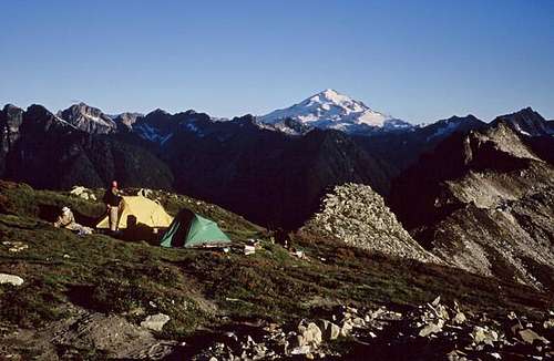
The approach follows the southern end of the Ptarmigan Traverse up the Downey Creek Trail and the infamous Bachelor Creek "Trail". Stash your bikes and hike the six gentle, well maintained Downey Creek Trail to the final log bridge over Bachelor Creek at 2,400 feet elevation. The forest service has done some major improvements to this trail within the last 5 years including many new boardwalks, new log bridges and brush cutting. At the end of the maintained trail is the six-mile camp which is a great place to rest and fill water. Locate the small Bachelor Creek trail on the north side of Bachelor Creek and follow it. It starts out very well established as it climbs steeply at first near the creek, then switchbacks at an easier grade. At about 4,000 feet, reach the first meadows. The trail at times is overgrown with salmon berry bushes and vine maples but it is still able to be followed. The bushwhacking is nothing more than pushing pushes to the side to walk although plan to get very wet if the brush is damp from dew or recent rains.Continue on the trail, passing by a side path heading towards the creek (do not take) and reach a spot where a big log crosses Bachelor Creek. In the past, this log was used to cross the creek and continue through slide alder on the south side however it is best to head due north at this log and follow a way path through some thicker bushes a short distance and aim for the forest. Once in the forest, the terrain opens up and allows for easier hiking. Continue through the trees and cross Bachelor Creek near a nice camp spot and catch the trail again at the base of a large avalanche chute and follow it as it switchbacks up the chute and back in the trees to the left. The trail finally reaches the forested ridge above Cub Lake at about 5,900 feet. Descend on steep switchbacks 500 feet to Cub Lake (great camping), walk around its north shore and follow the trail to Itswoot Ridge where great camping can be found at 6,400 feet with a stream rushing down from the Spire Point area parallels right next to the ridge. It is recommended you camp at the 6,400 foot camp on the ridge which has room for 3-4 tents.
For more details, see this page describing the last part of the Ptarmigan Traverse by Eric.
 Cub Lake
 |  Glacier Peak
 |  Itswoot Ridge
 |
Standard Route
Spire Point offers a variety of difficult scrambling routes and a few climbing routes all of which are of good quality. The rock is mainly granite and solid. The only negative to the rock is the large amounts of black lichens that grow on the surface which can make the rocks a bit slick even when dry. Use caution if proceeding unroped.
East Face - Class 4Special Gear 60 meter rope, harness and belay device for the two rappels. A few very small cams can be used to protect the final 50 feet.
This is the standard route on the mountain. From camp at Itswoot Ridge, begin hiking north up the ridge staying to its left (west) side on talus next to a stream. This avoids the towers just above camp. Only occasionally where the ridge crest is gentle will you be on the crest. You will likely hit snow at some point where you can either climb the moderate 30 degree snow directly to 7,760 foot Spire Col or traverse around the edge of the snow on the ridges' left side. In late season, the last 100 feet to the col melts out and can be a loose scree fest. There is a boot path here you can use though. A great bivy site can be found at the col. Other nice bivy spots with room for a tent can be found at various places along Itswoot Ridge.
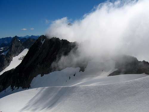
 Itswoot Ridge
 |  Spire Point
 |  Spire Col
 |
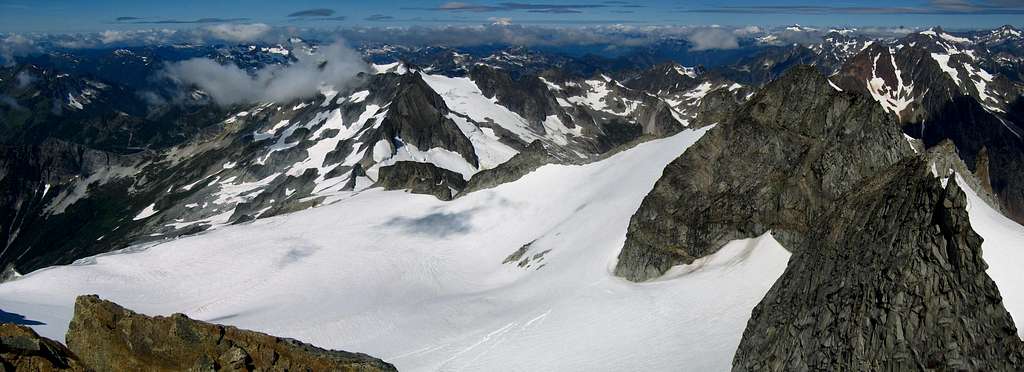
Once you reach the col, drop a few feet to the very upper edge of the Dana Glacier and do an ascending traverse left (northwest) along the edge of the snow aiming for the southeast face. There is really no need to rope here since you are at the very upper edge of the glacier next to the southeast ridge of Spire Point. At an elevation of 8,000 feet, the snow ends and you will find the 4th class scramble route directly above you to the left.
 Spire Point
 |  Dana Glacier
 |  The route up
 |
It starts with a bit of loose talus then climbs a short 30 foot chimney (class 4). Above this chimney, continue up class 3 ledges to the crest of the southeast ridge. Here you will find a nice rappel anchor which marks the 2nd rappel. From here, traverse onto the east face and aim towards the highest point and reach a small ledge about 50 feet below the summit (Class 3). The final 50 feet is the most challenging and the idea is to climb a short rib on its left side using some friction climbing on a slab, then reaching a second ledge just below the summit block (Class 4). If you're good, you can climb the overhanging summit block for 15 feet from here (Low 5th Class), otherwise traverse back to the left and reach a third, larger ledge near the crest of the southeast ridge. This makes a nice belay spot and a fantastic horn can be used as a rappel anchor.
 Class 4 chimney
 |  Top of chimney
 |  The ledge 50 feet below summit
 |
The remaining climb goes up a slab to the ridge crest, crosses the crest to the west side and traverses above the west face on a few small ledges to the base of the highest rock (Class 3). The exposure to the west on this final traverse is incredible with at least 1000 vertical feet below you. A 5 foot move gets you to the high point which is nothing more than a single pointed rock with room for one person to sit. Many slings are found here for a rappel directly off the summit.
 Traversing SE ridge
 |  Traverse to summit
 |  Josh on 1st Rappel
 |
Descent
I was able to use two small nut-cams in a couple narrow cracks to protect the final part. We were also able to belay one another to the summit and back from the highest 3rd ledge with the summit slings as an anchor. We chose to rappel off the horn on the 3rd ledge instead of the summit to give us more room to work with. This 28 meter rappel took us directly to the first anchor we passed above the first Class 4 chimney. From here, another 28 meter rappel took us to the easy talus at the base of the chimney. From here, return the way you came through Spire Col.
Likely the second most popular route on the peak is the 5 Full-Pitch 5.6 rated south face.
Spire Point South Face
Summit Views
 Dome Peak
 | 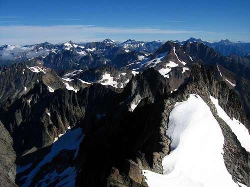 View NW from summit
 | 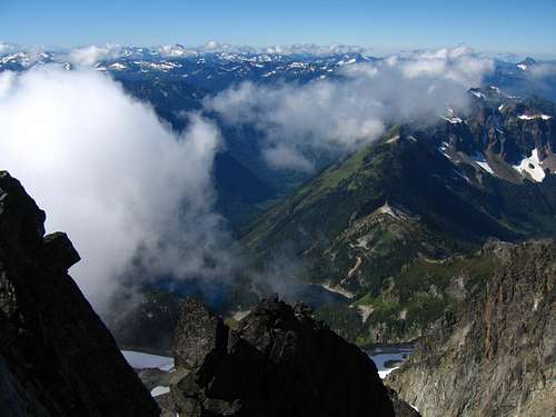 View south from summit
 |
Map
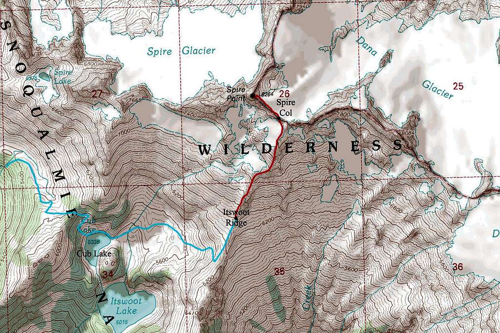
LIGHT BLUE: Ptarmigan Traverse Approach via Bachelor Creek and Cub Lake
RED: East Face route via Itswoot Ridge/Spire Col - Class 4
When to Climb
This peak is best climbed from June through September. Early season climbs can be more difficult due to the long approach and the possibility of the trails still being covered in snow. By mid-October, snow has usually fallen and will cover the rock, making the ascent substantially more difficult. A winter ascent of anything in this whole area would be a major undertaking due to the large approach.
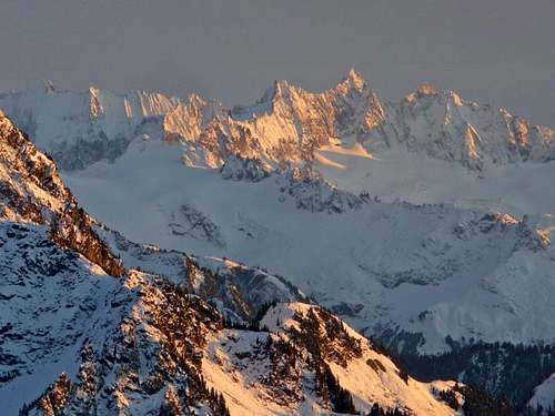
Typical snow over the North Cascades
Camping/Red Tape
There are fabulous camping spots at six-mile camp at the end of the Downey Creek Trail, at Cub Lake, on Itswoot Ridge at 6,400 feet or 6,900 feet, and at Spire Col. This is a wilderness area so no motorized travel is allowed. Contact the rangers at the Darrington office for any questions.
Camping on Itswoot Ridge
External Links
For a weather forecast of the mountain see this page
Darrington Ranger Station
1405 Emens Avenue North
Darrington, WA 98241
(360) 436-1155
Check out Fred Beckeys "Cascade Alpine Guide" 2: Stevens Pass to Rainy Pass for a route description as well as details for other routes.