
-
 949 Hits
-
 75.65% Score
-
 6 Votes
|
|
Mountain/Rock |
|---|---|
|
|
38.48970°N / 107.578°W |
|
|
Montrose |
|
|
Hiking |
|
|
Spring, Summer, Fall, Winter |
|
|
8894 ft / 2711 m |
|
|
Overview
 Spring Benchmark
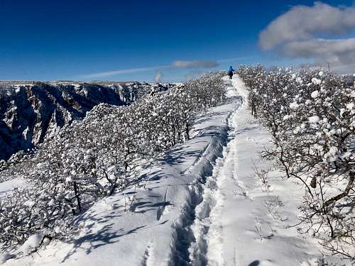 Spring Benchmark
The peak is a ranked summit with a rise of 394 feet.
Colorado Rank: 3002
Parent Lineage: Line Parent Bald Mountain. Proximate Parent Pine Ridge.
Difficulty: Class 1
You can hike it any time of the year. I would recommend to check it out on your way to North Rim of Black Canyon.
Getting There
 Summit Spring Benchmark
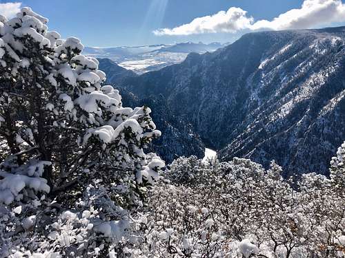 Gunnison River
US Highway 50 runs from Gunnison to Montrose and crosses through Curecanti N. R. A.
Crystal Creek Trail and Spring Benchmark trail are located along Highway 90, turn north from US Hwy 50 and follows this road nearly towards the western end of Curecanti National Recreation Area. There is a pull out parking lot on the south side of road with vault toilet and marked trailhead.
Route
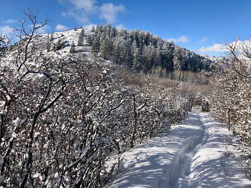
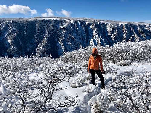
The trail is easy to follow. It winds its way through oak brush, aspen and Douglas fir trees. There are a couple of benches along the trail to sit and sip into the views of surrounding nature. You can see get a glimpse of Gunnison River below from some areas. The information sign says that the hike is 5 miles round trip with 804 feet of elevation change and rated as strenuous, but the hike felt really easy to me despite the deep snow. My Gaia application measured the hike shorter, probaby because we did not continue to the overlook over the river, we stopped at the actual summit.
Red Tape
The Spring Benchmark is located within Curecanti National Recreation Area. Parking at the trailhead is free. There is a vault toilet and information sign with a marked trailhead. You are allowed to take dogs on a leash on this trail, but bikes or horses are not allowed. There are no fees to hike, or park at the trailhead.
When to Climb
Anytime of the year is good. Summer can be hot, part of the trail goes through a forest/vegetation, but the majority is open terrain = hot. I hiked during the winter time and the snow was about 20 to 30 cm deep (~ 1 foot). Consider bringing snowshoes in the winter and trekking poles. There is no avalanche danger.
Camping
There are 10 campgrounds located within Curecanti National Recreation Area. There is no official camping at the trailhead to Spring Benchmark.
Here is a list of campgrounds and services provided.