A route I'd long wanted to do
As trip reports go, this isn't especially exciting. Nothing went drastically wrong; the weather was downright pleasant throughout; and these mountains, I admit, don't typically rank especially high on people's SP bucket lists. I'm posting it for two reasons: because it's a great (and highly accessible) route, which might well appeal to others, and because this trip was, for me, the fulfillment of a longstanding ambition.
I live on the East Coast, so perhaps the smartest thing I ever did was marry a Coloradan, meaning that, courtesy of a family home in the center of the state, I have regular access to some of N America's finest mountains. We visit en famille every summer for a couple of weeks (being a Brit, I never learnt to ski, so winters are less enticing). My mountain ambitions have been governed to a major extent by the capabilities -- read, state of development -- of my offspring, twin females currently 16. For several years, every summer we would hike the "
Lost Man Loop" on the Aspen side of Independence Pass. This is a well-known and popular hike to a couple of alpine lakes, Lost Man Lake and Independence Lake, and over the 12,800' pass between them. Because it starts high, it's a painless way to spend time in a spectacular alpine area. The trail gives good access to the surrounding tops, and Geissler Mtn E, 13,380', was Katie's first 13-er -- a short scramble up from the Lost Man Pass -- back in 2006. Eventually, however, trails get boring, and we started instead to do a high route over the three peaks of Geissler Mountain which would bring us down to the Lost Man Pass, from where we would head down the Lost Man trail to the Linkins Lake trailhead. Easy, accessible, and with great views, this "Geissler traverse" is one of my favorite hikes and a summer fixture for the family. I've
written it up, in fact, for SP; a route that has garnered precisely zero entries in the page's climber's log!
The frustrating thing about the Geissler traverse is that the return phase -- from the pass to the trail head -- is down the basin between the Geisslers on your right and the continental divide on your left. You have traded the airy ridges of the first part of the walk for a rather less exhilarating valley descent.
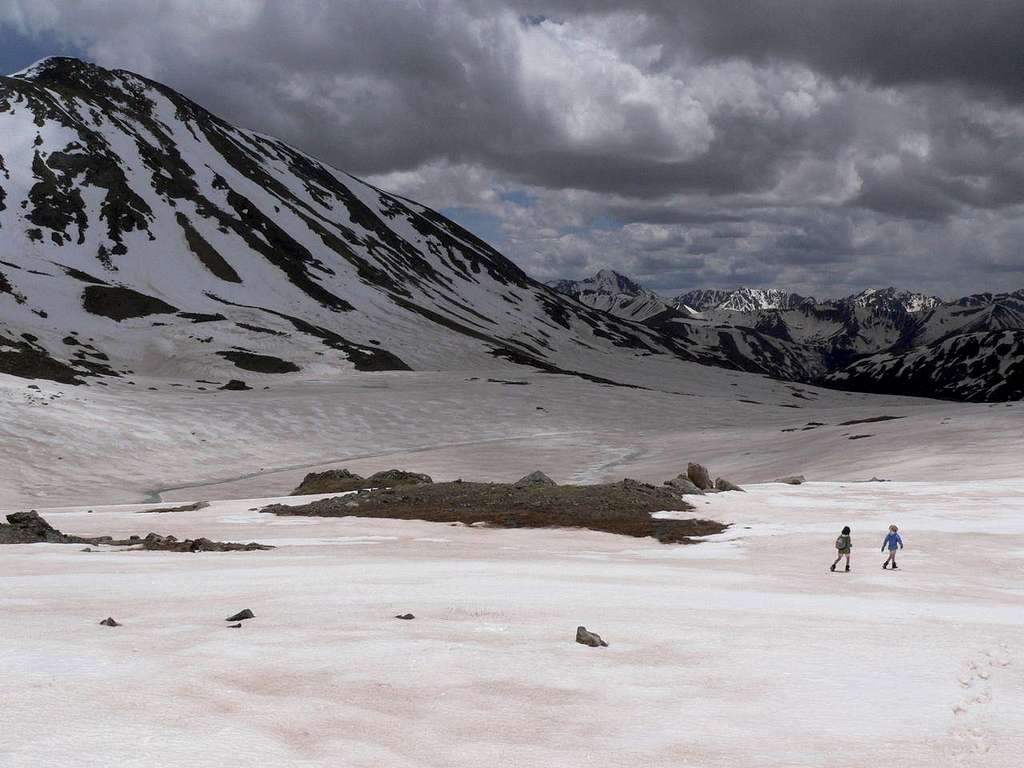
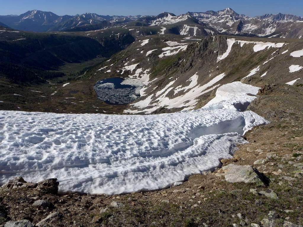
![Descending past Independence Lake]() Following the Lost Man Loop Trail past Independence Lake. Twining Mtn on the left. 18 June 2009
Following the Lost Man Loop Trail past Independence Lake. Twining Mtn on the left. 18 June 2009
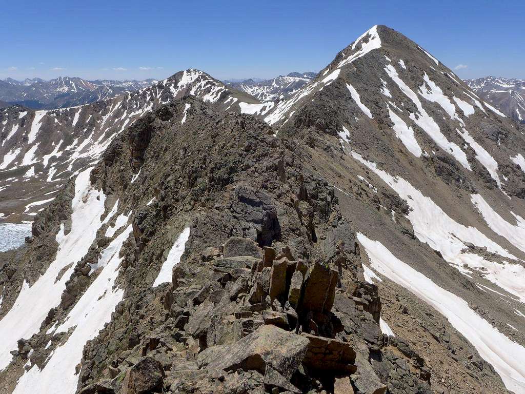
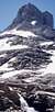
Crowning this segment of the divide as it meanders towards Independence Pass is Twining Peak (13,711'). Why not, instead of descending via the valley from the Lost Man Pass, go straight across the pass and up to the continental divide on the other side, and follow the ridges around to Independence Pass? I mentioned this possibility in my Geissler Traverse route page, but had never done it. The ridge is tricky in places: Kane's wonderful
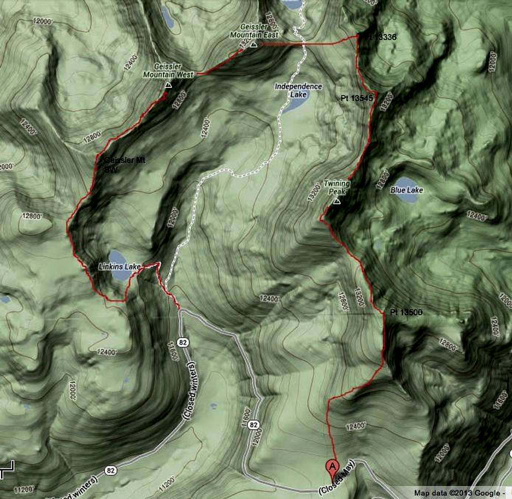
SP account refers, for example, to "a committing and exposed class 4 move on dirty slabs of granite" and, also, Kane mentions that he was "lucky to have had ideal weather conditions that day because it allowed me to really take my time" in figuring out the route-finding problems posed by the ridge. Didn't exactly sound inviting: I'm a hiker, not a climber, and I'm scared of heights. But with the goal of a doing a full ridge route, it was still worth checking out. Here's what the route looks like from a Google Terrain perspective:
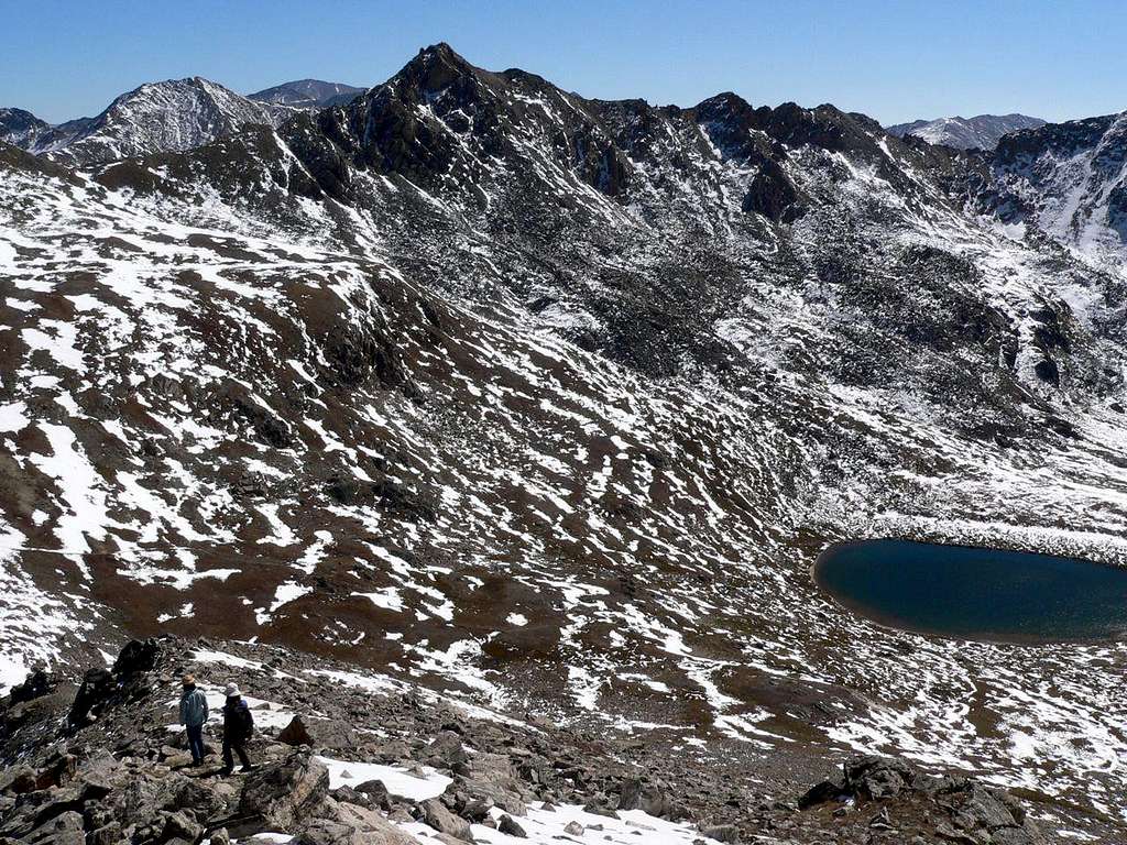
And this is what the awkward part of the route looks like from part of the route I was thoroughly familiar with, the E ridge of Geissler E (ie below is the Pt 13,545 - Twining Peak ridge viewed from Geissler E)
![Descending Geissler E, looking towards the divide]() 28 Sept 2009. The spiky peak is Pt 13,545. Independence Lake to the right.
28 Sept 2009. The spiky peak is Pt 13,545. Independence Lake to the right.
According to Kane, the trickiest part of the traverse was the north ridge of Pt 13,545, but there was plenty more class 3/4 and exposure in the section from Pt 13,545 to the low point of the ridge between Pt 13,545 and Twining Pk. I did some reconnaissance. One summer, with a lousy weather forecast for the afternoon, we went up to Twining Peak from Independence Pass. We continued over Twining towards Pt 13,545 but bailed before we reached the low point of the ridge between the two tops. I had a good view of the ridge to come but not good enough to determine whether or not the ridge was within my (and/or my girls') range. We ended up scrambling down a rather steep gully above Independence Lake and walking back down the trail in pouring rain.
![Heading N from Twining Peak]() Looking N towards Pt 13,545. Is the craggy stuff up ahead a deal-breaker or not?
Looking N towards Pt 13,545. Is the craggy stuff up ahead a deal-breaker or not?
Then, in summer '12, after completing our regular Geissler Traverse, Katie and I headed up from the Lost Man Pass to the continental divide. Katie fell asleep in the sunshine, and I checked out Pt 13,545's north ridge. Awkward in places, for sure, but that "committing and exposed class 4 move on dirty slabs of granite" was rather scarier in my imagination than it was in person. I got to the top and surveyed the ridge to come, but I didn't want to drag Katie up there, so I headed back, awoke the slumbering teenager, and we dropped down in to the valley to pick up the Lost Man trail, as usual.
![Unnamed Image]() 2012. Checking out Pt 13,545
2012. Checking out Pt 13,545
Enough reconnaisance! Let's do it.
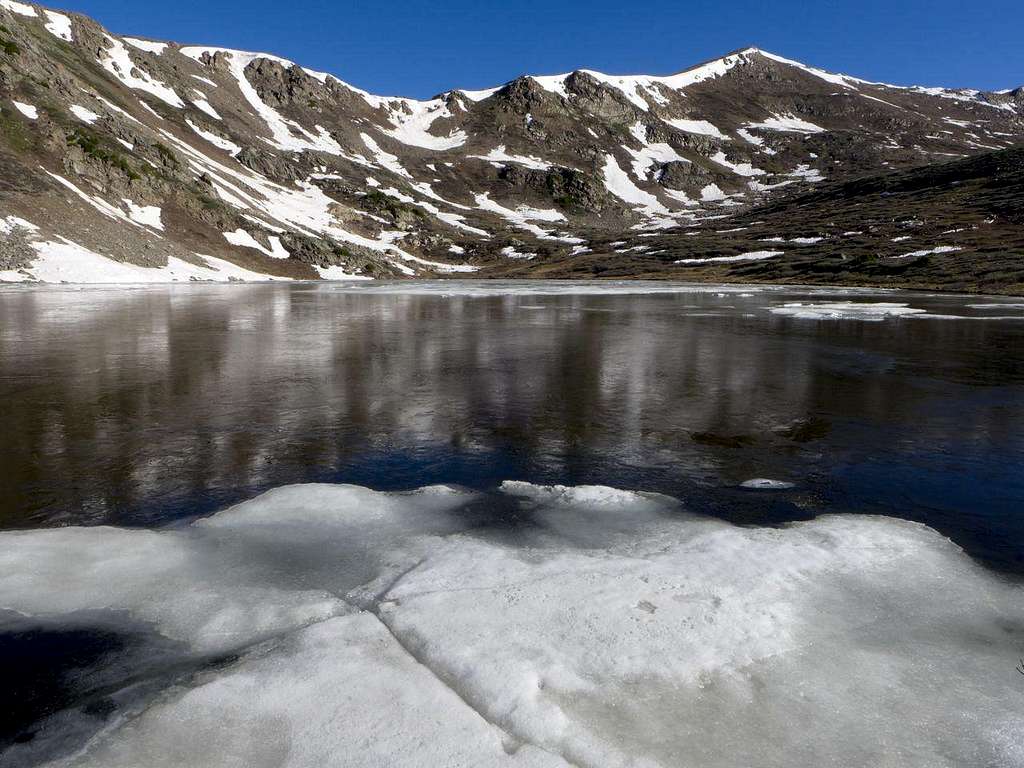
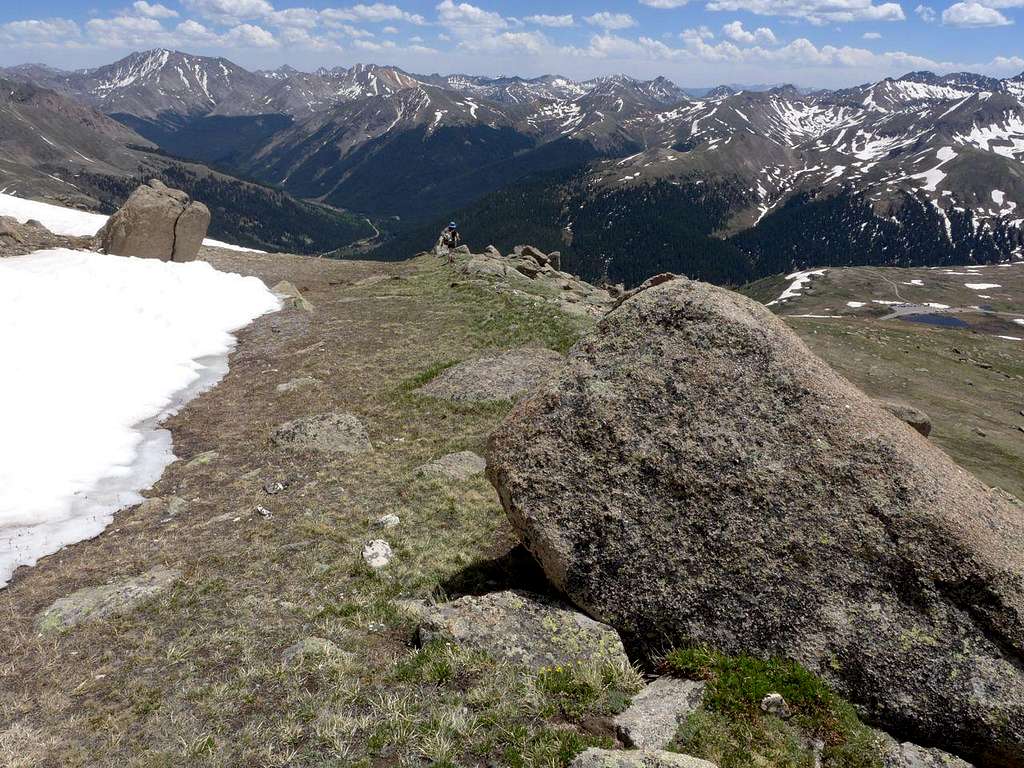
This year, 2013, would be the year I would finally connect all these segments in to a single trip. 21 June. Good chance, I hoped, that the day would be fine throughout, as the area's pattern of afternoon thunderstorms tends to kick in a little later in the summer. Katie was in Madrid on a Spanish exchange, so it would be just Megan and me. We parked at the Linkins Lake trail head at around 7. (Ah, the joys of a house in the mountains: no sleeping in the back of the car for me). The first part of the trip is very familiar: up the trail to Linkins Lake. Not very much snow this year, but still a little ice on the lake.
![Linkins Lake]() 21 June 2013. Still some ice.
21 June 2013. Still some ice.
![Above Linkins Lake]() All the Geissler Peaks laid out. L to R: Geissler SW, W, & E
All the Geissler Peaks laid out. L to R: Geissler SW, W, & E
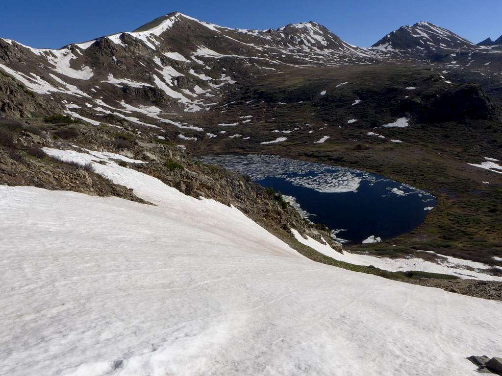
Then it's good bye to trails and a steep haul up the scarp at the SW corner of the lake and up to one of the most magical places I know in the mountains: a rolling high altitude plateau with panoramic views across the Sawatch and to the Elks. Castle flanked by spikes; Snowmass as white and dominant as ever; Sopris, isolated and grand, at one extreme of an ocean of mountains.
![Rolling High Sawatch Plateau, above Linkins Lake]() Looking S towards Grizzly A and Anderson
Looking S towards Grizzly A and Anderson
![Looking S to Linkins Lk & Rte 82]() La Plata (L) and Grizzly A (R) dominate the skyline
La Plata (L) and Grizzly A (R) dominate the skyline
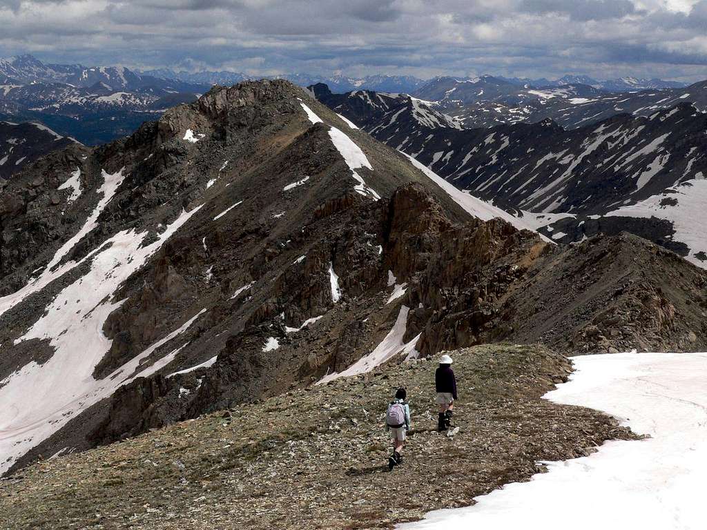
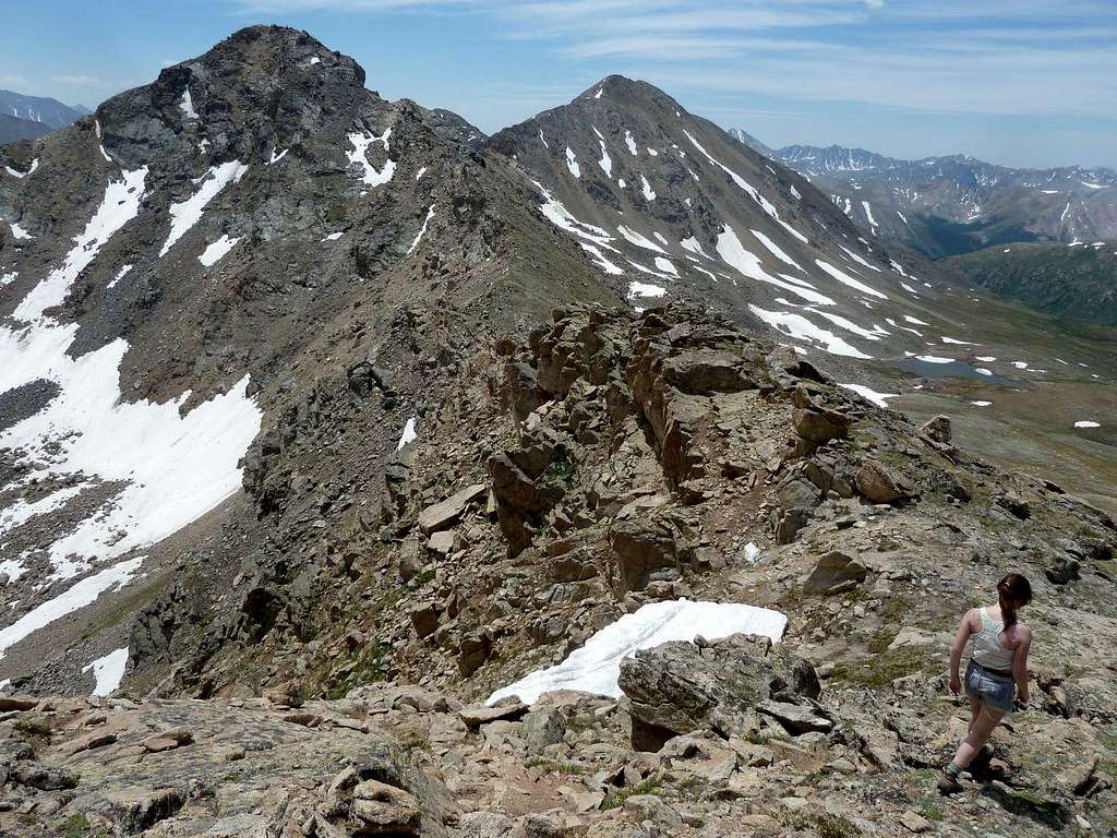
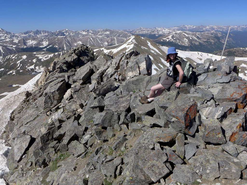
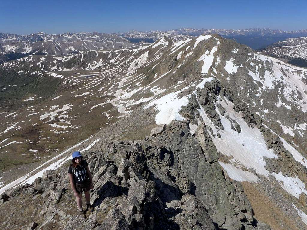
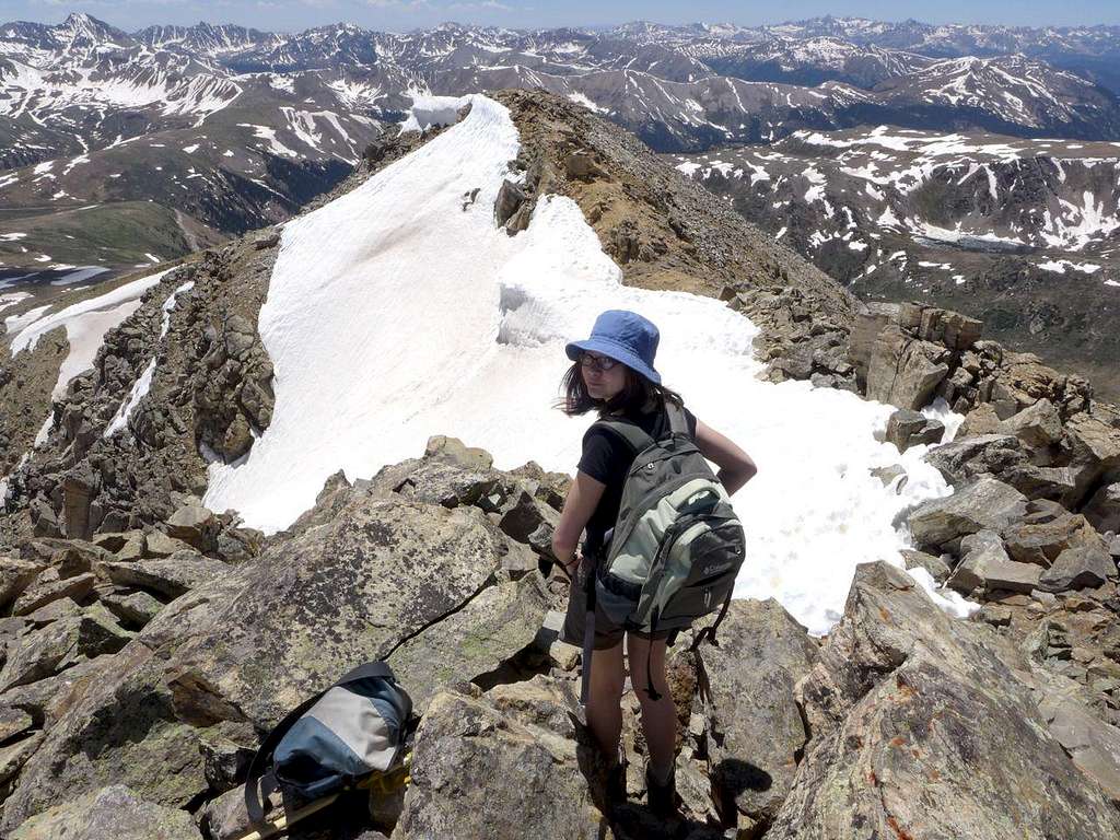
Our first top was Geissler SW, where the day's ridge-walking started in earnest. Like any and all SP-ers, I like a peak as much as the next person, but the greatest pleasure mountains can provide comes, in my opinion, in the form of ridges. You're high, the views are ever present, you're probably going up and down but you're not typically looking at very prolonged bouts of either, and there's the challenge of following the ridge when gendarmes block the way. To treat a peak with the respect any and all mountains deserve, I prefer to traverse it -- ie descend by a route different from the one by which I've ascended -- and that's what ridges do for you.
There's nothing especially challenging about the Geissler ridges -- there are occasional segments of 2+ but nothing more -- but it's a wonderfully rewarding walk.
![Heading NE from Geissler SW to Geissler W]() Heading NE towards Geissler W from Geissler SW
Heading NE towards Geissler W from Geissler SW
![Viewed from the Geissler Mtn Ridge]() The Williams Mtns from the ridge between the SW and W peaks of Geissler Mtn
The Williams Mtns from the ridge between the SW and W peaks of Geissler Mtn
![Between Geissler SW and Geissler W]() Approaching the low point on the ridge between Geisslers SW and W
Approaching the low point on the ridge between Geisslers SW and W
![Starting up Geissler W]() En route from Geissler SW
En route from Geissler SW
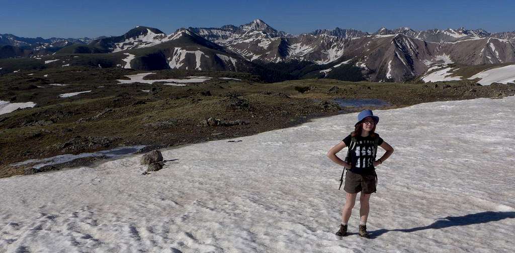
Ah, the ravages of time. I was up on these same mountains on my 40th birthday. The girls, then 6, were too young to be up with me then. Now, a couple of weeks shy of my 50th, I was being eclipsed by Megan. I've been accustomed for years to being the strongest hiker in the party, but Megan's upward trajectory -- as she gets fitter, stronger, and more experienced -- has well and truly crossed my downward one -- as I decay inexorably in to middle age. Traditionally, I've been the one in front, the one who pauses to let others catch up and then irritatingly starts off again as soon as they've arrived. Now the roles are reversed. Megan was out ahead. I would catch up, gasping, and she would politely enquire whether I wanted to stop for a drink or a snack. One advantage of this New World Order (well, new familial order) is that trailing a daughter, rather than looking back at her, meant that I gained a new perspective on some familiar scenery. Seen from the south west, I found, the summit of Geissler W is rather dramatic.
![Summit of Geissler W]() The top of Geissler W viewed from a SW approach
The top of Geissler W viewed from a SW approach
![Atop Geissler W]() Atop Geissler W
Atop Geissler W
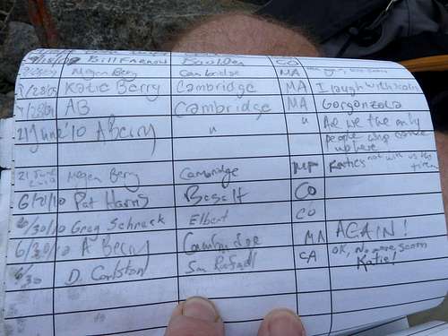
There's a summit register on Geissler W (there's also supposed to be one on Geissler E, but I don't recall ever finding one. There's typically a lot of snow on that summit so it's probably still buried when I'm there) and I was sorry to find that it had gotten wet. Very wet. All that remained was a mush of paper. Sorry to say good bye to that as it has served almost as a private log of family trips. Here, complete with Katie's unhelpful comments, is a photo of the register in 2010.
![Geissler W Summit Register, RIP]() 2010. My kin definitely over-represented (complete with silly comments). Sadly, as of 2013, the register is unreadable pulp.
2010. My kin definitely over-represented (complete with silly comments). Sadly, as of 2013, the register is unreadable pulp.
Now that I am the slowest member of the party, the Geissler Traverse truly is a short walk. We made excellent time to the top of Geissler E. We saw a couple of people laboring through the snow on the trail up from the Linkins Lake TH to the Lost Man Pass. They reached the pass and watched as we descended to the pass from the top of Geissler E; then, before we reached the pass, they headed back down valley. Presumably the route down to Lost Man Lake and beyond was still too snowed up to complete the loop. Certainly, there were no footsteps in the snow on that side of the pass. We, in contrast, crossed the trail and headed up to the continental divide; time for an early lunch.
![On Geissler E, looking back towards Geissler W]() Looking back to Geissler W from Geissler E
Looking back to Geissler W from Geissler E
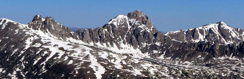
![The Divide viewed from Geissler E]() Looking E from Geissler E: the continental divide. The spiky peak is Pt 13,545
Looking E from Geissler E: the continental divide. The spiky peak is Pt 13,545
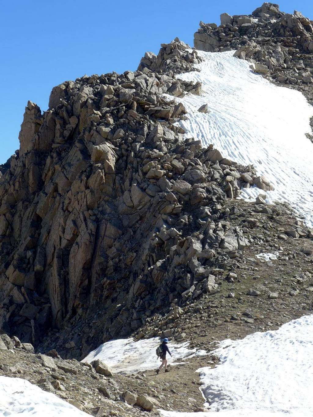
Now came the tricky part. The weather was holding fine so at least we could check off Kane's sole entry under "Essential Gear" for this route: Good weather. First there was the route up the north ridge of 13,545.
![Approaching Pt 13,545]() Pt 13,545 in the foreground; Twining Peak beyond
Pt 13,545 in the foreground; Twining Peak beyond
![N Ridge Pt 13,545]() Approaching the N ridge of Pt 13,545
Approaching the N ridge of Pt 13,545
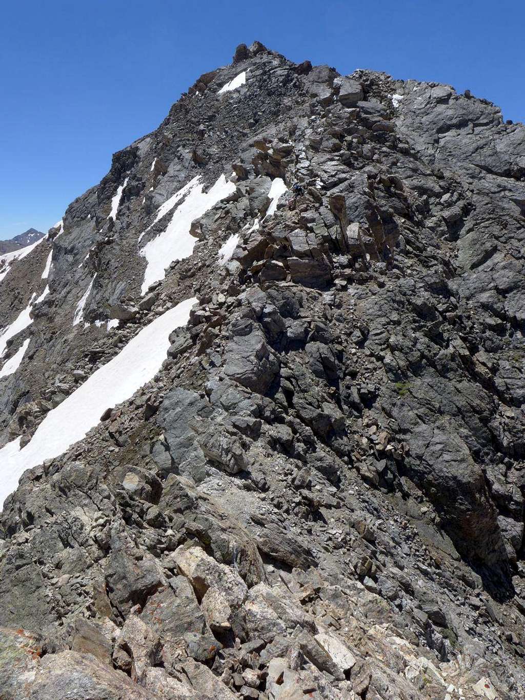
![North ridge of Pt 13,545]() Loose stuff on the N ridge of Pt 13,545
Loose stuff on the N ridge of Pt 13,545
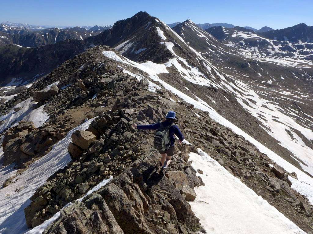
Parental and anxious, I was inevitably somewhat concerned about how Megan would handle the scrambling. Would the exposure freak her out? Nope. I shouldn't have worried. She was surefooted, careful, and perfectly comfortable with the occasional exposure. In fact, I realized that Megan was probably more agile and adept on the rock than I was. A day of sustained parental eclipse (well, and parental pride). How much longer will she continue to defer to me on route-finding?
![Looking N from Pt 13,545]() This view gives some sense of the terrain on the N ridge of Pt 13,545
This view gives some sense of the terrain on the N ridge of Pt 13,545
![Summit, Pt 13,545]() The ridge of Champion behind, with Elbert and Casco on the skyline.
The ridge of Champion behind, with Elbert and Casco on the skyline.
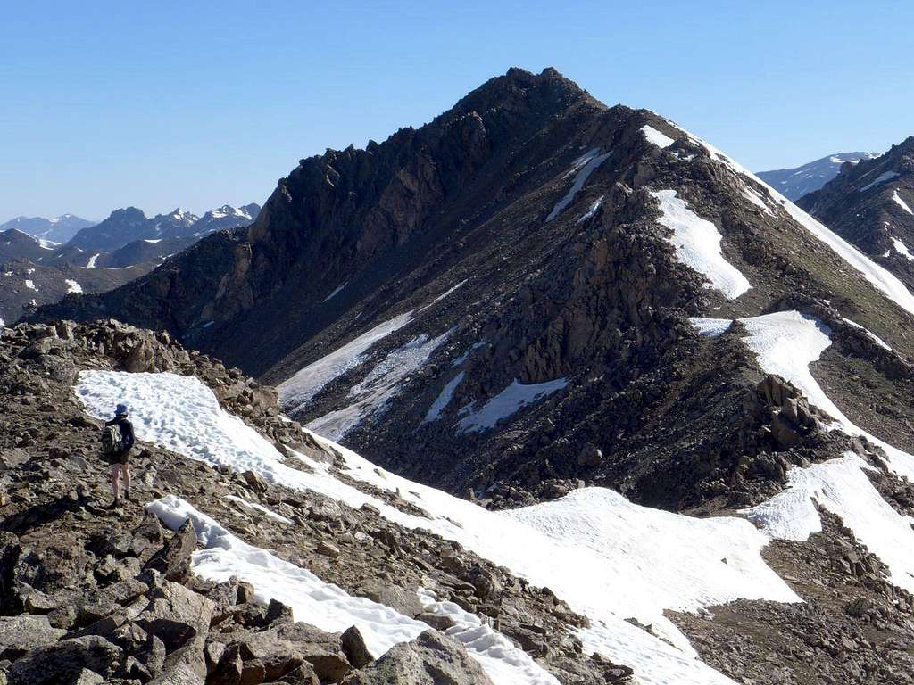
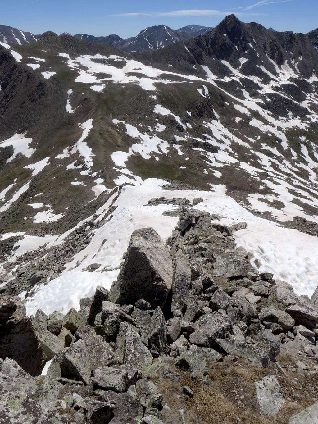
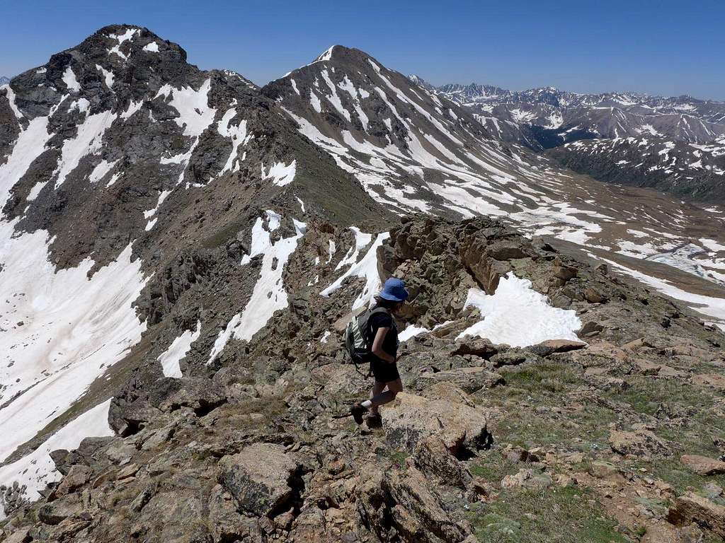
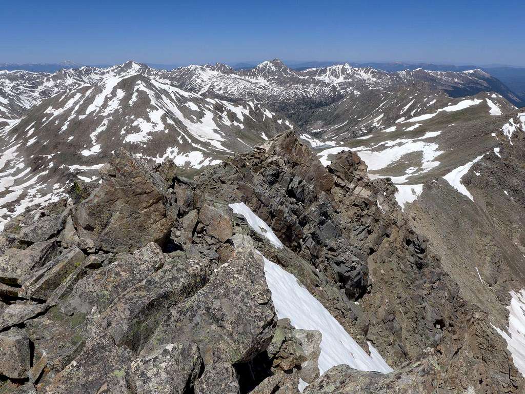
At the top of 13,545, we paused to survey what was to come: here we were entering in to terra incognito, the part of the route I'd not done before. The first segment is perfectly straight forward, but I knew that things would get messy again as we approached the low point between 13,545 and Twining.
![Looking from Pt 13,545 to Twining Pk]() The first part of the ridge is gentle and kind; further on, it is less so...
The first part of the ridge is gentle and kind; further on, it is less so...
![Ridge between Pt 13,545 and Twining Pk]() And things get messier further on
And things get messier further on
![Looking S towards Pt 13,545]() Photo taken looking N about half way along the ridge from Pt 13,545 to Twining Pk.
Photo taken looking N about half way along the ridge from Pt 13,545 to Twining Pk.
![Looking S, close to the half way point on the ridge from Pt 13,545 to Twining Pk]() Looking S towards Twining; Pt 13,500 to the left
Looking S towards Twining; Pt 13,500 to the left
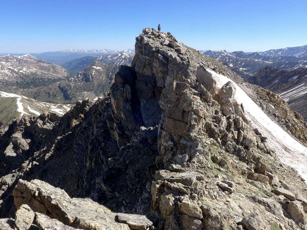
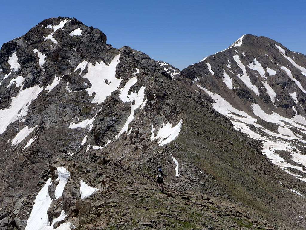
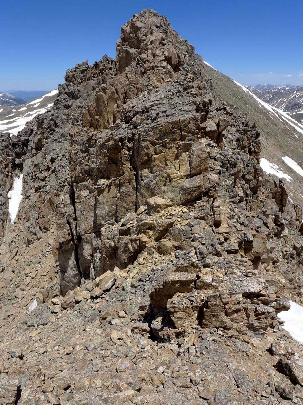
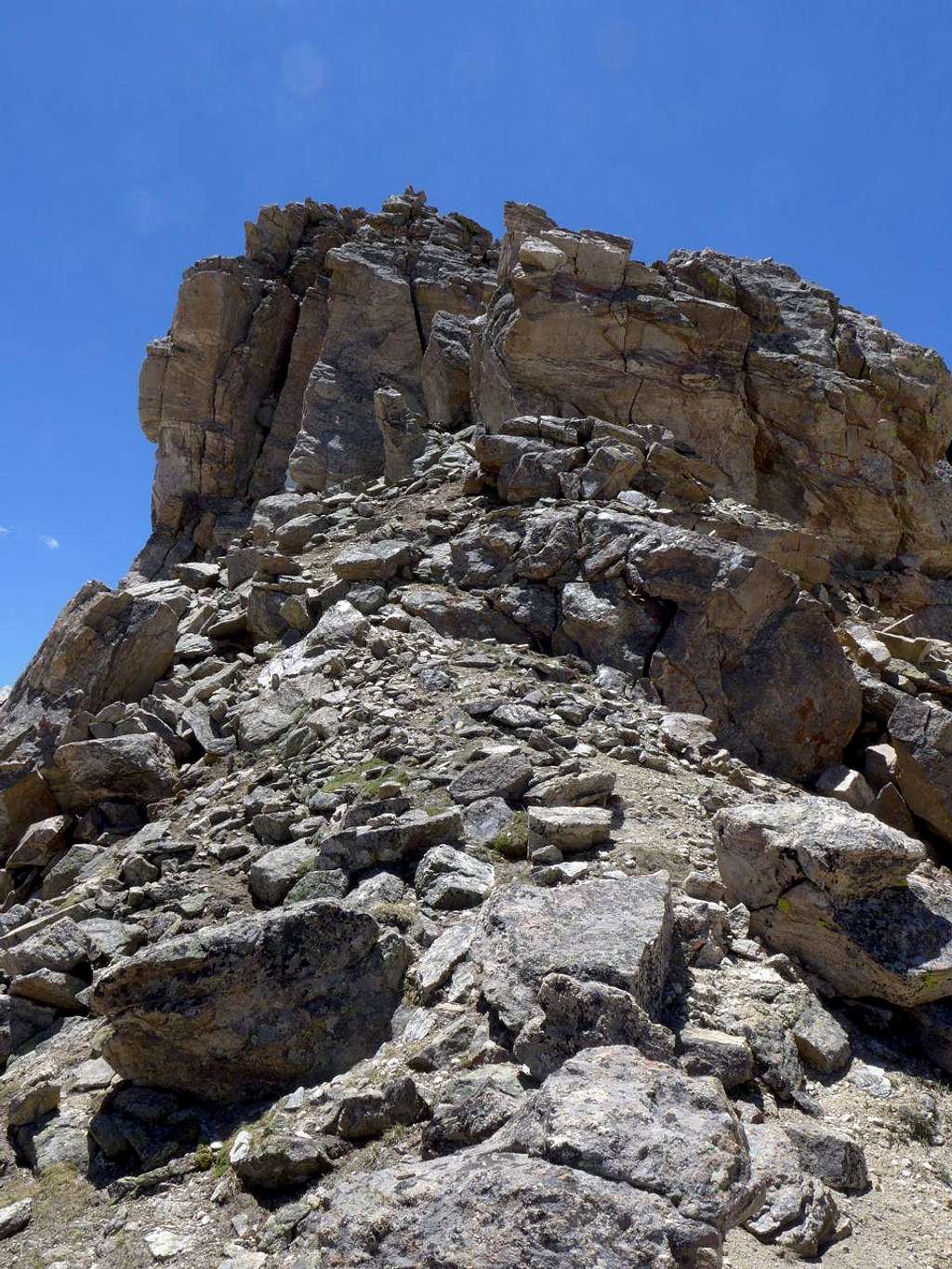
Things were indeed messy, and we had to drop off E of the ridge crest on a couple of occasions to avoid towers, but before too long we found ourselves staring at what Kane promised was the last serious obstacle on the route: a substantial ridge-spanning rock wall on the Twining side of the 13,545-Twining low point. Kane had said the key was the crack in the middle, forming a short chimney. How right he was. 30 seconds of vertical work and we were on the broad class 2 ridge heading upwards to Twining.
![The Obstacle: close to the low point on the Pt 13,545 to Twining ridge]() The key: a short scramble up the chimney-like crack in the middle.
The key: a short scramble up the chimney-like crack in the middle.
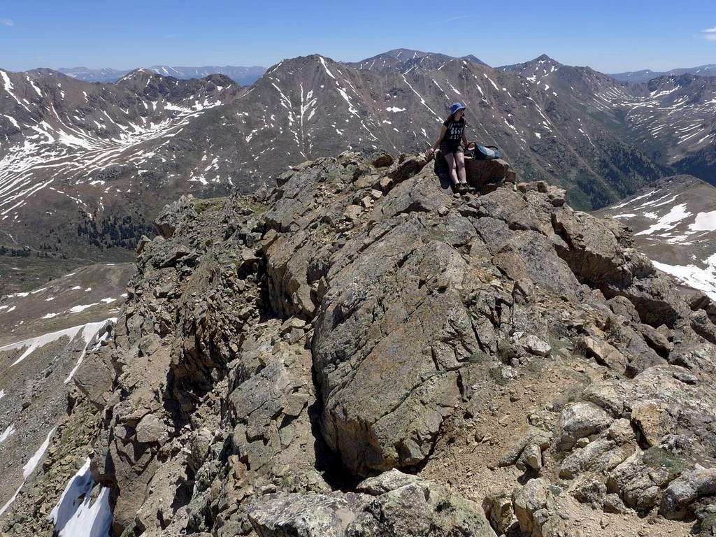
![Atop Twining]() Atop Twining. Grizzly A on the skyline to the left
Atop Twining. Grizzly A on the skyline to the left
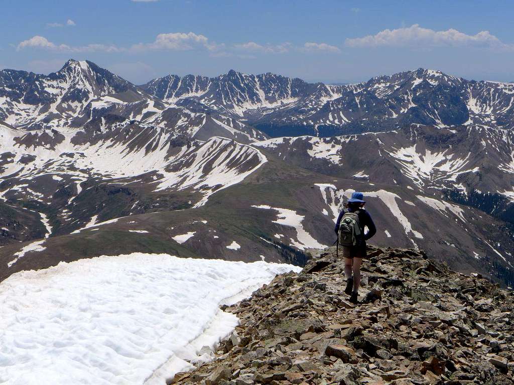
On the top of Twining, we had our first human contact of the day. A fellow from Salida had climbed a snow-filled couloir above Blue Lake up to the summit of Twining. Now we were faced with a choice: we could stay on the ridges and follow the continental divide around to Independence Pass via another top, Pt 13,500, or we could head directly down from Twining towards the Linkins Lake TH (and the car). My inclination -- the weather was still gorgeous -- was to stay high, and Megan agreed. The drawback: we would have to walk from Independence Pass to the TH or, hopefully, get a lift. It's not very far, probably only a couple of miles, but it's fast road with little in the way of a verge -- not fun to walk along. And I've not had the best of luck with getting lifts along it. Most memorably, the time Megan, Katie (then both 12) and I had ditched in bad weather from the Twining Peak ridge down to Independence Lake had resulted in us walking, soaked and demoralized, all the way up the road from the Linkins Lake TH to Independence Pass. The spectacle of two bedraggled 12 year olds did not apparently tug at the heartstrings of Rt 82's motorists. Perhaps it was my daughters' companion who put off would-be lift-providers: the sight of a drenched axe-carrying middle aged male maybe caused drivers to put their charitable impulses on hold. Anyway, the worst case scenario -- no lift -- today wasn't too awful: the sun was still shining and, heck, we would be heading downhill.
![Heading S from the top of Twining]() Heading S from Twining: Grizzly A is the dominant peak
Heading S from Twining: Grizzly A is the dominant peak
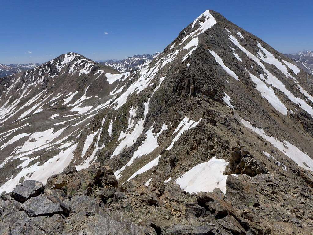
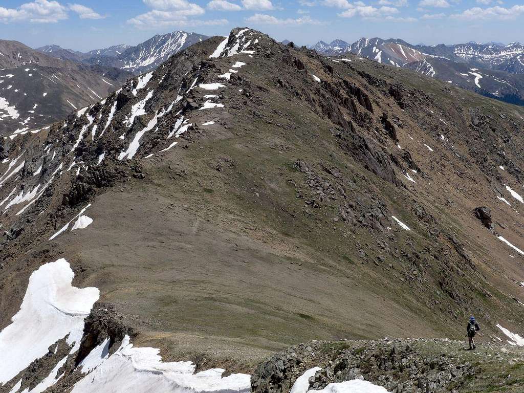
From Twining, it was an easy descent and ascent to Pt 13,500, a peak adorned with sets of weirdly sculptural standing stones. Then a gentle down to Independence Pass.
![Approaching Pt 13,500]() Approaching Pt 13,500
Approaching Pt 13,500
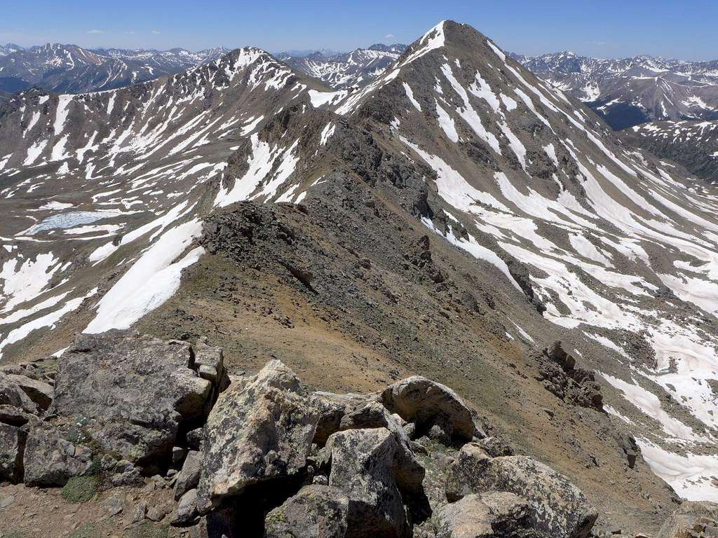
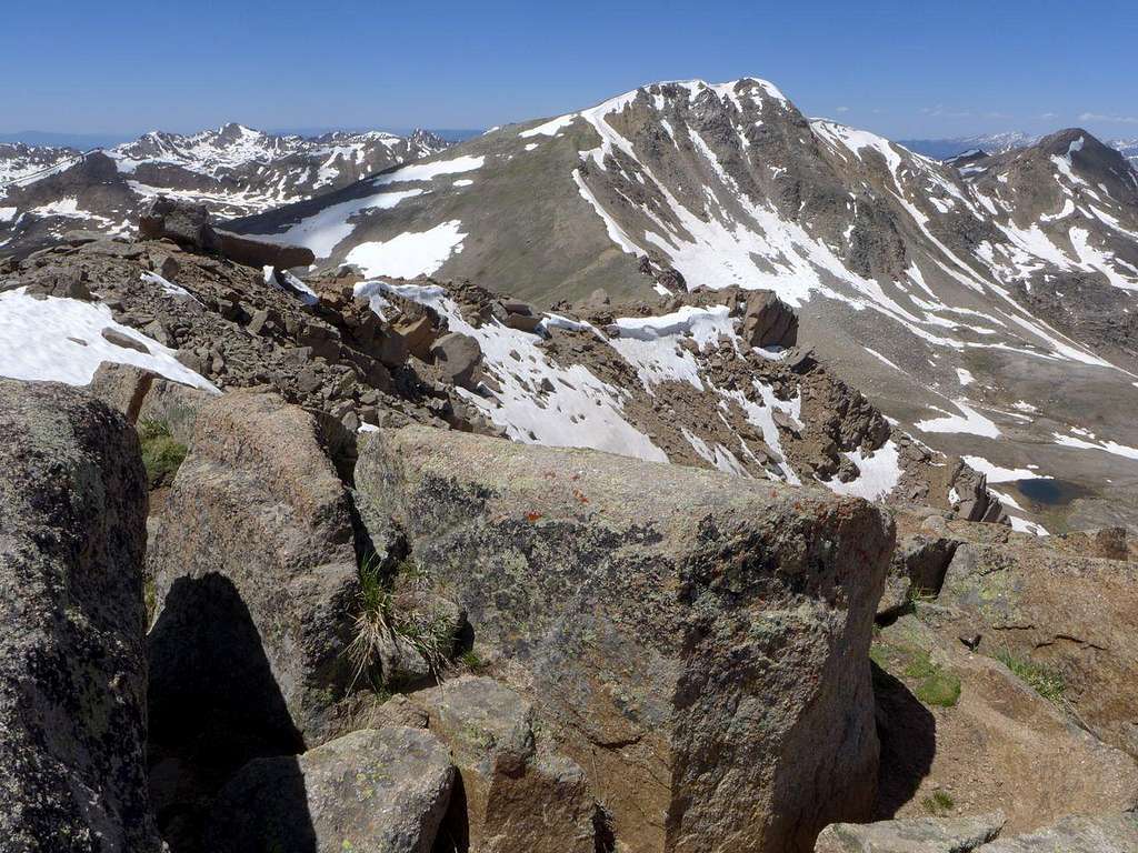
![Top of Pt 13,500, looking N towards Twining and Pt 13,545]() Looking back N from Pt 13,500 towards Twining and Pt 13,545
Looking back N from Pt 13,500 towards Twining and Pt 13,545
![Heading from Pt 13,500 to Independence Pass]() Coming off Pt 13,500 towards Independence Pass. La Plata to the left
Coming off Pt 13,500 towards Independence Pass. La Plata to the left
After the empty, airy thrills of the ridges, it was jarring to come down to the road and the pass. As usual, on a summer afternoon it was parked up and people were frolicking excitedly in the dirty snow patches beside the parking lot. The inevitable deafening arrival of motor cycles of the no-muffler,-sit-in-a-padded-chair-and-stick-your-legs-straight-out-in-front variety further accentuated the disconnect between where we had been and where we now were. We set off down the road, thumbs optimistically thrust out. Five cars passed. Two slowed down. Were they pondering giving us a lift or merely trying to avoid running us over? 10. 15. 20. Not looking good. But then -- miracle! -- a car pulled over. A kind young lady from Texas was concerned that we would be run over if she didn't give us a lift. A nice way to finish a fabulous day. A day of achievement and discovery. I had completed a route that I had visualized more than ten years ago when I was first up on the Geisslers, and I had discovered, definitively and with pride, that children surpass their parents.


Comments
Post a Comment