A Castle Rendezvous - August 10th, 2013
Castle Peak had been on Greg’s radar for longer than mine’s; having already climbed most of the range highpoints and P2K’s in the area, he had for years gazed tantalizingly at Castle in the distance, scrutinizing its ever changing profile from every direction. Me, less so, but Smoky Dome and a couple other trips to the Sun Valley area peaks this summer had allowed me a glimpse of this towering behemoth hidden deep in the White Clouds. Greg had wanted it last summer, but with inclement weather and the giant haze storm from a particularly bad year for wildfires, the timing never really worked out. Now with a week off in early August to do some peaks deeper up in North/Central Idaho he figured he could start with Castle after leaving Salt Lake, then work his way further into the Idaho interior. This worked for me too, as I could get Castle in as an exciting scramble the weekend before I was due to fly back to Massachusetts for a wedding.
We both left Friday, Greg a few hours before I, and he made it to a campsite along Pole Creek road headed towards the Washington Lakes trailhead while I slept in a residential pullout past Hailey.
I was running a little late the next morning for our rendezvous at the trailhead and busted ass down the rough and rocky dirt roads much faster than I should have. Somewhere along the way I must’ve passed Greg’s camp without noticing, as he saw me fly by and though shit, he better pack up camp and catch up with me. The plan was for us to meet at the Germania Creek Trailhead before we both drove up to the Washington Creek Trailhead. I waited for awhile and wondered if Greg had already headed up to the upper TH. I was about to backtrack and ask a camper further back along the road to see if he had seen Greg’s car drive by when I saw his 4Runner trudging up the road. He explained that he saw me pass through earlier, and we headed up the definitely rougher and rockier road to the proper Trailhead.
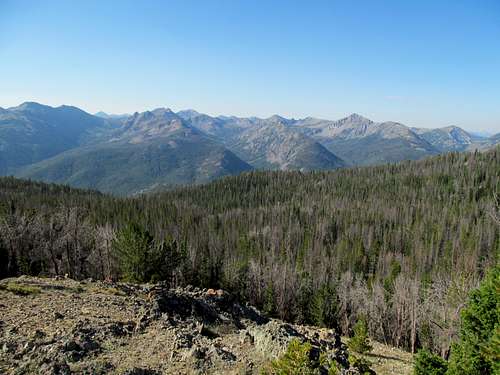
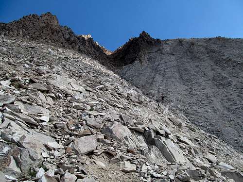
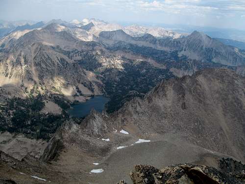
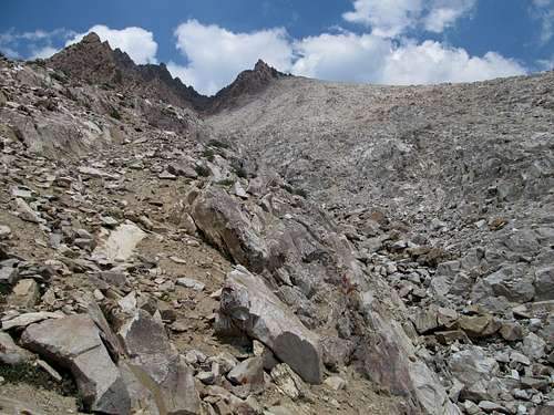
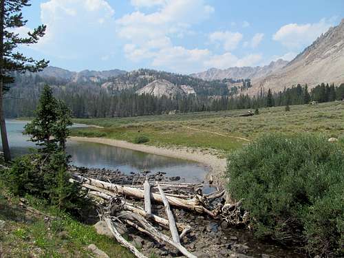
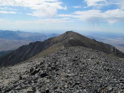
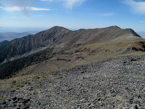
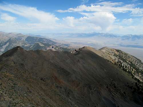
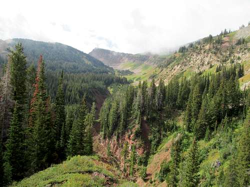
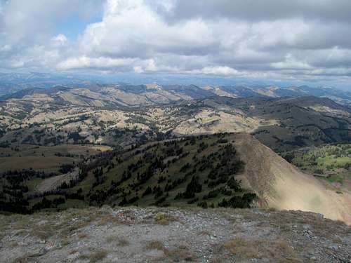
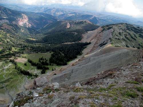
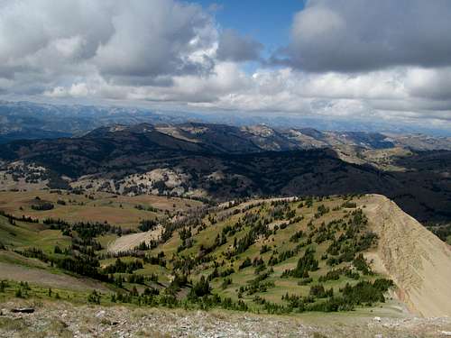
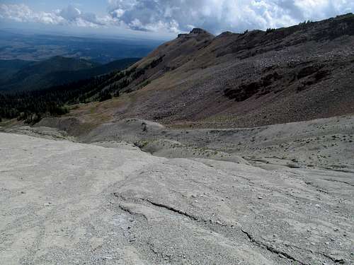
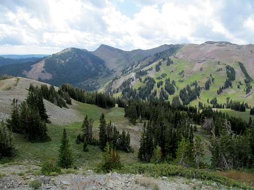
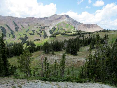
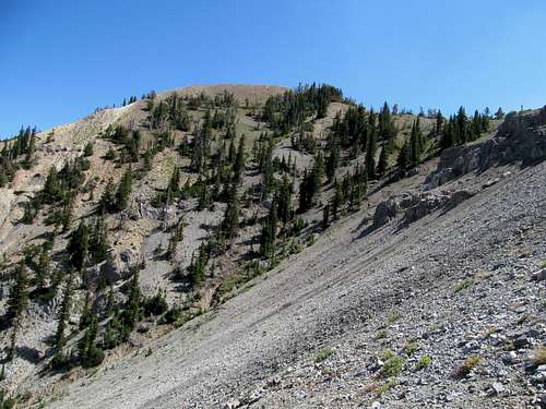
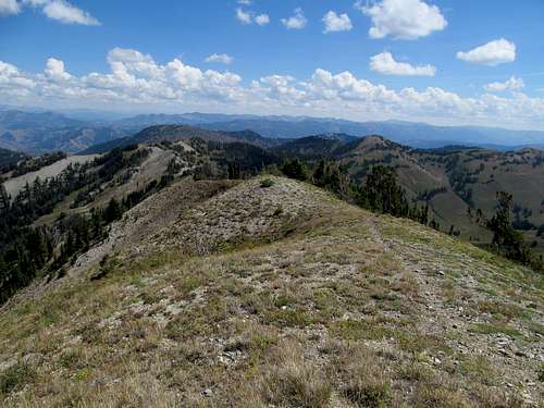
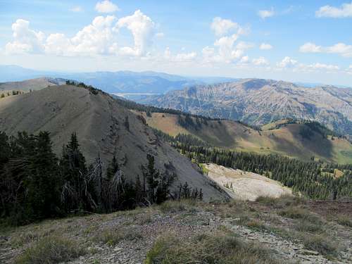
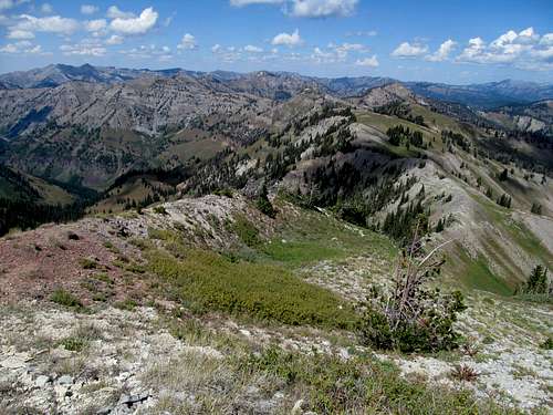
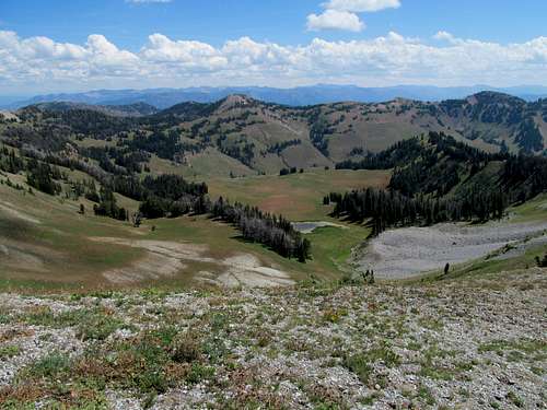
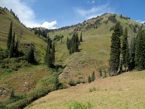
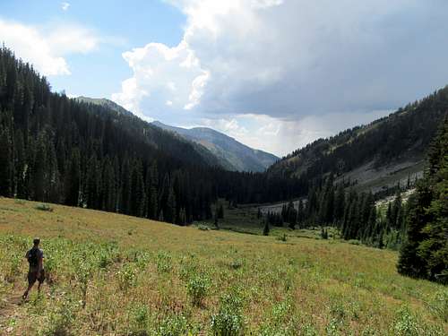
We had debated different options for the ascent, considering at points the Splatski shortcut from Fourth of July Lakes down into Chamberlain Basin, but Greg reasoned that despite it being a longer approach, we would make faster progress heading down the good trails approaching via the Washington Lakes trail to Chamberlain Basin, where both routes collide to ascend one of the several rocky gully’s on Castle’s south face. So we headed down a pretty gentle trail as it undulated up and down for five or so miles before finally reaching a high divide overlooking Castle and the lakes below it in Chamberlain Basin; it was as imposing and an intimidating of a route ahead as North Maroon many years back.
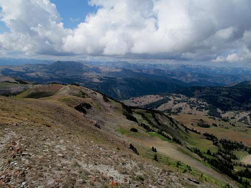
Greg had been right, as our progress the first five miles or so had been pretty fast. We cruised our way down the wide trail into the basin and the lake below Castle’s South Face, noting bike tracks in the dirt, and braced ourselves after hiking past the lake and the last of the trail part of the route for the last 2,700 feet or so of nastiness.
As we signed the register at the trailhead I had noticed the name “Gilliland” in the register above us, signed the same day. I wondered whether this could be the famed Duane Gilliland, mentioned here on SP as one of the very select few to have climbed all 58 Ultra Prominent peaks, including St. Helens before it blew. We debated about how many peakbaggers out there would have that last name and wondered if they were further up in the gullies in the south face; ironically neither one of us noticed the other name signed in the register that same day was Bob Bolton.
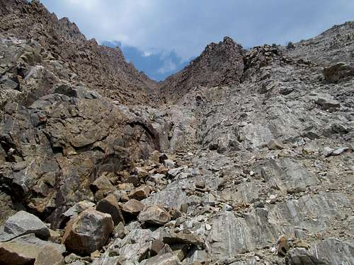
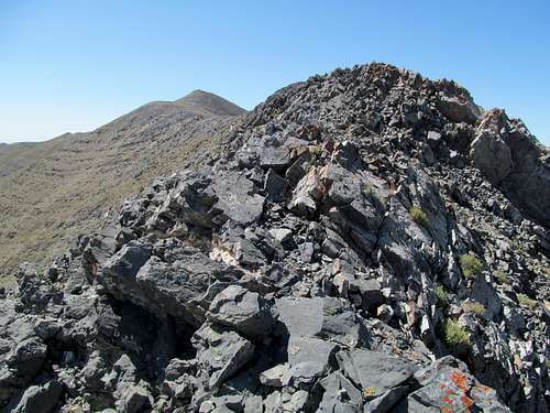
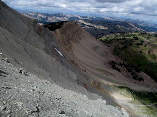
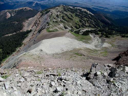
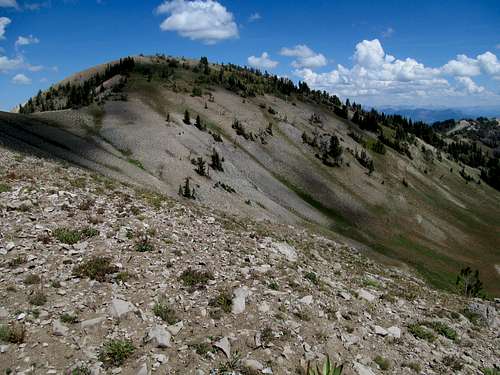
Greg had downloaded Dennis Poulin’s GPS track from peakbagger and we tried following it as closely as possible, first up a climber’s trail up a steep hillside leading up from the lake to the left of a prominent gully. This would be the gully we would eventually ascend, and after the climber’s trail faded into scree we started sidehilling to the right to join the gully. The rocks here were delightful to scramble up in this lower section, solid granite steps. Greg put some distance between him and myself, partly to avoid knocking rocks down (on his part as well as Oquirrh’s), and partly because he is much faster than me, especially on scrambling sections.
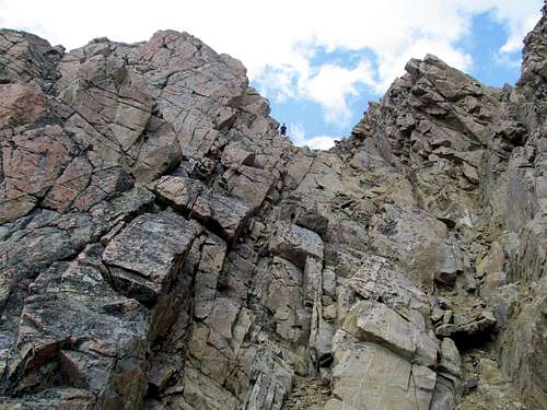
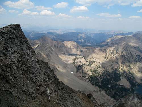
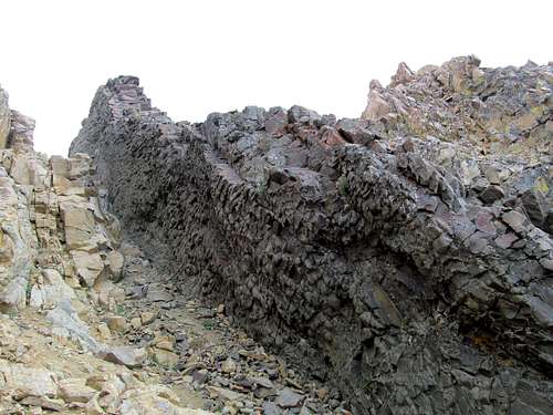
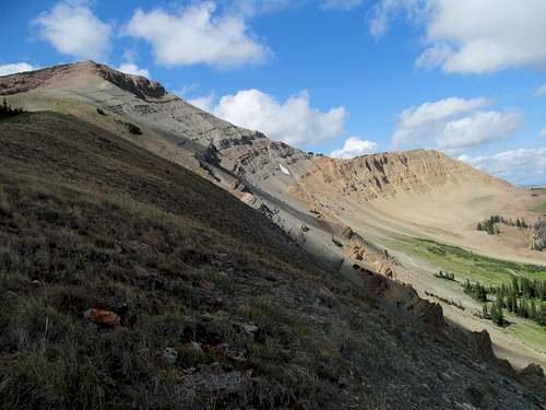
The quality of the rock deteriorated further up as the solid granite gave way to brown talus, but the scrambling was still basic and not too loose. The upper sections is where it got both looser and a little more precipitous, the ledges having more bite. I climbed up some reddish volcanic rock thinking it would be more solid than the loose dirt gully to the right, but it turned out to be very loose and slippery. Some black colored rock had some slightly more difficult scrambling but better footing, but still somewhat loose.
Further up Greg had chased down the other two climbers, who had already summitted and were on their way down. It turns out that indeed they were the famed Bob Bolton and Duane Gilliland, prominence peakbaggers extraordinaire, and the three prolific peakbaggers chatted as I clambered my way up to catch up.
Introductions were made a second time for them as I caught up with them, and we chatted briefly before they continued down and we continued up. The gully seemed neverending but eventually I made my way to the top. Greg, however, had vanished.
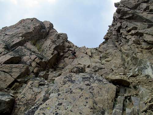
I assume he stood on the summit, but the way there seemed lost to me. He had yelled down something about taking a left before disappearing. I first followed the gully all the way to the top, topped out but found lots of cliffy terrain amidst a sheer drop off the north face between me and the summit. I backtracked and tried another smaller gully trending left, made some precipitous and tougher than expected moves, only to cliff out the same way. I was pretty confused about where to go and where the summit was. I yelled Greg’s name a few times to try and hear and gauge which direction he was, but didn’t hear back (he was exploring a route to Castle’s west summits at the time…and didn’t find much of one, an easy one at least).
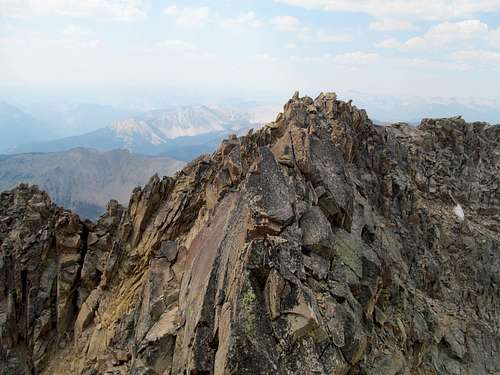
I finally found a small cairn further down the gully. I had seen it before but it seemed to lead towards a route disappearing down a cliff. I reexplored this area and finally found the route as it took a very hard left while traversing a ledge, where I found myself in a small, parallel gully that led to the summit. Greg was there, wondering where I had been. As expected there were a couple class 3 or so moves in this area; they were a little loose and had some moderate exposure.
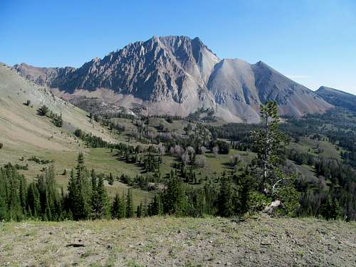
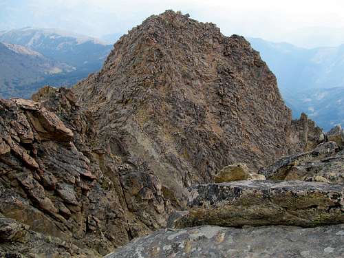
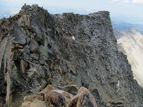
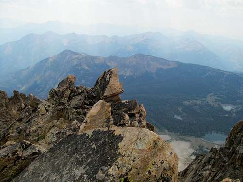
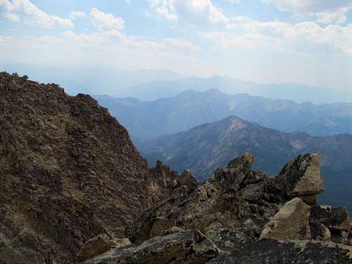
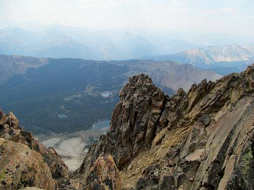
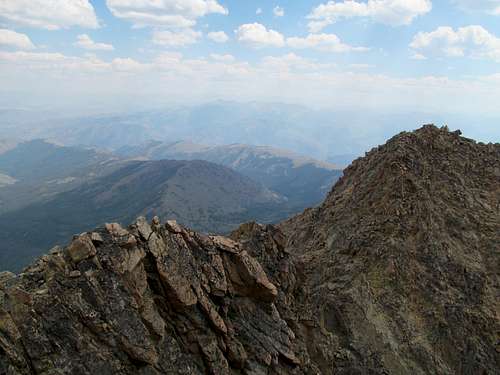
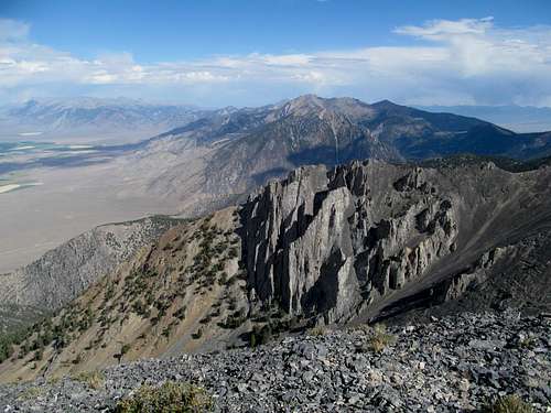
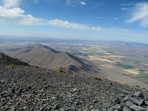
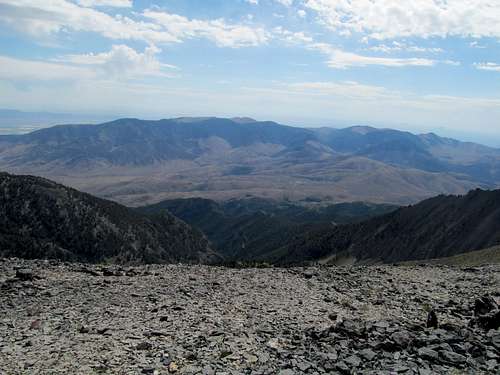
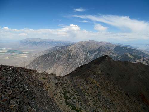
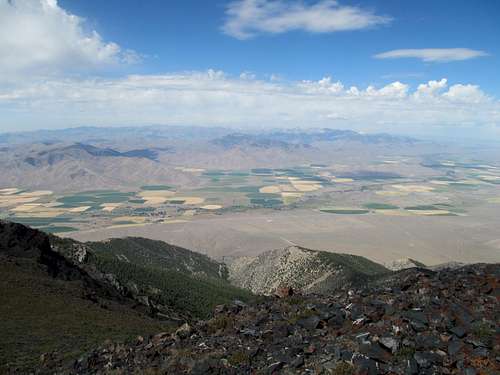
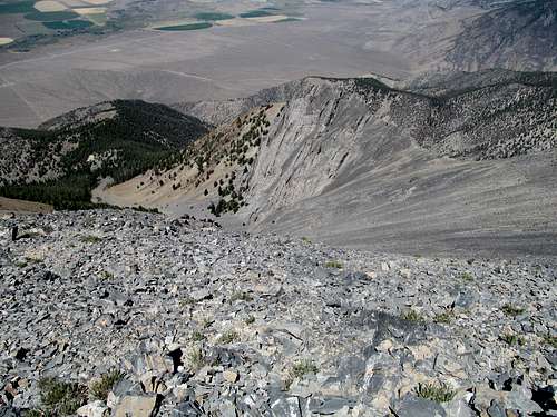
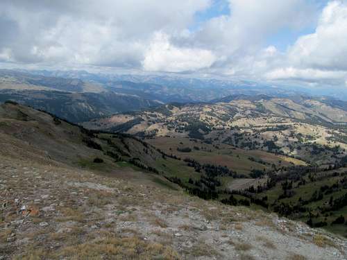
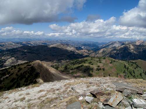
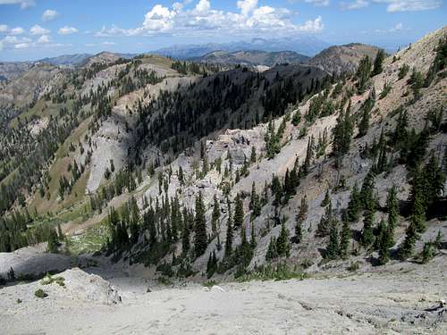
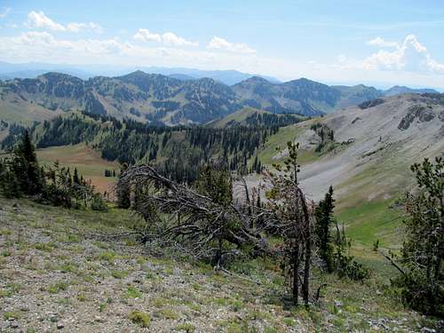
The summit area was small, full of precarious boulders stacked atop a cliff, and you get the sensation that one wrong step off a summit boulder and you could plummet down the north face. Haze from a rapidly building wildfire west of Hailey had already surrounded the area; views south were close to non-existent, though the views north into the White Clouds were decent, and you could still make out the Sawtooths to the west.
We didn’t stay too long, but had trouble leaving the summit area…why you say? While I’m usually the coward on the peak, it was Oquirrh this time who was scared and adamantly refused to downclimb/run down the summit area blocks. Greg tried coaxing him, to no avail, and I tried as well. He wouldn’t budge.
The plan was for Greg to descend first and then for me to follow after awhile so that we’d avoid knocking loose rocks on each other. Faced with this unforeseen difficulty I downclimbed ahead of Greg and Oquirrh, and watched from below as Greg eventually carried a still very reluctant Oquirrh down the loose last hundred feet or so of the summit area.
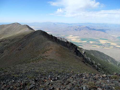
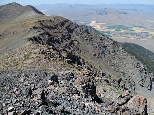
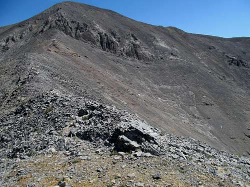
They went ahead again, Greg running down the talus while I carefully made my way down the rocks, wiser this time to the bad red rocks. Further down the scrambling got fun again, and I stayed in the gully for the sheer enjoyment of it before exiting it lower than where we entered it on the ascent.
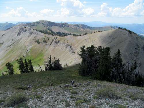
Greg was waiting down by the lake, and we headed back up the trail to the divide. Before we reached it we ran into Duane and Bob, and hiked with them the rest of the way as we all talked prominence peak war stories until we all returned to our respective vehicles. Despite its distance and overall gain (over 5,600’), the quality of the trails make the approach and the overall trip seem a lot less. The suckitude is really limited to the first uphill section up from the lake and the last thousand feet before Castle’s summit.
Bob and Duane were on their way to hit Bell Mountain in the Lemhi’s the next day, a county highpoint, before going for several P2K’s in Montana. Greg was on his way towards Cape Horn, a peak I had did a few weeks prior, Blue Bunch, before hitting up some notoriously long, remote and difficult peaks in the Salmon Rivers and Lick Creek Ranges (Big Baldy and North Loon). With Stanley as usual out of hotel rooms, I had booked one 60 miles east of it in Challis, planning to backtrack Sunday morning and climb Thompson in the Sawtooths. I was quickly disabused however of the notion pulling out of the Pole Creek Road back to the highway. While it had been hazy in Castle, the valley here looked like an apocalyptic wasteland, with giant dark clouds of wildfire smoke turning day to near night and practically wiping out the afternoon sun. The forecasts for the next day didn’t appear better, so I decided to forego Thompson.
King After Castle - August 11th, 2013
Since I was already in Challis I decided to do a peak nearby. Unfortunately a major fire was burning in the White Mountain Peak area immediately north of town, so I decided the best course would be to get a peak in the Lost Rivers on the way back. I had decided on Doublesprings in the northern end of the range, but woke up Sunday morning to find that the noon thunderstorm forecast for the area had moved up in its ETA to 10-11 AM ish. The forecast in the southern end of the range was much better, so I settled on North King as a consolation prize.
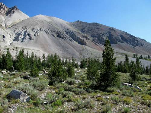
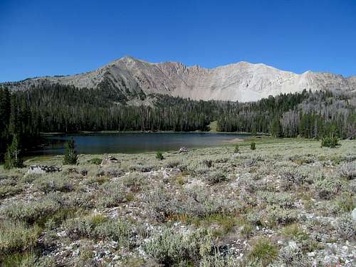
I drove down the scenic road past Borah and the Lost River Crest through Mackay, and made my way down the dirt roads leading to the paragliding launch site at the base of North King. The last 30 feet of road before the upper launch site proved too loose and steep for me, though I’m sure a better driver of shit roads could have easily taken a 4Runner past it. I backtracked a little further down, walked the last steep section of the road, and started up the steep ridge, where a climber’s trail took me steeply up the ridge through the woods and the talus above treeline.
My leg muscles burned as I continued up the route, the triangular face of King Mountain greeting me. I saw one rocky section further up but the trail wound by it easily; it was not the crux section as described on SP. That came later as the trail passed very loosely to the left of some rocks. You can climb a very loose dirt type gully on the left or climb the rock on the right. I opted for the latter, and then followed the talus to the summit of King.
The traverse to North King, the highpoint and P2K, looked like quite a long haul, and my legs settled themselves for further tortune
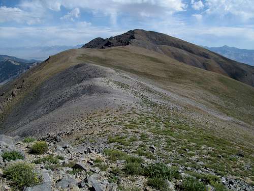
I resigned myself and traversed around to the right of some rocky areas along the ridge crest. Eventually I found the sidehilling tedious and discovered the one truth to this traverse; stay along the ridge crest and the rocks will provide solid footing all the way from one summit to the other without requiring any difficult moves.
One section has a cool little gap too that feels like a tunnel providing passage through some steep ledges.
I enjoyed the views. It had rained a little in the morning when I first started out, but it had been clear since then, with stifling heat. The White Clouds had had very ominous clouds over it ever since the early morning drive out of Challis, though I wasn’t sure whether it was due to the wildfires, or thunderstorms, or some devilish combination of both. I saw a small cloud over Diamond and Bell in Lemhi’s, and wondered whether Bob and Duane were staying dry battling the latter.
I stayed along the ridge crest on the way back, and once more downclimbed a few tricky sections in the crux.
The steep downclimb back to the car definitely took a toll on my leg muscles, and I soothed them with a burger, a beer, and a coffee at Pickles in Arco. After a quick stop at the Nuclear Reactor museum south of town, which was a cool little attraction, I made my way back to Utah well before it got dark.
Gettin' a Hoback - August 24th, 2013
It hurt a little bit to lose an August weekend in the Northern Rockies, but if I could sacrifice two late summer days for anything it’d be for a trip back home. I hadn’t been back to Massachusetts since the prior Thanksgiving, and after almost nine months away from home, this trip was long overdue. I thoroughly enjoyed myself catching up with friends, family, and eating endless Hor d’oeuvres (including Bacon Wrapped Scallops!) and enjoying the open bar as well the appetizer buffet of lobster and shrimp at a beautiful beachfront wedding on the cape. (oh and the main course steak was delicious too, which the best melt-in-your-mouth gnocchi I'd ever had the pleasure of tasting). As far as a vacation away from the Northern Rockies, it was as good as it gets.
I returned that week ready to make the most of the remainder of the summer. On Greg’s radar were Baldy and Observation Peaks, two P2K’s that he had yet to summit, despite the fact that we had both climbed the range’s highpoint (and oddly enough not even a 2K prominence peak) almost exactly 52 weeks prior. I was keen on Observation, but for some reason Baldy didn’t appeal that much to me, and the fact that unsettled weather on Saturday in the Baldy area threatened the early afternoon skies made me look for an alternative.
I noticed a better forecast further east in Wyoming and decided to go after Hoback Peak. Greg and Dean would go for Baldy despite the forecast, and then we would all meet in Alpine, where we’d camp (shudder) and Greg and I would try and figure out the best way up Observation Sunday.
I made my third trip into Wyoming this summer in downright hazardous conditions, leaving Salt Lake in the early morning and first encountering the thick fog from Park City into Evanston. Past Evanston and post sunrise the fog was just as bad in spots between Kemmerer and La Barge, and I worried about both conditions and the possibility of clouded over views on Hoback, though the weather still showed low chances of thunderstorms.
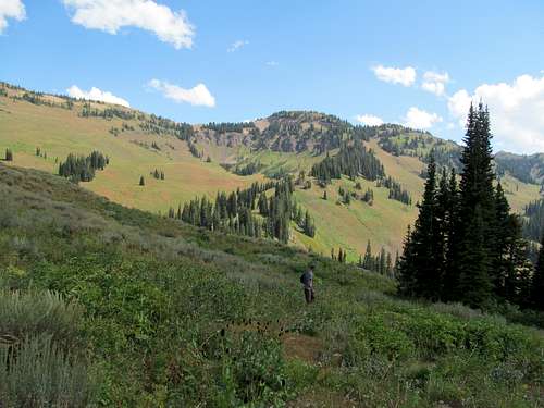
It was downright cloudy by the time I reached the Bondurant area, and the low valley between the Gros Ventres and the Hoback area looked to be completely enshrouded from the highway above. The trailhead was easy to get to, and the morning mist burned off as I made quick progress through the first few miles of the trail. After the many longer treks this summer my legs, and more importantly my head were well conditioned to the accumulation of miles on foot by now, and the eleven mile round trip on Hoback didn’t seem like much.
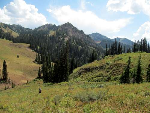
I reached the pretty waterfall and the dramatic and curvaceous cliffs of Hoback’s southeastern ridge revealed themselves as the trail switchbacked up to a small meadow below a ridge to the north (climber’s right) of the waterfalls. Here I noticed a sidetrail junction to the left and followed it as it blazed a short but steep path up and through the ridge and into a wooded area guarding the terrain between the waterfall and the high basin east of Hoback. The trail wound through a few more meadows and trees before disappearing near what looked to be an informal backcountry campsite. A hillside on the right would have allowed for access to the northeast ridge, and it would be my descent route on the way down, but for now I walked cross country a short distance through the woods heading west and soon emerged into the upper reaches of the upper basin.
The basin had a quaint, boxed in feel to it, still maintaining its greenery in the late summer. One could ascend a drainage through the grassy lower portions up to the clay like badland dirt of the upper reaches of Hoback’s NE Ridge, but I opted to ascend the hills to the right further down along the ridge.
The views of Greyback Ridge, the Greys River, Clause Peak to the north, and the Salt River Range greeted my views the rest of the way up. Walking along wide swaths of badlands-like dirt on the upper ridge was a delight, and the steep cruxy loose section below the summit was short and easy to navigate past.
The summit area is quite broad, with a lot of flat areas, hills, and drainages along the east ridge as it pauses before rejoining the summit at the high point, and despite the low cloud cover the views west were breathtaking.
But I got greedy. I wanted badly to see the Gros Ventres, partly because I had yet to get a great glimpse of that range from any other summit before, and this would be the most proximate summit not in that range itself, and partly so that I could survey Doubletop and look in satisfaction of glimpsing a peak already climbed.
There was still a possibility of storms based on the forecast, but that possibility seemed increasingly rare as I watched the cloud cover burn off and each puff coming from the west loom smaller and smaller. Even in the afternoon sun shapes that threatened to form thunderheads never carried through, and I waited and waited.
The Salt River Range and the Snake River Range to the north changed colors along with the weather, though the latter seemed to sit in perilously dark conditions and I wondered how Dean and Greg were doing on Baldy Peak.
I kept a close eye on the shapes of the clouds over the Gros Ventres; it was certainly storming there but I hoped that those clouds would burn off as well…slowly but surely they were shifting millimeter by millimeter in the horizon, and rising higher and higher so that the lower foothills of the range gradually revealed themselves.
But the higher peaks of the range remained stubbornly hidden, and I eventually lost my patience as I descended the NE Ridge.
There’s a fascinating bench to the ENE of Hoback that one views from the summit, forming the head of the ridge leading north from the waterfall and lining the northern end of the basin. I figured I could follow the ridge down and reascend the bench, then follow the edge of the bench back down to the waterfall instead of descending directly down into the upper basin. This way I could keep my eyes peeled east towards the Gros Ventres in case the clouds ever burned off.
I followed this course down the ridge and onto the edge of the bench, which provided for great views and a different perspective of both Hoback and the curves of its SE ridge opposite the basin. I crested the edge of the bench and spied the rocky ramparts of the upper Gros Ventres. I had finally and successfully waited out the clouds and was so thrilled at the view and my patience paying off that I screamed and shouted random obscenities, absurdities, making weird noises, animal and inhuman, acting like a five year old special needs kid on LSD. Sometimes its these little things that turn a good day in the mountains into a great day, and this deferred view of the Gros Ventres granted to me by the late afternoon respite gave me a sense of closure to the rapidly ending summer.
I descended some steep grassy terrain down from the bench towards the opening of the upper basin, finding the trail near its end past the waterfalls and following it back. The trek back to the trailhead flew by, and I enjoyed additional views of the Gros Ventres on the drive back and over to Alpine.
Blind Wanderings on Observation - August 25th, 2013
I had lunch and coffee in town while awaiting Greg, Kadee and Dean’s arrival from the other side of Idaho, meeting them at a gas station. They bulked up on supplies, and we drove south of town and followed the dirt roads while Greg looked for a camp-spot along the southern end of Palisades Reservoir.
Most of the best non designated spots were taken, but we found a deserted USFS campground right on the southern shoreline of the mostly dry reservoir. Here we enjoyed views of the entire expanse of the Snake River Range across the dry lake in the evening light. It was a fun camp, with Dean’s company and me making many uses of punnage one can make on the name Hoback. I enjoyed myself despite lingering uneasiness in the back of my mind at the lack of a shower, mattress, and knowledge of the day's NFL preseason scores.
I was concerned about Sunday’s weather forecast as well. With a 30-40% chance of thunderstorms in the early afternoon, we decided to take a staggered approach to Observation. I would wake early and start early, making my fast walk pace down the trail, while Greg slept in, got up on his own time, and would do his normal trail running to catch up with me at some point.
There’s not a lot of hard data out there on Observation. Topo maps show trails approaching and reaching the summit from different directions, but there’s precious little info on trail conditions and lengths. There’s actually a good trail map at the trail head with mileages, and from a quick cursory glance I figured it would match what we had already estimated…perhaps 14-15 miles round trip. It would be a significantly longer both in numbers and in perception.
Both of us agreed upon the North Fork trail as it seemed to offer a more direct and slightly shorter approach than the South Fork of Indian Creek. As planned, after another night in the back of the truck I woke in the early morning sun and backtracked my way to and through Alpine, finding the Indian Creek trailhead without much difficulty. The trail takes you many miles through the lush drainage of the North Fork and is for the most part easy to follow, though I did lose it following some goat paths near one of the creek crossings along the approach.
I kept expecting to hear Greg running up, waiting for him at a small uphill section past where I had temporarily lost track of the trail, but with no signs of his approach I continued on. Lost and oblivious in my audiobook I was completely unaware a few miles down the trail when he did catch up and caught me off guard as I jumped when he yelled “boo”.
We continued on. Greg had caught up with me close to where the trail was going to curl south towards the peak. We saw a small trail junction onthe right and followed it, thinking this was where the turn was, but we eventually realized something was wrong as we first squeezed through the path as it narrowed and narrowed to the point where it was almost overrun by brush, and both of us were getting soaked from the condensation on the vegetation. Eventually we crossed, re-crossed, re-re-crossed the creek a billion times over, often wallowing through and getting bogged down in mud and swamps as we found each impromptu creek crossing more and more brushy and deep. While goretex kept my feet relatively dry Greg in his trail runners was not loving this terrain, and we both cursed what we thought was an extremely unkempt trail.
Eventually at a dead end spot where any reasonable path through the thickening brush along the creek seemed to come to an end, we realized the actual trail was further above on the drainage wall to our left, which meant that we had left the trail too soon. We made another rough crossing and ascended steep dirt to regain the trail, but the efforts down in the creek had already drained (no pun intended) much out of me.
We had wasted precious time in the water too, and while the skies still seemed clear at the very least the sun and humidity was building up as we started one of the steeper parts of the ascent, following the trail as it finally climbed up above the drainage and started switchbacking up into the higher meadows of the range. As we got higher I kept a careful eye on the skies, looking for building thunderheads.
We reached a high meadow around 8,400’ about 7 miles in, according to Greg’s GPS, and near a junction turned left to follow a smaller trail that would take us higher towards Observation (Trail 210), but our utilization of this trail would be fleeting seeing as we would only follow it while it served us as it crossed a small drainage. From this high meadow we could see a couple of summits, and Greg’s GPS indicated that they were likely Observation, though still a few miles away. (We were looking at Observation, but mostly at its lower western summit, the true summit barely in sight behind it). My memory in this area is blurry, but I do remember us having to leave the trail and ascend a steep grassy slope to gain the wooded area along the ridge running northeast from Observation’s west (false) summit.
We ascended through gentler terrain higher and higher towards the base of Observation’s west summit. Here I thought the easiest course would be rounding up the western summit’s west ridge, then losing some elevation to gain the saddle and reach the true summit. Greg opted for a straight shot of the rocky, scree strewn north face of the two summits to reach the same saddle, and I reluctantly followed his course.
It sucked, the scree, the looseness, the tractionless sidehilling through kitty litter rocks and dirt made for a long and awful traverse, reminding me of the east slope of Provo Peak from earlier in the summer.
Greg went around some cliffy areas and disappeared as he rounded the northeast face of the west summit, and by the time I reached there I figured some scrambling through the cliffs would hopefully give me a respite on solid rock. It was wrong, the rocks here were just as loose and holds were rare, and those that were there were downsloping and unstable. I forced myself up through this section, and finally through the last of the scree to reach the saddle.
Greg had already summitted, and I limped towards the top.
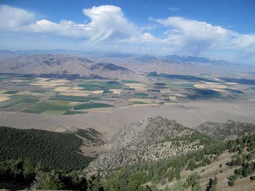
The last few hundred feet are surprisingly long and steep, as the saddle is deceivingly short of the peak. The views at the top were breathtaking through, as I glimpsed the Snake River Range and the area in general for the first time without haze, clouds, or smoke. The Tetons finally presented themselves to me clear and unencumbered to the north, past the steep drop off from the Snake River Range down into picturesque Jackson Hole as seen from afar and further up. I viewed with satisfaction of the Gros Ventres, Wyoming, and Salt River Ranges with a sense of closure that comes with having discovered all their P2K’s (though I do still hope to return and tackle the less prominent peaks of those remarkable ranges).
The rich green color of the Snake River Range itself features unique hues not found in its neighboring ranges, and I enjoyed their splendor amidst a sky that was starting to cloud up, but was hopefully still an hour or two away from building up to thunderheads.
Now it was decision time, whether to return via the North Fork or explore uncharted terrain to loop back around the South Fork. Possibly because of the boggy drainage on our way up, Greg leaned towards the latter, and I was up for discovering a new, possibly shorter route (but probably not).
We descended down the summit, reclimbed the west summit, and followed the trail as it made its way along the rocky ridge before eventually dropping into a table south of the ridge crest and sporting a small pond at just below 9,100 ft.
Here is where things got a little complicated. The main trail swings east and diddles around for quite a bit before curving back west and south to descend the South Fork Indian Creek Drainage back to our trailhead. But we could see the drainage immediately ahead of and below us, and Greg’s GPS indicated that a connector trail called the Red Slate Trail or something of the sort should lead us straight down, saving us 2-3 miles. But the trail did not exist in real life (or at least we weren't able to find it), so we were forced to negotiate our own way down. We, and more so I, were both worried about cliffs blocking our way, but fortunately as we headed downhill in a southeasterly direction from the pond we were able to avoid or find a way around most difficulties. After descending the initial slope Greg did some scouting while I pondered a route directly down the drainage. We decided to descend the rocky drainage, which was rocky at points but made for a relatively simple descent until we joined a wider drainage further down.
Here we continued following this drainage until a cliffy dryfall area required some maneuvering about, and I crossed to the left side of the drainage to avoid the cliffs. The terrain progressively mellowed as we descended lower, and signs of a trail (or what used to be a trail) revealed itself as we continued down towards South Fork.
Upon rejoining the trail we were still many miles away from the trailhead along the Idaho Wyoming border and, as we had not planned on doing the loop, had to walk an extra mile or two back along the dirt road to reach our cars at the North Fork trailhead. Our total mileage this day would end up totaling over 20 miles, but I had really only brought enough granola bars and water for 15, so my journey out was a battle against thirst and an increasingly dry throat and empty stomach.
The tardy afternoon showers brought a respite from the heat and humidity, but the rain started to really come down heavily by the time we finally recrossed state lines back into Idaho and passed by the South Fork trailhead. Drenched, we walked by the wide campgrounds here and noted that we could've camped here the previous night and been much closer to the trailhead, though the views weren't as nice here compared to our actual lake shore campsite. Greg had offered further up the trail to get a head start and run back the remaining portion so that he could get back to the car and drive to the South Fork to pick me up, and while my slowly dwindling rations made me amenable to this idea, I never pulled the trigger and gave him the word go, so we both ended up walking back the full length of the loop. Greg was able to find a shortcut using his GPS, so we left the road when we were close to directly south of the North Fork trailhead. I housed down the remaining portion of a shitty subway flatbread (and yes I refuse to capitalize subway out of principle) and we parted ways, each making the long drive back through Idaho Falls then back to Salt Lake. I watched the early evening thunderheads pummel the mountains and felt a little bittersweet at having finished all the Wyoming P2K’s of this area from the Snake River to the Salt River to the Wyoming and Gros Ventres ranges, but hopefully I haven’t yet seen the last of these ranges.


Comments
Post a Comment