Introduction
The title of this trip report makes sense in a couple of ways. Just south of Hollister the road sign clearly warns "No Services Next 75 Miles". This was astonishing for anywhere just 100 miles or so from San Francisco. I would expect a sign like that in the middle of Nevada, but on the outskirts of the Bay Area? Also, I encountered relatively few people on this hike - less than ten going to the top of North Chalone Peak - this at a time when the campground which has over a hundred sites was filled up. I can only conclude that 90% of the visitors were hiking the more popular trails - the Balconies or the High Peaks for example. All in all, the relative lack of people plus the outstanding topography on this route combined to impart a sense of adventure to this outing.
Highlights:
Fun caves, nice little lake for a rest stop, colorful spires and cliffs, well maintained and graded trail, good views. Also home to the California Condor, North America's largest bird, and other interesting species such as the Canyon Wren. Can also make a bit of a loop out of this hike by returning via the Rim Trail and High Peaks Trail. This hike rates 9 stars out of 10 in the book "California Hiking". The only hike with a higher rating in Pinnacles National Park is the "Balconies Caves" trail.
Bear Gulch Trail 0.3 miles
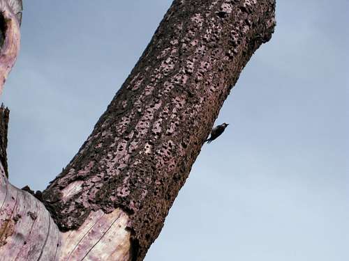
![Woodpecker]() Woodpecker
Woodpecker
Woodpecker at the Bear Gulch Visitor's Center.
If the parking lot is full at the end of the road, you have to park at the Visitor's Center and walk along a trail that parallels the road for 0.3 miles.
There are a number of trail intersections on the first part of this hike up as far as the Reservoir, but they are quite well marked. A map helps in understanding this, like the one in the "Pinnacles" brochure that you can get for free at the entrance to the Park.
The woodpeckers have done an amazing job of pecking holes in this tree.
Moses Springs Trail 0.2 miles
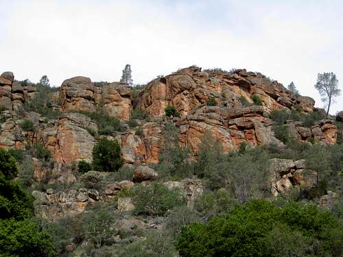
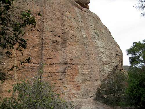
![Cliffs at Start of Trail]() Cliffs Near Start of Trail
Cliffs Near Start of Trail
Typical Pinnacles rock.
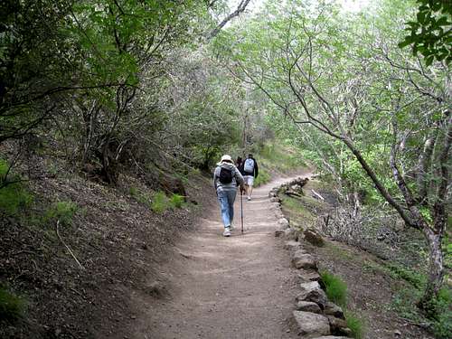
![Start of Moses Springs Trail]() Start of Moses Spring Trail
Start of Moses Spring Trail
Just beyond the pavement the trail starts a gradual up hill climb.
Note the pleasant dappled sun, shade and greenery.
Bear Gulch Caves Trail 0.7 miles
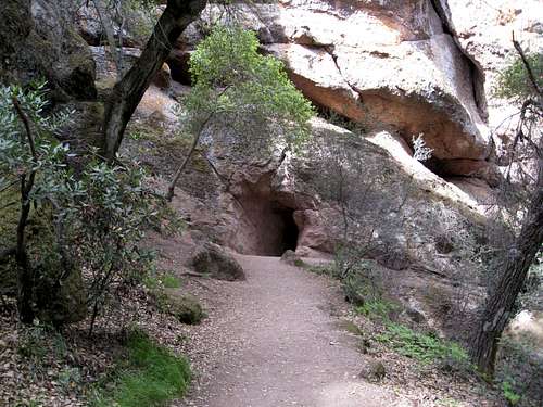
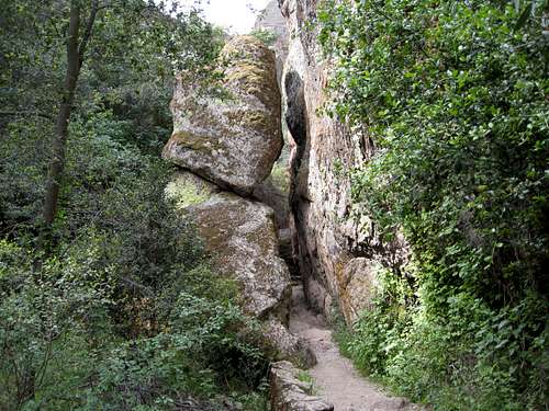
![First Cave]() First Cave
First Cave
The trail disappears into this black hole.
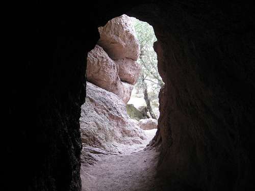
![Looking Out From Cave]() Looking Out From Cave
Looking Out From Cave
But there is light at the end of the tunnel.
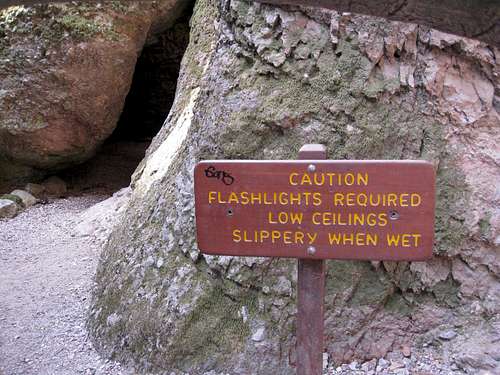
![Warning Sign]() Warning Sign
Warning Sign
But the pictures above were just of the
first cave. Now the going gets serious. The sign pretty well tells us what to watch out for except for one thing...
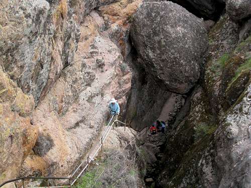
![The Trail Narrows]() The Trail Narrows
The Trail Narrows
They forgot to warn us about getting stuck in the Jaws of Death!
![Climbers Wall]() Climbers Wall
Climbers Wall
Oh, by the way, there's rock climbing in Pinnacles National Park. Who'd a thunk it?
![The Climb Out]() The Climb Out
The Climb Out
At last, we climb out of this dreadful place. Note the large-ish boulder wedged between the canyon walls. Now
that's a chalk! Not exactly where I would choose to tarry, but fortunately I didn't see any squished hikers on the way back.
Chalone Peak Trail 3.3 miles
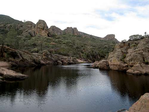
![Bear Gulch Resevoir]() Bear Gulch Reservoir
Bear Gulch Reservoir
The Bear Gulch Caves Trail tops out here at the Reservoir. A lot of people pause here for a snack, as the squirrels will surely tell you. From here you start the 3.3-mile trek up to the Peak.
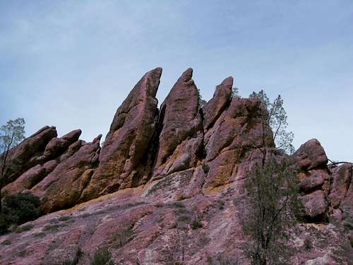
![The Sisters]() The Sisters
The Sisters
Less than ten minutes from the Reservoir we come to these interesting rocks.
![Chalone Peak Trail Scenery]() Chalone Peak Trail Scenery
Chalone Peak Trail Scenery
Typical scenery along the Chalone Peak Trail.
![Looking Down on the Reservoir]() Looking Down on the Reservoir
Looking Down on the Reservoir
About an hour from the Reservoir I took this photo looking back down towards it. Can you see it?*
*(Of course it's the little dark spot just a little bit below and to the right of the middle of the picture.)
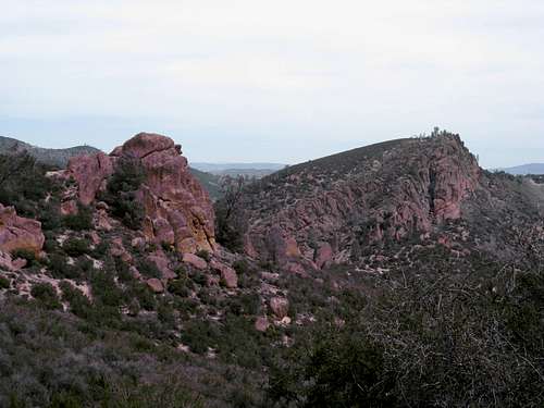
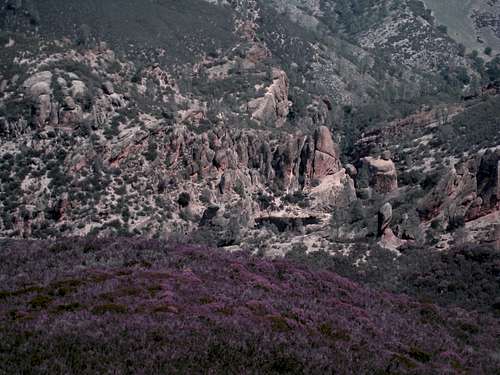
![High Peaks Area]() High Peaks Area
High Peaks Area
The Chalone Peak Trail provides good views of the whole expanse of the High Peaks area.
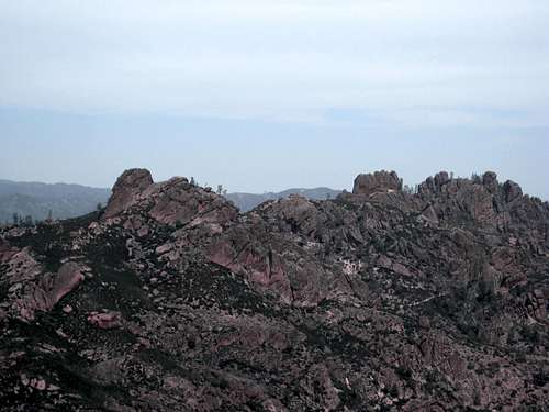
![North Chalone Peak]() North Chalone Peak - 3,304 feet
North Chalone Peak - 3,304 feet
At last, the objective of the expedition comes into view, mighty North Chalone Peak. We don our oxygen masks and trudge upwards into the Death Zone.
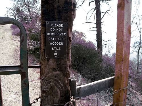
![The Crux Pitch]() The Crux Pitch
The Crux Pitch
But, we encounter one last obstacle...
Oh no! The gate is locked! We have to climb over the wooden thingy to the right, risking a crotch full of barbed wire. This reminds me of the Hillary Step on Mt Everest, only worse. Will we make it???
At The Summit
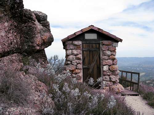
![Summit Comfort Station]() Summit Outhouse
Summit Outhouse
YES !!! Victory is ours! We've reached the historic Summit Comfort Station. But where on earth could they have ever found the stone to build this?
Ah...mystery solved. The expedition geologist identifies it as having come from a quarry in Vermont, circa 1839.
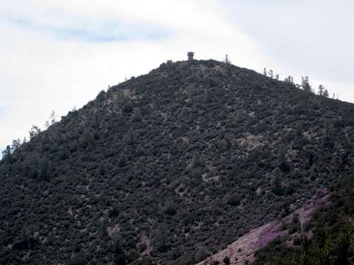
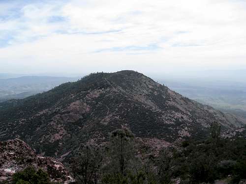
![South Chalone Peak]() South Chalone Peak - 3,269 feet
South Chalone Peak - 3,269 feet
No sooner do we claw our way onto the summit of North Chalone Peak then another gigantic massif comes into view, even more fearsome than the demon we have just conquered - mighty South Chalone Peak. Can we somehow gather the fortitude to climb it, too?
No, alas, our food and fuel are all but gone, our oxygen bottles exhausted. We stagger down from the summit at once, lest we are engulfed by the coming nightfall and a certain death from exposure.
The Descent
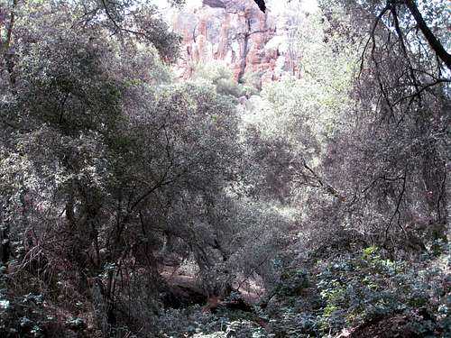
![Verdant Forest on High Peaks Trail]() Verdant Forest on High Peaks Trail
Verdant Forest on High Peaks Trail
We bypassed the caves on the way down, opting for the Rim Trail connecting to the lower portion of the High Peaks Trail then back to the trail head. Back down in Bear Gulch we enjoyed the lush forest and shade. The descent was an easy and pleasant couple of hours and still with some new scenery.
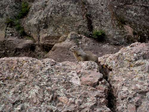
![Squirrel]() Squirrel
Squirrel
"Goodbye fellas, come again."
I'm sure we will...


Comments
Post a Comment