
-
 5592 Hits
-
 79.04% Score
-
 10 Votes
|
|
Route |
|---|---|
|
|
Mountaineering, Trad Climbing, Scrambling |
|
|
Summer |
|
|
Most of a day |
|
|
5.2 (YDS) |
|
|
Overview
I dedicate this page to Vernon Garner, Saintgrizzly, whose body we lost to cancer but whose spirit remains, and who loved Glacier above all other places. Vernon always wanted to climb Mount Wilbur but never got around to it, and he would have loved to see this page and use it to plan a climb up this spectacular peak. We miss you, Vernon.
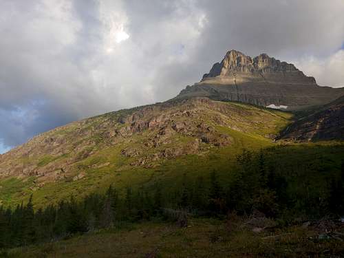
Mount Wilbur is one of Glacier's iconic peaks, and Thin Man's Pleasure is one of the park's iconic scrambling routes. In fact, it is probably the "standard route" on Wilbur.
The view from the summit of Wilbur is one of the best you will ever get from a day climb. Peaks, glaciers, lakes-- especially stunning Iceberg Lake more than 3000' directly below you.
It's not a long route distance-wise, just around 8 miles round-trip. However, the elevation gain is significant-- about 4500', with almost all of it attained over less than two miles. So expect a full day even if you're not going to rope up for some pitches.
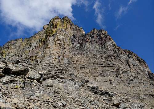
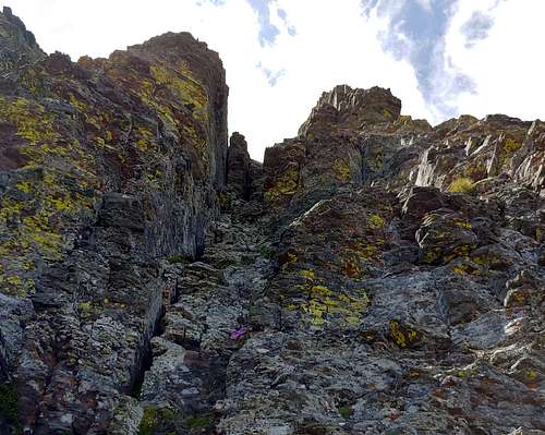
Difficulty varies by the source but goes at 4th Class to easy 5th. Loose rock is the major concern, though there is one section with serious exposure, as in you're going to die if you fall. Some rope up for that section, and that is the only place we did, but the protection is marginal and the moves are a lot easier than they look.
Don't forget your pepper spray; this area of glacier has a lot of grizzly activity. As we were ascending, we watched a large male grazing in meadows a few hundred feet below us.
Getting There and Approach
From the trailhead in Many Glacier Valley, hike to Redrock Lake and past Redrock Falls at its head. Your goal next is to get to the massive, obvious southeastern spur of Wilbur. Now things get a little tricky, and what you end up doing could have a big impact on your day in time spent out there.
The Edwards guide isn't terribly helpful for deciding where to leave the trail. A good online trip report I found had some solid suggestions, but I misinterpreted a feature and ended up selecting a terrible approach.
That terrible approach was this: shortly after the falls, a spur trail headed up to an open area just off the trail. From there, a use trail led into dense brush and then disappeared, leaving us to thrash first down into a drainage and then back up out of it. Frequently, we could not see the ground below us or open sky above us. It was awful; do not go that way.
Instead, I suggest one of the following:
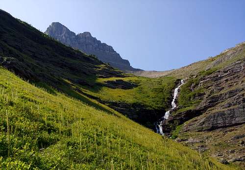
Keep hiking toward Bullhead Lake. After crossing a drainage that flows from a lovely waterfall in the basin high above, look for a way through a short section of trees to a series of meadows that will take you in the direction of the shoulder. This was our return route, and it was much better than our start. As you ascend, you can choose between directly ascending the shoulder, finding more meadows and exploiting weaknesses in several cliff bands, and finding a series of game trails that ascend the drainage on its west side until they run out and you have to go up the shoulder. The latter is less direct but is not as steep.
Or continue on until the shoulder comes down and almost meets the trail. This is what I will do if I ever climb this route again.
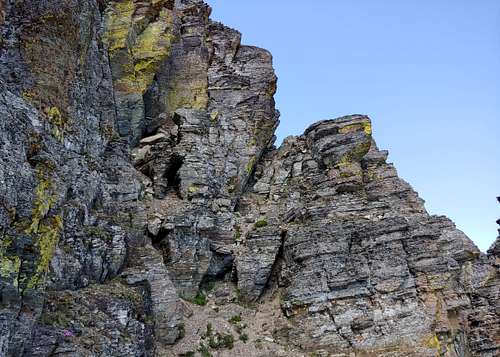
Once on the shoulder, keep heading up increasingly steep and rocky terrain until you are at the base of the east face of Mount Wilbur. Now the fun begins.
Route Description
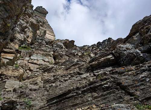
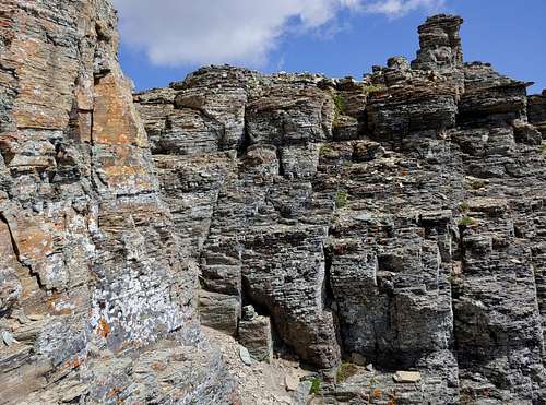
Scramble up some loose stuff until you reach a section of diorite cliffs. The diorite cliffs probably present the hardest climbing on the route, but the rock is by far the best on the route, and although you could protect the climbing over one or two pitches, you may just want to keep going and enjoy soloing the solid rock with wonderful holds and fun moves. Somewhere near the top I found a rappel station and intended to use it on the descent, but I missed it on the way down and we just downclimbed.
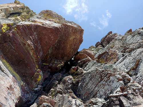
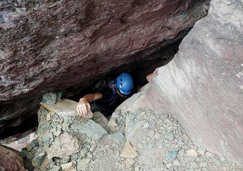
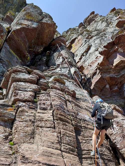
Next up is the feature that gives the route its name. Look up for a "hole" formed by a large chockstone, and then climb through that hole. It might be easier to remove packs for this part and pass or haul them up, but we were able to squeeze through with packs on. Above the hole, there are a couple pitons you can use as a belay or rappel anchor. There were slings and other gear there when we climbed, but don't count on their presence or their quality, and bring your own gear in case.
|
|
Now scramble up a gully and trend right on a large ledge until you reach a very exposed and narrow section above what is the East Chimney route. This is where we roped up, but the protection was pretty bad. I placed two pieces, both of them nuts, and one of them popped. On the way back, we just did it without roping up.
|
|
Head up a little more until a gully appears on your left. This 4th Class gully will take you to within a few yards from the summit. Reach the summit and enjoy the views from one of the best of them.
|
|
Descending, we rapped over the hole instead of squeezing back through it. The location of the station made the ropes tough to pull, though, and we might have been better off just downclimbing or extending the anchor and leaving something behind.
Essential Gear
We went with helmets, ice axes we didn't need, a set of nuts, the classic set of Tricams, and two 30m half ropes. Were I to do this route again solo or with someone with no exposure issues, I would leave the trad gear and the ropes behind.