
|
|
Route |
|---|---|
|
|
39.30030°N / 106.1825°W |
|
|
Hike |
|
|
Most of a day |
|
|
class 2 |
|
|
Approach
RT-8 miles and 3,100-ft
DON’T DRINK THE WATER OR EAT THE SNOW IN THIS AREA, THE LAND HAS BEEN HEAVILY MINED
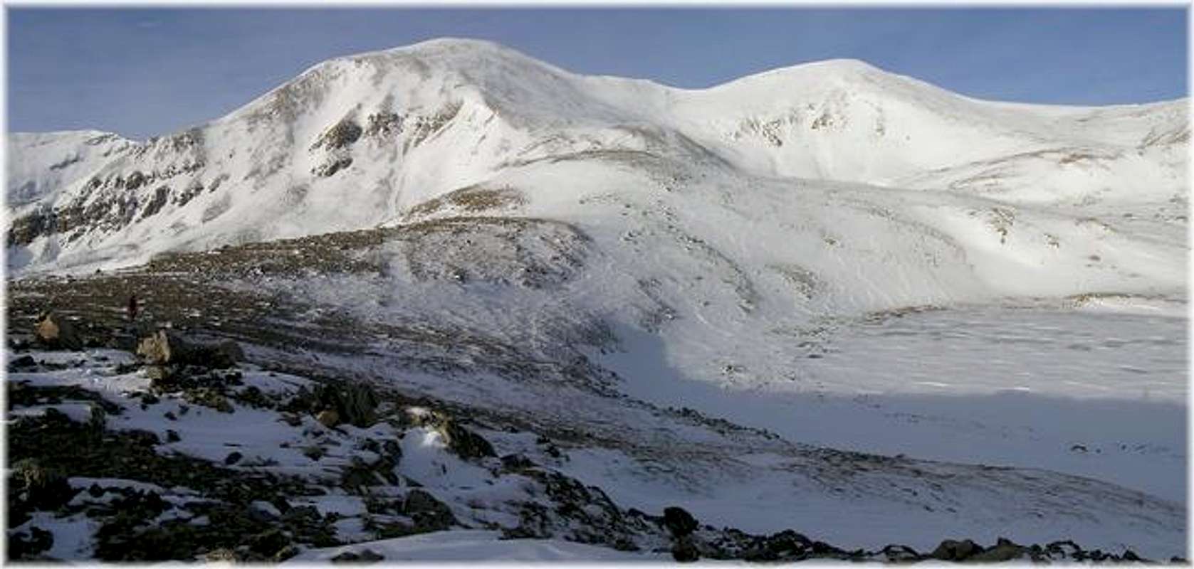
This is a nice loop route that efficiently tags the summits of three officially ranked 13,000-ft mountains. It’s a logical route for early winter and may work for all of winter, conditions permitting. The route first ascends to Treasurevault Mountain (13,701-ft) and on to Mosquito Peak (13,781-ft) and finally ends with an ascent of London Mountain (13,194-ft.) Descending London Mountain’s obvious northwest ridge allows this loop route to finish well by intercepting the Mosquito Pass Road, which can be followed back to the TH at London Mine.
This route in November/December is virtually avy proof. If attempting this route in late Dec-April be cognoscente of avy danger in two spots; descending the lower portion of Mosquito’s southeast ridge and hiking the Mosquito Pass Road below London Mountain’s STEEP north slopes.
The proposed starting spot is just north a few 100 yards from the turn-off to North London Mill at 11,440-ft, refer to topo. This was our starting spot in middle to late November before road conditions worsened due to snow. Expect a longer round trip if attempting this route in Dec-March.
 |  |  |  |  |
Route Description
Starting at 11,440-ft, stay on the road and follow it as it quickly crosses Mosquito Creek. The road will begin an ascent up into Mosquito Basin. At around 11,900-ft, look sharp for another mining road that veers off to the north (right); this road continues on up to Cooney Lake at 12,600-ft. Hike around Cooney Lake’s south side and continue up steepening slopes to an obvious col that intersects Treasurevault’s direct north ridge at 13,500-ft. From here it’s an easy class 1 hike to the summit of Treasurevault Mountain.
Next, descend Treasurvault’s rounded south ridge to the saddle between it and Mosquito Peak. Ascend Mosquito’s class 1 north ridge 380 vertical feet to the summit of Mosquito Mountain.
The logical route for descending Mosquito is the southeast ridge, and from the summit it looks like it goes with relative certainty. The ridge crest is typically blown clean but, you can’t see is the steep portion or last 200-ft of ridge at the very bottom of the ridge crest. Descending the entire wind scoured ridge crest during this portion is not feasible; you must traverse out onto the southeast slopes a bit to negotiate this section. This is the place to be wary of potential avalanche danger for that southeast face gets loaded with the snow that blows off of the south ridge of Mosquito Peak.
Essential Gear
We didn't use snowshoes but I would still recommend them for later in the winter season.
Miscellaneous Info
If you have information about this route that doesn't pertain to any of the other sections, please add it here.