
-
 1460 Hits
-
 81.18% Score
-
 13 Votes
|
|
Mountain/Rock |
|---|---|
|
|
44.16796°N / 7.30667°E |
|
|
Maritime Alps, Piedmont |
|
|
Trad Climbing, Sport Climbing |
|
|
Summer |
|
|
9121 ft / 2780 m |
|
|
Overview
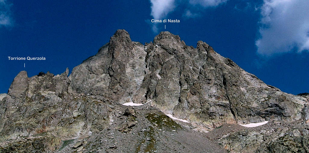
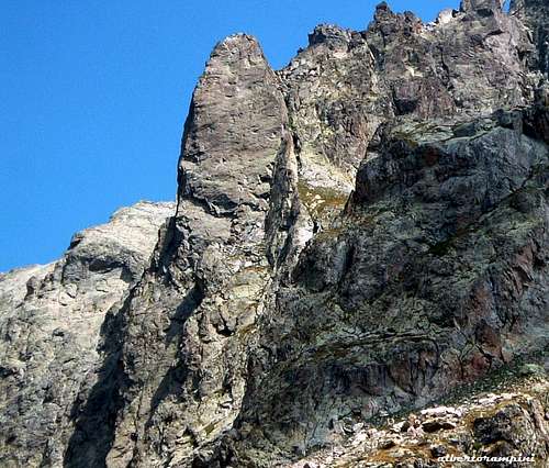
Torrione Querzola
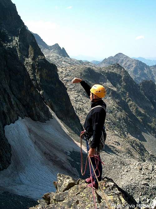
Torrione Querzola 2780 m is a noticeable and slender rocky pillar located near the Rifugio Remondino and belonging to the wonderful group of the Maritime Alps (see the main page on SP), Brocan-Baus-Nasta chain. Observing Cima Nasta from the Rifugio Remondino the tower is located to the left end of the wall at the foot of the North-West Spur of Cima di Nasta. The tower has a characteristic blade shape and is therefore easily identifiable. It is a summit essentially frequented by climbers, due to a beautiful route running on its narrow West face on spectacular and compact reddish gneiss, "L'Uccello di Fuoco". The wall is very impressive in the front view and invariably attracts the eye of the climbers. Actually it is less steep than it seems and offers a magnificent and demanding climb on slabs of great beauty, especially in the last lengths.
Getting There
Road approach
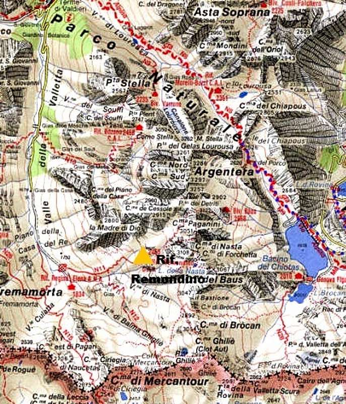
From Torino (85 km.) or Genova (145 km.) follow the autoroute Torino-Savona as far as the Cuneo exit. From Cuneo follow the road to Borgo San Dalmazzo, driving up on Valle Gesso and reaching Terme di Valdieri (35 km. from Cuneo). From here a narrow road, at least unpaved, leads up a lateral valley named Vallone della Casa. Follow it as far as Pian della Casa 1743 m, where the road ends (parking). 6,5 km. from Terme di Valdieri.
Walking to the Refuge Remondino
From Pian della Casa 1743 m – parking lot - a good path follows the Vallone di Assedras leading to the hut in about 1,45 hours from the parking. The hut is a natural “belvedere” over the Argentera Massif and a strategic important hut for all the ascents to Cima Nasta, Argentera Normal Route and several treks inside the Argentera and Nasta groups, offering meals and beds
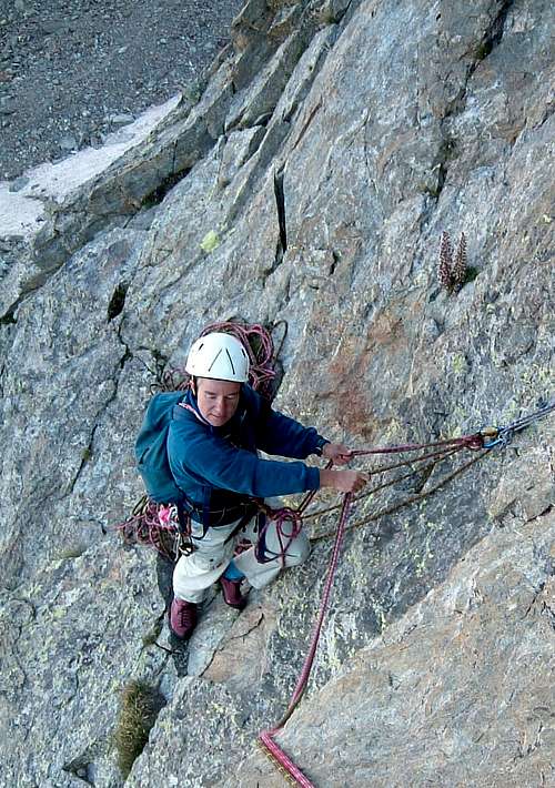
Route "L'uccello di fuoco"
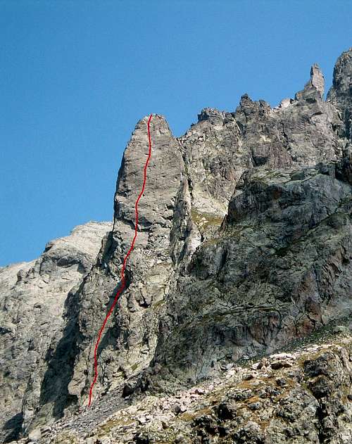
Difficulty: Alpine TD, 6a+ max (French scale)
Climbing length: 300 m
Equipment: fix 10 mm, some friends or small nuts are useful to integrate
Exposition: West
First ascent: M. Pukli e S. Mao 1994
Hut: Rifugio Remondino 2430 m
A great route not to be missed for the beauty of the climb, the quality of the rock and the environment
Approach
From the Rifugio Remondino follow the path that leads to the Passo dei Detriti, as soon as you reach the basal amphitheater turn to right in the direction of the tower and climb up a steep gully of rocks and grass reaching the start of the route.
L1 - Climb the short wall starting with a difficult passage, continue to the left on easier ground in the direction of an overhang, overcome it and belay, 5c
L2 - Climb the dihedral situated to the right of the stance and continue on slabs and walls, 5c
L3 - Climb easily the slanting slabs, cross a small gully then take a brief wall, leading to the belay, 5c
L4 - Climb the crack above the belay with fine climb, then slanting left on inclined slabs up to the belat at the base of a roof, 5c.
L5 - A short pitch up the roof with good protections, then with nice climb up to the belay, 6a+
L6 - Climb the beautiful vertical slab with technical climbing. The pitch is fine and sustained with spaced bolts, 6a+
L7 - Up the slab with delicate passages, then more easily to the belay, 6a
L8 - With a short rope-length to be protected reach the summit of the tower, 4a
From the summit you can enjoy a great view over Cima Paganini 3051 m and Monte Argentera 3297 m.
Descent: abseiling the route
Other routes
- South ridge D-, 300 m
- West face direct TD-, 300 m
- North-West ridge TD, 300 m
The Normal route is situated on the South side and follows a gully without particular difficulties.
Red Tape
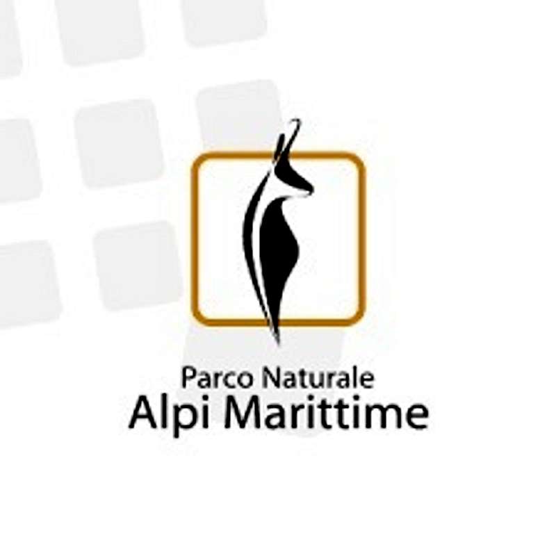
No fees no permits required. Torrione Querzola is situated inside the Parco Naturale Alpi Marittime. Please respect the rule and the restriction provided in the park regulations.
When to Climb
The best season goes from the end of June to middle September
Hut
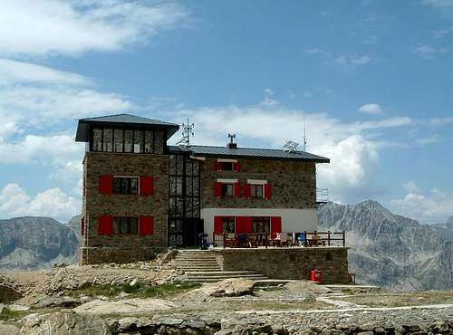
Rifugio Franco Remondino 2430 m
Owner: CAI Club Alpino Italiano Sez. Cuneo
Size: 46 people + 12 in the winter shelter
Open: from June to September
Approach
From Pian della Casa 1743 m – parking lot - a good path follows the Vallone di Assedras leading to the hut in about 2 hours from the parking. The hut is a natural “belvedere” over the Argentera Massif and a strategic important hut for all the ascents to Cima Nasta, Argentera Normal Route and several treks inside the Argentera and Nasta groups, offering meals and beds
Guidebooks and maps
“Alpi Marittime Vol. II” by Euro Montagna-Lorenzo Montaldo-Francesco Salesi – Guide dei Monti d’Italia CAI-TCI
"All’Ombra della Nasta" – G.Bergese
“Le Alpi del mare" – Scalate moderne nei massicci dell’Argentera e del Mongioie” by Flaviano Bessone – Idee Verticali Edizioni
Maps
"Alpi Marittime" Map 1:30.000 - Meridiani Montagne
Meteo
External Links
Rifugio Remondino - Gruppo Nasta climbing info
Parco Alpi Marittime