
-
 7601 Hits
-
 90.81% Score
-
 33 Votes
|
|
Route |
|---|---|
|
|
46.54375°N / 10.45898°E |
|
|
Hiking |
|
|
Summer, Fall |
|
|
Half a day |
|
|
Hike |
|
|
Overview
 Korspitz, Kl. Tartscher Kopf, Tartscher Kopf above Trafoier Höhenweg Korspitz, Kl. Tartscher Kopf, Tartscher Kopf above Trafoier Höhenweg |
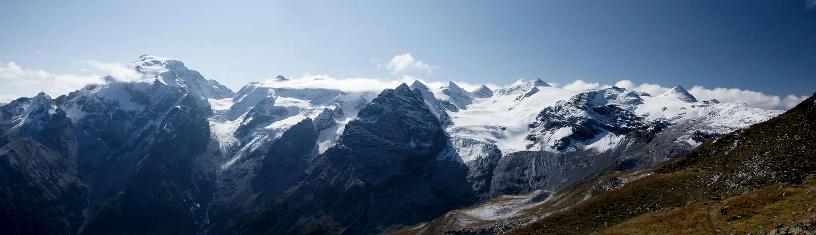
Strictly speaking, Trafoier Höhenweg (also Goldseeweg) is not the ascent route to any mountain, with the exception of the unimpressive Dreisprachenspitze / Cima Garibaldi. It is a panoramic high route which leads from Furkelhütte above the village of Trafoi to Stilfser Joch / Giogo dello Stelvio. However, rather than descending into the brouhaha which permanently goes on on the pass, you can alternatively climb Rötlspitz / Punta Rosa. From Dreisprachenspitze / Cima Garibaldi you need an additional hour.
Trafoier Höhenweg is a very popular trail. Most hikers start at Stilfser Joch / Giogo dello Stelvio, heading down to Trafoi. It has been maintained as a nature and history trail with quite a number of signs explaining the WW I era around the pass. Unfortunately the trail is also popular with mountain bikers, who also head down from the pass towards Trafoi. Generally they are not allowed on the trail due to heavy erosion in some of the passages, but nevertheless a large number still go here.
When starting very early from Trafoi (the chair lift starts operation at 8:30 a.m.) you'll have the first part of the trail for yourself and accordingly can enjoy the views of the Ortler Group undisturbed.
Getting There
 Monte Scorluzzo above Stilfser Joch / Giogo dello Stelvio
Trafoi is located on the road to Stilfser Joch / Giogo dello Stelvio. Follow the instructions on the Rötlspitz / Punta Rosa main page.
Route Description
 Tartscher Kopf
- Start altitude: 2153
- Summit altitude: 3025m
- Prevailing exposure: S
- Type: Hike
- Protection: None
 Trafoier Höhenweg Trafoier Höhenweg |  Trafoier Höhenweg Trafoier Höhenweg |
Take the chair lift from Trafoi (1532m) to Furkelhütte / Rifugio Furcola (2153m). The hiking trail alternative runs along underneath the lift and is therefore only barely recommendable. From the hut turn westward and follow a dirt road for a couple of metres. At the cabin of a ski lift, Trafoier Höhenweg turns off into the forest. It performs a wide loop, traversing Furkeltal / Val di Furcola, finally heading above the timberline. Here the steepest part of the trail heads up to Trusgrat / Costa di Traus, a ridge heading down from Tartscher Kopf.
 Trafoier Eiswand Trafoier Eiswand |  Ortler summit Ortler summit |  Geisterspitze Geisterspitze |
Now you enter the wide Valley of Tartscher Alm, which the trail circles in a wide loop. It finally reaches another highpoint, a plateau above Korwand / Croda Nera, on which several avalanche protectors are installed. Turning south-westward the trail now heads for Goldsee, a lake which carries water only in Spring and dries up over the cause of every year. The lake is passed and the final part of Trafoier Höhenweg heads sttraight at Dreisprachenspitze and the WW I positions underneath.
  |
The regular route to Rötlspitz / Punta Rosa starts on the Stilfser Joch side of the Dreisprachenspitze, climbing it on the way but with a short scramble you can cut it short reach the ramp, which heads up the south slopes of Rötlspitz / Punta Rosa. It heads directly for Col Costainas, which separates our mountain from neighbouring Korspitz / Col di Quaira (also an interesting destination). In the pass turn west and head up the slopes of Rötlspitz in a steep scramble.
 WW I ruins WW I ruins |  Goldsee Goldsee |