
|
|
Mountain/Rock |
|---|---|
|
|
38.05260°N / 110.56251°W |
|
|
Wayne |
|
|
Hiking, Mountaineering, Bouldering, Scrambling |
|
|
Spring, Fall, Winter |
|
|
5499 ft / 1676 m |
|
|
Overview
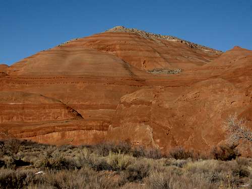
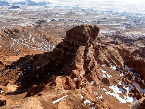
Turkey Knob is a beautiful desert peak located about 25 miles SSE of the small town of Hanksville Utah. The peak is in a fairly isolated area, but there is much to do in the region. This fantastic little peak has a wide panorama overlooking the North Wash desert country, the Dirty Devil River country, the badlands south of Hanksville, and piercing the sky to the west are the Henry Mountains. The peak is a kaleidoscope of color as well with its many banded rock layers.Although the peak looks formidable from many angles, there are a few class 3 routes (albeit loose) on the north side. The final section of the route has some exposure, but it isn't too severe, though as always one must use caution.
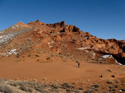 Approaching the upper slopes of Turkey Knob.
Getting There
The access road is Highway 95 between Hanksville and Hite. Turkey Knob is roughly half way between the two locations. Both Hanksville and Hite have fuel, but Hite has sporadic hours, especially off season, so be aware of this. As always, make sure to have a good road map before heading out to this isolated region.To climb Turkey Knob, park along Highway 95 anywhere between mile 24.5 and 25.4. Since we were doing Death Canyon on the same trip, we parked at mile marker 24.5.You can get slightly closer to the peak by driving the Cedar Point Road (gravel) north from mile 25.4. Since the peak is visible most places along this road, park where ever you find suitable.
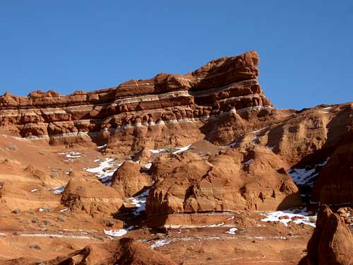
 These are some of the colorful domes around the base of Turkey Knob and right at the trailhead.
Routes Overview
There are many routes available to climb Turkey Knob, but the final approach up the summit area must be from the north unless you enjoy climbing on very crumbly rock. A couple of gullies on the north side provide some class 3 routes, but be aware of loose scree and a bit of exposure for the last 20 feet or so of the climb. Other than that, there are no real difficulties other than some loose sand and steep slopes.Because of the nature of the rock, technical climbing is not recommended.This fairly short half day climb makes an excellent combination with Death Canyon or any of the North Wash canyons to make it into a full day or more. You can easily spend several days, weeks, months, years or even decades exploring this spectacular region.
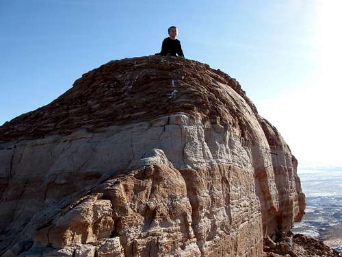 Kessler on the exposed summit of Turkey Knob on January 17 2010. It was a challenging climb to get here.
Red Tape
There is no red tape, so make sure to use LNT methods of travel.
 There is no red tape, but there is some red rock.
Camping
There aren’t any campgrounds in the area, but you can camp almost anywhere. There is no private land for miles and miles around in this area. One good campsite is around mile marker 24.4, but it’s a pretty well known one. Mile marker 28.1 has a good campsite as well and the Cedar Point Road also has countless campsite opportunities.
When to Climb
The peak can be climbed year round as Highway 95 is always open, but summer can be extremely hot. October through April is the ideal season to climb the peak. Winter is usually a good time to climb. Usually the area has very light snowfall, but if you are there after a rare snowstorm, conditions will be dangerous on the final section of the climb. If there is not much snow around (which is normal), in some ways winter is the best time to climb as wet or frozen sand is easier to walk in than dry sand.
 Looking at the east summit of Turkey Knob from the highest summit of Turkey Knob on January 17 2010.
Mountain Conditions
Since there are no ranger stations and since no one lives in the area, it isn’t easy checking on current conditions (which are usually not bad). The best bet might be to call one of the hotels in Hanksville, but this area is about 25 miles away.CLICK HERE FOR WEATHER FORECASTThis is a land of temperature extremes, but of little rain or snow. Temperatures have ranged -35F (-37) to 114F (46C) at Hanksville. Sunny weather predominates and it only rains a few times a year, but when it does rain, it can really pour! Weather and climate data for the Hanksville is below. *National Weather Service Data 1912-2004.
| MONTH | AVE HIGH | AVE LOW | REC HIGH | REC LOW | AVE PRECIP (in) |
| JAN | 39 | 9 | 69 | -35 | .33 |
| FEB | 49 | 19 | 74 | -33 | .21 |
| MAR | 60 | 27 | 88 | 4 | .42 |
| APR | 70 | 35 | 98 | 10 | .40 |
| MAY | 81 | 44 | 107 | 23 | .46 |
| JUN | 91 | 53 | 110 | 31 | .27 |
| JUL | 97 | 60 | 114 | 38 | .48 |
| AUG | 94 | 57 | 110 | 35 | .80 |
| SEP | 85 | 48 | 105 | 24 | .68 |
| OCT | 72 | 35 | 95 | -6 | .68 |
| NOV | 56 | 22 | 82 | -8 | .42 |
| DEC | 44 | 14 | 70 | -24 | .29 |