
|
|
Route |
|---|---|
|
|
43.40312°N / 110.57015°W |
|
|
Scrambling |
|
|
Summer, Fall |
|
|
One to two days |
|
|
Class 3 |
|
|
Overview
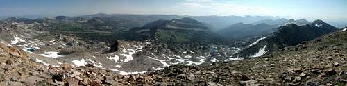
Gros Peak Summit Views
An easy hike and scramble to the summit of Gros Peak, one of the high points of the Gros Ventre Range. Located in the Gros Ventre (pronounced gro-VONT) Wilderness, between the Teton and Wind River ranges, this peak is part of some very wild country. Real Wyoming at its finest.
Getting There
Hike to Turquoise Lake, which can be approached from several different trailheads.
From Jackson, WY: Drive to the Cache Creek Trailhead. Follow the Cache Creek trail to the wilderness boundary. About a mile after the wilderness boundary, take a left at a trail junction, then follow signs to Turquoise Lake. About 14 miles one way.
Drive to up Curtis Canyon to Goodwin Lake trailhead. Hike past Goodwin Lake, meet up with trail on the approach mentioned above, follow to Turquoise Lake. The hike will be shorter than Cache Creek approach. The drive up Curtis Canyon road to trailhead will probably require high clearance vehicle, patience, or both.
From Granite Hot Springs: Drive south of Jackson, left at Hoback Junction. Approximately 15 miles after Hoback Jct., take a left and drive up Granite Creek road to the end. Hike from this trailhead to Turquoise Lake: about 13 miles.
See excellent maps on main Gros Peak page.
Route Description
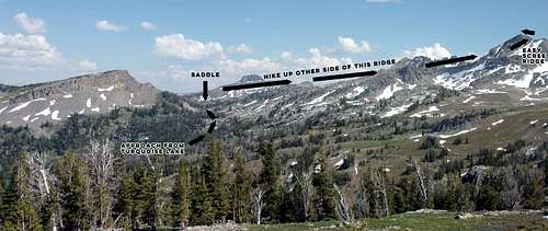
Gros Peak - Turquoise Lake Route
From Turquoise Lake, hike ESE to the saddle shown in the photo above. Hike up on the distant side of the ridge, class 1-2.
This photo taken from the pass west of Turquoise Lake.
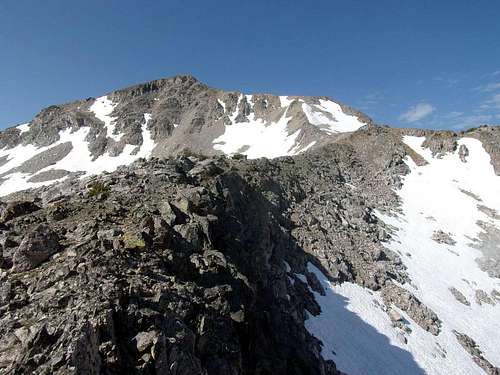
Gros Peak - Turquoise Lake Route - Ridge Approach
One at the top of the initial ridge, pass a small tarn on the left side, and scramble up a scree ridge (class 2-3).
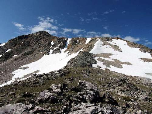
Gros Peak - Turquoise Lake Route
There were no cairns, but evidence of a faint climbers trail was there. Once at the top, go left, walk along the ridge, and scramble to the top (class 2-3).
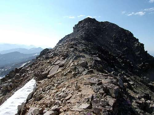
Gros Peak - Turquoise Lake Route - Upper Mountain
Essential Gear
The distance from trailheads mean that this will be part of a backpacking trip for most people.
Standard backpacking gear. High wildflowers, horseflies and mosquitoes make long pants and bug spray highly recommended.
I did the route early July 2015, and the route could be done without touching snow. An ice axe may be necessary, conditions depending. Beta on conditions will likely be hard to find for the Gros Ventres, but current conditions in the nearby Tetons is easier to come by. A couloir left of this route could be a good moderately steep snow climb.