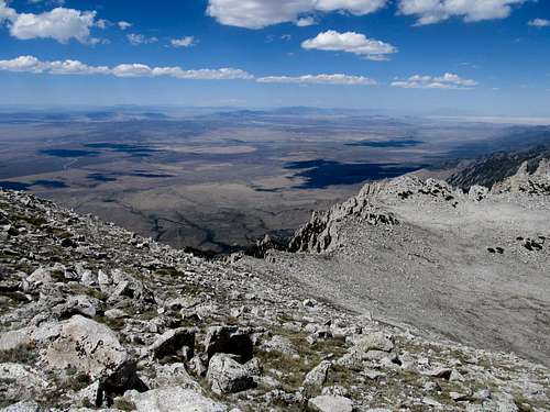
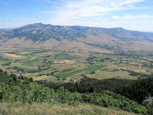
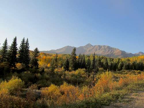
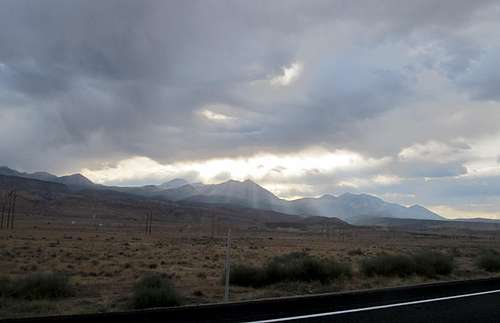
Ibapah Isolation - July 28th, 2012
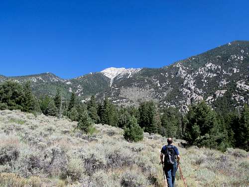
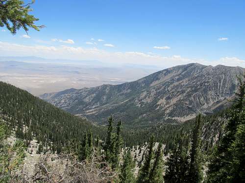
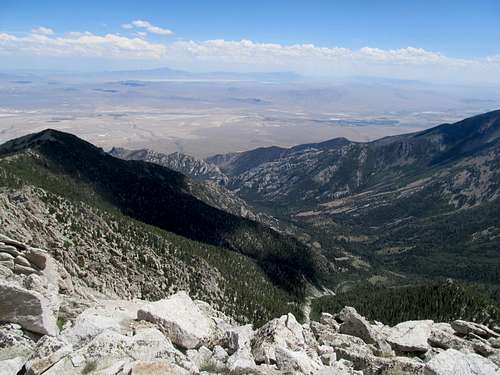
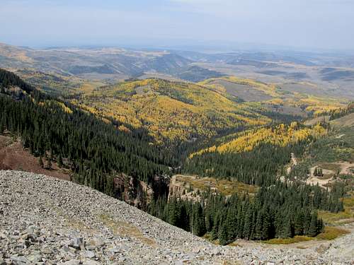
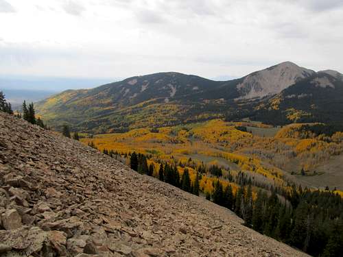
On an unofficial impromptu gathering of prominence chasers on Lewis Peak in July (privately owned, but Dean got us all access), I had talked with another local hiker and vaguely discussed possibilities about teaming up for Ibapah Peak later in the summer. Brett followed up a few weeks later, and we decided that, weather permitting, we’d give it a go the last weekend of July. Bluebird skies were in the forecast as the day approached, so I picked Brett up at 5 AM and we set out for the long drive to Wendover, then the longer drive down good dirt roads towards Granite Canyon on the east side of the Deep Creeks. I pushed my Camry a few miles up the canyon approach road, then we set off. Without 4WD, the trip would be around 16 miles round trip and probably 6,000-6,200’ of gain.
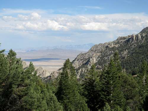
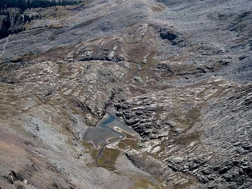
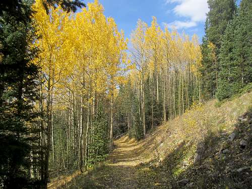
Brett had a unique system for hiking, where he monitors his GPS and takes a minor rest every 400’ gained, and a longer water/food break every 1,200’. This worked well on Ibapah, with 6000 being a number easily divisible by both. Once we were in the canyon we found ourselves hiking through pleasantly shaded woods, and though I had read about it it was still shocking to see and hear running water out here in the West Desert this late into the summer.
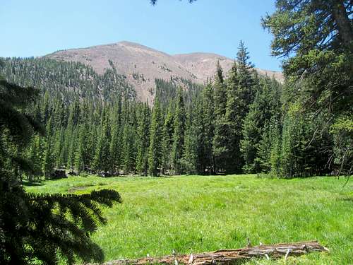
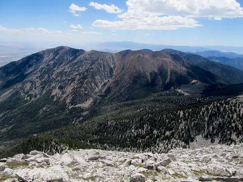
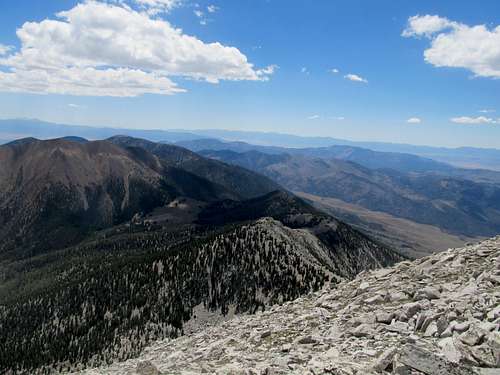
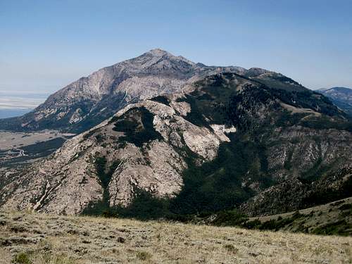
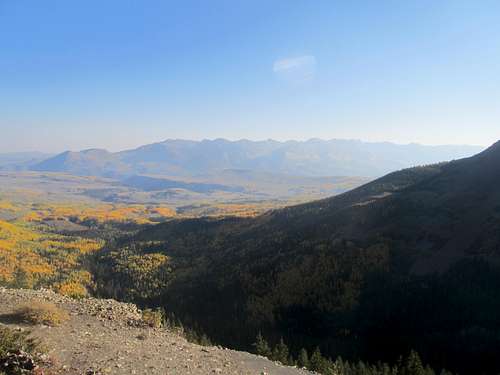
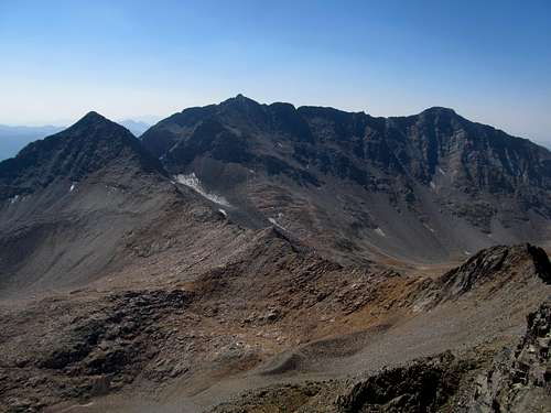
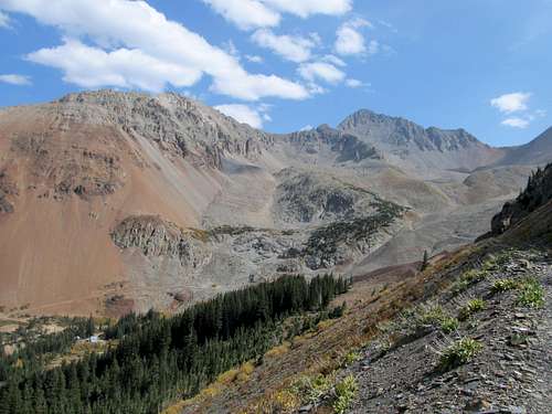
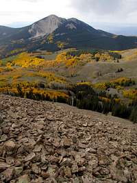
Eventually we topped out at the surprisingly lush and broad saddle at 10,000’. Ibapah, which had looked deceiving close the few times we spotted it along the canyon, looked miles away. Which it was.
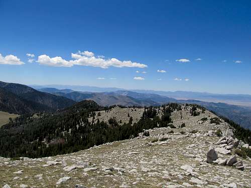
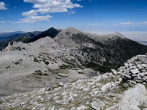
Here the trail disappeared and we navigated through some easy cross country terrain to reach a ridge, where the trail reappeared.
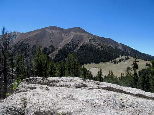
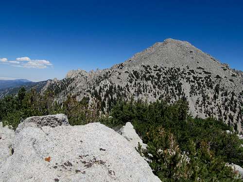
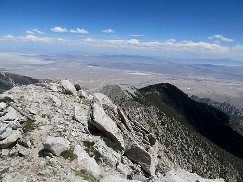
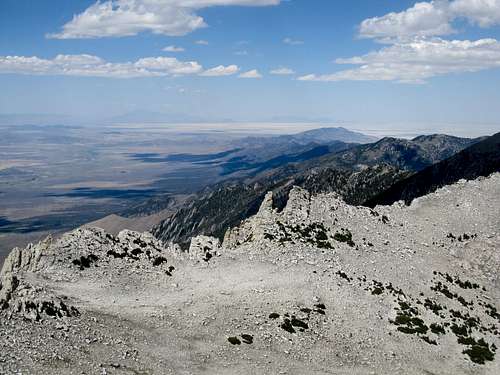
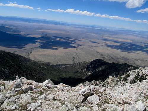
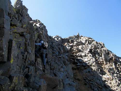
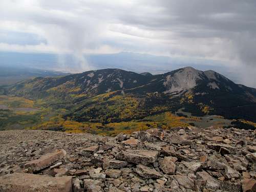
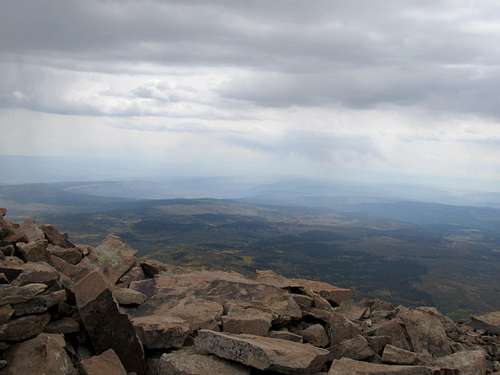
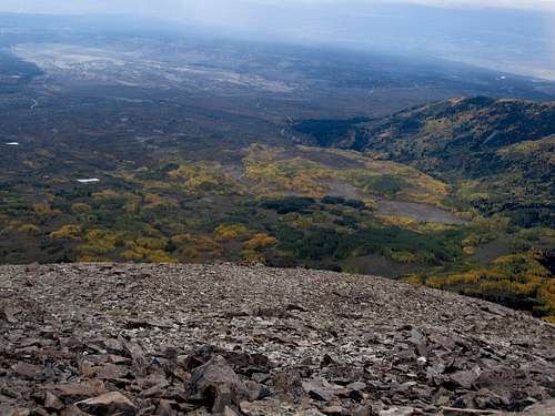
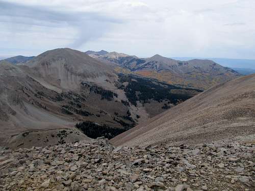
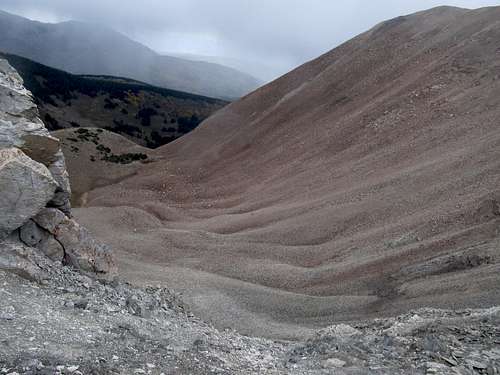
After some minor elevation loss along the talus ridge we ascended a fine trail 1,000’ to the top of Ibapah and unparalleled views into two states.
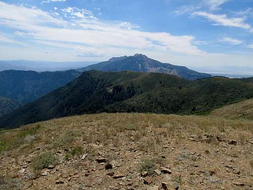
With a clear weather forecast for the day we lingered atop the giant summit cairns/wind barriers lining the long ridge-like summit of Ibapah. On the descent we ran into a couple of hikers along the traverse between the 10,000’ saddle and the summit block, the only other hikers we saw all day. It was a long trudge back to the Camry, but it was late enough so that the air was no longer blistering by the time we were back at lower elevations.
An Eyrie Hike - July 29th, 2012
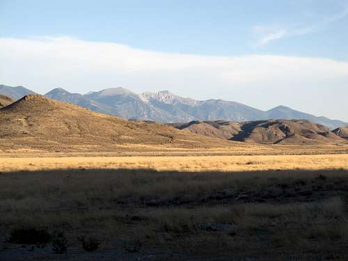
I had done some damage on the Camry two weeks ago in Idaho, and the Ibapah trip had further ruined it. It was moaning and groaning something awful along the drive back from Ibapah, so I decided for something nearby Sunday, ideally with a paved road to the trailhead. After getting home and getting up late, I decided for nearby Eyrie Peak, ranked in the Utah top 100 in prominence. Despite the paved access my Camry still barely made it to the parking lot, and I struggled in the early afternoon heat due to my late start up the trail.
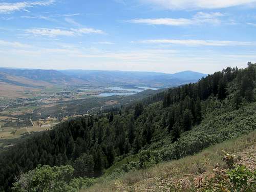
A rattler scared me as I walked right by it along the trail, and that encounter gave me the heebie jeebies the rest of the way, especially through the densely brushed areas. The rest of the way to the top dragged forever, despite the nice views east to James Peak and Pineview Reservoir.
Not feeling it on this hot humid day, I decided to forego Lewis Peak further south and focus on getting home and getting the Camry to a mechanic the next day before it broke. (turns out there was something wrong with the tires, one of them was falling apart or something).
Tour d'Coors - September 22nd, 2012
It was late September. I had spent Labor Day weekend 3 weeks ago in Montana. Two weeks ago I was deathly ill, and one week ago I was on yet another Vegas bender. Now sobered up, healthy, and back down to earth, it was time to refocus on some high peaks before winter kicked in. Specifically, a 14er. Before 2012 I had been atop one every year since 2007, but still hadn’t had a chance to make the long drive to Colorado as of September; every time I had given it consideration it seemed the area was monsooned out. The weather was clear for this weekend, so I sucked it up and left SLC around 2 AM and made it to Moab in around 3 and a half hours driving. Then the drive dragged on until the sun rose while I passed through the Naturita area, finally arriving at Placerville and the steep rocky dirt roads leading to the Silver Pick trailhead around 9 AM.
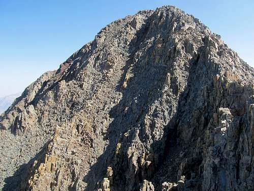
I was pretty much the last person starting up the trail, but the weather forecast for the day was good, so no worries. I began catching up with everyone else on the mountain as I approached the Rock of Ages saddle. From there, quickly to the Wilson/Gladstone saddle, where I found myself surrounded by a small group from Telluride. We all ended up foregoing the loose climber’s trail as it descended, instead picking our way along the sometimes downsloping ledges above the route (described in the 14ers.com route description). There were some narrow spots, and it was a little exposed, but we all made it and rejoined the main route. From there on out it was another steep huff to the false summit.
I had caught up with the bulk of the people ascending Wilson today (and there were many). I waited as a few people on their way down made their way over the false summit, then looked at the route ahead. Somehow I ended up at the head of the group of people that all seemed to mass here at the false summit; there was no one else on top, and no one in between. I suppose I’ll lead then way then.
The downclimb from the false summit seemed to be the sketchiest part of the (standard) route, with some long steps down on the downclimb, and a narrow ledge at the saddle. I descended, then gave some quick heads up on the route to the people behind me. The last few hundred feet up the summit block was easy, fun scrambling, and I had the summit to myself for a few minutes before everyone else caught up.
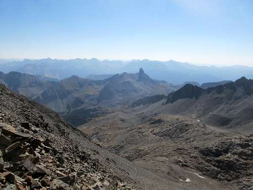
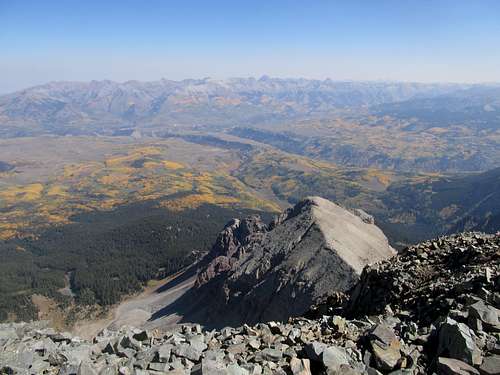
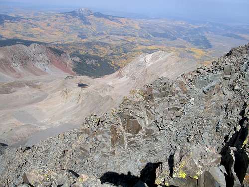
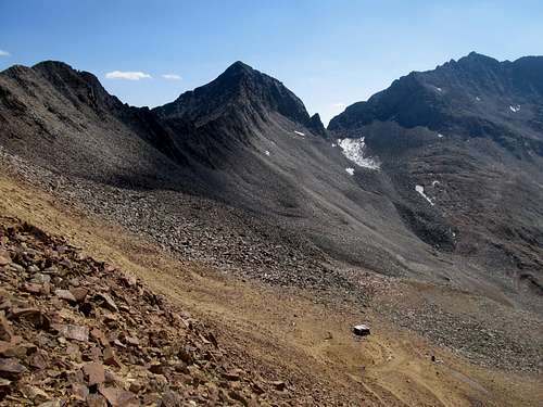
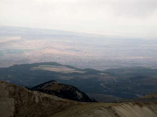
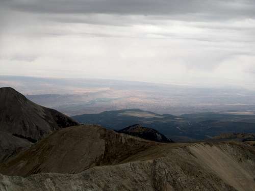
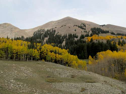
The great haze cloud of 2012 had hit Colorado as well, but fortunately it sat on its fringes. Though the far peaks such as the La Sals were blocked from view, the views of the nearby Grenadiers, Sneffels Range, Lizard Head, and the very immediate and dominating silhouette of Mt. Wilson and El Diente were enough to satiate my long distance viewing fetish. The aspen in their golden prime enhanced our panoramas. We all lingered at the top for awhile, then all somehow ended up descending around the same time.
I was in the middle of the pack on the descent, and ahead of me was an older gentleman climbing by himself (but who is really alone on a weekend on a 14er?). We made our way back to the false summit, and I passed him further down as the terrain eased. I hopped across a rock during a flat but talusy section of the trail, and it wobbled under my foot. I swayed but quickly caught myself and moved on. Behind me was the older fellow. I had thought about warning him that the boulder was a little loose (but also thought he might have heard it anyhow), but before I could do so I heard the same boulder crack loose again and saw the guy slide and fall several feet down the slope. Being the closest to him, I was the first person on the scene. There was a lot of blood, but fortunately he was wearing a helmet. He had slipped several feet down the slope and ended up upside down and completely disoriented. I gathered his belongings and helped him upright when he was ready. By this time others had arrived at the scene was well. I fed the guy some GU and gave him water, while others pitched in with bandaids and tape for his wound. Fortunately it was only a flesh would on his scalp, which, though bloody, wasn’t the worst thing in the world considering. The fellow was more angry at himself for falling than anything else. Eventually he recovered his bearings, and while some others stayed behind to walk with him I hopped on ahead to tell someone in their group waiting past the Rock of Ages while they were taking so long.
I meant to take the basic climber’s trail back to the Gladstone saddle, but somehow ended on the ledgy parts above the trail again, though this time I was a few ledges below where I had traversed up earlier. The terrain seemed even sketchier than on the ascent, and it took me forever to get back to the saddle.
From then on out it was a quick and easy hike back to the Camry, then a long drive back to Moab where I hoped to salvage my viewing of that afternoon’s college football lineup.
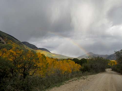
A-Peale-ing the La Sals - September 23rd, 2012
I vaguely remember watching Kansas State whoop up on Oklahoma as I whooped it up in a Moab bar, trying to sample every flavor of mojito they had on the menu. All things considered I didn’t have too rough of a wakeup on Sunday morning. The goal was Peale.
My main concern was that the haze would inhibit the views down into Arches and Canyonlands from this Utah classic. It turns out the weather should have been more of a concern, as the rainclouds were already in full gear by the time I drove towards La Sal Pass in the morning. The road was more than kind to the Camry all the way to the pass, and a rainbow shot down into the Pass as I approached it from the east. No pot of gold there, but a nice trailhead, and that was good enough for me.
I chatted with a fellow from Flagstaff at the trailhead who had camped there the previous night. He had done Peale the previous day, and was going after Tukuhnikivatz today. I wished him luck with the weather and such and we both headed our separate ways into the hills.
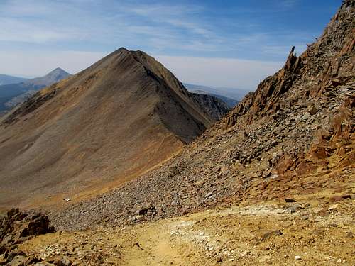
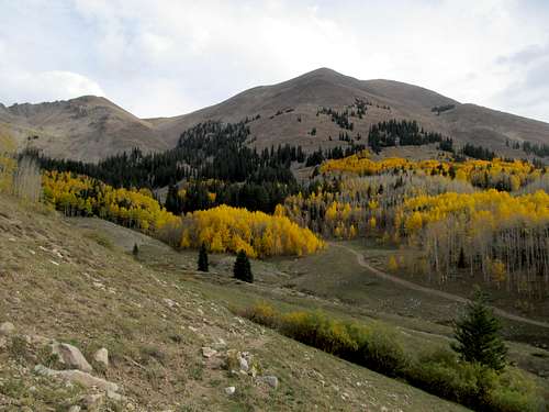
The small trail quickly disappeared in the aspens, so I relied on my spidey sense through the open groves of pine and aspen. I went up a small hill, then down into a drainage, then eventually dropped on what looked like the jeep track immediately below the south face of Peale. I know now in hindsight that I should have turned and followed the road left (west), where eventually there would be a cairned turnoff and a climber’s trail into the main ascent gully. Not knowing that, I left prematurely and, after ascending through some brushy ravines, went up 2,000 straight feet of talus directly over Peale’s south slopes. It honestly wasn’t that bad, and having ascended similar terrain 3 weeks ago on Tweedy and two weeks ago on Watson, I figured it was my lot this late in the year.
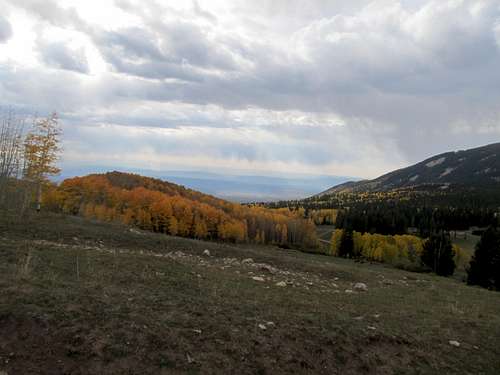
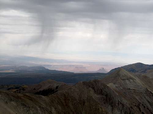
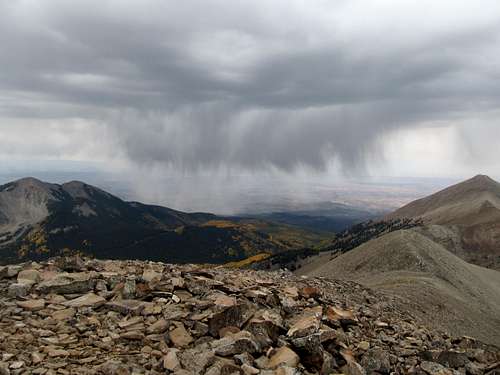
I kept a close eye on the weather. All the storms and precipitation was coming from the southwest, which I had a view to the entire hike. Each small cell would consistently hit the range and pass through La Sal Pass east into Colorado, leaving me dry on Peale. Further east I could see the outlines of the San Juans and Wilson, which I had climbed yesterday. They were getting stormed on pretty badly, and I learned later that it would be their first dusting of snow; I felt considerably lucky to have climbed Wilson on its last dry day of 2012…couldn’t have timed the sole 14er of the year better, or any later.
Eventually I crested the talus and joined up with the standard route as it traversed over a small rocky bump and made its final ascent to the top of Peale. The views were breathtaking, the storms having cleared out the haze, but most of the views west into Moab and the Canyonlands were blocked by Tukuhnikivatz.
I took pictures from this fascinating summit but soon noted line of black speeding towards me. This was some serious precip, and rather than divert through the pass like its predecessors, was headed straight for Peale and myself. I decided it was high time to get the hell off the summit. Not time enough though, as this small storm pocket hit me hard as I was traversing the ridge west of Peale. I struggled to move against the probably 50 mph winds, the small bits of hail blowing so hard horizontally that it was shooting right through my cheap gas station winter gloves to strike the flesh on my hands. It was an awful few minutes, but it passed, and I made it down the standard descent chute easily and without incident.
The fellow from Flagstaff had descended around the same time too, and we chatted about mountains and peakbagging for awhile before I headed my merry way home. The drive from Moab through Price back to I-15 on a September Sunday afternoon highlighted really the worst of the already atrociously horrible driving habits of Utahns, but nevertheless I made it home well in time for kickoff to Sunday Night Football, where the Pats were screwed out of a victory against the Ravens by the f’ing replacement refs. I don’t know whom I hate more, Ray Lewis (cough-serial-killer-cough), or the replacement refs. What an awful NFL season 2012-2013 would prove to be.


Comments
Post a Comment