
-
 5597 Hits
-
 81.18% Score
-
 13 Votes
|
|
Route |
|---|---|
|
|
40.30310°N / 105.686°W |
|
|
Mountaineering, Scrambling |
|
|
Summer |
|
|
Most of a day |
|
|
Moderate snow, loose Class 4 rock |
|
|
Class 4 |
|
|
Overview
This doesn't seem to be an established route in RMNP, and it really is only a slight variation of the Tyndall Glacier route, but I doubt I'm the only one who has ever climbed this, and I want to present it as an option for those who want some snow and rock on the same outing.
If you're in good shape, this also makes a solid half-day foray. I had to catch a late-afternoon flight home but wanted something more than a hike that I could complete by noon at the latest. By climbing the route described here and descending via the Flattop Mountain Trail, I was able to complete the whole thing before 11 with a 6 A.M. start.
You'll want to start that early (or earlier) in any event because storms move in quickly here and more than half the route is at or above timberline.
This route involves Class 4 rock, and snow up to 50 degrees.
Hallett Peak and Flattop Mountain, with the Tyndall Glacier Rock Variation
Getting There
Enter Rocky Mountain National Park on the east side and drive Bear Lake Road to its end. Go very early if you want to get a parking spot; otherwise, use the free shuttle system.
Route Description
Tyndall Glacier-- Rock Variation
One-way distance is around 4 miles, with about 3300' of elevation gain. Expect moderate to steep snow and loose, Class 4 rock.
Hike the scenic 1.8-mile trail to Emerald Lake. Early in the morning, this is a quiet, inspiring hike. After continental breakfast ends at most hotels, this hike becomes an exercise in pondering the morality of government-imposed birth control.
From the slabs overlooking the lake, look left and notice a use trail heading up. Take this trail and then start working west up the gorge, below the impressive north face of Hallett and well above the south shore of Emerald Lake. (You can also stay lower and go straight up via the drainage, but it's my understanding that this is harder).
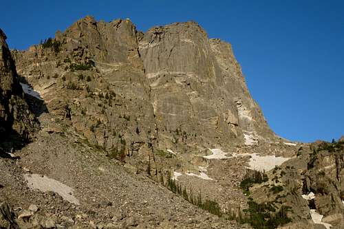
North Face of Hallett Peak
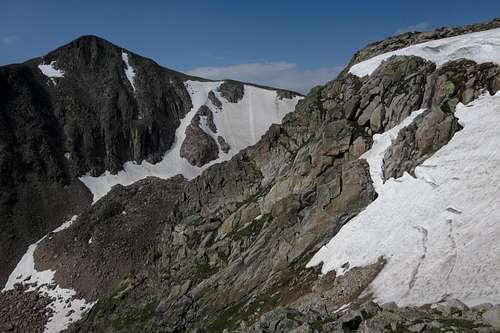
Although two very popular trails, both of which have views up the gorge or down into it, are close by, there is a nice wilderness feel as you ascend the gorge since only a relative few enter it.
The earlier in the summer it is, the more likely it is you will have to cross snowfields. None I crossed were steep, but an axe was still useful. I never felt the urge to put on my crampons.
In Tyndall Gorge
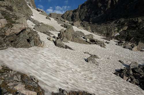
Your next significant landmark is a tarn fed by glacial meltwater.
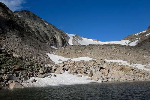
Tarn Below Tyndall Glacier
From the tarn, scramble up to the glacier's terminal moraine and then to the glacier itself.
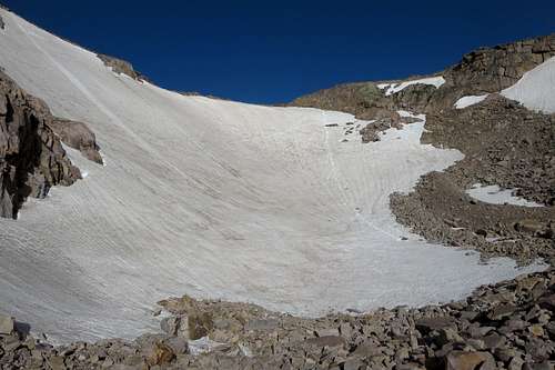
Tyndall Glacier
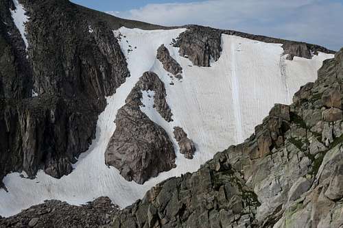
Now notice a rock "island" to your left amid the steepest side of the glacier, where the snow can get from 55-60 degrees. How much of this rock island is exposed will obviously vary according to the year.
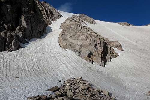
Tyndall Glacier and the island
Ascend to the base of the island and look around for the easiest way onto it. Because a moat will probably be surrounding the base, this isn't as easy as it looks from below. Once on the rock, scramble up the path of least resistance. Lower, I found the rock looser and more difficult-- call it Class 4 on some pretty rotten stuff. Higher, the rock is more stable and there is less difficulty and exposure.
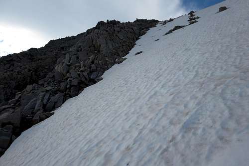
Eventually, the island gives way to the "sea" again. You can climb straight up the snow (steep) or, if conditions are right, traverse right and slightly up to another, smaller island. This section, too, is steep, and you will want crampons in addition to your axe. Here, the snow is steep enough for self-arrest to possibly be difficult and the fall is long enough to be bad news.
 From the Top of the Island-- 1 | 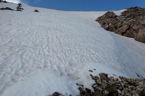 From the Top of the Island-- 2 | 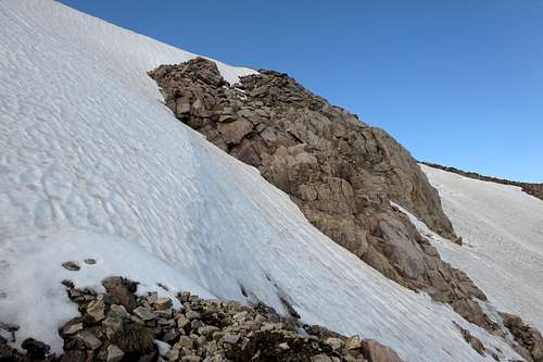 From the Top of the Island-- 3 |
If you do the latter, climb straight up the snow afterward and then pick up the cairned route for the final short distance to the summit. Or traverse right once again to talus slopes that lead to the cairned trail.
Try to hide the grin if you startle some hikers on their way over from Flattop Mountain.
To descend, hike to Flattop Mountain and take the trail all the way back. There are a lot of nice views along the way, but expect plenty of company.
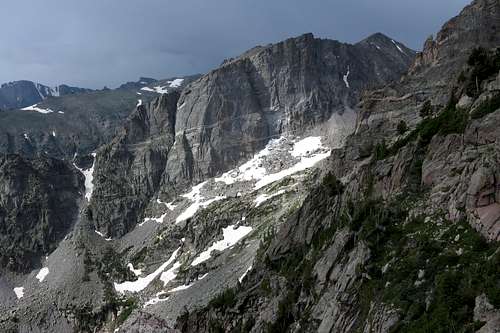
Hallett Peak and the Coming Storm
If you want a little more quiet on the return, return to Tyndall Glacier and glissade down and then clamber back to Emerald Lake. However, the trail back from there is likely to be even more crowded than the Flattop Mountain Trail, though it is shorter and not as steep. If you're going to do this, look for the sign pictured below and glissade from below it or from somewhere to the left; the grade becomes less steep the more to the left you go.
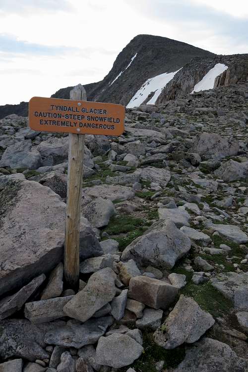
Sign Above Tyndall Glacier