
-
 25180 Hits
-
 92.59% Score
-
 39 Votes
|
|
Route |
|---|---|
|
|
68.17906°N / 14.23006°E |
|
|
Trad Climbing |
|
|
Summer |
|
|
A long day |
|
|
5.10a (YDS) |
|
|
TD sup., UIAA VI |
|
|
12 |
|
|
Overview
Geographical classification: The Scandes > Lofoten Islands > Presten > Vestpillaren Direct Start
***Vestpillaren Direct Start
Summit altitude: 590 m
Difficulty: TD sup., UIAA VI+, Norwegian 6, YDS 5.10a
Equipment: not equipped
Climbing length: 470 m
Exposure: West
First ascent: Arild Meyer and Brynjar Tollefsen in 1978
First free ascent: Hans Christian Doseth and Havard Nesheim in 1979
Starting point: Road 816 to Henningsvær (parking)

A world classic rock climb, the first route realized on Presten mighty pillar. A must!
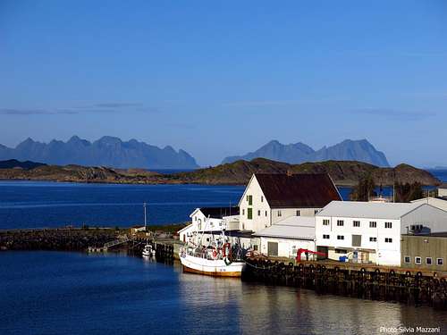
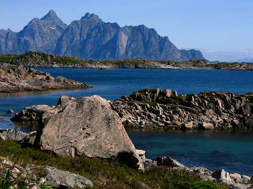
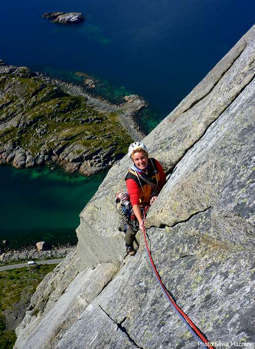
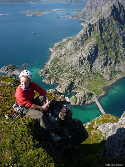
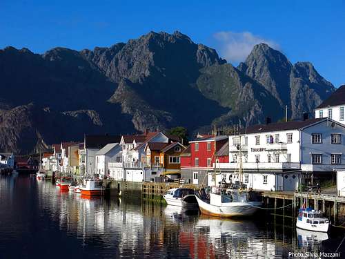
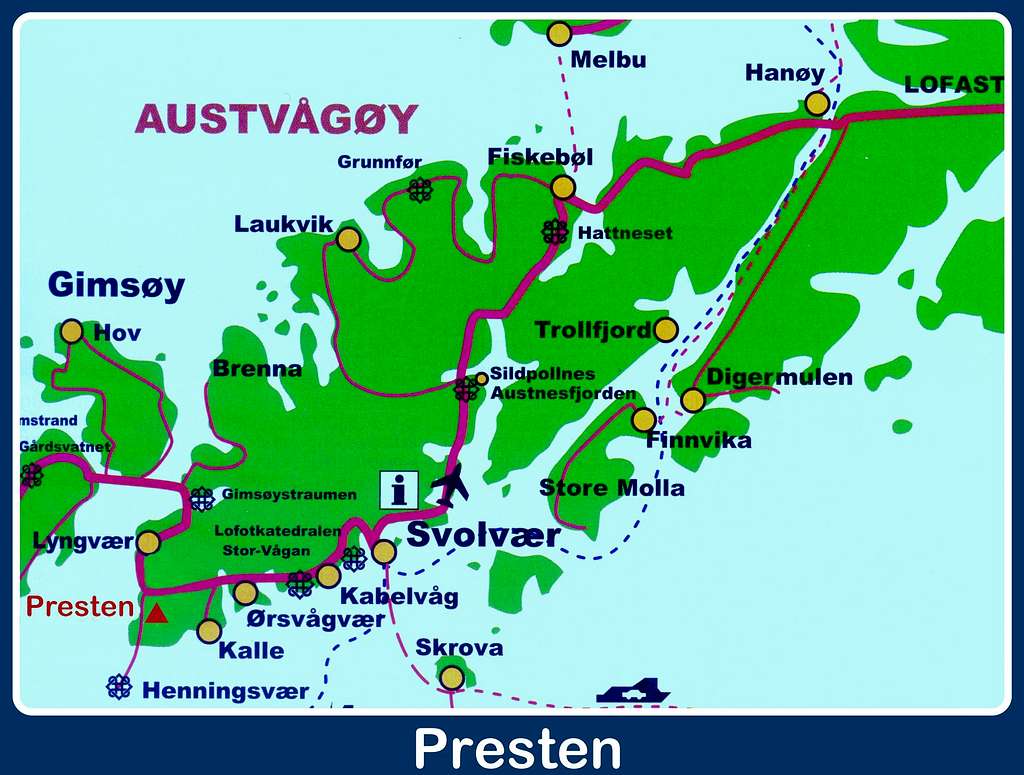
Presten (The Priest) is surely one of the best known cliffs on the Lofoten islands: a majestic 400 m granite bulk straight up from the ocean, situated close to Henningsvær, a charming village nicknamed “Lofoten’s Venice” located on the South-Western end of Austvågøy, Lofoten largest island (Vågan Municipality).
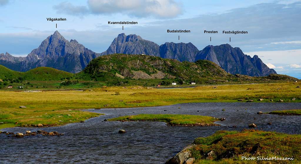
The unmistakable outline of Presten overlooks with its famous granite “Nose” the coastal road running towards Henningsvær, giving some unforgettable views when seen from here. On Presten West face it runs a great nymber of routes, the classic one is Vestpillaren (West Pillar).

")

This is the original route of the face, a trad climb up a system of corners and cracks on the right hand side of the "Nose". Here is related the “Vestpillaren Direct start”, the magnificent starting variant that makes the route a bit more challenging. Not equipped.
Getting There
Getting to Lofoten
There are various possibilities:
- By car from Evenes airport (located between Harstadt and Narvik) to Svolvær
- By ferry boat from Bodø to Moskenes, Værøy or Røst (South of Lofoten)
- By ferry boat from Skutvik to Svolvær or Skrova (North of Lofoten)
- By plane from Bodø

Road Access
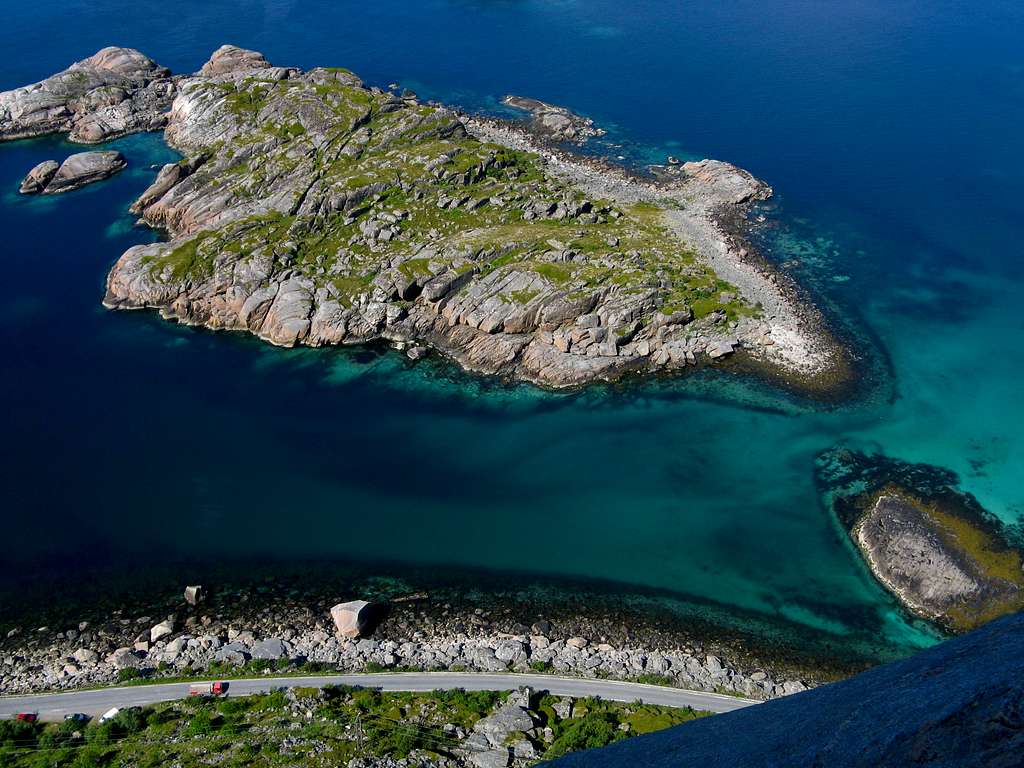
Possible the approach to the pillar both from Svolvær (20 km) and Kabelvag (15 km) following the road E10 and turning to left to Henningsvær (Road 816) at E10 and Road 816 forking. Otherwise the shortest way is from Henningsvær (less then 5 km), or from Lyngvæar (less then 5 km), a good campsite along E10, about 20 km West to Svolvær. The coastal road to Henningsvær crosses Djupfjord narrow isthmus in the beginning, then reachs a pull-out just below Presten.
Approach path
From the pull-out on the road R816 to Henningsvaer, just below Presten, follow a grassy trail heading towards the right-hand side of the wall. Vestpillaren Direct Start begins about 20 meters to the left of the obvious steep and grassy gully where it starts “Vestpillaren original start” (10 minutes from the road).
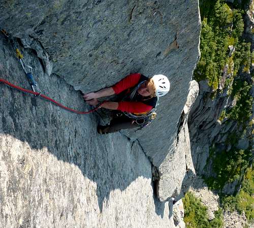
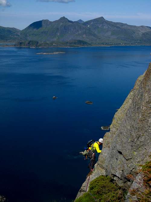
Vestpillaren Direct Start report
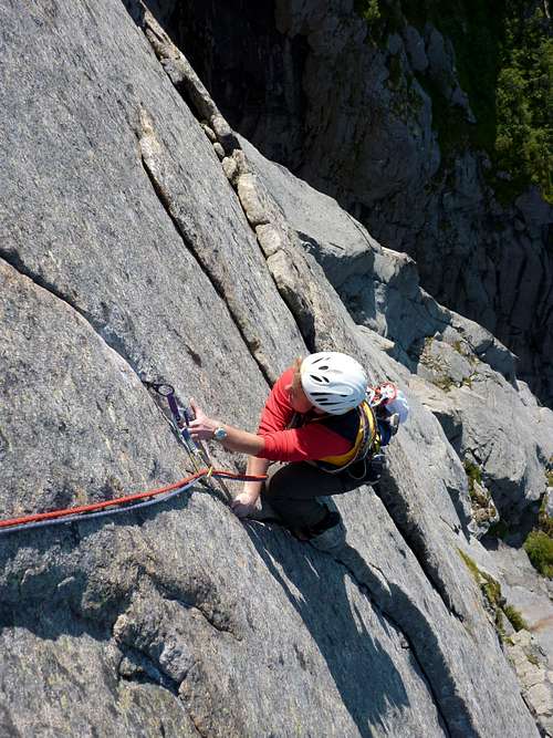
Thin cracks...
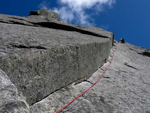
The slanting corner - Photo Silvia Mazzani
Sixth pitch beautiful corner
Vestpillaren Direct Start report UIAA Scale
The starting point lies just below three shallow corners.
L1 - Climb the right-slanting corner, the central one of three ones, reaching an easy ledge, then traverse left along the ledge to a steep crack leading to another small ledge below a corner. Belay on the ledge. VI-, 45 m (fixed belay).
L2 - Up the corner towards a flake on the left, climb the flake, then a thin finger-crack, widening in the upper part and leading to a belay VI, 40 m (fixed belay).
L3 - Straight up along a system of narrow grooves by thin finger jamming, ending to the left on a diagonal ramp leading to a small stance, VI+, 50 m (fixed belay).
L4 – Straightly over the belay, then climb up a hard corner – maybe a variation – leading on the right edge of the big grassy ledge named Storhilla. V, VI+ the hard corner variation, 25 m (fixed belay).
L5 – Along Storhilla move towards right around a big block, climb a crack on the right side of the block and belay on its top, IV+, 30 m.
L6 – Straight up climb a thin crack, then a clear corner, ending on a good ledge; traverse down and left the ledge – some blocks – and belay on a higher small ledge below a magnificent shallow corner, VI, 45 m.
L7 – A bit slanting right to enter the corner, climb it and the upper fine flake, becoming a thin crack. Traverse left to take another thin crack leading on the left face of an open groove. Climb it and belay a bit hanging into the groove, VI+, 45 m.
L8 – Up again along the groove with steep sections, then slightly to the right climb an easier corner reaching a stance below and a bit left of a magnificent right-leaning corner, “The Slanting Corner”. VI, 40 m.
L9 – “The Slanting Corner”. Up the entire corner with superb climb to a tiny ledge, then climb a thin technical crack to a belay at a block. VI+, 40 m.
L10 – Climb directly, then left towards a big loose flake; climb the flake, then a chimney-groove and belay on a ledge below a shallow diagonal corner V, 30 m.
L11 – Climb the nice corner to its end, then move down and right along a delicate slab, gaining the grassy final gully, V+, 35 m.
L12 - Easy climb up the gully to gain the summit of the pillar, III+, 55 m
Descent
DESCENT (2 hours): from the summit walk up towards SE, then scramble along a ridge, gaining a col between Festvågtinden (541 m) on the right and Budalstinden (663 m) on the left. From here there are two different ways of return:
- Direct descent: from the col cross the ridge and start to descend directly on the other side at first on rocky terrain, then along a steep grassy gully with enormous ferns. Gained the bottom of the gully, head to right (West) along blocks and grass, reaching the small lake Heiavatnet. From here take a marked and well worn trail leading to Festvåg on the road, between Presten parking lot and Henningsvaer. From here follow rightward the road to return at the start.
- Across Festvågtinden (longer): from the col follow the ridge rightward in the direction of Festvågtinden, reaching a col on Festvågtinden summit crest. From here take the path to the left that goes down to the lake Heiavatnet. From here follow the same trail as told in the previous point to reach the road.
Essential gear
Rope 2 x 50, helmet, all size friends and nuts
Climbing Scales
A useful comparison table:

Where to stay
The closest town is Henningsvær, located a few km. from Presten. The closest equipped campsite is Lyngvaer Lofoten Bobilcamping, located in Lyngvaer 4 km. to Presten along E10. A free campsite is available in Festvag at about 1 km. In Norway free camping is allowed in every place, if not expressly forbidden. In Svolvær and surroundings there is a wide choice of different kinds of accommodations: hotels, campgrounds and the traditional and typical rorbuers, the Norwegian fishermen's cabins, available in Svolvær, Henningsvær, Kabelvåg, Kalle.
Images Gallery


When to climb
Lofoten are not at all famous about their meteo conditions, anyway sometimes “High Scandinavian” and “Gulf Stream’s” warming effects can bring fine weather with blue skies and sunshine. The best months for climbing are late May, June, July and August.
Climate
On Lofoten the weather can change suddenly from clear and blue sky with sunshine - or the Northern Lights (Aurora Borealis) - to violent storms with rain or snow. Maximum temperatures go from +30°C in June and July to -15°C in January and February; the average temperatures for these months are from +12°C to -3°C. The period with the minimum rainfall goes from April to June, while we may expect the maximum rainfall or snowfall between October and December.
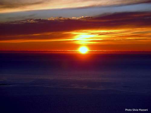
Midnight sun: from 27 May to 17 July Polar night: from 6 December to 6 January
The Northern Lights can be seen over Lofoten from September to April.
Useful info about climate: Meteorological Institutt
Meteo
- Meteo Lofoten
- Meteo Henningsvær
Guidebooks, literature and maps


"Lofoten Rock" by Chris Craggs and Thorbjorn Enevoid
"Season on Lofoten - Summer" by Cody Duncan
"Season on Lofoten - Winter" by Cody Duncan
External Links
Climbing info: Rockfax Lofoten Guidebook
Tourist info: Lofoten Islands Lofoten