|
|
Route |
|---|---|
|
|
42.29900°N / 123.8453°W |
|
|
Road / trail |
|
|
Half a day |
|
|
walk up / drive up |
|
|
Approach
See the getting there section on the front page. All the information needed to find the TH is there.
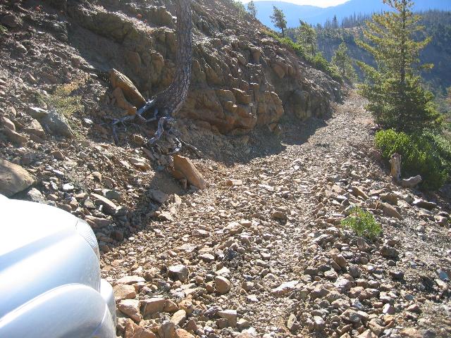
This is the most commonly used approach that people use to get to the top of Pearsoll Peak. An old miner's road of yesteryear serves as both a trail and a still functioning road. Be warned that the road is rough, rocky, nasty and may have a tree down across it from time to time. I'd suggest carrying an axe and / or a saw. Chain saws are not allowed since the road is in a wilderness area. The forest service has wanted to close the road but the public outcry from the local populace has kept them from doing so.
If you drive it, 4WD and high clearance is necessary to be sucessful
Route Description
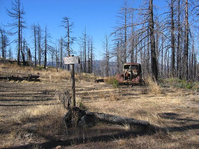
Walk or drive through the gate which is a very rough 4WD track,This road is a narrow, rocky and steep in places but driveable if you pay attention and have the right vehicle. The road climbs to 3600 feet at Chetco Pass (5.6 miles). At Chetco Pass (notice the old hulk of a truck from another era just beyond where you turn) Take the road to the right and stay right until you come to a fork after 1.2 miles that is signed. Take the fork to the left and go about 0.7 miles and park at a small parking area on the right side of the road. The peak and the lookout are visible from this point . Don't make the mistake of going too mcuh further or be lured into thinking that the road visible on the side of the peak as it is very difficult to get turned around. From the small parking spot, if you are driving, it is time to take a short hike. For those who walk the distance to this point, the end is in sight. Since the elevation of the Illinois River is about 1000 feet where you start, the elevation gain at this point is roughly 3500 feet. Less than 600 feet remains in 3/4 of a mile.
Round trip 15 miles Elevation gain: 4100 feet
The meeting of the Onion Camp route and the McCaleb route happens here at Chetco Pass.
Road closure
Note: There is a Port-Orford-Cedar disease road closure beginning October 1st which requires hikers to use the Onion Camp trail after this date.
They close and lock the gate but I am not totally clear if that means you can't even hike the road from the Illinois River to Chetco Pass.
I'll try and find out from the ranger station and post that information here as soon as I get it.
Essential Gear
Nothing special is needed unless a lot of snow has been deposited up above. . When the gate is closed, it is recommended that you access the peak from Onion Camp. I'm sure you could still walk up the 4WD road but that would be your choice. Good boots, lots of water and common sense.
This section of the road is beyond where you want to drive. Park down below in the saddle before heading further up the hill (walk up the road from the area in the right corner of the pic) .