Ticket to Cricket & Frisco - April 6th, 2013
I was on full tilt peakbagging. Two outings to Zion were very rewarding in their own right, but my peak totals for the year were quite low going into April. That, and the purchase of a gas guzzling bitch of a 4Runner meant that I was trading money, with the purchase of the car and additional gas moolah, in exchange for better access to more peaks and trailheads. Yet my first weekend with the 4Runner I visited only Dutch Mountain, a peak that the old Camry could have reached easily
With March Madness dying down in terms of overall quantity of games played I had a little more leeway in terms of peak options. During Final Four weekend I didn’t have to worry about any games to watch Sunday and even Saturday saw the games not tipping off until the late afternoon. I vowed to work around that and try to get as many peaks as I could in the Utah West Desert.
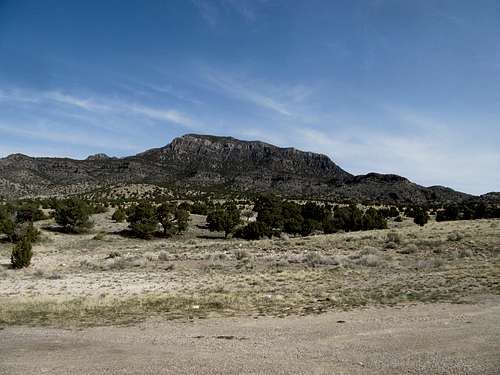
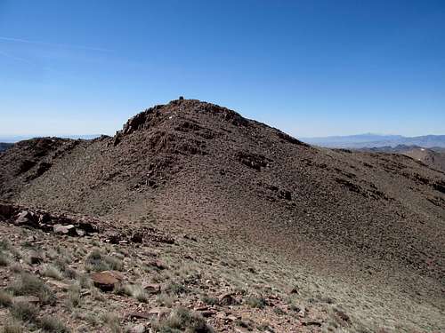
Cricket Mountains HP
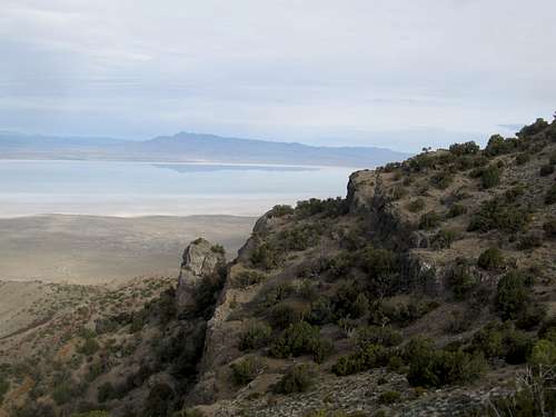
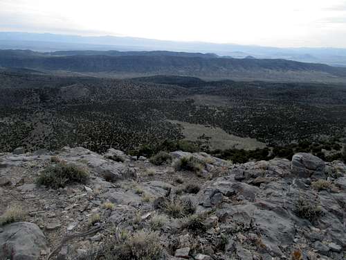
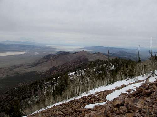
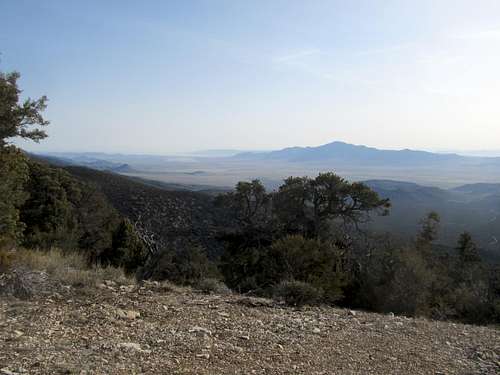
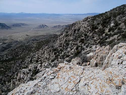
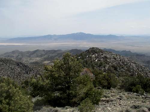
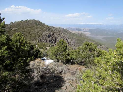
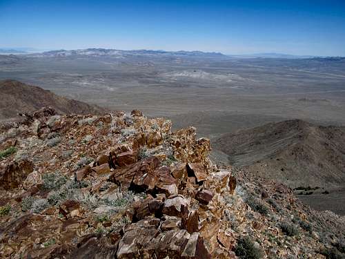
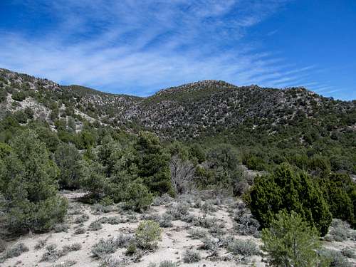
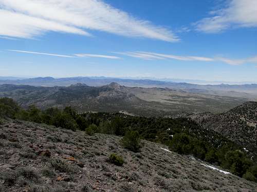
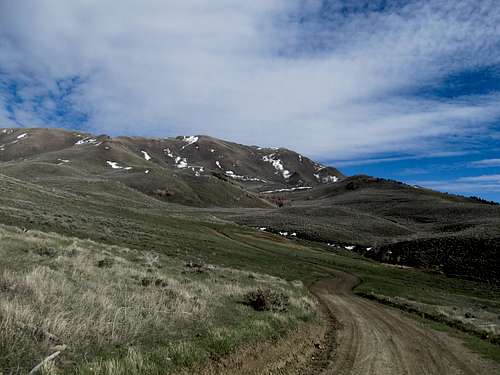
I planned to stay in the small little hamlet of Milford, on the other side of the Granite Mountains from I-15 and the more well-travelled town of Beaver. The long drive from Delta to Milford early Saturday morning yielded the first peak of the weekend, an easy hop and skip to the Cricket Mountains Highpoint. The access road in was smooth sailing, and though I couldn’t quite find a small 4WD road that supposed makes for a good starting point for the peak, the peak was close enough to the road that any differences were negligible.
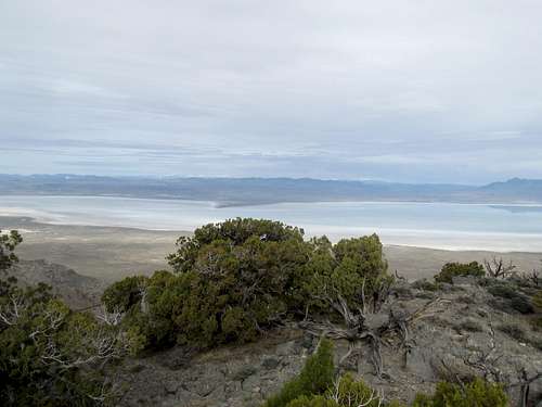
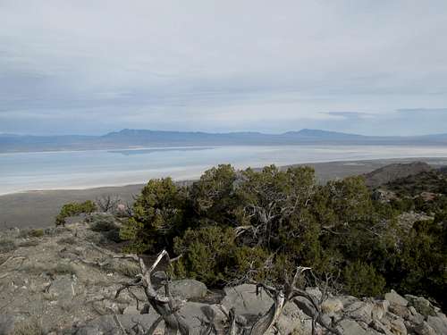
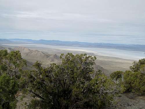
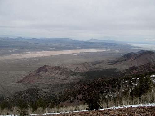
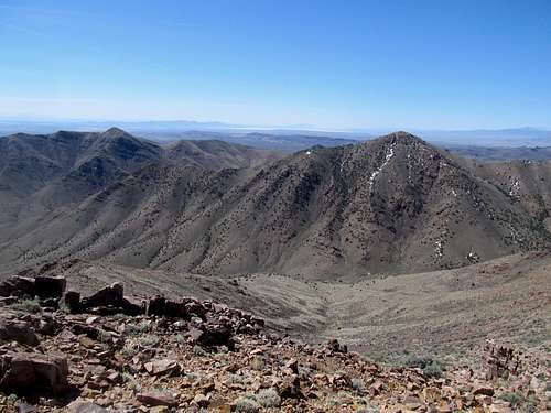
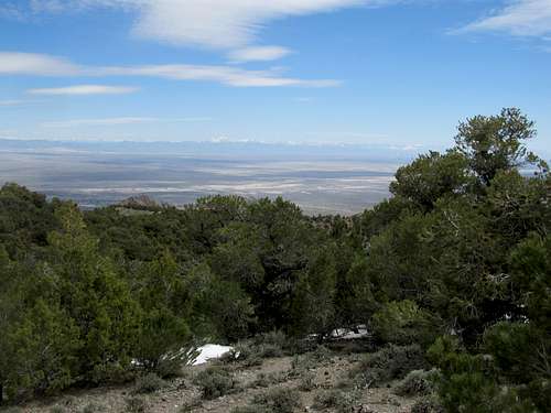
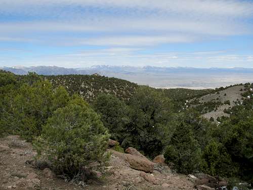
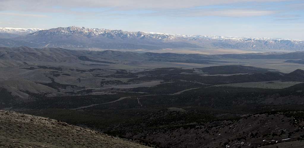
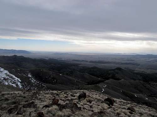
I set off and without too much trouble found myself on the summit ridge, and reached the summit a few minutes later. The views were as good as they come, especially for such an easy peak. Sevier Lake, a seasonal lakebed in the West Desert, lived up to its moniker and was fully stocked with water in the early Spring, and Notch Peak and the House Range stood out spectacularly across the lake under a low and grey cloud ceiling. To the east, the entire line of the Wasatch/Pahvant/Tushar divide opened up in what seemed to be a continuous wall of elevation standing between the Utah West Desert and well, I guess, even more desert on the other side of those peaks.
The descent was as easy as the ascent, and I drove down through and past Milford to head towards Frisco Peak.
Frisco Peak
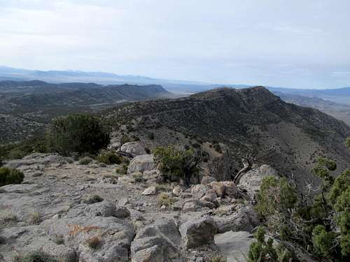
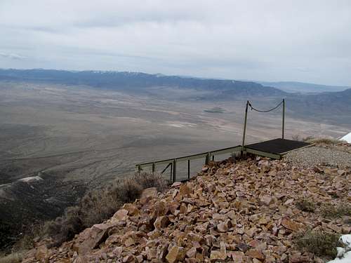
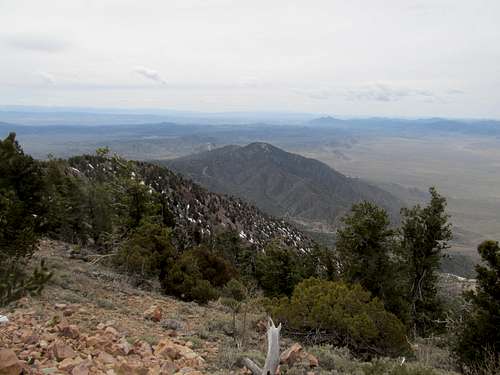
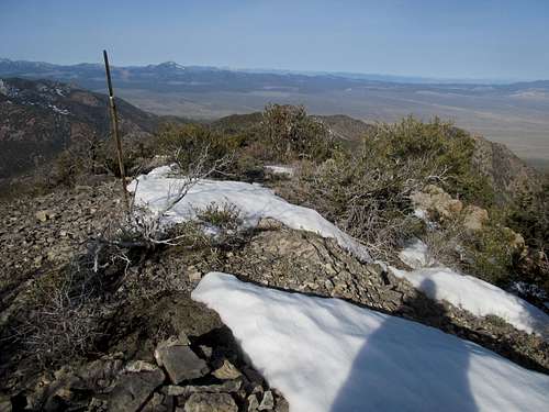
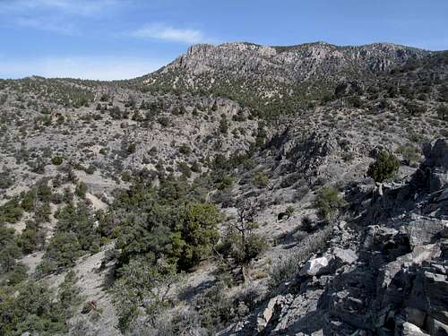
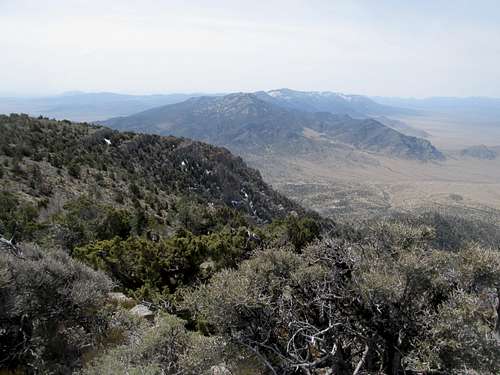
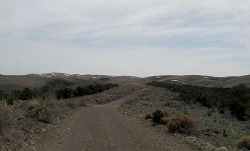
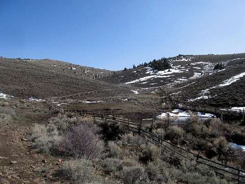
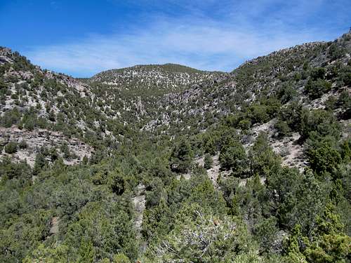
Frisco, a massive massif and one of the highest and most prominent peaks in the West Desert, is alas also graced with a 4WD road leading up to its summit replete with towers, facilities, and a hang-gliding ramp. The road was smooth gravel passable for all vehicles but turned rocky as it entered the small spruce forests at the base of the peak, especially past the path of a former rockslide. Around 7,850’ I saw a sliver of snow ahead near a switchback. Still new to driving these rough and remote dirt roads, I decided to stop here and walk the rest of the way. I walked past the snow that I had stopped for and found that it only lined the side of the highway, and I could have easily driven past it. Oh well…there was no harm in getting a better workout.
The main road branched right a very short while later at maybe over 7,900’. I saw a smaller side road leading left, towards the direction of the summit, and decided to take it, figuring that it could lead to a shortcut. In reality the snow covered road lead to no such thing; looking at Google Earth now it’s apparent the road just winds up and around some side ridges. At a point when the road curved away from the mountain I decided to continue straight ahead, where a short foray through a snow covered drainage led to some talus fields lining the eastern face of Frisco proper. I ascended this, then continued ascending through the trees contouring as much as possible in a southwest direction hoping that I was aiming for the shortest distance between two points, me and the summit. The terrain eased up after the talus but was still steep, and the slope seemed to last forever as I waited for the road, which I knew was on the summit ridge above me, to appear.
Soon it was apparently that I was approaching the ridge, and I popped up onto the road shortly before doing so. I followed it the rest of the way to the summit, noting that much of this stretch was covered by snow anyway, and took stock of the cloudy and chilly summit.
I followed it all the way back down to the 4Runner, then drove back to Milford to catch tip off of a hard fought game between Cuse and Michigan.
4 Wahs and a Poorman - April 7th, 2013
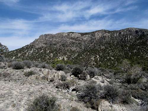
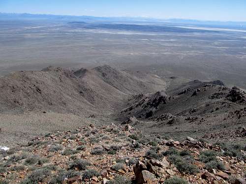
With no sporting events to watch Sunday I planned to maximize all the daylight hours I had. The plan was to go for the Wah Wah Mountains highpoint in the morning, hit up North Wah Wah on the way back and then, if I was running on schedule, get Poorman Benchmark near Beaver on my way back to I-15.
Wah Wah Mountains HP
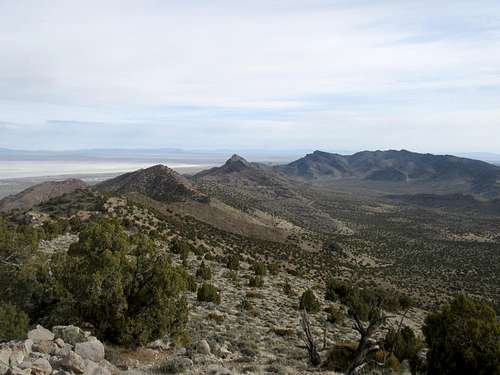
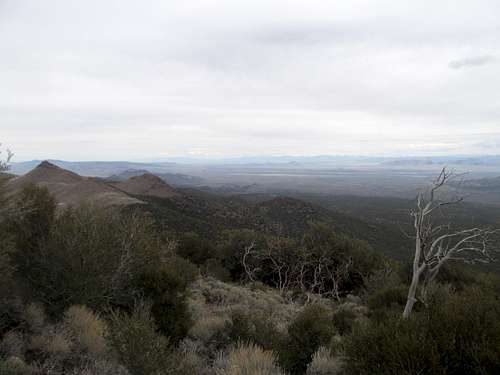
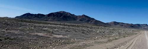
First was South Wah Wah. The range loomed pretty impressively in the morning light as I followed the highway traversing the range below North Wah, an impressive summit I planned to tackle in a few hours. I located the turnoff and followed the great graded dirt roads down into the Pine Valley and into the Wah Wah Range.
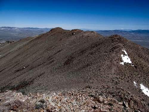
SP Member Eric Willhite’s website has great beta for Utah peaks, particularly for the two P2K’s in the Wah Wahs. I noted in scouting the routes the night before that there were three different ridges coming in from the south that converged below the summit. Willhiteweb and Dean’s SP route both followed the westernmost ridge, and both reported some spotty but thick brush. Dean noted in his page that the Mike Kelsey Guidebook route follows the road to a high pass further east, then follows the easternmost ridge to the top from there. This route, despite starting higher, looked longer and had a few minor up and downs. I sought to avoid the brush on the western ridge and on looking at the map, noted that the middle ridge in between the two looked reasonable.
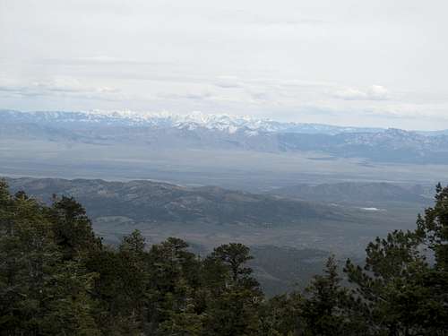
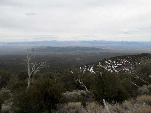
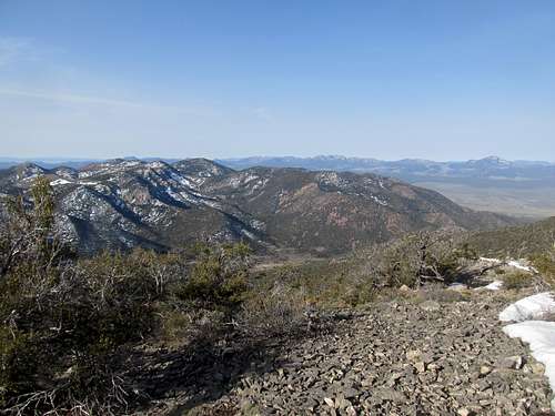
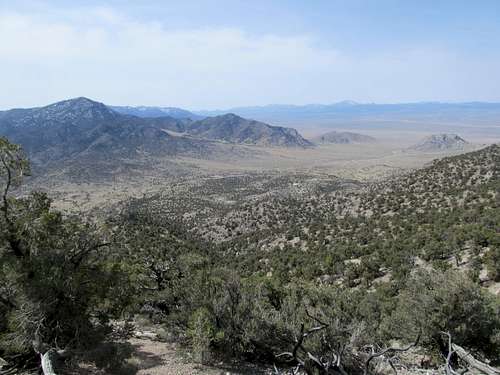
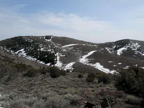
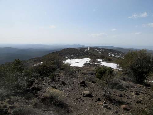
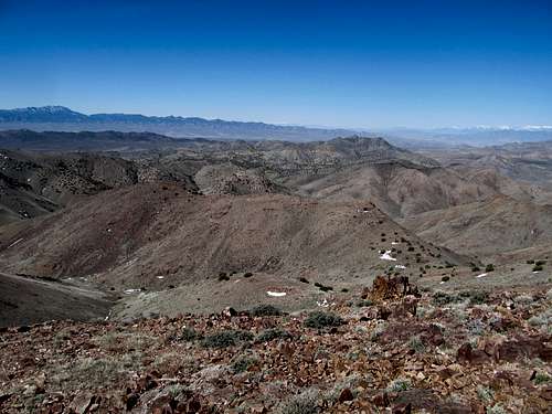
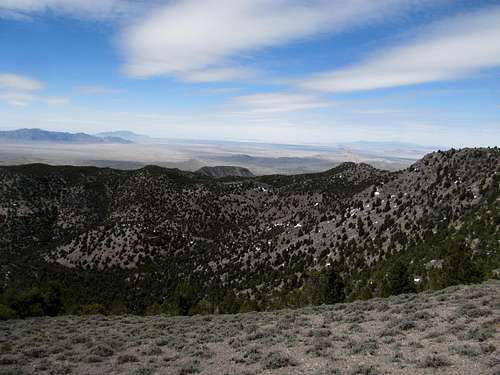
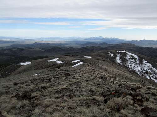
Perhaps it was serendipity that spot snow on the road stopped me on what I recognized was right before that middle ridge (before you hit that obvious switchback on the topo maps). I hit the slopes to gain the false summit at 8,924. So far the ridge had been downright pleasant, not too loose, not too steep, and not really brushy at all. To the south the snow covered north faces of the Wah Wah peaks glistened in the morning sun, but the peak was for me a snow free affair.
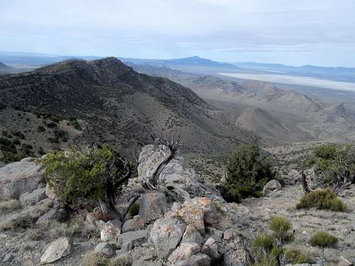
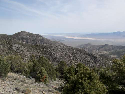
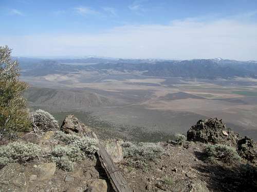
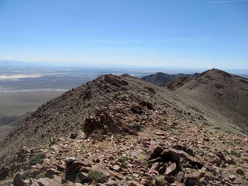
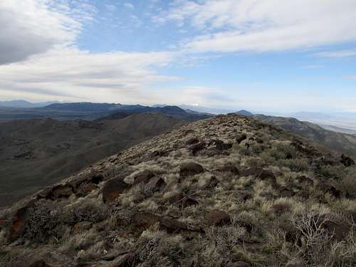
I could see the true summit ahead. The traverse took a little longer than it looked but I enjoyed the summit of the Wah Wahs tremendously; the day was young, and Indian Peak dominated the view across the Pine Valley.
The promise of this bright and warm day mirrored for me the promise of the hiking season to come, and I hurried down for the second summit of the day, running into some brush when I strayed a little too far off the ridge crest but again experiencing no problems as long as I stayed on the ridge. I popped out a little further down the road from where I parked and started the drive to North Wah Wah, the range’s other P2K.
North Wah Wah
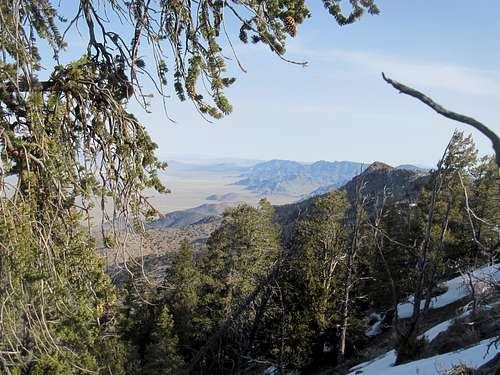
The day no longer seemed so young by the time I reached Wah Wah Summit and rumbled the rocky and rutted less than a mile before I stopped short of the end of the jeep track. The objective loomed impressively above me. Again I had beta from Dean’s SP page and willhiteweb. In this case Dean had once more reported some bad brush and scree ascending the drainage coming down the middle of the massif, but Eric Willhite had on his webpage a supposedly better, brushfree alternative ascending the ridge to the right (east) of that drainage. I decided to try his approach and ascended the moderate slopes leading towards a line of cliffs that seemed to match his description.
I looked for the rock spire he noted and ascend up towards it…the last few hundred feet below the spire had some loose talus but as promised, was free of any bad brush.
Above the spire was a steady and consistent climb over shallow ledges of white colored rock to reach the ridge crest. Then followed a long but mostly flat traverse westish then northish, the final part through the trees aiming for what looked like the highpoint, to the top, where a cairn and registered confirmed that I had indeed found the right summit.
Disaster almost struck on the way down as I traversed through the cool conifer forest of the summit plateau. I realized after a bit I was descending the wrong drainage northeast, and that I was headed down the opposite side of the mountain. I had to traverse back up and over through the trees to find my way along the southern plateau rim, where I retraced my steps down the white rocks and around the spire. The descent was once again steep, but I managed to avoid the talus on the way down.
Poorman BM
It had been a warm desert day so far (anything over 50 qualifies as warm when there’s no breeze and you’re on the ascent), and I done my share of sweating on North Wah Wah. But I seemed to have enough daylight left where I calculated that I could go for Poorman Benchmark, yet another P2K and the highest point of the Black Mountains outside of Beaver, and still make the long drive back to SLC to get back at a reasonable time. Added incentive was that this peak is a really cool looking plateau from I-15, and had always intrigued me the numerous times I drove past it. There wasn’t a lot of beta for the approach I wanted to take, the dirt roads coming in from the north and Minersville Reservoir; I tried my best to memorize the roads from Google Earth and match them to the scratches on my DeLorme atlas, but soon found myself somewhat lost and driving once more, a dirt road that exceeded my comfort level my first weekend really testing the 4Runner.
To this day I’m not quite sure which road I ended up taking and which road I should have taken, or even whether they were one and the same. All I know is that I started walking down the dirt road that broad grassy knolls surrounded me on either end (and realizing to my chagrin that I had driven past the worst…its quality had improved almost immediately past where I parked). The tunnel vision made it hard to distinguish clearly where I was and I hoped that the higher snow covered hills further ahead were the summit, or perhaps even hills further removed than the summit from me.
I think I was ultimately anywhere from 1.5-2.5 miles from the summit and around 1,000 feet below. After walking down the road for awhile I ascended the hills to my left and traversed on southwards over higher knolls that blocked my view of wherever my objectives were.
Eventually I reached the last ridge and saw a few hundred feet below me the small stock pond that I knew marked the base of the true summit and the main route. Rising above it across from me was the summit. I could descend down and reascend the hill, or I could make a windy sidehill traverse to the left and back around to the top. I opted for the latter, and crudely put, it truly sucked balls.
The sidehilling wasn’t even the worst part as I made my way down towards a saddle below the true summit. The brush was the worst, thick and tall enough to be all encompassing whenever I needed to burst through it, and wherever I could avoid the brush the only alternative was leftover snow, sometimes waist deep and always a slushy consistency in the afternoon sun. As I reached the plateau rim and saw the 18-wheelers cruising down on I-15 below a third not-so-palatable option presented itself: a rocky traverse along the loose rock lining the ridge crest, with thousand foot drop offs and brush lining the edge making passage along the ridge impractical if not impossible in spots.
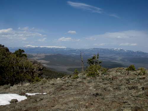
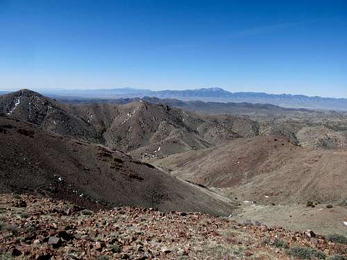
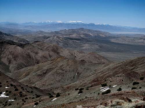
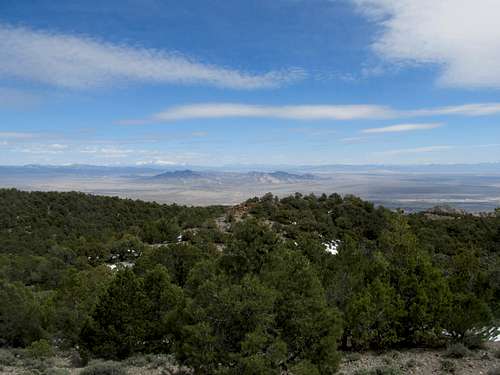
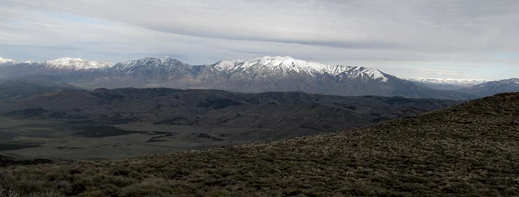
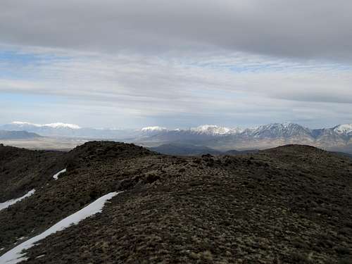
I crawled, pushed, and swore myself through these three evils while not wandering too far from the rim in order to avoid missing out on the summit cairn. I pretty pissed off at the mountain and in general by the time I found it, so I took some pictures and descended in a huff. The views were nice though, the Tushars looming above, dominating the area and still looking quite alpine in the spring snow, while Granite Peak/Milford Needle looked quite pointy and alpine as well from this angle to its south.
The descent was a lot simpler, down the slow and the road that I should have just stayed on in the first place.
Fortunately I had plenty of time and daylight to spare as I pulled into Beaver, gassed up and started the drive back, my anger placated somewhat by the knowledge that in my full tilt mindset I had gotten five 2,000’ prominence peaks in two days, including a three peak day that featured over 5000’ of total gain.
Tapping Keg, Drum & Tintic - April 14th, 2013
A week later I had only one day to get out, but once more managed to do three separate peaks to make it count. Saturday was both a hangover day and a weather washout, so Sunday it was. With a clear forecast I decided to once more return to the West Desert, this time to a few peaks closer by SLC: the Drum Mountains Highpoint, Keg Mountain and, if I had enough time, Tintic Mountain on the way back.
Drum Mountains HP
First was Drum, a long drive west from Lynndyl on first paved then good gravel roads to the base of these surprisingly impressive, if low, mountains. I was able to locate the turnoff without issues but the road did get rougher and rockier. More problematic was the sheep ranchers parked along the road…not only did I have to navigate through a herd of sheep but I also had to crawl at 2-3 mph as maybe five different sheepdogs surrounded my car and barked at me from every direction; it took all my skill, if not patience, to avoid hitting them, and they did not leave me alone until I was well past the herd and in the mountains.
I parked at the junction where another 4WD leads east up a drainage and sidehilled towards an obvious saddle. From here the summit wasn’t too far away, but life is an expectations game, and knowing how easy an outing Drum was made the quick ridge hop and few hundred feet seem that much further.
At the top I spied a summit further to the south. Not being sure which was the true summit I headed for the southern one as well, topped with a large and obvious cairn.
After scoping out this summit as well I sidehilled back down, making a straightshot back to the saddle. From there I continued south over the small summit (7,014) and continued down the ridge back to the drainage.
Keg Mountain
It was something of a trial to make my way to Keg Mountain, next on the list. First I had to contend with the sheep dogs again, then try to find my way through some of the desert roads that, as usual, were tough to match up with certainty with the roads on my map (did I mention again I need a GPS?). Somewhat helpful to my navigation was the actual sight of Keg Mountain and the pass to the west which I knew I needed to drive towards. Eventually I found the main road where Keg Pass branches off and found the right roads to the trailhead.
As described in the SP page you’ll get your vehicle scratched up a little as you drive through some thick brushy areas, but the road overall wasn’t too rough. I drove to probably within decimal point miles of the end of the route and found a turnaround point. I could see the peak to the northeast and headed towards there through the small brushy forest. My concern was more finding the car through the indistinguishable trees clustered in the small basin on the way down.
As promised there were some cliffs around 6,500’. Like the other rocks in the area the ones here were oddly warped and curved into interesting looking shapes. I chose to scramble directly through the small cliff band, even though it looked like you could circumvent them to the right. Afterwards I got a good view of the summit area further above aimed in a general direction towards the area.
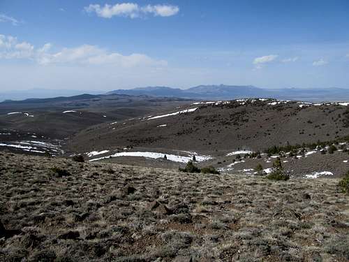
The last few hundred feet you’re climbing blind through the trees, so all you can do is keep going up and hope that you’re still going the right direction because you’re still ascending. This seemed to drag, especially there were more snowbanks near the summit area, but soon I reached the summit cairn, which its open views to the west.
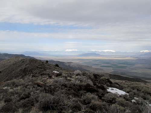
Keg’s summit plateau is pretty broad, and the areas higher looked north. I decided to head in that direction, hoping to get some views north too, and tried to stick as close as possible to the highest terrain possible before I ended up at an area in the trees that seemed like the highest point along the plateau. I went on a little further to some pretty good views northwest towards the Granite Range and the Dugway Proving Grounds, then backtracked my way to the summit cairn and register.
Note that you want to descend somewhat in a southeastern direction rather than due south; I did the latter and ran into some thick brush. Back at the cliff band I tried to contour left (east) around the rocks but still ended up descending some loose ledges nevertheless.
Finding my car proved easier than I had anticipated after I located the road a little further down from where I had parked.
Tintic Mountain
I had enough time to go after Tintic; the question was whether I had the will. First it was a long drive down dirt roads, good ones, but heartbreakingly remote nevertheless, back through the desert to hit US-6 near the Little Sahara Sand Dunes.
With much daylight remaining, the imposing bulk of the peak bent my will to its pull. Tintic is not a P2K and not the highest point of its namesake Tintic Range, but it has more than its share of prominence and is subjectively the most dominating peak of the north south crest of the Range (the highest peak, Boulter, is on an offshooting ridge to the northwest), looming over US-6 between Eureka and Santaquin. My legs still felt fresh enough as most of my exhaustion was mental, from all the dirt road driving, each mile still driving bullets through my nerves. What seemed to appeal about Tintic was that access through the forest road to the ghost town of Dennis at its base was short and easy, a road that supposedly any sedan could make. That more than anything else convinced me to make the turn right off the highway (after circling around a few times actually to make sure this unmarked junction was the correct one), where I parked a little past and above the townsite.
I followed a small 4WD dirt track on foot south before heading straight up the west slopes of Tintic. Not too long afterwards I ran into the same track as it circled back around to a small saddle along the ridge. Then it was a long thousand feet plus of gain at the end of an already long day; the terrain was steep, the sagebrush was slightly thick at times, but it was a technically simple, though topographically crude, ascent to the summit ridge. (I could’ve saved some elevation gain and distance by taking the 4Runner up another 4WD track to the north, but this time I opted to avoid the additional wear and tear on my car).
As I’ve stated, I’ve found some of my favorite summits to have been the ones I gain in the mornings, when the air is fresh and the lighting is spectacular and promising at the same time. Tintic was a rare evening ascent for me, and though it had a much different feel to it, a terminus rather than a dawn, the views on their own merits were just as spectacular. Nebo is the monarch of the area and directly across I-15 on the other side of the valley, while to the west Black Crook Peak and the Sheeprock Range stood sentry besides a setting sun that heralded both the West Desert and the end of my day spent amidst it. To the south Fool Creek Peak stood between the approaching night to the east and the last fringes of sun to the west, and to the north the Wasatch and my route back to SLC beckoned.
My peak greed rewarded, I trudged down the slopes and followed the 4WD track back to my truck.
I felt a little more satiated with 8 peaks done in two consecutive weekends (and only three actual days of hiking), and the chip (read: car financing) on my shoulder mollified a little on the drive back to Salt Lake. There were more summits left, even in the West Desert, but I felt a little more caught up in the race.
Comments
No comments posted yet.