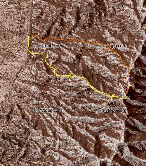
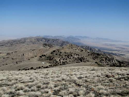
Camera-less on Vickory - February 4th, 2012
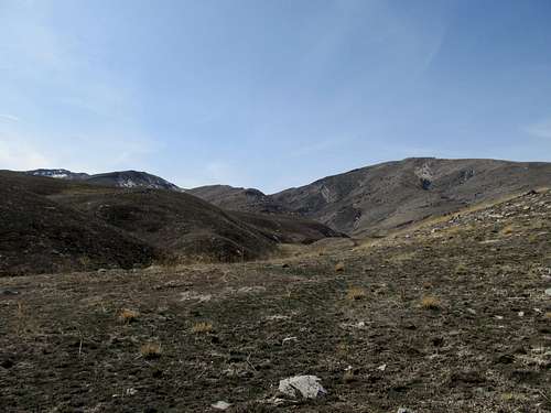
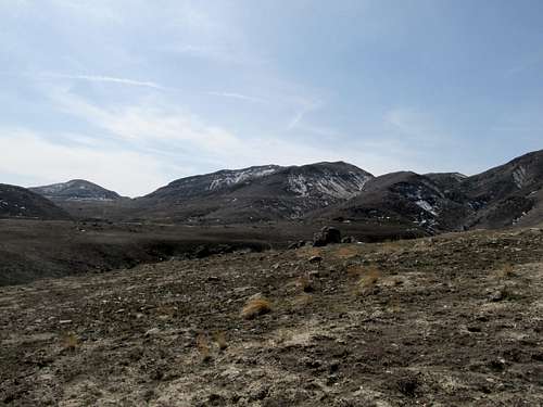
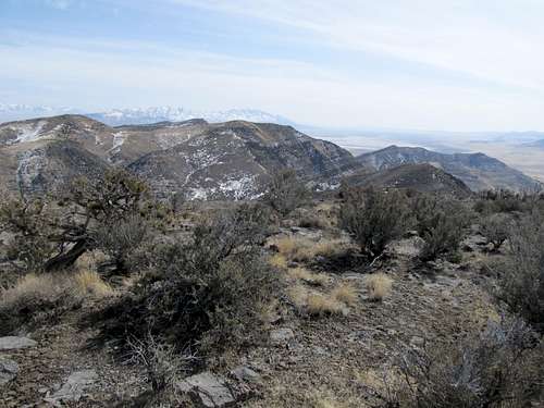
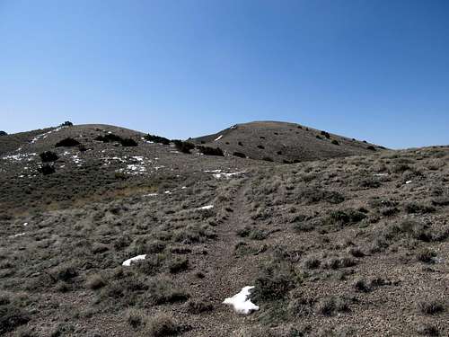
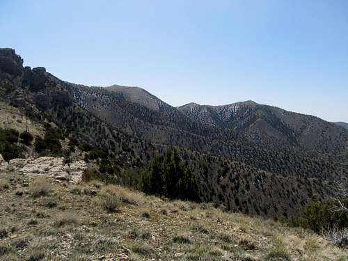
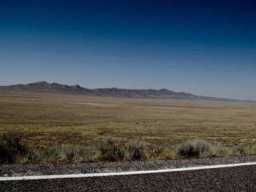
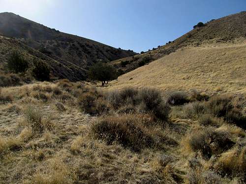
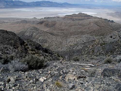
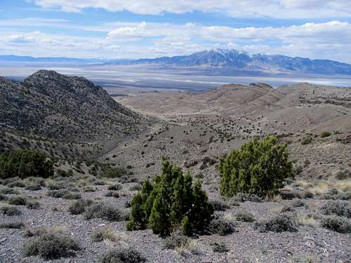
The day before the Superbowl (which we shall no longer mention again, like, ever) I teamed up with Matt (mtybumpo on SP) for an attempt at Vickory. The south ridge looked like an extremely appealing route up to a high summit, and yet was free of avalanche danger amid one of the more hazardous winters in recent history. We started a little above sunrise at Johnson Pass and worked our way up. The snow was crunchy and of a perfect texture all 4000 feet and 4 miles to the summit, and the views were among the most glorious I had ever seen. Alas, I had forgot my camera, and could only capture a few blurry pics from my cell phone. Deseret looked haughty and forbidding from the top, its slopes looking like they could burst at any time. We returned to the Camry tired from a long day, but the trip to this monarch of the Southern Stansbury’s was well worth it during the winter.
Crazy Craner - March 11th, 2012
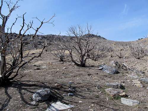
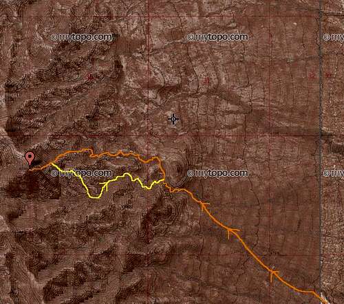
I met up for a trip up Olympus with Dean and Kadee on Saturday. After summiting in the snow and slush, I decided for warmer climes out in the West Desert of Utah for Sunday. Since moving to Salt Lake City I had only been as far west along I-80 as the Stansbury Island exit, so I figured Craner in the Lakeside Range, the next range over, would be a logical goal for the day. I didn’t much feel like waking up that morning, so after a late start I drove west and didn’t arrive at the exit for the magnesium plant until near noon. The dirt roads leading to the canyon were fine until a rutted, boggy section, where, despite not even intending to cross it with my Camry, I got stuck adrift the mud. Fortunately a hunter passing through nearby was able to haul it out with a rope, else I would’ve been stuck with a hefty tow bill and a long wait on a Sunday even for the tow truck driver.
After offering my profuse thanks I drove around the area, trying to figure out the best way to reach Craner in view of the roadblock. The mystique of the range, the furthest I’d ventured west along I-80 since moving to Utah, had long vanished. I was in a dry, barren, desert, trying to find a route to a bland desert peak as the clock ticked away the day. From where I was I had two options, really: continue along the road on foot several miles north, then hike west up Craner Canyon and up the standard route, or head straight west from where I was into where Carter Canyon disappeared into the range, then figure out if there’s a good, possibly efficient, way to traverse north through the range to the top of Craner.
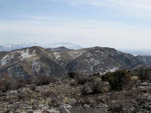
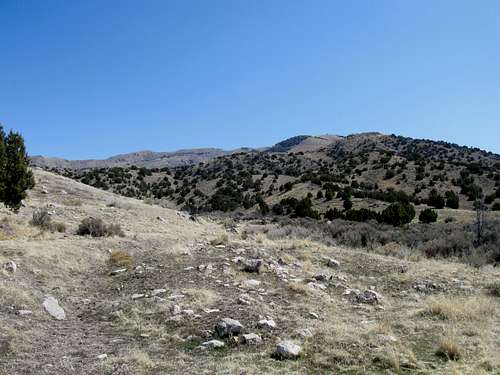
The initial hike up the wide mouth of Carter Canyon was dull and dry, but I soon began to gain elevation. The canyon narrowed, and I ascended a small hill on the right to try and sneak a peek at the terrain ahead. The southern portion of the Lakeside Range rose to my left, one of them with communication towers on top, and one of them probably named Black Peak something (there are several Black’s in this range). They were pretty and still dotted with small specks of snow.
Eventually I crested at a pass blooming with green pastureland from the early Spring, the landscape akin more to the Irish highlands (not that I've ever been) than the Utah desert. I stayed along the eastern crest of the range bearing north, ascending and descending some small ravines but overall trying not to lose too much elevation. Every once in awhile I would come upon traces of a jeep road, and I would follow it until it started leading in the wrong direction.
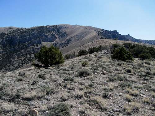
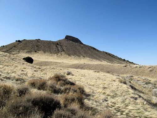
Eventually after some ups and downs I arrived at Craner Canyon, or really, above Craner Canyon, overlooking the main dirt road leading into it. What this meant was that I would have several hundred feet of steep hillside to descend before I could start where anyone with a reasonably clearanced 4WD vehicle would start for the peak. I obliged and wearily, after already a few hours or so of traversing the range, began the actual ascent of Craner.
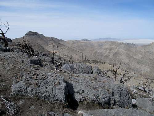
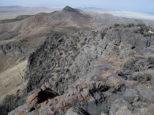
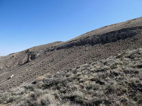
It was straightforward: up a steep slope, up a ravine, some more slope-age, avoid the big cliffy rocks on the left, avoid the rocks in front of me, traverse through some thick brush and end up scrambling over the rocks anyway, more slope, the grade eases, and finally gain the false summit. One doesn’t actually lose elevation getting to the real summit, but the ground was boggy and sunk a little beneath my feet from recent snowmelt.
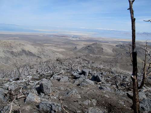
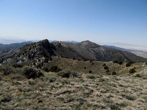
I did not expect to see the cliffs dropping so dramatically off the western side of the range. That, along with a very odd summit log entry, made my time at the top just a little uneasy.
I saw the Cedars in the distance and somehow told myself they were next. And so they would be. The descent was inconsequential; I took the boring way out, following the dirts roads out of Craner Canyon and back to my car, moo’ing at the cows all the while.
Easter atop Cedar - April 8th, 2012
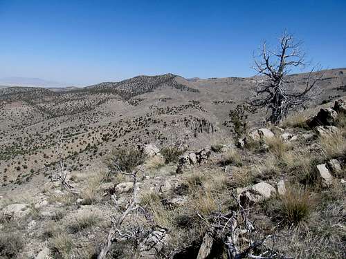
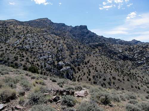
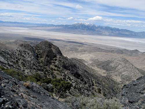
And so Cedar would be next, but not until almost a month later. On Saturday I joined Dean up Dale Benchmark and Pt. 7,500 overlooking the University of Utah. Easter Sunday I decided for a two-fer if I could; Cedar Peak in the morning, then an attempt at Grassy afterwards. I drove my Camry down the fine road marking the western flank of the Cedar Range; it was slightly rough at times but nothing a beat up East Coast passenger car couldn’t handle. I parked near the cattle watering hole and ascended the dirt road and soon left it. The slope up the Northwest Ridge was easy but mentally tricky. One keeps expecting a drop off and some elevation loss and regain from one immediate bump to the next, but the transitions were fairly smooth. The rocky ridges lining the summits north of Cedar HP made for pleasant aesthetics along the way.
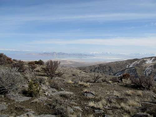
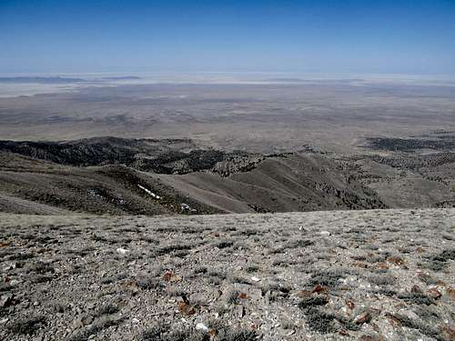
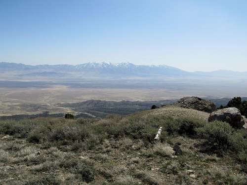
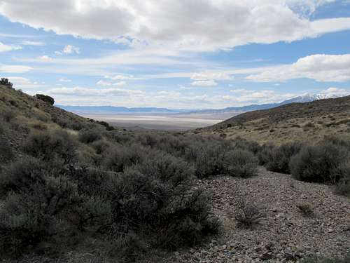
Upon reaching the ridge crest I was immediately rewarded with a dramatic view of Deseret and the Stansbury’s, looming still almost 4000 feet above where I stood high in the Cedars. The rest of the way to the highpoint was basic if dull, and one lumpy hill after another.
I enjoyed perfect weather, views, and temperatures at the summit, though the haze barely allowed views of the Deep Creeks and Pilot in the distance. The rocky peaks south of Cedar HP, hidden from view until the summit, impressed me; I doubt they are visited that often.
In researching the peak the previous night the West Ridge had intrigued me. This ridge seemed a more direct route, rising almost immediately above the valley and the Cedar Range road to the summit. A muddy area near the cattle trough had prevented me from driving further to inquire, but standing here at the summit the ridge presented itself in its full glory. I decided to descend it and make it a full tour D’Cedar.
I stayed near the crest of the ridge the entire way and was rewarded with some my best views yet to the north and south. I knew the ridge got a little cliffy near the bottom, but slopes fit for descent were plenty. I walked down along the edge of a small ravine to follow the main drainage north of the West Ridge as it curved and winded directly onto the road, probably a half mile or less south from where I had parked.
It had taken me only two hours Camry to Camry, so I figured I was in good shape to make an attempt at Grassy.
Grassy the Long Way - April 8th, 2012
My main concern was access. Theoretically a road goes within 600 feet of the summit, but I didn’t know if my Camry could make it. Indeed, the road got rougher and rockier as it led west from the paved Puddle Valley road. Not wanting to push my luck with the lessons from Craner Mountain still in my mind, I took a soft, sandy road north a few miles before finding a good place to park. Grassy loomed in the distance, but it would be a two to three mile walk across open desert before I even reached the lower flanks of the range. I figured I still had time, so without really knowing much about the terrain ahead I got my stuff out and began traversing the desert. A featureless mile later I looked back into the direction of my car and noted that, from where I was standing, it was in the direct line of sight past the only three stunted trees within immediate view. I memorized this for the way back.
Ahead I was aiming for a small canyon opening between two small hills. Some of the surrounding hills looked like they connected right off Grassy, but by now I figured I knew the Great Basin enough not to be fooled by such fantasies. Following the ravine, however, will take me further and possibly allow me to skip ascending some ridges to nowhere, or so I thought.
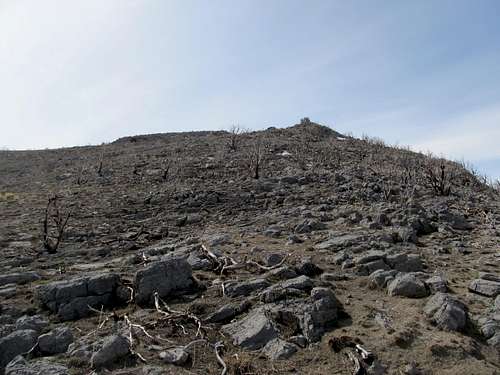
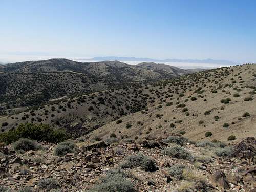
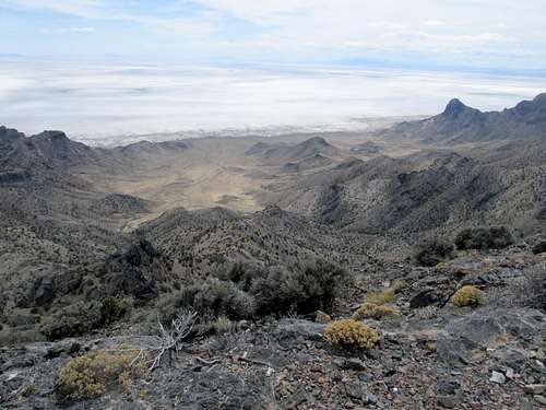
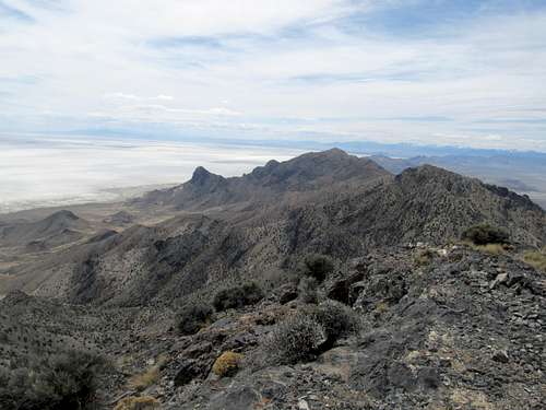
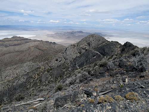
One to two miles later I found myself finally entering the canyon. I kept traversing on either side of the creek bed, as often the canyon narrows one side at a time. Up a few rocks, then I see a ridge ahead of me. Grassy is nowhere in sight, but I figure I’ll ascend this ridge to see how far I am from it. This continued several times, as I kept contouring one ridge after another towards the northwest, while Grassy, which couldn’t have been more than a thousand or so feet above me, loomed distantly, its shape resembling a worn down version of the Matterhorn of Swiss fame. As I inched higher and higher I noticed the next ridge to the right connected straight to Grassy’s summit. I figured that would’ve been a nice ridge to be on, but mine’s probably would take me there directly as well.
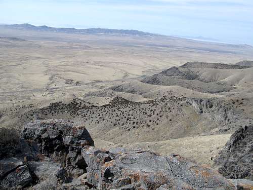
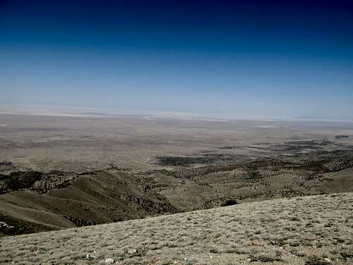
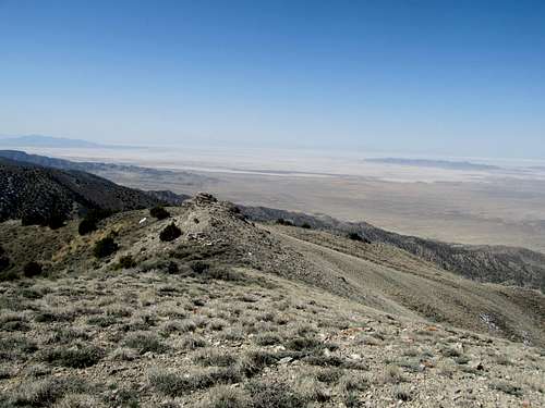
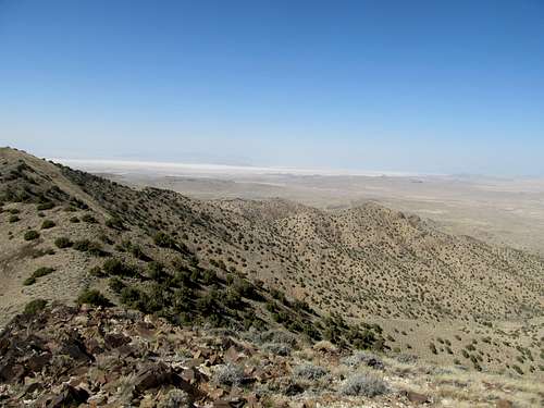
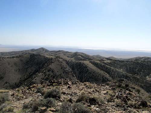
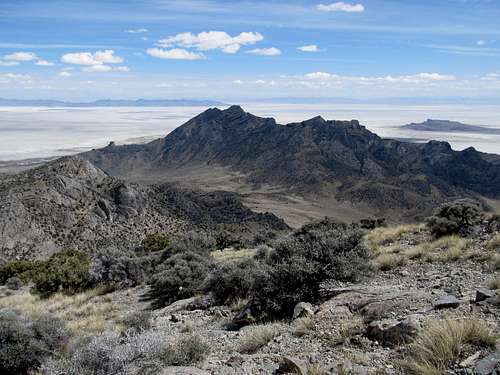
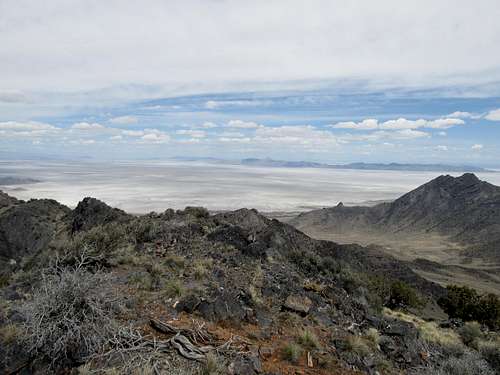
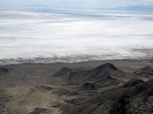
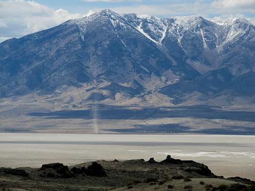
And so it was. The final five hundred feet or so were steep, and the final fifty rocky. The summit itself was a delightful surprise after I ascended through a chimney composed of sharp, jagged chunks of dark maroon tinted volcanic rock. The sun was still a few hours from setting but had began its fade through the west, making the Salt Flats shine like a brilliant vast sheen of bleached albino glass. A range stood passively in the middle; I guessed at the time that it was the Silver Island Range, but found out later that it was actually Desert Peak and the Newfoundlands.
I made a straight shot for the ravine after descending the steeper top flanks of grassy, and wandered through the cool sagebrush streambed as it dryly waded and wiggled out of the Grassy’s. At times the western sun set the blades of fresh grown grass on fire, and I knew I couldn’t have picked a better day or a better time to make my ascent. I drove back to Salt Lake with a sense of accomplishment, thankful for a Happy Easter indeed.
Cracking Graham - April 15th, 2012
The following Saturday I went with Matt (mtybumpo) and climbed Spruce Mountain in Nevada in a snowstorm. Sunday’s weather boded better, and I decided to do another West Desert peak. Graham had been high on my list since the prior November, but it was only now that I finally set out to climb it. It worked out though, as I had slowly been making my way west peak-wise along I-80, one range at a time.
The day was sunny and hot, a clear contrast from the prior day. After taking the long way up the last few West Desert mountains, I decided to make Graham as easy as possible…which meant trooping the Camry about a half mile up the Campbell Canyon jeep track before letting the car call it a day. My distance was reduced from 13 miles to 12 now, and those first few dragged as I followed the road’s progress through the desert.
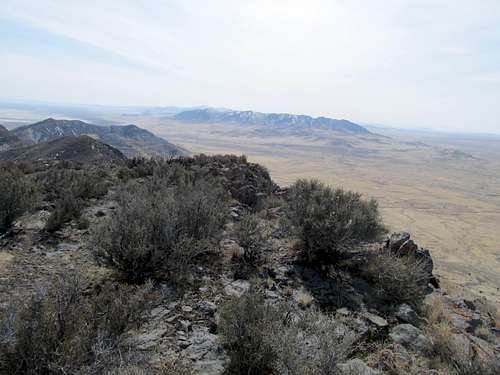
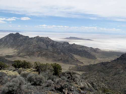
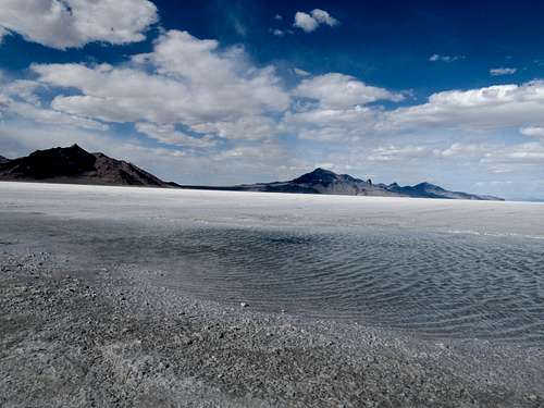
I aimed for the easily visible notch provided by Greg J in his excellent route description. The rounded hill to the right of the notch looked nice, so I ascended that and gained the ridge about a hundred feet above the notch. On the other side, the Salt Flats were still drying from the prior day’s storm. The ridge up to the false summit of Graham was tedious at times but the view was always excellent. The winds at the Bonneville Rest Area had been intense, probably 30-40 mph, earlier in the day, so I was relieved that it was fairly mild on this side of the Salt Flats, with the breeze picking up only once in awhile.
The true summit looked discouraging from the false, but I was able to pick my way around the rocks to make it to the top fairly easily. The views were a good picture of the West Desert peaks behind me, and all the Nevada ranges in the distance that I had yet to climb.
Pilot loomed to the west, as it did the entire trip. I read the summit log, which included some amazing entries (one was a traverse from Leamus all the way to Graham…wow!). I read Greg J’s entry; to paraphrase, it said something like, “Graham Peak…good climb. I think Pilot’s next”. My thoughts exactly, buddy.
Though as of this writing Pilot remains still on the list (along with Onaqui BM, Deseret, and Desert, as some other peaks along I-80 towards Wendover), I felt a sense of closure atop Graham. I had started my journeys in the Great Basin with the West Desert peaks close, then less and less close, to SLC. Now ahead of me lay longer drives and longer days, but that was why I moved out here (and certainly not the nightlife, that’s for sure. Sigh).
I startled a solitary pronghorn antelope on the way down. It ran west until it disappeared somewhere between me and a dust devil swirling below the flanks of Pilot.
Comments
No comments posted yet.