
|
|
Route |
|---|---|
|
|
39.72490°N / 113.4404°W |
|
|
Download GPX » View Route on Map |
|
|
Hiking |
|
|
Spring |
|
|
Most of a day |
|
|
Class 3 |
|
|
Challenging |
|
|
Overview
(This is the first route I've added to SP. Apologies in advance for any errors.)
Approach from West side. Advantage = climb not that bad. Disadvantage = greater distance to base of range. But if you elect to use a mtn bike, that problem goes away (see below)Getting There
I'm going to assume you can use Google Maps. You want to get this point along the Pony Express Route: 39 50' 26" N, 113 29' 23" W. This the point where, driving East from Callao, the road bends 60 degrees to the North. From Callao this point is about 13 miles heading East. If coming from Fish Springs NWR, it is 6.8 miles after you pass "North Springs" the small distinct pond on the East side of the road with a "No Swimming" sign (and often a flock of pelicans.)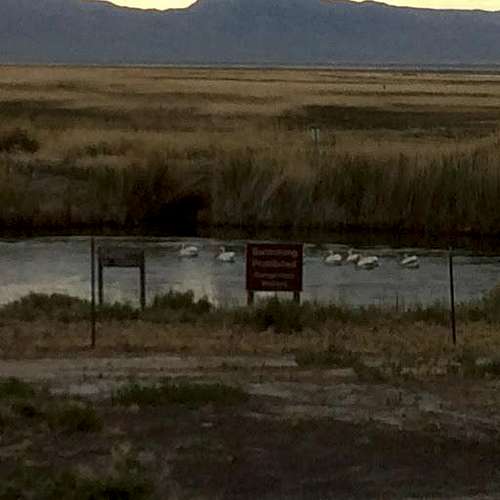
Route Description
This route- either option- is ~5.3 miles to the summit one-way. But here's the deal: the first 2.9 miles is on the old jeep track. It's easy walking, and even easier mtn biking (average 8% grade, easy climb.) The technicality here is that the jeep track may traverse WSA land. It's not signed, and there are ATV tracks, but I believe technically it is. So evaluate and do what you're comfortable with. I'm not telling you to bike it- I'm just saying it's an easy, pleasant spin.At mile 2.9 (39 44' 18" N, 113 28' 15" W) the jeep track ends in a large meadow. Turn South here and start walking. You'll follow the West side of the range due South over a couple of low rises until you reach your ascent option. (Terrain is open and easy here, and you'll often follow wild horse trails.
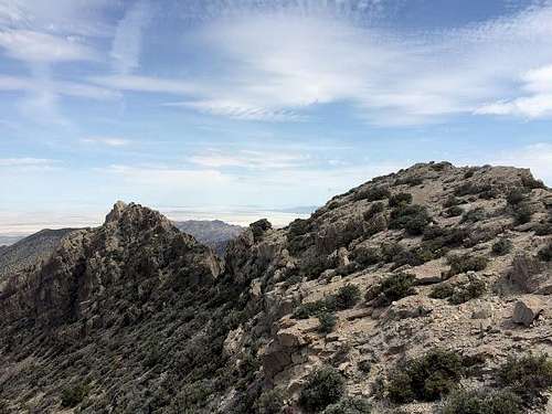
There are two ridges which can be ascended, which I'll refer to as "North" and "South". They're almost the same distance, and roughly the same difficulty. A nice way to do this peak is to ascend one and descend the other. (I ascended South ridge, and descended North.)
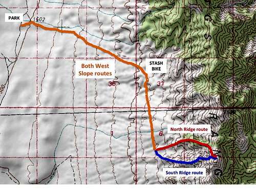
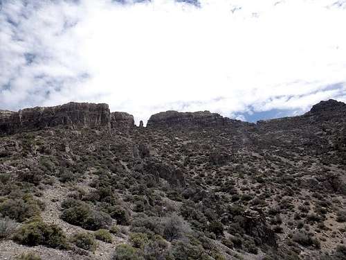
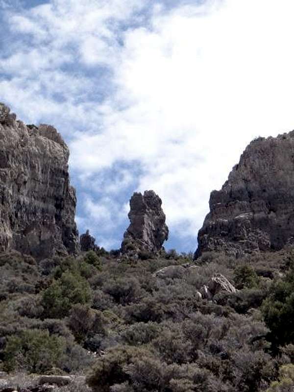
Ascent Option 1: North Ridge. (This attached GPX is for this route- logged as a descent.) Make for point 39 44' 26" N, 113 27' 35" W. Turn due East and start walking up the ridge. The first 2/3 of this ridge is a piece of cake- great footing, class 2. Then it'll get a bit steeper and looser. Straight above you is what I call the "Tooth" a big pillar of stone standing alone in a gap in the ridgeline. ![Unnamed Image]()
Keep climbing toward the tooth until you're maybe hundred yards below it, and then turn to the Southeast, climbing/side-hilling your way to the summit. ![Unnamed Image]()
This is the tedious part- lots of loose scree, several minor (class 3) ledges and some brushy sections (mountain mahogany). Eventually you'll climb up a break in the ~15 ft wall guarding the summit about 50 feet South of the actual summit.![Unnamed Image]()
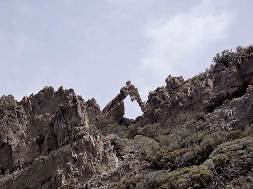
Advantages of this route are the easy lower ridge, and easy access to two very interesting features on the ridge- the aforementioned "Tooth" and a cool triangular arch (maybe ~8 ft high) just North of the summit.![Unnamed Image]()
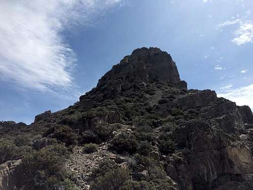
Ascent Option 2: South Ridge. Make for point 39 43' 20" N, 113 27' 32" W. Turn due East and start walking up the ridge. Navigation is probably even easier on this route, but the ridge includes more rocky outcrops that necessitate brief detours or class 3 scrambles. Nothing too hairy, just a little more tedious. You'll keep working your way straight up, aiming for a castle-like turret, which from below, you may initially mistake for the peak.![Unnamed Image]()
At the base of the turret, skirt it to the left (North) and make your way up to the final break in the low wall below the summit. This last section, skirting the turret, is kind of a b****, but you're never exposed more than 8 - 10 feet.
Amazing views all around. This is a great peak. I first climbed it- largely on a lark- in 2005. Recently there's been talk of adding this range to the Air Force range, which could possibly limit future access, which spurred me to re-visit this fine peak.