
|
|
Route |
|---|---|
|
|
39.81080°N / 111.7644°W |
|
|
long hike |
|
|
A long day |
|
|
Long walk up |
|
|
Approach
To reach the Willow Creek Trailhead, take the Mona exit (exit 236), and drive west into Mona. Turn south (left) and Highway 91 and drive to Cemetary Lane. Turn east (left) on Cemetary Lane, follow it under the freeway, and proceed to Willow Creek. The dirt road follows Willow Creek to the trailhead. The last part of the road is rough for cars.
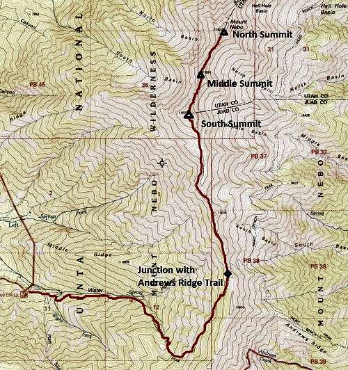
Route Description
The Willow Creek trail is a good alternate route to Mt. Nebo. It is pretty well defined and mantained, but it usually isn't a crowded trail. From the trailhead, follow the trail along Willow Creek. The trail eventually circles up a forested slope and around a huge natural ampitheater. The trail follows the ridge after the ampitheater and joins up with the Andrews Ridge Trail near timberline. This is a nice route, and the trail is pretty well defined.
It is a long day hike, especially if you plan on reaching the north summit, so some may want to camp one night. There are some small campsites on the ridge with good views. There is no water on the mountain after the snow melts, so carry plenty. There should be snowbanks near the timberline until early July in most years.
The elevation gain to get to the south summit is about 5200 feet.
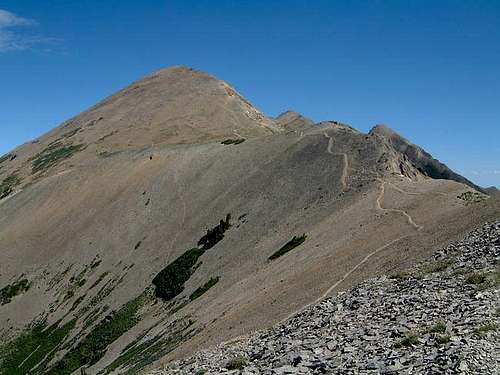 Looking east at the south summit.
Essential Gear
Take all the normal hiking gear. Consider taking an ice axe before late June.