
Viewing: 1-1 of 1

Burchey - May 23, 2013 6:47 pm - Hasn't voted
Nice workWe turned around on the Whitney glacier that day.
Viewing: 1-1 of 1
|
|
Trip Report |
|---|---|
|
|
41.41386°N / 122.17201°W |
|
|
May 18, 2013 |
|
|
Mountaineering |
|
|
Spring |
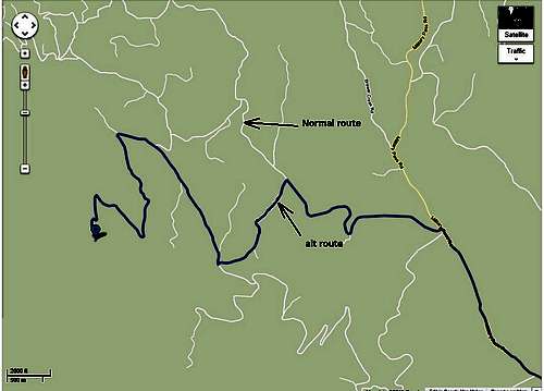
I planned the trip to start at the Brewer Creek Trailhead. I called the rangers ahead of time and they said I could not make it all of the way to the TH in my car due to snow. By the time we had arrived there that weekend, the snow was almost all of the way melted but fallen trees were blocking the road so it didn't matter anyways. We tried to take an alt route to the TH (the old Brewer Creek Road) but that had enough snow and fallen trees on it that we had to park the car and pack in to basecamp. Remember to get your permits and waste bags at the ranger station in McCloud (permit=$20/each, waste bags=free).
Parked car: 41.43410 -122.11640
From the parked car, we walked up the old Brewer Creek road, stepping over fallen trees, until we hit Gravel Wash. We followed the wash by staying on the east side of it all the way up to basecamp to 8500' elevation.
Basecamp: 41.42934 -122.15615
The wind was blowing slightly and we set the tent up in the trees to get some cover in case the wind picked up. The temperatures were nice...maybe in the high 40s during the day but cooled off at night in the high 20s. I planned for this location because it was close to the start of the route. We discussed when we should start the next morning and we decided to start climbing at 0430. This was a little late but with no moon to give us light and climbing in unfamiliar territory, I decided that it was appropriate. I wish now that we would have started earlier (such as 2:30) because it actually started to get light around 0500 and it would have been ideal to be on the glacier just as it started to get light.
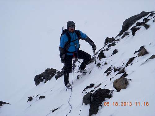
We worked our way up the mountain and we finally approached the start of the glacier. As the sun was rising above the horizon we roped up with me in the lead. The mountain then decided to "wake-up". This is what I wrote in my journal after the climb:
Difficult and exhausting but we summited at 1430 hours after 10 hours of brutal ascent climbing in terrible winter like weather with high winds and almost no visibility for most of the day with clouds and blowing snow. We were in crampons the entire day and carrying heavy gear. My buddy was really cramping a lot but it was difficult to eat enough and drink enough in the freezing, exhausting cold. Crevasses were common but we were completely roped-up and we fortunately didn't have issues. It was very steep and grueling in most places that really spent our energy. Once at the summit, we barely had enough energy to descend for 5 hours back to basecamp by 2000 hours. We didn't want to spend another night on the mountain so we packed up our gear and backpacked the 2 hours back to the car and then drove to a hotel in Susanville and finally arriving there at 0200 and getting to bed at 0300. I had been up for 24 hours by this time.
Below are the waypoints that I used. Verify these on Google Earth before you head-out.
41.42198-122.17051WP1
41.41940-122.18281WP2
41.41360-122.19206WP3
41.41497-122.19479WP4
41.41233-122.19641WP5
41.41112-122.19642WP6
41.40910-122.19485Actual summit
Bart posing on the Hotlum Glacier
Taking a break on the Hotlum Glacier
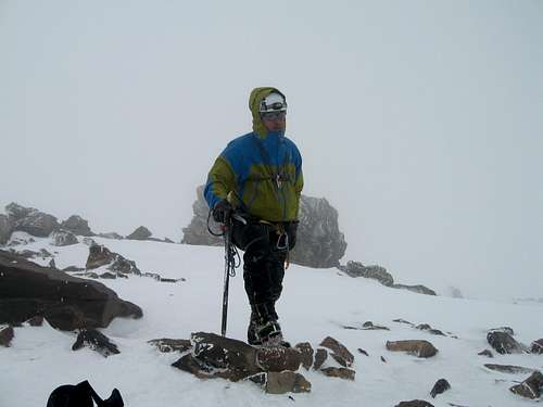
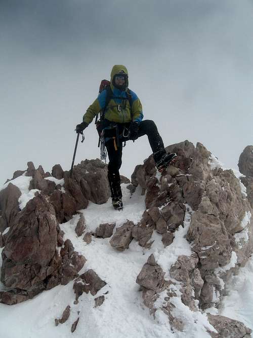
Rich glad to be on the summit!
Here's a short video clip of the conditions: https://www.youtube.com/watch?v=_Zc60KLzLJ0
We actually descended a different way down crossing over the Wintun Route and onto the Hotlum-Wintun glacier route with a bearing right for our basecamp. No crevasses on this glacier but still very, very steep in some places. Glissading was helpful in some areas.
If you have any questions regarding your upcoming trip, you can email me at xandish@hotmail.com! Good luck!
We turned around on the Whitney glacier that day.
Comments
Post a Comment