
|
|
Area/Range |
|---|---|
|
|
35.88196°N / 76.51287°E |
|
|
Hiking, Mountaineering, Trad Climbing, Big Wall, Mixed, Scrambling, Skiing |
|
|
Summer |
|
|
28251 ft / 8611 m |
|
|
Overview
The Karakoram, meaning 'Black rock' in Turkic, is one of the great ranges of Asia. The Nepalese Himalaya may have the highest number of 8000m peaks but the Karakoram has the world’s highest concentration of high peaks and some of the largest glaciers outside the Arctic poles. The range contains four 8000m peaks with another 30 rising above 7500m that receive few climbing expeditions compared to the Himalaya. The Karakoram is frequently known for the general K2 area but, as I hope this page illustrates, the range is vast with many areas which are equally breathtaking. It’s impossible for me to write about the Karakoram with the detail it deserves as there are just too many mountains and still so many parts that I have not properly explored. This page is intended as more of an overview and to inspire people to visit and explore the area for themselves.

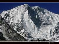
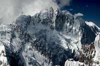
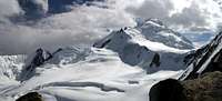
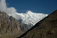
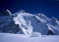
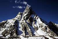
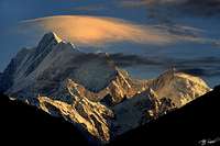
The Pumari Chhish massif
The Karakoram is an arid and inhospitable place but that is its very beauty. The topography often consists entirely of glacier, bare rock and mountain peaks. There are no tea houses, no pine or rhododendron forests, no remote hilltop villages, often only mountains and glaciers as far as the eye can see once away from the central valleys. These are mountains in their rawest form and some of the most impressive anywhere in the world. The Karakoram considerably less populated than the Himalaya further east. This is mainly due to its rugged, infertile topography and extensive glacial formations that make much of the range unsuitable for farming or grazing livestock. Despite the lack of habitat the range is considerably easier to visit than the Nepalese Himalaya with 7000m base camps accessible in less than a day from the Karakoram Highway, which bisects the Western half of the range. This means a trip to the Karakoram allows for more time in the high mountains and less time trekking in the foothills as in Nepal.
One of the big advantages of climbing in the Pakistani Karakoram is that there is minimal red tape compared to the Himalaya. The Pakistani side is very cheap to climb in provided you stay away from the 'restricted zones' close to border areas. Climbing below 6500m requires no paperwork and so long as you are in an open zone you are free to explore and climb whatever you choose. For me the Karakoram allows for a lot more spontaniety than other ranges where pre-planning is everything.
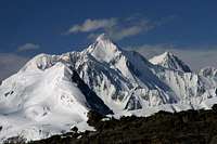
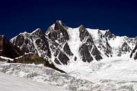
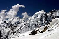
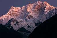
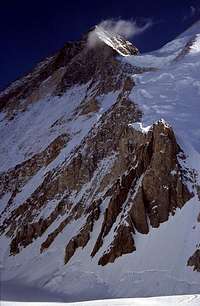
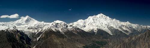
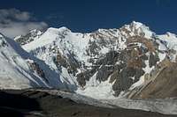
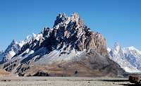
North Side of the Hispar Muztagh
It is rare to encounter other foreigners once into the mountains and even rarer to encounter other climbers. The majority of peaks have only a few ascents and many remain unclimbed. The number of visitors to the Karakoram is a fraction of that to the Himalaya but that is half the beauty as the region is unspoilt by tourism. Villages still maintain a traditional way of life and as a foreigner you will be shown a high degree of respect. Political tensions are a fraction of that in Nepal at present despite the general media portrayal that Pakistan is a dangerous place. Parts of Pakistan are dangerous but these places are not in the Karakoram.
Climbing and trekking are the most popular activities but there is excellent potential for white water rafting and kayaking, ski touring, hand-gliding and mountain biking. The flip side to this is that a greater self reliance is required than in Nepal as tourism is in its infancy.
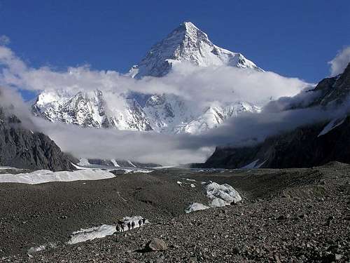
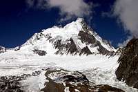
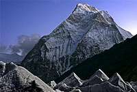
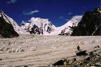
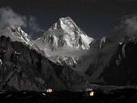
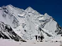
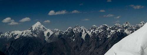
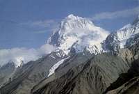
K2 from Concordia
Location, Location, Location
The Karakoram is located in Pakistan, India and China. The region forms part of the disputed territory between Pakistan and India that is generally refered to as Kashmir (the Kingdom of Kashmir encompassed what is today the Northern Areas, Ladakh, Aksai Chin and the Kashmir Valley prior to the breakup up British India). To make things worse the region directly north of the Karakoram on the Indian side, Aksai Chin, is also heavily disputed between India and China. Dispite the Karakoram appearing to be at the centre of a political hotspot waiting to explode at any minute the current situation is excellent and the area is quite safe to visit. Ties between India and Pakistan are better than they have been for a long time and China and India are slowly increasing ties.
The highest peaks are located at the centre of the range along the Pakistani-Chinese border and close to the Indian border. Nearly all climbers visit the Pakistani side because it is less bureaucratic and expensive than to visit the Chinese and Indian sides. Away from the central crest of the Karakoram most of the mountains fall on the southern side of the Chinese border. The range extends west to meet the Hinduraj and Hindukush ranges and also the Pamir in the Wakhan Corridor area to the north-west. North of the Karakoram is the Tibetan Plateau and above this the Kunlun range. South of the Karakoram is the Himalaya. The range southern borders are demarkated by the Gilgit, Indus and Shyok Rivers. Although often associated with the Himalayan range the Karakoram is a totally separate range that runs parallel without touching at any point.
The Karakoram was formed as a result of the ongoing collision between the Indian and Eurasian land masses some 50 million ears ago. The Indian landmass buckled and slid under Eurasia, which crumpled and heaved upward, forming the Karakoram. The Karakoram and Hindukush is actually a single continuous upthrust block that runs north of the main suture line between the Indian and Eurasian land masses. The Karakoram started to form after the Himalaya and considerably quicker resulting on its dense mountain topography. The suture line roughly corresponds with the Indus River with Nanga Parbat representing the prow of the Indian landmass and Rakaposhi the prow of the Eurasian land mass.
Structure
The Karakoram can be divided in to the Greater and Lesser Karakoram. Most of the high peaks are found in the Greater Karakoram, which forms the main crest line extending for over 300km in an approximate east-west direction. The Greater Karakoram is divided in to subranges termed Muztagh, which is the Turkic word for any great ice mountain. From west to east these Muztaghs are:
Batura Muztagh
Hispar Muztagh
Panmah Muztagh
Baltoro Muztagh
Siachen Muztagh
Rimo Muztgah
Saser Muztagh.
The former three fall in Indian controlled territory.
On the north side are the following subranges of the Lesser Karakoram:
Lupgar Mountains;
Ghuzherav Mountains (North and South);
Wesm Mountains;
North-East Rimo Mountains;
On the south side are the:
Naltar Mountains;
Rapaposhi-Haramosh Mountains;
Spantik Sosbun;
Mango Gusor Mountains;
Shimshak Mountains;
Masherbrum Mountains;
Saltoro Muntains;
and Kailas (South Saltoro) Mountains
Sections on the Greater and Lesser Karakorum are listed below. There are numerous high peaks located in the Lesser Karakoram and this part of the range can be just as spectacular. Masherbrum (7821m) and Rakaposhi (7788m) for example both fall in the Lesser range despite being collosal lands bulks.
The range can also be divided by general geographical location. The Western Karakoram includes the Batura Muztagh and Lupgar and Naltar Mountains, all of which are conveniently located west of the Karakoram highway. The Eastern Karakoram is located in Indian controlled territory. Everything in between is the Central Karakoram including the mountains on the Chinese side, the exception being the Ghuzherav Mountains which form the Northern Karakoram.
Climbing Conditions
Weather

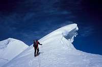
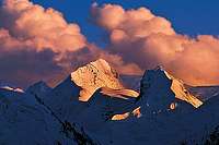
Karakoram in Summer!
The Karakoram has four distinct seasons: pleasant spring (March to May); a hot summer (June to mid-September); a cool autumn (mid-September to November); and a cold winter (December to February). The summer monsoon in the Bay of Bengal moves steadily westward usually reaching Pakistan by late June and continuing through to September. Being north of, and in the rain shadow of the Himalaya, the Karakoram receives little monsoonal rain and generally has a dry climate in the summer months. When the monsoon breaks in the down-country Pakistan, it’s usually stormy in the mountains too. A curious precipitation peak also occurs in late August. During mid-summer Gilgit (1494m) is usually around 40°C with the temperature dropping 6.2°C for each 1000m.
For many people visiting Pakistan's Northern Areas for the first time the warm summer's take time to adjust to. Even in the mountains the weather can still be uncomfortable at times. On days where there are no clouds a single layer will surfice and measures need to be taken to prevent sun burn. Weather can change quickly with fresh snow falling at any time in the year or heavy rains at lower altitudes. Come prepared for a range of climates.

Avalanche!
Snow and Ice Climbing Conditions
Nights are generally warmer during the climbing season compared to destinations such as the Pamir, Tien Shan or Napalese Himalaya and an early start when climbing is usually imperative to avoid soft snow in the afternoon. It is not unusual for there not to be a proper freeze at night leading to poor snow conditions under foot. At the top of the couloirs snow conditions can sometimes be particularly bad with hard, sugary ice beneath. The majority of the routes attempted in the Karakoram involve climbing ridges as these have less objective dangers. Only in Alaska are avalanches probably more regular making faces a dangerous place to climb unless perfect conditions prevail which is rarely the case.
When To Climb
The mountaineering season runs from June to September with July and August being the most popular months to climb in Pakistan. Outside these months snow can be problematic at high altitude. Late september/october is possibly better for some steep mixed routes where rock is poor as there will be more ice formation and less chance of rock fall. Bad weather can hit anytime of the year. Winters are severe in the Karakoram and anybody attempting a climb this year will hopefully have done their research.
Maciej Berbeka initially believed he had made the first winter ascent in the Karakoram of Broad Peak on March 6, 1988 however he later realised that he had only reached the foresummit and quickly pointed this out. When Berbeka reached the foresummit, a very strong wind blowing from the direction of the main summit drifted snow and prevented his seeing clearly where he was.
Rock Climbing
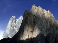
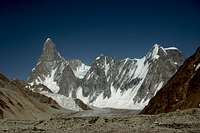
The big (Nangma Valley)...

...and the small
Rock climbing in the Karakoram can be world class or terrible depending where you go. Much of the range's rock is unfortunately poor quality but when it is good it is solid granite heaven.
The best spots are in the following areas:
• The Baltoro Glacier
• The Charakusa Valley
• The Nangma Valley
• East of Snow Lake
• The Kondus and Saltoro Valleys
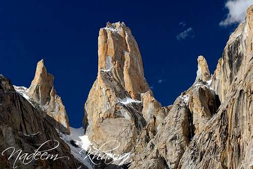
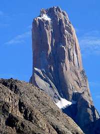
Baltistan contains most of the quality rock. At the Western end of the Baltoro Muztagh, north of the Baltoro Glacier the Trango Towers are the Karakoram's most most famous rock. In close proximity are other collosal spires such as the Cathedral Towers, Uli Biaho and Shipton Spire.
The other Karakoram hotspot is the Charakusa and Nangma Valleys in the Masherbrum Musztagh which are big wall heaven. The Nangma Valley is home to Amin Brakk, the Great Tower (5800m). The Charakusa Glacier is also excellent with K7 being the most famous. These valleys have received a lot of climbers in the last ten years or so and there are already various 'classic' lines. New routes are being put up every year in these latter areas.
Much of the good rock in Central-Eastern Baltistan is off-limits due to the proximity of the line of control between India and Pakistan. Big walls in the Kondus and Saltoro valleys rival Baltoro yet receive vitually no visiters due to being in a 'closed' zone. An expedition managed to visit the valleys in 2000 and officials can only say 'no' to an application.
Elsewhere there is sporadically good rock. Lady Finger above Hunza is excellent rock. The rock on Pumari Chhish South was also found to be excellent quality.
The Karakoram isn't ALL about big walls. There is some excellent granite right above Karimabad on route to Ultar meadow for example. A friend of mine put up an E2 route here and no doubt there are other potential lines. Bouldering has also yet to be exploited and I have seen some good boulder fields west of Skardu on the main road and in the Lupgar valley. No doubt there are numerous other places.
 Nameless Trango
Getting There
Travel to the Northern Areas
Islamabad is the nearest international airport with flights arriving from around the world. Gilgit is the largest town in the Northern Areas served by regular transport from the north and south.
Domestic flights
PIA fly daily between Islamabad and Gilgit tickets can either be booked via their ticket offices or via their website. One-way fairs are currently Rs1590 with little discount for return trips. During bad weather planes may be grounded at short notice. Availablity is also a big problem. There are also daily flights to Skardu which operate a higher percentage of the time.

The KKH near Passu
The Karakoram Highway
Despite much of the mountain range's remoteness many high peaks have become relatively easy to access due to the Karakoram Highway (or KKH) besecting it north to south. The highway links Pakistan with China and is the highest paved international road in the world. It's highest point is the Khunjerab Pass which straddles the Pakistani-Chinese border.
The KKH runs approximately 1300km from Kashgar, a city in the Xinjiang region of China, to Havelian, located in the Abbottabad District of Pakistan. An extension of the highway meets the Grand Trunk Road at Hasan Abdal, west of Islamabad, Pakistan.
Buses
Buses ply the KKH daily between Rawalpindi's Pir Wadhai bus station and Gilgit, and vice versa. Buses leave throughout the afternoon and arrive mid-morning next day. Book tickets in advance if poosible to avoid a bone jarring, sleepless ride on the back seat. Travel along the KKH is anything but predictable and landslides, mudslides, rock fall and even avalanches can sever it for hours, days or weeks at a time. Due to Tribal tensions in the Kohistan buses were travelling in convoy for a significant stretch of the journey further lengthening an already long journey. NATCO and Masherbrum both run buses daily with a limited number of seats available at student discount.

Flat tire just below the Khunjerab Pass on the Pakistani side
The Northern Areas can also be reached from China with the trip from Kashgar to Sost taking 2 nights with an overnight stop in Tashkurgan. Hi-Ace vans travel between Sost and Gilgit throughout the day leaving as soon as they are full. There is now a direct bus between Tashkurgan and Gilgit, however, if travelling from China, it is better to buy a ticket to Sost only then take local transport to Gilgit as the international bus sits in the customs yard at Sost for a couple of hours while luggage is checked before continuing to Gilgit. The Chinese side of the KKH (called the "Sino-Pakistani Highway" by the Chinese" has been a distaster area for the last couple of years due to roadworks. Rather than repair small sections of road at a time as most countries do, the Chinese labour force likes to dig up great strectes. The journey to the border therefore means a lot of off-road travel. The road works has unfortunately causedsignificant soil errosion either side of the road that will be irreversable.
Cycling
This is an excellent way to travel along the KKH and detour to nearby villages. The Chinese currently don't allow cyclists to cross the border so you'll need to take to international bus between Sost and Tashkurgan.
Pakistan 1999: Cycling the Karakoram Highway
From Chitral
Vehicles leave Chitral (in the Hindukush) for Gilgit at least once a week, the journey taking about 16 hours by Land Cruiser. The road crosses the Shandur Pass (3,734m/12,251ft), which is passable for an even shorter period than the Lowari Pass. Otherwise Private Landcruisers can be hired for the journey which allows you to plan your own itinerary.
The Chinese Side
The general gateway to the Karakoram on the Chinese side is Kashgar - although don't expect to be able to see the range from your hotel window! The range is a long way south by Jeep and trekking. Kashgar has daily flights to Urumqi to the east which is itself connected to major cities in China (as well as a few international cities). Else there is the 24 hour Urumqi-Kashgar train and bus journeys that also run daily. Kashgar is also easy to reach from Kyrgyzstan.
From Kashgar travel to Yecheng 260km east. From here the road south, closer to the Karakoram begins. This road eventually leads to Ali, close to Mount Kailash. There is some good info about reaching the range on the Chinese side on the Crown Peak page. I'll add more general details with time however I have not climbed on the Chinese side so have no personal experience. Ultimately you will not be travelling independently anyway due to the area being in a closed zone and therefore a travel agent will be responsible for the logistics of getting you to the mountain.
Red Tape
Pakistan
Visas
A valid visa is required. Visas are NOT issued at the airport and must be obtained prior to arrival. Some embassies such as those in Central Asia are reluctant to issue visas and advise you to obtain them from your home country. A single-entry tourist visa is valid for 3 months from the date of arrival in pakistan and for 6 months from the date of issue. Some visas are only valid for 3 months from the date of issue so check if necessary when applying. Visa prices vary. Americans pay the most for their visa whilst Japanese get theirs free! Visa extensions and reentry stamps used to almost impossible to obtain however the process has become remarkably easier in the last few years. Gilgit DC is a good place to try.
Climbing Royalties
The Ministry of Tourism has decided to maintain the 50% reduction in mountaineering royalty fees for peaks above 6500m during 2009. Royalties per expedition are based on a party of 7. Persons additional to this number will be subject to an additional royalty fee. Current royalties are listed below.
| Elevation | Normal Fee | Fee for 2009 | ||
| Expedition Royalty | Additional royalty per person | Expedition Royalty | Additional royalty per person | |
| K2 | $12000 | $2000 | $6000 | $1000 |
| All other 8000m peaks | $9000 | $1500 | $4500 | $750 |
| 7501 - 8000m | $4000 | $500 | $2000 | $250 |
| 7001 - 7500m | $2500 | $400 | $1250 | $200 |
| 6501 - 7000m | $1400 | $200 | $700 | $100 |
| Up to 6500m | $1400 | $200 | No fee | No fee |
For peaks below 6500m no royal fee is currently payable for 2008. Prior to the discounted royalty fees all peaks between 6000 and 7000m were subject to a $1500 royal fee with additonal royalties of $200 per additonal member.
Royalties for peaks in the Gilgit Region are currently reduced to 10% although Spantik is excluded. The Gilgit distict is bounded by the Wakhan Corridor in the North, Xinjiang (China) in the North and Northeast, and Skardu in the South and Southeast. The district includes Gilgit town, Naltar, Hunza, Gojal (Upper Hunza) and Shimshal.
| Elevation | Normal Fee | Fee for 2009 | ||
| Expedition Royalty | Additional royalty per person | Expedition Royalty | Additional royalty per person | |
| 7501 - 8000m | $4000 | $500 | $400 | $50 |
| 7001 - 7500m | $2500 | $400 | $250 | $40 |
| 6501 - 7000m | $1400 | $200 | $140 | $10 |
| Up to 6500m | $1400 | $200 | No fee | No fee |
A liaison officer is not required for the Gilgit region but is required for the Skardu region (ie Baltoro). The liaison officer (usually an army officer) needs fully equipping despite the fact that he will not go above BC, will mostly play cards with the other LOs and will probably leave BC ahead of you. Oh, and he will likely try to sell everything you've bought for him back to you at the end of the trip! The only real benefit that a LO brings to an expedition is that they can usually arrange an emergency helicopter (via the army) if required. Now that the LO is no longer required for Gilgit hopefully this will extend to the Skardu area at some point. In my experience the LO rule discourages people from climbing in the high peaks in the Karakoram which ultimately means less employment for local porters, cooks, guides, etc.
Restricted Zones
Restricted zones are areas relatively close to border areas (ie India, China and Afghanistan). In order to visit these areas a permit must be purchased from the Ministry of Tourism ($50 per person), a licensed guide hired, and a personal accident insurance policy taken out for the guide(s) and porters. The guide is required for the duration even though he will do little once at base. There are climbing guides in Pakistan however few are any good by Western standards (this is probably the wrong mountain to be climbing anyway if you require a guided ascent). One member must attend a mandatory briefing and debriefing at the Ministry of Tourism in Islamabad although many skip the debriefing. Most people use a trekking company in Pakistan who will provide a licensed guide, deal with bureaucracies and make all arrangements.
The above requirements are only for foreigners. Pakistanis who are not from the Northern Areas can easily visit these areas without a permit.
A list of open and restricted zones can be found here
Closed zones
Areas directly buffering the border are generally closed to tourism although the odd climbng permit has been issued when the political climate dictates.
China
The Chinese side is more expensive and more bureaucratic than the Pakistani side to visit. Peak fees for the peaks in the Karakoram are listed below.
| Height | Fee |
| 8000m Peaks | $1760 |
| 7000m Peaks | $1080 |
| 6000m Peaks | $700 |
| Under 6000m | $30 per climber |
The above are for a maximum 11 members. For a group of more than 11 members (including high altitude porters from a third country), the registration fee for each extra member is 10% of the registration fee.
A special registration fee shall be charged for the first ascent of any virgin or newly-opened peak in China. The rates are as follows:
| Height | Fee |
| 7000m Peaks | $1500 - 10000 |
| 6000m Peaks | $1000 - 5000 |
The Karakoram is in a 'closed' part of China meaning that you will need to apply for a permit to visit and will have to sign on to a tour to get this which will significantly increase costs. The scale of the tour partly depends on your negociating skills. For K2 costs are generally about 50% higher on the Chinese side. Those wishing to obtain a permit should email the Chinese Mountaineering Association (CMA) (cma@sport.gov.cn). Expect a reply in 1-2 weeks. Kong Baocun (climbing@126.com) of the Chinese Xinjiang Mountaineering Association (CXMA) may also be able to help and is usually prompt at replying to emails.
India
Visas
Indian visas are very easy to obtain and for many nationalities are for 6 months and multiple entry. Time of issue varies from same day to a week depending on the embassy.
Climbing Regulations
Climbing from the Indian side is extremely bureaucratic. 198 peaks are open but it seems quite possible to obtain a permit for a peak which is not on the list, provided it is not in a security area.
All peaks in the Eastern Karakoram attract a $4000 peak fee!
The fee is for a party not exceeding 8 foreign members. An additional peak may usually be added to the permit either in advance or with the approval of the LO for 50% of the normal fee. All applications should be to the Indian Mountaineering Foundation (IMF). Climbers should apply at least three months in advance since the applications have to be processed through two Departments of the Government of India. There is a standard application form obtainable free of charge from IMF. Any change in personnel of an expedition (except simply deletion of a name) has to be put to the Government with consequent delay of at least six weeks. Obtaining permission is at the discretion of the authorities and will depend on sensitive the area you plan to climb in is along with the current political situation. Peak fees must be paid within two months of provisional approval being received.
Expeditions to the Eastern Karakoram must include Indian mountaineers
In joint expeditions, out of maximum 16, 8 must be Indians. Minimum three foreigners and three Indians are needed to form a joint expedition. This may sound insane but it is how it is.
Each expedition is required to take a Liaison Officer
This is usually an army officer. There is no charge for the LO but his food, accommodation and transport must be paid and a porter-cum-cook arranged for him from roadhead. Liaison Officer equipment will be provided by the IMF at a cost of $500 to the expedition (it may be compulsory to equip the LO through the IMF). In reality the only equipment that the LO will need are some books to read while you are climbing as he will not go above BC.
Also...
A licence must be obtained for walkie-talkies (it will be sent by IMF along with the peak application form). However the IMF now offers Walkie-Talkies on hire, subject to availability (Priority for remote areas).
Charges are:
4 sets for 4 weeks: $200
Extra per set per week: $10
Security deposit per set: $450
Organising an Expedition to the Pakistani Karakoram

Porters above the Hispar Glacier
This can either be done independently or with the help of a Pakistani-based company. When climbing in a restricted zone a Pakistani trekking company is nearly always used (see red tape). Where this is not the case it is quite easy to organise things independently. Local porters usually know the trails well meaning a local guide is rarely essential. Porters are easy to hire at trailheads at short notice and keen to be employed. Tell your driver that you are looking for porters before you arrive at the trailhead and they will usually know who to speak to in the village on your behalf, else ask at a village guesthouse. Some villages have a porter rotation system so that everybody gets a piece of the cake. It’s essential to agree prior the number of stages, the rate per stage and any extra allowances that the porters may request, such as equipment allowance. Having made reached base camp porters can easily be arranged to return on a predetermined date. The degree of English spoken varies widely from perfect English to none at all. Somebody is usually always on hand to translate I’ve found.

Gear!
Jeeps to trailheads are also easy to organise in most large settlements in the Northern Area at no notice. Karimabad in particular has numerous Jeeps for hire. A small amount of bargaining is sometimes needed as is the culture but the people tend to be fairly honest in this part of the world and hard bargaining isn’t the norm.
Suitable food is easy to come by in Gilgit, Aliabad, Karimabad and Skardu and kerosene is readily available everywhere down to small villages. The kerosene is not very clean and needs straining before use. A decent multifuel stove will be required to burn it properly such as a Dragonfly or XGK for example. Gas canisters can also be found in Gilgit, Karimabad and Skardu although supply may not be enough for a large-scale expedition. I use kerosene at base camp as it is very cheap and easy to acquire, and then use gas when climbing.
Local trekking companies remove the above responsibilities and also deal with any red tape for you such as acquiring peak permits. They can also provide trekking guides and cooks who are generally of a high standard. If you need high altitude porters which are in shorter supply than regular porters then a good company will definately be of help in finding these as this is not sherpa land. If you’re looking for a climbing guide then you are best using an international tour operator (see External Links section) although this will limit your climbing options severely to the usual regularly climbed peaks and will make things very expensive. Local climbing guides exist in Pakistan but unfortunately many are not up to Western Standards in my experience with often insufficient knowledge of crevasse rescue techniques and poor rope work. There are some good Shimshali guides. This isn’t Nepal though and it pays to be self sufficient in the Karakoram.
There is some good general info about putting together an expediton here
Is Everything Hard to Climb in the Karakoram?
No! Although there is less easy stuff compared to the Himalaya in my experience. Some fairly easy peaks to climb that could be compared to the 'trekking peaks' in Nepal are:
Climbing Yazghil Sar

Peaks on the S Side of Hispar Glacier
Sonia Peak, 6300m (North Ghuzherav Mountains, Shimshal)
Yazghil Sar, 5964m (North side of the Hispar subrange close to Shimshal)
Mingulig Sar, c.6000m (South Ghuzherav Mountains, Shimshal)
Spantik, 7027m (Easiest 7000m peak in the Karakoram)
Boe Sar, c.5700m, 900m, 35 degrees maximum incline, Alpine F (Near the Boesum Pass, South Ghuzherav Mountains, Shimshal)
Shar Izat Peak, c.5700m, 45 degrees, Alpine PD (also near the Boesum Pass)
Sheltar Peak, 5982m (Between the Bualtar and Barpu Glaciers, Nagar)
Workman Peak, 5885m (Snow Lake)
Mid-5000m peaks near the Nushik La on the south side of the Hispar Glacier
Gondogoro Peak, 5700m (Gondogoro Valley, Baltistan)
These are just suggestions of my own and not a definitive list. If anybody else has suggestions let me know please. Likewise, anybody who wants more info please PM me.
Besides Spantik, easy 7000m+ peaks are hard to come by. Diran is probably the Karakoram’s second easiest 7000m+ peak but it can be dangerous due to avalanche. Rakaposhi’s SW Spur is not technically difficult but very long. Gasherbrum II is the Karakoram’s easiest 8000er followed by Broad Peak, both of which are popular with commercial expeditions (see external links). Gasherbrum I is harder with K2 widely considered to be the hardest 8000m peak out of all fourteen. Overall the success rate in the Karakoram is significantly lower than in the Himalaya (see Climbing Conditions for an explanation).
For those looking for the toughest challenge look no further than the Karakoram! Some of the toughest big climbs belong here: Kunyang Chhish East, Ultar, the Ogre, Gasherbrum IV… the list is endless! Of course to make things harder you could also try a winter ascent although I know of no successful winter ascents on a major Karakoram peak as the conditions are guaranteed to be desperate.
Regions of the Karakoram
Gilgit
The Gilgit region as far as permits are concerned actually encompasses everything to the north as far as the Chinese border and East as far as the Skardu region, which constitutes Baltistan.
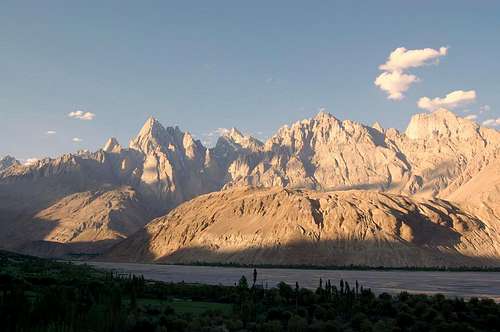
Hunza & Nagar
The Hunza and Nagar valeys are one of the most beautiful spots in Northern Pakistan. Hunza is located to the west side of the Hunza river with the east side constituting Nagir. Hunza is historically Ismaili whereas Nagir is Shia. The KKH passes through Hunza. The Jeep track to Nagar starts a short distance north of Ganish, the oldest setlement in Hunza.
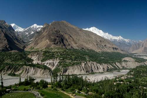 The Hunza Valley
Gojal
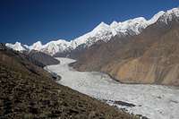
Located north of Hunza and extends all the way to the Chinese border. Contains some of the Northern Areas finest scenery including the Hispar and Batura Muztagh. Glaciers such as the Passu Glacier flow almost down to the Karakoram highway. Regions such as Shimshal and Chapursan make for fabulous excursions from the KKH.
Shimshal
Shimshal forms the Eastern part of the Gojal region and contains some of the most remote areas of the Karakoram that are rarely visited.

View towards the Lupgar Pir Pass
Chapursan
The area of Chapursan is located in the far north of Pakistan’s Karakoram, close to the Afghan border. It is on the south side of Afghanistan’s Wakhan corridor from where the Tajik Pamir rises to the north side. While the area is technically the Karakoram the transition to Pamir is evident as the densely packed aggressively angled peaks giving way to rolling mountains and broad grazing pastures.
Baltistan
Home to Pakistan's highest peaks and longest glaciers. Much of the region is also extremely remote and inhospitable. Permits are often required to visit the most famous parts such as Baltoro, Biofo, Concordia and Gondogoro. Eastern Baltistan is famed for its huge granite towers, many of which remain unclimbed. The likes of Siachen, the longest glacier outside the Arctis Poles and the Saltoro Valley are currently firmly out-of-bunds for climbers due to their close proximity to India.
Logistical Centers

Gilgit from the KKH
Gilgit
Gilgit sits adjacent to the Karakoram Highway and is the largest town in the Northern Areas. It is still a town with a relatively relaxed pace of life. The town is well served by public transport and is the best place to stock up on camp food. The bus station is to the West of the town. Public transport in Gilgit is in the form of small Suzuki wagons. Suzuki No. 1 runs between the bus station and the centre. Taxis are also cheap if you have a lot of equipment.
There are a couple of outdoor shops selling second hand equipment but it is recommended that you bring all equipment from home as the choice and quality is poor and prices are not great.
There is good accommodation with the Madina Guesthouse being the central traveller haunt and one of my favourite places to stay wanywhere. Those looking for more luxery should check out the Serina Hotel. The hotel also does excellent buffets for around Rs450 which are good for replenishing strength lost during climbing. No.2 Suzukis running from the central bazaar and along airport road terminate at the hotel.
Sporadic sectarian violence flares up in Gilgit so check the current situation although don't be too paranoid about it.

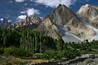
Karimabad
Karimabad
Capital of Hunza. Popular with tourists because its laid back atmosphere combined with awesome vistas of surrounding 7000m peaks which include Rakaposhi, Diran, Spantik and Ultar. There is an excellent range of guesthouse’s and hotels in Karimabad and plenty of shops with trekking food and gas/kerosene. Either before or after and trek or climb it is an excellent spot for some R&R.
Karimabad is just off the KKH but is easy to reach with regular transport from Gilgit and Aliabad. It is an excellent base for visits to the South side of the Batura Muztagh, the Hispar Glacier, or the numerous beautiful valleys in Hunza and Nagar. There are plenty of Jeeps for hire and onward travel is easy.
Aliabad
Located below Karimabad on the KKH. It's possible to kit yourself out for an expedition in Aliabad although the town is nowhere near as attractive as Karimabad and accommodation options are poor in comparison. HiAce minibuses stop here on route between Gilgit and Sost. There’s regular transport for the short trip up hill to Karimabad meaning few linger.
Passu
Passu is one of the most pleasant villages on the Karakoram Highway with plenty of accommodation and good short and longer treks nearby. The nearby giant suspension bridges across the Hunza River are worth checking out and can be done via a short trek to nearby Hussainabad. A day walk to the Yunz Valley is also highly recommended. For longer treks, the Batura Glacier is one of the longest and most dramatic in Pakistan and requires no red tape to visit. Passu is also the jumping off point to for travel to Shimshal, the largest Wakhi settlement not on the KKH.
There are a couple of small shops that sell basics such as pasta, porridge, biscuits, etc, (but no chocolate), however don't expect the same variety as in Aliabad, Karimabad or Gilgit.
 Passu |
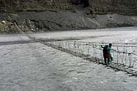 Bridge near Passu |
 Passu Wall |
Sost

Sost
Last town before the Karakoram highway crosses in to China. Not many people hang around Sost for more than one night. There are enough shops to buy food however you won't find any gas. Kerosene is available. Plenty of hotels of mixed quality. Restaurants have extensive menus but cannot prepare anything on them!

Skardu
Skardu
Skardu is the starting point for trips to the mountains of Baltistan, or to the Daosai planes to the South . It’s not the most attractive town in the Northern Areas and most people pas through fairly quickly. There are enough shops for buying food and kerosene, and a number of shops in the bazaar sell gas and ex-expedition clothes and equipment but not at bargain prices. Bring all equipment from home as what you do find is often poor quality.
Skardu has a small airport with daily flights between Islamabad. Daily buses travel to and from Gilgit although the scenery does not match that of the Karakoram Highway.
Kashgar
Starting point for trips to the Karakoram on the Chinese side. You can get everything in Kashgar and there is good accomodation to boot.
The Muztaghs of the Greater Karakoram (West to East)
The Pakistani Side
The Batura Muztagh
This is the Karakoram's Western-most subrange beyond which lies the Hindu Raj and Hindukush. The Batura Muztagh is easy to get to since the Karakoram highway skirts the Batura Muztagh directly to the east. Peaks such as Shispare (7611m) and Passu Sar (7476m) are visible from the road near Passu and the likes of Ultar Peak rise abve Karimabad. The close proximity of the Muztagh to the civilisation is exemplified by the Gulkin Glacier which descends all the way to the Karakoram Highway from the east side of Shispare and Ghenta (7100m) requiring road workers to hack a gap in it annually to allow traffic to pass through.
 Lady Finger & Hunza Peak |
 Bojohaghur Duansir & Ultar Sar |
 Shispare (7611m) |
 Gulmit Tower (5810m) |
The Batura Muztagh contains some of the Karakoram's highest peaks outside the Baltoro region and some of the most impressive. Of particular note are the huge, dramatic ice flows that descend the Batura north faces. The Passu Massif and Batura Wall constitute the heart of the Muztagh. These are densely packed along the southern side of the Batura Glacier, the fourth longest in Pakistan - although there have not been many ascents from the north. Only Batura III (7729m) has been climbed from the North. Other Batura peaks have been climbed from the Muchuhar and Baltar Glaciers to the south. Batura II (7762m) and Muchu Chhish (7453m) both remain unclimbed. The former is the Karakoram's highest unclimbed peak despite a number of attempts in recent years. Batura I (7784m) is perhaps the modern day 'Killer Mountain' (not Nanga Parbat) as it has taken a number of lives on both the north and south faces. Kuk Sar I (6943m) and II (6925m, unclimbed) at the Western end of the Muztagh are some of the most impressive in all the Karakoram.
The Batura Wall
 South face of Batura I (7795m)
The Passu Massif
 SW Face of Passu Main (7478m) |
 West Face of Passu East (7295m) |
Peak to the South of the Batura Wall
 Sangemarmar Sar (7050m) |
 Hachindar Chhish (7163m) |
 Gutum Talji (6080m, left) and the Pute Towers (5870m, right) |
Peaks at the Western End of the Batura Muztagh
 Kampir Dior (7168m) |
 Pamri Sar (7016m) |
 Kuk Sar II (6925m) |
 West Face of Sani Pakkush (6952m) |
Minor Peak at the South-Western end of Batura Muztagh
 Sath Marau Tower (5967m) |
 Swat Maras (6005m) |
 Kuti Pokush (5750m) |
 NE side of Purian Sar (6293m) |
 Koran Peak (c.5900m) |
SP Pages
Batura I (7795m)
Ultar II (7388m)
Hachinder Chhish (7163m)
Pute Tower IIIm (5870m)
Gutum-talji (5220m)
Point 6315m (6315m)
External Links
Excellent topos/information on the Batura Muztagh (in Polish)
Photos from the 1990 Swedish Batura I expedition
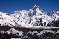
The Hispar Muztagh
The Hispar Muztagh contains some of the highest peaks in the Karakoram away from the general Concordia region. Distaghil Sar (7882m) is the highest peak west of K2. Unlike Concordia this region does not share close proximity with the Chinese border and therefore not in a 'restricted area' requiring permits to visit. Whereas the Karakoram's 8000m peaks receive annual attempts, high peaks in the Hispar Muztagh have only each been climbed a hand full of times each. Scenary and mountain grandeur are also a match for anywhere else in the Karakoram. To the north of the range is Shimshal, home to some of the friendliest people in the Karakoram - and some of the best local climbers. To the south is the Hispar glacier, one of the largest in Pakistan. Many of the peaks are easily accessible from the glaciers extending south from the Passu-Shimshal road or north from the Hispar Glacier itself. More challenging approach routes exist via the glaciers east of Shimshal. Besides Distighil Sar there are numerous other 7000m in close promimitysuch as the Kunyang Chhish peaks, the Pumari Chhish Peaks, and Trivor to name a few.
The Central Peaks of the Hispar Muztagh
 Momhil Sar (7343) |
 Trivor (7720m) |
 Bularung Sar (7200m) |
 North Face of Distaghil Sar (7885m) |
 Kunyang Chhish (7852m) |
 Kunyang Chhish East (7400m) |
 Yazghil Domes |
Pumari Chhish |
 Yukshin Gardan Sar (7530m) |
 Kanjut Sar (7760m) |
 Kanjut Sar 2 (6831m) |
 Tahu Ratum W (6651m) |
Peaks to the North of the Main Chain
 North Ridge of Shimshal Whitehorn (6303m) |
 Summit of Shifkiten Sar (ca 5700m) |
 West face of Yazghil Sar (5964m) |
Peaks to the South of the Main Chain
 South Face of Faloling Chhish (6140m) |
 Khani Bassa Sar (6441m) |
 Hispar Sar (6400m) |
SP Pages
Kunyang Chhish East (7421m)
Khani Basa Sar (6441m)
Shimshal Whitehorn (6303m)
Yazghil Sar (5964m) + Trip Report
Faloling Chhish (6140m)
External Links
Blank on the Map - Hispar Muztagh
First ascent by Bularung Sar
Kunyang Chhish East trip reports
First Ascent of Pumari Chhish South (7350m)
Panmah Muztagh
Loacted on the Western border of Baltistan much of the Panmah Muztagh is made up of steep rock towers. The most famous and highest is Baintha Brakk (7285m), aka the Ogre, made famous by the epic British expedition in which Doug Scott broke both ankles following the first rapple from the summit. Later, partner Chris Bonington broke two ribs and contracted pneumonia. The pair descended in terrible weather. By the time the climbers stumbled back to base camp, with Scott crawling the entire way, they found that their support team had left. Their rescue took ten days, and 24 years and 25 failed attempts passed before anyone summited The Ogre again. Their summit is one of the great stories of the Karakoram.
Other notable peaks in the range include Latok I (Central), II (West) and III (East).
 The Ogre (7310m)
 SW Face of Latok II (7108m) |
 Latok III (6946m) |
 Marpho Goro Towers |
SP Pages
Latok IV (6456 m)
Lukpilla Brakk (5380m)
The Baltoro Muztagh
The Baltoro Muztagh lies at the heart of the Karakoram close to the Indian border and contains some of the range's greatest scenary and four 8000m peaks including K2. Unfortunately it is in a 'restricted zone' (see 'red tape') meaning it is more expensive to visit than areas further West.
Baltoro Muztagh follows the Chinese border for its entirity with the Baltoro Glacier running parallel on the south side for much of its length. This is the second largest glacier in the Karakoram. In the West of the range are some of the Karakoram's most famous big walls such Great Trango (6286m), Nameless Tower (6239m) and Uli Biaho (6109m). These huge granite faces attract climbers to their valleys on an annual basis. Nearby Muztagh Tower (7284m) ranks as one of the most impressive peaks in the whole Karakoram.
 The Trango Towers
 Payu Peak (6610m) |
 Uli Biaho |
 F. Trango Tower (5763m) |
 Great Trango Tower (6286m) |
 Nameless Tower |
 Cathedral Tower (5828m) |
 Muztagh Tower (7273m) |
External Links
Mike Searle photos Taken while attempting Biale
Shipton Spire by Mauro Bole
Women and Chalk; Mauro "Bubu" Bole's new route on the Shipton Spire Including individual pitch grades
Shipton Spire "Ship of Fools" by Mark Synnott
Shipton Spire East Face Routes Excellent overview of routes
Alpinist.com - Shipton Spire: Ascents and Attempts
Shipton Spire: "Inshallah" Route by Lizzy Scully
Shipton Spire 2004 Slovak expedition report
Shipton Spire Karakoram 2004 Photos
Karakoram Trifecta Ascents of Cat's Ear Spire, Hainabrakk East and Shipton Spire by Jonathan Copp and Michael Pennings
Trick of the Light 2001 AAJ report of above climbs by Jonathan Copp and Michael Pennings
Hainabrakk East Tower Topo of routes
Hainabrakk East Tower - Mystical Demno In Polish but some excellent photos
Spectacular Cat's Ear Spire Climbed: By Dougald MacDonald Report of 2nd Ascent
Uli Biaho new route by Kopold and Cmarik
Alpinist.com - The Flame: First Ascent, and Shipton Spire, The Khanadan Buttress, New Route by Josh Wharton
Alpinist.com - Great Trango Tower, Hainabrakk East Tower and Shipton Spire: Various Activity
Alpinist.com - Trango Towers Group: Various Ascents
Dodo Kopold on Assalam Alaikum, a New Route on Great Trango
Great Trango Tower "Brave New Worlds" route By Mark Synnott
Great Trango Tower by Xaver Bongard
Alpinist.com - Great Trango Tower, Northwest Face Including topo of routes
Just Climbing - The first ascent of Great Trango Tower's southwest ridge By Kelly Cordes
Alpinist.com - Trango Tower: First All Female Ascent
On the Big Stones - John Middendorf: the Dean of Big Wall Climbing
South Africans take Trango Tower Ascent of Nameless Tower via the Slovenian route
SA Trango Tower Expedition Official page
Todd Skinner - Nameless Tower
Trango Nameless Tower 6239m Topo of routes
The Northern Baltoro Muztagh
At the heart of the Baltoro Muztagh is K2, the second highest mountain in the world but arguably the hardest 8000er. The peak dominates the entire region casting in to shadow nearby many of its mighty neighbours. South of K2 flows the Godwin Austin Glacier which meets the Baltoro and Upper Baltoro Glaciers at a glacial crossroads known as Concordia. This is a magnificent spot that has attracted trekkers for decades who rarely leave disappointed.
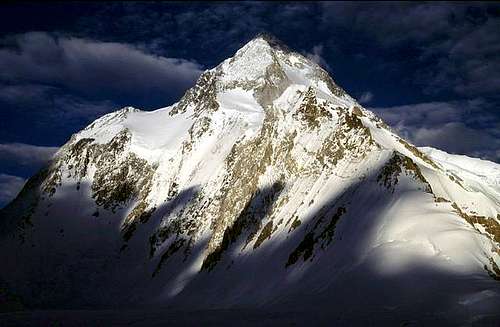
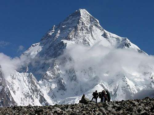 K2 (8611m)
Besides K2 there are many high mountains that are rarely attempted. Chongtar Kangri (7330m), located 8km west of K2, is the highest peak in the Karakoram north of the Chinese border. In 1994 a largely Austrian team climbed the north peak (7250m) and the main summit, but the south summit (7180m) remains unclimbed. A failed attempt on the main summit had previously been made in 1985 by an American team.
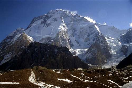 Broad Peak (8047m)
 Angel Peak (6858m) immediately West of K2 |
 Praqpa Ri (7156m) & Skil Brum (7360m) |
 Marble Peak (6256m) |
Savoia Kangri (7286m) is located immediately SW of K2 and is one of the highest unclimbed peaks in the Karakoram despite a number of attempts. A Scottish team led by Ruaridh Pringle made two attempts in 1998, reaching 7000m on the first attempt before retreating due to deep, unstable snow. Paul Schwitzer and Nick Bullock made three attempts in 2006 but all failed.
Skil Brum (7360m), immediately south-west of Savoia Kangri, was first climbed in 1957 by Fritz Wintersteller and Marcus Schmuck after their ascent of Broad Peak. Starting from Broad Peak’s BC (4950m), they camped at 6060m, made the summit the next day, then camped again at 6060m, and then returned to base camp the next morning. The whole ascent, from base camp to base camp was done in 53 hours, a startlingly short time for a major Himalayan ascent in that era.
External Links
Echoes by Nick Bullock – Savoia Kangri 2006 trip report
The Eastern Baltoro Muztagh
The Eastern Baltoro Muztagh is those peaks east of the Godwin Austen Glacier. This includes Broad Peak and the Gasherbrums which demarcate the border between Pakistan and China. Nearly all climbers approach from the Pakistani side due to less bureaucracy and easier routes of ascent to the main peaks. The mountains east of the Gasherbrums are still sometimes called, for geographical and political reasons, the “blank on the map” since the first expedition of Francis Edward Younghusband in 1887. Since Eric Shipton visited the area in 1937 few have returned. Rather than being called the Baltoro Muztagh the Chinese peaks are commonly called the Aghil Mountains although geographically they are the same sub-range.
Broad Peak is the third highest peak in the Karakoram after K2 and GI. As the name suggests, the peak is very broad from north to south and contains three sub-peaks (North, 7387m; Central, 8006m; and South-West, 7721m) in addition to the main summit (8051m). The main summit was first climbed by an Austrian expedition in 1957 via the West Flank which climbs from the Godwin Austen Glacier. Marcus Schmuck and Fritz Wintersteller reached the summit first followed by Kurt Diemberger and Hermann Buhl. The route is now normal route of ascent.

Map of Gasherbrum area
The six Gasherbrum Peaks rise in a semi-circle arrangement around the South Gasherbrum Glacier. This flows to meet the Abruzzi Glacier which extends east beyond the Upper Baltoro Glacier. Frequently climbed Gasherbrum II is the easiest 8000m peak in Pakistan and generally considered the third hardest 8000er after Shishapangma and Cho Oyu. The frequency of climbing in this area shouldn't disguise the fact that it is a long way from anywhere. William Martin Conway called Gasherbrum I the 'Hidden Peak' in 1892 due to its remoteness. In contrast to Gasherbrum II, Gasherbrum I is the world's least attempted 8000m peak. The peak holds particular significance for the fact that is was first 8000m mountain to be climbed in an Alpine style by Reinhold Messner and Peter Habeler in 1975. Relatively few people try the other Gasherbrums, which are below 8000m. In stark contrast to Gasherbrum II, Gasherbrum V has only one ascent and Gasherbrum VI remains unclimbed.
 Gasherbrum I (8068m)
 Gasherbrum II (8032m) |
 Gasherbrum III (7952m) |
 Gasherbrum IV (7925m) |
 Kharut Peak (6805m)
Besides the famous 8000m peaks the Baltoro Muztagh contains a number of rarely attempted 7000m peaks. Immediately east of Gasherbrum I are the Urdok Peaks.
Urdok I (Urdok Kangri) (7200m) lies southeast of Gasherbrum I and was first climbed in 1975 by an Austrian Expedition led by Hanns Schell. Having set up base camp on the South Gasherbrum Glacier they climbed Gasherbrum I via the “American Route” to camp III at (22300ft). From here they deviated to the summit on Urdok I. The team also climbed Gasherbrum I a week later. Urdok II (7422m) and Urdok III (6950m) remain unclimbed as far as I am aware.
SP Pages
K2 (8611m)
Gasherbrum I (8068m)
Broad Peak (8047m) + Trip Report
Gasherbrum II (8032m)
Gasherbrum III (7952m)
Gasherbrum IV (7925m)
Skil Brum (7360m)
Trango Towers (6286m)
External Links
Photo Documentation: Karakoram'94: The Baltoro Glacier trek to K2 Base camp
There are stacks of links on the pages above so please use these for the time being. I'll add some links here at some point.
The Indian Side
The Siachen Muztagh
This is one of the remotest sub-ranges of the Karakoram. It is almost impossible to visit the area due to it buffering the Indian side of Line of Control between Pakistan and India. The range lies to the North of the Siachen Glacier, one of the longest glacier outside the Polar regions.
The highest peak is the little known Teram Kangri I (7462m), first climbed in 1975 by an eighteen man Japanese expedition. From the Teram Glacier they climbed the south ridge to the summit of Teram Kangri II (7406m) before traversing to the main summit. It was again climbed in 1992 by an Indian army expedition.
 The Siachen region from Machulu village
External Links
Excellent info on the politics of the Siachen Glacier region is available here
Rimo Muztagh
Located in the far northwest corner of the Karakoram, the Rimo Muztagh is one of the remotest subranges. Despite containing high peaks such as Mamostong Kangri (7516m), Rimo I, II, II and IV (7385m, 7373m, 7232m, 7169m) and Padmanabh (7030m), the region receives few expeditions. This is largely due to its remoteness and the fact that it lies close to the militarily sensitive Siachen Glacier. Besides the afforementioned 7000m peaks there are numerous 6000m+ peaks awaiting the intrepid climber.
The Muztagh is bordered to the north by the Rimo Glacier which is the largest in the Karakoram to the East of the Siachen Glacier.
The Saser Muztagh
This is the eastern-most subrange of the Karakoram. The Eastern end, as with the Western end has some formidable peaks with the most impressive being the Saser Kangri massif. Peaks on the massif have nearly all been climbed with the exception of Saser Kangri II E (7511m), which is one of the highest unclimbed summits in the Karakoram.
Immediately north of the muztagh is Aksai Chin, a barren corner of the Tibetan plateau heavily disputed between India and China dispite the fact that this spot is isolated from India by the Karakoram and therefore practically useless to India.
The sub-range is bounded on the south, east, and northeast by the Shyok River, which bends sharply around the southeast corner of the range. Beyond this to the South are the Ladakh mountains. To the West are the South Saltoro (Kalais) Mountains on the Pakistan side of the border. The Thulam Puti River leading to the Saser La (5395m) mark the boundary northwest between the Saser and the Rimo Muztaghs.
Saser Kangri I is the highest peak in the Eastern Karakoram at 7672m. The mountain has now been climbed four times. The first two ascents were via the South ridge which was gained from the North Shukpa Kunchang Glacier to the east. An Indo-Tibetan border police expedition made the first ascent in 1973 with an Indian Army expedition making the second ascent in 1979. The latter two ascents have been from the Pukpoche Glacier via the North West Ridge and were first climbed in 1987 by an Indo-British military expedition and repeated by an Indian-Nepalese army expedition in 2005. Indian (1988) and Indo-Taiwanese (1990) expeditions claimed to have climbed the NW Ridge however the Himalayan Club, IMF and ITBP do not accept them.
Saser Kangri II has two summits which are the same altitude with a 1km ridge spanning between the two. The West summit was first climbed in 1985 by an Indo-Japanese expedition in 1985 via the NW ridge from the Sakang Glacier to the south.
Saser Kangri III was also first climbed by an Indo-Tibetan border police expedition in 1986. Saser Kangri IV (7410m) was first climbed by the Indo-British military expedition in 1987 immediately prior to ascending Saser Kangri I.
The Lesser Karakoram
South of the Muztaghs
The Masherbrum Mountains
Masherbrum (7821m)
The Masherbrum Mountains are located on the south side of the Baltoro Glacier. The subrange contains some of the grandest mountain scenery away from the main ridge line and some world-class granite. Masherbrum, the mountain that the subrange takes it's name from is the 22nd highest in the world (7821m) and one of the hardest 'big ones' in the Karakoram with only a few ascents. Other colosal peaks include Chogolisa (7665m), Baltoro Kangri (7312m) and K6 (7282m), the latter of which has recently been made available to climb again after politcal tensions put the mountain off-limits. In Laila Peak the Masherbrum Mountains have what is one of the most beatiful mountains in the world. There is also some of the best rock and mixed climbing in the Karakoram here. The Nangma Valley is home to Amin Brakk, the Great Tower (5800m), K6, Shingu Charpa, along with numerous other rock walls and towers. The Charakusa and Chogolisa Glaciers are also excellent. K7 is the Charakusa valley's most famous but Nayser Brakk (5200m), Beatrice (c.5800m) and Iqbal's Wall (c.5400m) are rapidly becoming established classics. New routes are being put up every year in these areas.
 Laila Peak (6200m) |
 Chogolisa (7665m) |
 Baltoro Kangri (7312m) |
|
Amin Brakk (5800m) |
 Mitre Peak (6100m) |
 Drifika (6447m) |
SP Pages
Masherbrum (7821m)
Laila Peak (6200m)
Mitre Peak (6010m)
Amin Brakk (5800m)
External Links
Reports of a base Jump made after completing a new route on Amin Brakk are available here, here and here
Good first ascent info of Shingu Charpa is available here and here (This climb was nomiated for the Piolet D'or 2006)
There's also good good info on routes put on the Chogolisa Glacier here and here and on the Charakusa Glacier here
The Rakaposhi-Haramosh Mountains
 Diran (left, 7266m) and Rakaposhi (right, 7788m) rising above the Hunza Valley
These form the south-western corner of the Karakoram range and contain some of the highest mountains away from the main crest of range. The highest peak is Rakaposhi which forms the center piece of the Hunza valley. Many of the peaks are amongst the largest in the world with respect to the distances above local terrain.
The mountains stretch from the Hunza River near Gilgit in the east all the way to the Shigar River in the east near to Skardu. The range runs parallel with the Spatik-Sosbun mountains which are to the north and separated by the Barpo and Chogolungma Glaciers. The south of the range of marked by the Gilgit and Indus Rivers.
 Diran |
 Rakaposhi (7788m) |
 Malubitang (7458m) |
 Haramosh (7409m) |
 Miar Peak (6824m) |
SP Pages
Rakaposhi (7788m)
Diran (7257m)
Spantik-Sosbun Mountains
This is a narrow 120km long subrange of which Spantik is the highest peak. The subrange runs along an east-west axis and is located south of the Hispar and Biafo glaciers and north of the Barpu and Chogo Lungma glaciers. South running parallel are the Rakaposhi-Haramosh Mountains. To the South-East the Braldu River separates the Spantik-Sosbun from the Mango Gusor Mountains. Spantik is Pakistan's easiest 7000m peak attracting commercial expeditions on a yearly basis (see external links). The beautiful Bal Chhish peaks, which line the southern side of the Hispar Glacier also form part of the group.
 Spantik (7020m) |
 P 6105 |
 Men Chhish (5814m) |
 P 6407 |
 P 6340 & Gandes Chhish (6346m) |
 Makrong Chhish (6607m) |
 Peaks near Nushik La |
 Peak 6041m |
 Peak 6031m |
 Haigutum East (5783m) |
 Gloster Peak |
 Peak 6243 from BC |
 Peaks on the south side of Snow Lake |
 Sosbun Brakk, 6413m |
 Peaks on South side of the Biafo Glacier |
 Gama Sokha Lumbu (6282m) |
SP Pages
Spantik (7027m)
Makrong Chhish (6607m)
Haighutum Middle (6031m)
Haighutum East (5783m) + Trip Report
The Saltoro Mountains
Due to to the subrange's location on the southwestern aspect of the militarily sensitive Siachen Glacier there has been little climbing activity. The Saltoro Mountains are particularly famed for their huge granite towers that would be a climbers paridise were it not for the location. Saltoro Kangri (7741m) is part of a huge massif and is the highest peak of the subrange and 31st highest in the world. First reconnoitered by Workman in 1911, has only been climbed twice since with the fist being a Japanese-Pakistan expedition in 1962. Other 7000m+ peaks include Saltoro Kangro II (7705m), K12 (7428m), Sherpi Kangri S (7380m) and E (7303m) and the Ghent massif containing four 7000m+ peaks (Ghent I the highest at 7401m). There are also numerous 6000m+ peak awaiting first ascent (and first attempts).
North of the Muztaghs
Lupgar Mountains
The Lupgar Mountains
These mountains which lie to the north of the Batura glacier form the north-western corner of the Karakoram, beyond which is the Hindu Raj, Hindukush and Pamir ranges. The mountains lie close to the Wakhan Corridor of Afghanistan with some valleys buffering the border falling in a ‘restricted zone’. The largest village Raminj is home to renowned mountaineer Nazir Sabir although he spends nearly all his time in Islamabad nowadays. Chapursan at the heart of the subrange is famed for its ochre landscape and steep canyons. Much of the range has a definite sense of transition from the seemingly vertical Karakoram to the rolling peaks of the Pamir and this corner of the range has topography like no other. The glaciers are relatively small in this area and most peaks are around 6000m but still impressive. Rock is particularly poor quality with huge scree slope descending down many of the mountains. Many 5000m+ peaks in this area are generally easy to climb and ideal for the first time visitor in Pakistan.
 Upper Mintaka Valley |
 Gul Khwaja Uween Glacier |
 Mintaka Pass |
SP Pages
Ghorhil Sar (5800m) + Trip Report
Ghuzherav Mountains
Sonia Peak, 6300m
These lie north of the Hispar Muztagh and continue as far as the Chinese border. Many people will have seen these mountains whose western end buffers the Karakoram Highway from Passu north. The mountains extend south to the Shimshal River and Virzherav Glacier and east to the Braldu, beyond which the Wesm Mountains begin in the Chinese Karakoram. The general division between the southern and northern half of the Ghuzherav Mountains is the Ghuzherav valley which begins north of Sost on the KKH. The Southern Ghuzherav Mountains contain the highest and most famous peaks whereas parts of the northern subrange have only been explored by a few Westerners. Most of the peaks are around 6000m. As with the Lupgar Mountains the rock quality here is particular poor and the scree slopes are often massive.
The Southern Ghuzherav Mountains include the Passu wall, a huge rock barrier seen from the village of Passu. Nobody has climbed any of these rock buttresses from the highway side as the rock is of appalling quality. The highest peak in the wall is Tupopdan (6106m), a huge rock cathedral unique for its numerous gardomes. The highest peak in the southern subrange is the beautiful Karun Koh (7164m), which has only been climbed once in 1984 by an Austrian team. They climbed the SW ridge from the Boibar Valley.
The North Ghuzherav Mountains have only been properly explored by a few and is largely unclimbed despite them bordering the Karakoram highway for a significant distance north of the border town of Sost. The best way to approach these mountains is from Shimshal to the south or via the Ghuzherav valley to the west. Trying to enter east of the military check post at Dehi, which is approximately midway between Sost and the border on the KKH, will likely be problematic without permission from authorities in Gilgit or a restricted zone permit.
 Karun Koh (7350m) and the Southern Ghuzherav Mountains
SP Pages
Sonia Peak
The Wesm Mountains
Also kown as the Yengisogat range, these are located in China north of the Western end of the Baltoro Muztagh and Eastern end of the Panmah Muztgah. The highest peak is Huangguan Shan, or Crown Peak, 7265m.
 Crown Peak (7265m) |
 Peak in the Wesm Mountains |
Lukpe Lawo (Snow Lake)
Snow Lake or Lukpe Lawo (4877m) is a high altitude glacial basin at the head of the Hispar and Biafo Glaciers that is snow covered year round. It lies north of the Spantik Sosbun subrange, east of the Hispar Muztagh and west of the Panmah Muztagh. When Conway first explored the region in described Snow Lake as "beyond all comparison the finest view of mountains it has ever been my lot to behold, nor do I believe the world can hold a finer". In 1899, the husband-wife team of William Hunter Workman and Fanny Bullock Workman came and speculated that Snow Lake might be an ice-cap like those in the polar regions, from which glaciers flowed out in all directions.
Despite the grandeur of Snow Lake, relatively few people visit the spot compared to the Baltoro/K2 region. Those that do nearly always make the Biafo-Hispar traverse crossing Hispar La at the Western end of Snow Lake. Few people cross the Khurdopin Pass (5790m) to the north which is more technically difficult. Passes at the head of the Sim Gang Glacier to the East of Snow Lake cross into restricted zones and are therefore crossed by even fewer. These are Lukpe La (Sim Gang Glacier – Braldu Glacier), Skam La (5833m, Sim Gang Glacier – Nobande Sobande Glacier) and Sim La (5833m, Sim Gang Glacier – Choktoi Glacier).
 View East across Lukpa Lawo to the Biafo Glacier
Camping

High bivi
Wild camping is unrestricted in the Karakoram although there are a couple of spots where a charge is levied - namely Ultar Meadow above Karimabad, and a campsite close to the Minapin Glacier beneath Rakaposhi East. Water can sometimes be sparce and often silty and camping spots are often determined by where clear water can be found. It's possibe to camp on the gounds of some hotels and guesthouses however few bother due to accommodation being so cheap.
At high altitude I've used a bivi bag below 7000m in conjunction with a good down sleeping bag as the Karakoram's summer weather is relatively mild. I've never used snow caves in the Karakoram due to snow being soft in the afternoon and often not properly freezing at night. At higher altitudes a good four season tent is a must however as weather can always turn quickly.
Overview of Popular Treks in the Karakoram

Gondogoro La
A list of open and restricted zones can be found here
The best starting point is to buy the Lonely Planet ‘Trekking in the Karakoram and Hindukush’, which is indispensable. Here’s a few of the popular destinations although there is loads of other stuff and you can spend a lifetime exploring the range.
Baltoro Glacier/Gondogoro La – The most popular trek in the Karakoram. Trek among the biggest rock towers in the Karakoram; take in views of K2 and Broad Peak from Concordia then cross the Gondogoro La from where there are good views to the Gasherbrums, K2 and Broad Peak.
Snow Lake
Biafo-Hispar – Not as popular as Baltoro Glacier but on a par as far as scenery. Trek along the Biafo and Hispar glaciers which connect to form the longest stretch of glacier outside the poles. Cross the unique glacial plateau of Snow Lake, climb to the Hispar La. Excellent views of the Panmah and Hispar Muztaghs as well as the beautiful Bal Chhish peaks on the south side of the Hispar glacier.
Batura Glacier – Easily accessed from the KKH. The trek follows meadows along the north side of the glacier from where there are great views towards the unclimbed north faces and huge icefalls of the Batura Muztagh.

Trek to the Shimshal Pamir via the Tang Trail
Rakaposhi Base Camp – A popular trek from Minapin village that can be done without a tent as locals provide food and tent accommodation at it finale. Despite the name of the trek this base camp hasn’t been used for two decades and noone has ever summitted Rakaposhi from this base camp - only Rakaposhi East. Diran base camp is a short distance away and a worthy excursion.
Rush Peak – Climb this hill in Nagar for some of the best views of any trek in the Karakoram.
Shimshal treks – The adventurous option for those looking to get off the beaten track (if there is such a thing in the Karakoram). Shimshal Pass is the only really popular trek. Best advice in this area is just close the guidebook, get the map book out and make a route up. Locals make excellent companions so don’t go alone.
External Links
Ministry of Tourism: Trekking Rules and Regulations
Safety in Pakistan's Northern Areas
In short, the Northern Areas is a surprisingly safe part of the world to visit - certainly more so than Nepal at present. Pakistan is often viewed as a dangerous country to visit due to the country often making international news for the wrong reasons. Most of Pakistan’s problems stem from either sectarian tension between Sunni and Shiite Muslims or between conservative and moderate thinking Muslims. These religious tensions and political convulsions that often wrack parts down-country Pakistan are conspicuously absent in the Northern Areas. The one exception is Gilgit with its equally balanced Sunni and Shiite population. The town is usually a calm place however there have been a number of isolated incidents in recent years that have led to a current high level of army and police presence on the streets. These isolated incidents have not involved Westerners to any degree. Best rule is to stay clear of any political demonstrations or parades, especially religious ones.
Pakistan is also often thought to a country with strong anti-Western sentiment. While there is undoubtedly such sentiment along with tribes along the Afghan border I have never experienced any anti-Western sentiment in four trips to Northern Pakistan. I’ve found people to be some of the friendliest and hospitable that I’ve met anywhere in the world and have made new friends on every visit. Most people I meet in the mountains simply want to get to know me and my reasons for choosing to visit their valleys.
Highest Mountains
The Karakoram contains four of the fourteen 8000m meter peaks and numerous 7000m peaks. Many peaks over 6000m are still unclimbed or have only received one ascent and still have plenty of potential for new routes.
| Name | Height (m) | Height (ft) | Latitude | Longitude | Climbed? |
| K2 | 8611 | 28250 | 35o52'48" | 76o30'38" | 1954 |
| Gasherbrum I | 8086 | 26509 | 35o43'38" | 76o41'24" | 1958 |
| Gasherbrum II | 8035 | 26361 | 35o45'00" | 76o39'00" | 1956 |
| Gasherbrum III | 7952 | 26088 | 35o45'36" | 76o38'24" | 1975 |
| Gasherbrum IV | 7925 | 26000 | 35°45'00 | 76°36'36" | 1958 |
| Disteghil Sar | 7885 | 25869 | 36o19'12" | 75o11'24" | 1960 |
| Kinyang Chhish | 7852 | 25760 | 36o11'24" | 75o12'00" | 1971 |
| Masherbrum | 7821 | 25659 | 35o38'24" | 76o18'00" | 1960 |
| Batura I | 7784 | 25537 | 36o30'36" | 74o31'48" | 1976 |
| Rakaposhi | 7788 | 23129 | 36o25'48" | 71o50'24" | 1958 |
| Batura II | 7762 | 25465 | 36o31'48" | 74o30'00" | NO |
| Kanjut Sar | 7760 | 25459 | 36°12'00 | 75°25'12" | 1959 |
| Saltoro Kangri | 7742 | 25396 | 35o24'00" | 76o50'24" | 1962 |
| Batura III | 7729 | 25357 | 36o31'48" | 74o30'00" | 1954 |
| Trivor | 7728 | 25354 | 36o16'48" | 75o00'48" | 1960 |
| Saser Kangri I | 7672 | 25170 | 34o50'24" | 77o43'12" | 1973 |
| Chogolisa | 7665 | 22998 | 36o34'12" | 72o03'36" | 1975 |
| Shispare Sar | 7610 | 25157 | 35o36'24" | 76o33'36" | 1975 |
| Batura IV | 7594 | 24914 | 36o31'48" | 74o30'00" | 1978 |
The coordinates are a duplication of those listed on the Alpine Club Himalayan Index. Maps in Pakistan are not accurate by Western standards so the above coordinates may not correspond.
Largest Glaciers
| Name | Area (km²) | Length (km) |
| Siachen | 685 | 71 |
| Baltoro | 529 | 62 |
| Biafo | 383 | 65 |
| Hispar | 343 | 49 |
| Panmah | 254 | 42 |
| Skamri | 248 | 37 |
| Chogo Lungma | 238 | 44 |
| Batura | 220 | 56 |
| Rimo Central and North | 215 | 42 |
| Kaberi and Kondus | 163 | 36 |
| Sarpo Laggo | 136 | 30 |
| Khurdopin and Yukshin Garden | 135 | 37 |
| Braldu | 123 | 36 |
| Barpu | 123 | 33 |
| Yazghil | 114 | 31 |
| Virjirab | 112 | 38 |
| Rimo South | 109 | 26 |
| Terong South | 104 | 25 |
| Singhi | 72 | 24 |
| Momhil | 68 | 26 |
| North Gasherbrum | 67 | 25 |
| Malangutti | 53 | 22 |
| Staghar | 50 | 27 |
| Gharesa (Trivor) | 48 | 27 |
Colour Coding is according to country...
Glaciers in Pakistan
Glaciers in India
Glaciers in China
India have occupied the Siachen Glacier since 1984. The army checkpost at the southern end of the glacier marked on the 1990 Swiss map is an Indian post.
External Links
There isn't a great wealth of information on the Karakoram on the net. The information by far is found in climbing journals such as the American Alpine Journal. If you are serious about putting a trip together for to the Karakoram a literature search is often almost essential. The Mountain INFO section of CLIMB magazine is often even better.
The Alpine Club Himalayan Index always a good place to start although the records a few years a out of date.
K2climb.net has news from the Karakoram but it focuses just on the large-scale expeditions and never on the low-key expeditions that climb often more interesting stuff in a better style. I personally don't like this site for this reason but other people do.
Blank on the Map One of the best mountain-related sites on the web.
Steve Razzetti Has some stunning photos of the Karakoram.
There are some nice photos of Karakoram from the KKH here
The following companies operate fixed departure commercial expeditions in the Karakoram:
Adventure Consultants (Gasherbrum II, Broad Peak)
Adventure Peaks (Spantik, Gasherbrum II, Broad Peak, Kharut Pyramid, K2)
Field Touring (Spantik, Gasherbrum II, Broad Peak, Workman Peak)
Jagged Globe (Spantik, Cathredal Peak)
Mountain Madness (Gasherbrum II)
The above companies are basically agents for local companies with a guide thrown in. Some Pakistan-based companies are listed below:
Askole Treks & Tours
Adventure Tours Pakistan (ATP)
Adventure Travel
Concordia Expeditions
Hunza Guides Pakistan
Hushe Treks & Tours
Jasmine Tours
Karakoram Treks & Tours
Saltoro Summits
Shams Alpine
This is not a comprehensive list but can be used as a starting point. I've listed the above companies in alphabetical order and have no preferences or recommendations. I am unable to comment on the qualities of any of the above as I lack sufficient first hand experience and have nearly always arranged everything independently.
Damien Gildea - Sep 17, 2007 4:54 am - Hasn't voted
Is Everything Hard to Climb in the Karakoram?Spantik = 7200m ???
BigLee - Sep 17, 2007 11:40 am - Hasn't voted
Re: Is Everything Hard to Climb in the Karakoram?Don't know where I got that figure from, thanks
Eleutheros - Jul 24, 2008 11:10 am - Voted 10/10
Added some photos from Nagar Valley areaMiar Peak, Spantik/Golden Peak, Shishpare, Ultar.
BigLee - Jul 31, 2008 1:01 am - Hasn't voted
Re: Added some photos from Nagar Valley areaThanks, I particularly like the Ultar photo. Lee
aaporik - Oct 11, 2009 1:52 am - Voted 10/10
Maps on PakistanHi, could you please add or link my info Maps on Pakistan publish in gear section. cheers
karlakuharic - Jun 10, 2020 7:48 am - Hasn't voted
Women Expeditions?Hello, Does anyone have any info on women expeditions? or can give me guidance on info regarding women climbing and trekking in the Karakoram Range? Much appreciated thanks
aaporik - Nov 7, 2023 8:49 pm - Voted 10/10
Re: Women Expeditions?Hi, Do you want historical information or planning women expedition in Pakistan. We can help you what the informations you need please in touch
aaporik - Nov 7, 2023 8:54 pm - Voted 10/10
Mountains Royalty FeeNow Mountains royalty fee is normal as mentioned above information chart by the author. For example, now K2 Peak fee is 12000 US dollars from 1 to 7 members and each extra members above 7 members and maximum 15. The peak royalty fee is 3000 US dollars per person. Furthermore, CKNP fee per person is 200 US dollars.