The logistics
[Updated: 05/21/2011] SummitPosters, if you like this report, please vote for it, thanks!
Check my profile for all my state highpoint reports.
I had a business meeting in Cleveland in Januaray, and had an afternoon open before my evening flight, so it make sense to knock off two state highpoints that are close to the town of Cleveland. I chose Campbell Hill in Ohio and Hoosier Mt in Indiana. The total trip, according to Google Map, would be 468 miles, 8 hours 58 minutes. I completed the trip under 7.5 hours, it was a non-stop driving and I was rushing to catch my return flight in Cleveland.
Renting a car from the Cleveland International airport, I drove directly down I-71S. (Putting Campbell Hill's Latitude/Longitude into your GPS is the best solution)
I encountered freezing rain but managed an average 70miles/h and saw two speed traps along the highway.
When you get off I-71S and get on state hwy 33, there will be traffic and two-lane road in the beginng as you drive through the town of Delaware, OH. Please be patient, there will be plenty of time later you can drive fast.
After a while you will get on closed highway Route-33 and Campbell Hill is right off the highway after about 15 minutes. You will first see a big sign on the lawn, don't hesitate, drive pass it and turn right, pull in the parking lot in the school. If there is no body around, you can even drive to the very top of the hill.
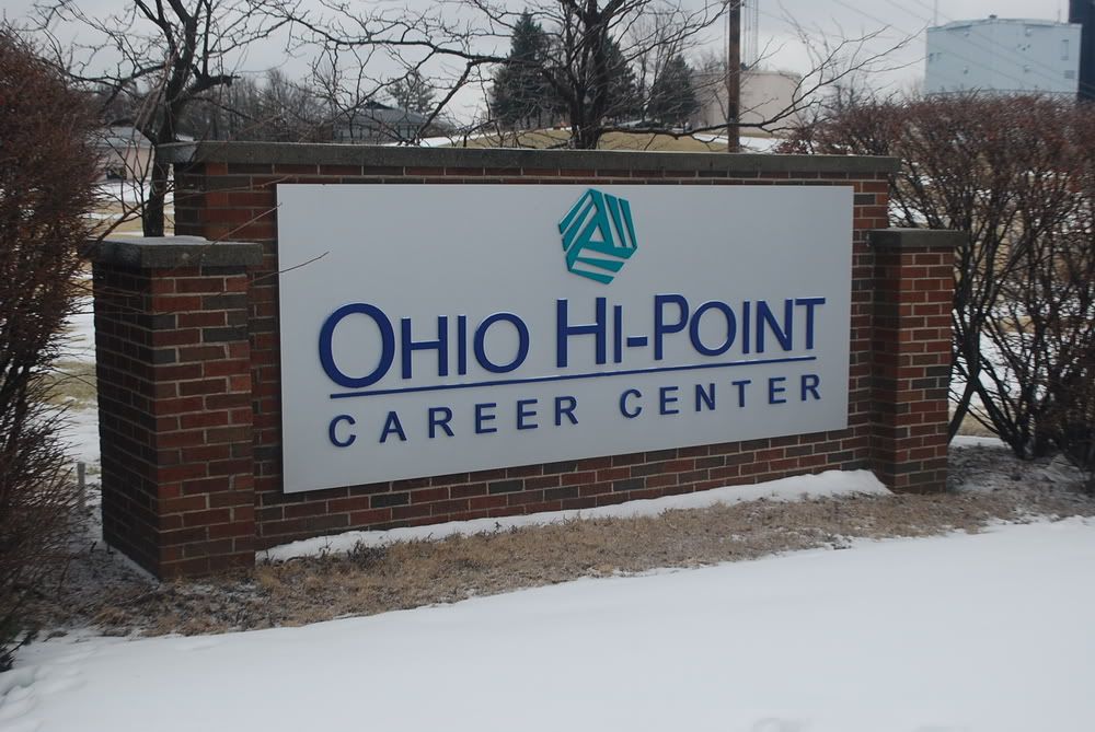 Do not stop when you see this.
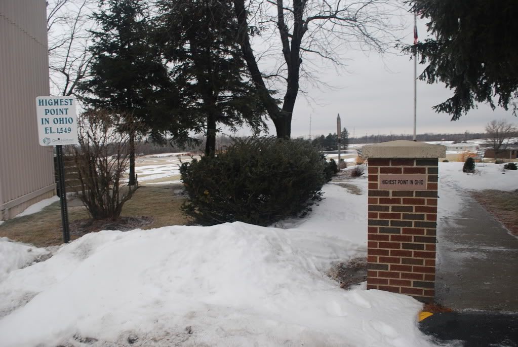
Walk uphill to where the big water tank is you will find the well marked highpoint, it's in a quiet and very nice campus, enjoy the view...

Comments
No comments posted yet.


