
-
 8255 Hits
-
 84.82% Score
-
 19 Votes
|
|
Mountain/Rock |
|---|---|
|
|
45.87652°N / 10.80334°E |
|
|
Trentino |
|
|
Hiking, Trad Climbing, Big Wall, Scrambling, Via Ferrata |
|
|
Spring, Summer, Fall, Winter |
|
|
2982 ft / 909 m |
|
|
Overview
Cima Capi 909 m
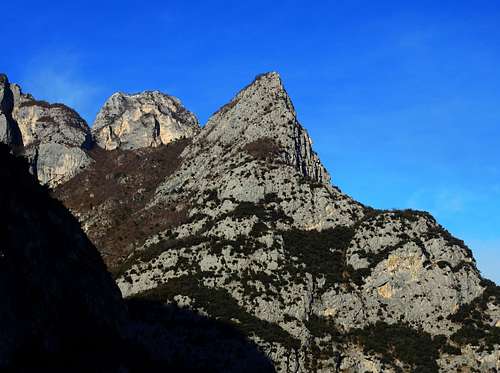
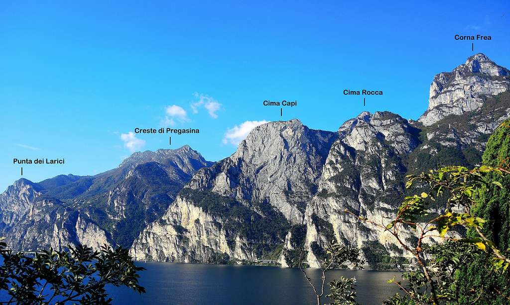
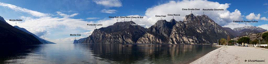
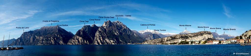
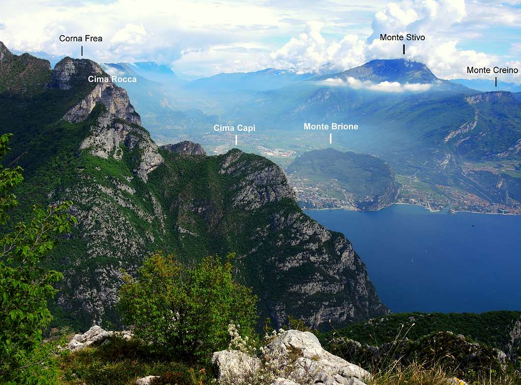
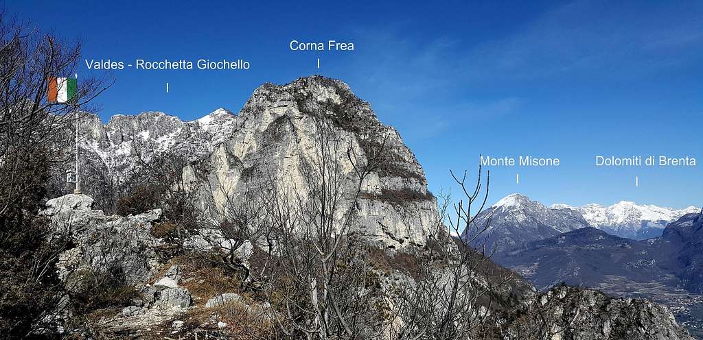
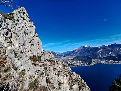
Cima Capi 909 m is a stunning rocky spur located at the SE end of the Rocchetta Group, Prealpi Bresciane and Gardesane, dropping down to the Garda Lake with an impressive rock wall. The South wall is called Sperone (Spur), while the impressive East face is one of the most difficult and feared of the Prealpi Gardesane. The summit is located in a sensational panoramic position overlooking the water surface and offering a magnificent view of the lake, Monte Baldo and the surrounding mountains, including Monte Stivo and Cima Rocca above.
The peak is especially impressive when observed from the road leading to the village of Pregasina, from which it appears as a superb pointed pyramid. Three reasons make the ascent to Cima Capi a fine experience: the interest of the approaching itinerary and the next Via Ferrata, the breathtaking views over the near Garda Lake and last but not least the important and well preserved remains of the First World War, a powerful defensive system built by the Austro-Hungarians on this mountain lying in a strategic position, with the purpose to check from the top the movements of the enemy troops.
Getting There
The starting point of the routes is Biacesa,
Access: from the Brennero autoroute exit Rovereto Sud and take the road to Riva del Garda. From here follow the road to Val di Ledro, leading through a tunnel to the small village of Biacesa di Ledro m. 418.

|

|

|
History
During the WWI Cima Capi was a cornerstone of the Austro-Hungarian army and was the scene of fierce fighting with the Italian avant-gardes who repeatedly tried to conquer the enemy positions.

Cima Capi Normal Route (Sentiero "Mario Foletti")
Cima Capi Normal ascent from Biacesa di Ledro (Sentiero Attrezzato "Mario Foletti")
Difficulty: EEA
Difference in level: 490 m from Biacesa di Ledro
Easy and very scenic route with a stretch of Via Ferrata, also suitable for beginners

|

|

|
Reached the only traffic lights in the village of Biacesa turn to right and follow the signposts to Cima Capi and Cima Rocca, leaving your car in a large parking lot. Walk briefly among the houses of the village, reaching a fork near a fountain, where on the right we find again the Club Alpino Italiano red and white signpost to Cima Rocca and Cima Capi. Here we take the right track that goes up through the last houses of the village, reaching a second fork. We leave on the right the path the Senter del Bech, another route to Cima Capi, and continue straight along the path 417 that enters the woods, reaching a third fork. Leave on the left the path 417 to the Bochet dei Concolì and follow the path on the right, at the next junction always follow to the right, rising to the Church of San Giovanni m. 840 (1 hours from Biacesa) with nice panoramic views over the Val di Ledro.

|

|
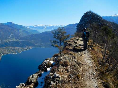
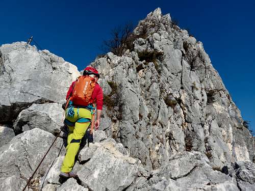
In just a minute we reach the Bivacco Arcioni 845 m, a nice eagle's nest from which it appears a breathtaking view of the vast expanse of water of Garda Lake and the nearby Cima Capi. From the Bivacco Arcioni head to North taking a path (signpost "Sentiero Mario Foletti") crossing the wood and leading to the base of a rock wall. Here it starts the "Via Ferrata". The route climbs up diagonally (cables and iron pegs), getting a ledge. Descend along the ledge to get a smooth slab and cross it with the aid of some ladders and iron cables. The path reach a wooden signpost on an exposed ridge.

|

|
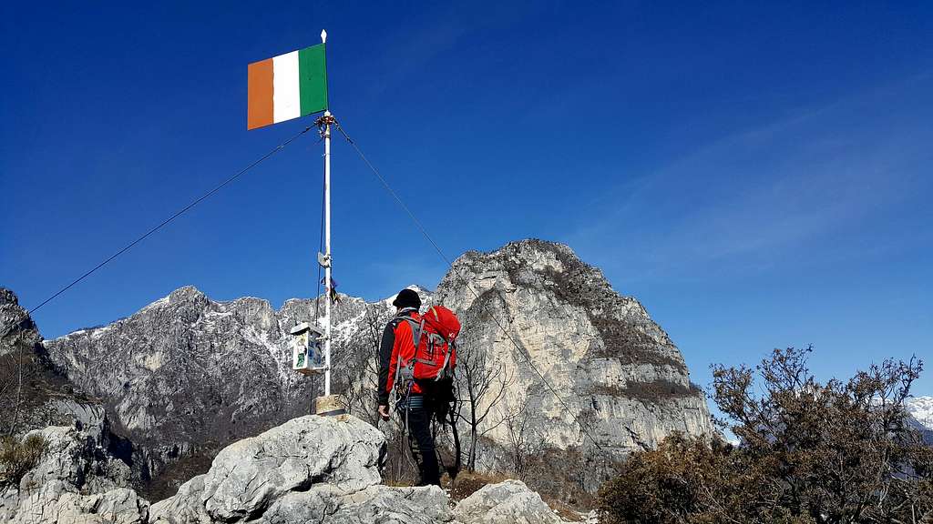
Here turn to right and follow a good exposed with breathtaking viewto the Northern shore of the Garda Lake, heading towards the well visible summit of Cima Capi. A last ascent leads to the summit flag and summit-book. The view is spectacular!
Descent: reversing the same itinerary

Senter del Bech e Via Ferrata "Fausto Susatti"
Cima Capi
Senter del Bech e Via Ferrata "Fausto Susatti"
Difficulty: EEA
Difference in level: 490 from Biacesa di Ledro
Another fine and very scenic way to reach the summit. The Via Ferrata, not difficult but with some exposed passages, is suitable for beginners and of sure satisfaction.
The first part of the approach is the same as the previous route. At the second fork ignore the mule track leading to the Church of S. Giovanni and take the right branch (signpost "Sentier del Bech", path n. 470). This path in the middle of the bush reachs an easy ledge with a rocky jump on the right, then continues with ups and downs to the small belvedere open on the underlying Garda Lake. The path then turns to the left, bordering a beautiful rock face where there are some WWI caves. After a short climb the Sentier del Bech leads to a terrace at about 1 hour from the start, then it gets the intersection with the path 405 coming from Riva del Garda.

|

|

|
This junction marks the beginning of the Via Ferrata "Fausto Susatti". We ignore the path to Riva and soon reach the first challenging jump. We remount a rocky chimney with some iron pegs. After an easy stretch we gain the true start of the Via Ferrata "Susatti", near a small cave (signpost "difficult path"). In spite of the first impression, the route climbs up the steep rock without sustained difficulties on excellent limestone rock. Finally you reach the summit flag with a wonderful view.
Descent: along the previous Normal route - From the summit walk Westward on the trail 405, still keeping the via ferrata set because there are still some equipped stretches (Sentiero Foletti). At a crossroads and take the path 460 (Sentiero Foletti) to the left. After a short "Via Ferrata" you reach a terrace on which a building was built by the Biacesa group of the SAT, the Bivacco Arcioni. From here reach in a few minutes the church of San Giovanni, where it starts the large path descending to Biacesa di Ledro. At the church, with a short digressions along the way you can stop to visit some galleries of the Great War and an interesting exhibition of ancient WWI photos.
Climbing routes
- Il Re del Lago 5c, 200 m - It is a climbing route recently equipped with fix that allows a good climb and exits to reach the Via Ferrata Susatti. Two possibilities: to continue following the Via Ferrata to get the summit or descending along a system of ledges to the start of the route.
The routes listed below are very demanding and very rarely climbed
- Via Arnaldo Bresciani
- Via Vento del ricordo
- Via del Grola
- Via Fox-Stenico
- Via Magic Line
- Via Alberi in Festa
- Via Scetinin
- Via Carmellini
Red Tape

No permits, no fees required
When to Climb
All year round
Accomodation
Several possibilities of accomodation in Val di Ledro and Riva del Garda
Guidebooks and maps
"Prealpi Bresciane" - Fausto Camerini - Collana Guide dei Monti d'Italia, C.A.I.-T.C.I.
"Alpi di Ledro, Valli Giudicarie" - Kompass n. 71 - 1:50000
Meteo

External Links