
|
|
Mountain/Rock |
|---|---|
|
|
33.66477°N / 4.09162°W |
|
|
Hiking, Mountaineering |
|
|
Spring, Fall, Winter |
|
|
10108 ft / 3081 m |
|
|
Overview
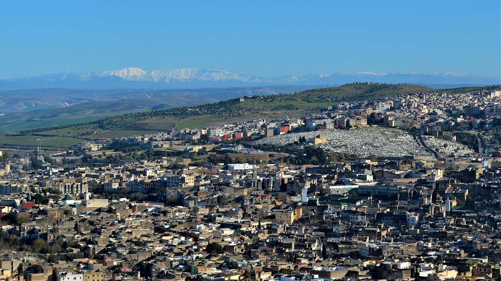
Bou Iblane ("bou" meaning mountain in Tamazight) soars to 3081 MSL. The ridge stretches 8 kilometers across the horizon. 100 klicks east of Fes as the bird flies, the mountain is sure to draw they eye on a clear spring day overlooking the ancient medina. It is unclear why Bou Iblane is the name that is "known" as opposed to her taller sister to the north, Mousa ou Salah at 3172 meters. Perhaps it is because at one time, some ill-fated plans for a ski resort were started under the northern slopes of Bou Iblane. Neither peak is particularly aesthetic, but the sweep of the Bou Iblane ridge, with 4 high points above 3000 meters, does impress in sheer mass and scale. The southernmost high point is marked on the Moroccan 100K map (Ribat el Khayr) from 1966 as the summit at 3081 meters—it is marked by a low cairn. The northernmost highpoint, overlooking Tizi n' Tzirouch is referenced by Michael Peyron in The Great Atlas Traverse as being higher at 3103 meters.
Bou Iblane is probably best known for visiting ski-mountaineers in Spring. The snowy slopes in winter definitely seem more attractive than the endless shaly slopes in summer. The southern end of the ridge does have some easy ridge scrambling though it can easily be avoided. Overall, Bou Iblane is not a technically difficult climb, but there is no established trail and if you have only hiked on groomed trails, do not underestimate the difference. The easiest way to navigate to the summit is to follow the ridge up to the north-east. However, if thunderstorms roll in, this would be the most exposed route. Don't be surprised if, as you cross a snowfield high on the ridge, you see sheep hydrating by eating the icy snow.
Getting There
Although the Taffert Refuge on the southeastern slope of Bou Iblane is less than 100 km from Fes as the bird flies and 129 km by road it, will take you about 3 hours in a private car. To get there using public transportation you will need to embark on a 3 stage journey:
Grand Taxi from Fes to Sefrou
Grand Taxi from Sefrou to Ribat el Kheir (you may need to notify the Gendarmeri here about your intention to climb the mountain - the taxi driver may insist)
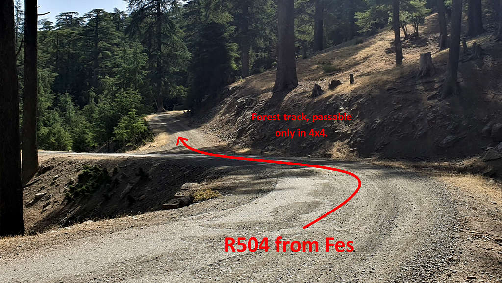
Mercedes 207 van on Market day (wednesdays in 2019) from Ribat el Kheir to Tamtroucht. You will want to get off before Tamtroucht at the gravel fork in the road where you are passing through the cedar forest. Hike the remaining kilometer to the refuge.
Route
Start out from the Taffert hut following the old access road just above the tree line. (Not the same track that leads to the paved road pictured above.
This track intersects with P5115 which leads up to the cell towers. Turn left onto this road and hike to Ain Laz (fresh water spring).
From here traverse north and up to gain the ridge. If you meet a cliff band, continue below it until the slope opens up.
Once on the ridge follow it north. There are multiple knolls along the ridge. The knoll with a cairn ontop is also labled on the topographic map as the summit at 3081 m but the last knoll before Tizi n' Tzirouch was higher by my GPS measurements and as mentioned above, Peyron indicates it at an altitude of 3103.
To descend reverse your steps of descend to Tizi n' Tzirouch, 2865m and head west toward the paved road. Once you reach the road follow it south to the forestry hut.
Red Tape
Though there are no formal restrictions, you are in very remote country. The authorities will probably have questions about your itinerary and may try to discourage your plans. If you are intending to overnight anywhere it is advisable to notify the Gendarmerie or the Muqadam (community representative).
When to Climb
Spring. But in general, just avoid July and August as they are the hottest months and the scorching winds from the Sahara are a force with which to be reckoned.
Camping
There is a fresh-water spring just 100 meters down the forestry road from the Taffert Refuge and just down the hill from the spring and the road is a primitive campsite with a fire ring.
External Links
https://www.alpinejournal.org.uk/Contents/Contents_1993_files/AJ%201993%20165-169%20Brown%20Atlas.pdf - a great article about a traverse of Bou Iblane and Bou Naceur.
https://www.cicerone.co.uk/the-high-atlas-mountains-morocco