|
|
Route |
|---|---|
|
|
35.64000°N / 83.445°W |
|
|
Hiking |
|
|
Most of a day |
|
|
Walk up |
|
|
Approach
Take US 441 south out of Gatlinburg, TN to the clearly marked Alum Cave trailhead. Parking is available at the trailhead; follow the trail to Peregrine Peak and - for those who want a longer climb - on to Mt. LeConte.Route Description
Trailhead elevation is 3850'. Follow the Alum Cave trail along the Alum Bluff Creek for one mile. The trail is well marked, well traveled and there are no confusing turns or splits in the path.After crossing the stream several times on a series of log bridges, the trail will bear left and leave the creek to wind its way up Anakeesta Ridge. You'll pass through Arch Rock, a staircase leading up into a hollowed out tunnel through solid rock, then cross yet another stream (Styx Branch Crossing) before reaching Peregrine Peak after roughly 2 miles of hiking. The lower portion of the hike is typified by deep forest vegetation, lots of creek crossings, and heavy foliage.
Just past the 2-mile mark is a steep, rocky wall known as Alum Cave Bluff. It is a fun and interesting detour, and all within sight of the main trail. The bluff's rocky overhang makes a nice shelter on rainy days as well as a conveniently placed rest stop. There are no broad scenic views until you are well past Alum Cave Bluff, after which you will encounter several amazing overlooks.
Alum Cave is precisely 5 miles in length and dead-ends into Boulevard Trail. Although you will actually be leaving Alum Cave Trail briefly, it is well worth continuing with a short eastward hike on Boulevard Trail while following the signs to Cliff Tops. This overlook is truly one of the prize views of the Smoky Mountains, with a 200-degree scenic vista and comfortable rocks for relaxing, soaking up the sun or having a meal. Although it draws considerable traffic during warm weather, it is still among the must-see views in the park. Cliff Tops is technically not part of Alum Cave Trail, but the trail still remains the shortest and most popular route to Cliff Tops.
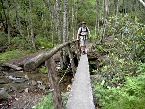
The author crossing one of many creeks in the first two miles of hiking

The view from an overlook along Alum Cave Trail just below the summit of Mt. Le Conte.
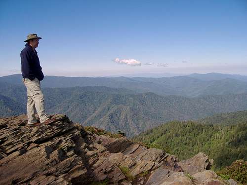
The author taking in the view at Cliff Tops
Essential Gear
A day pack is all that's necessary for three season climbing. Winter climbers should check the Peak's weather forecast (see main page) as snow and ice are common on the ridge and the peak.The exposed areas are not dangerous unless conditions are icy. All exposed sections of the trail have permanent cables anchored into the mountainside to assist climbers.