Dabbing Dana - October 2nd, 2014
A month of weekends in Idaho. An accident in Savannah. Crutches, last day at work, Montana, Idaho, Montana, Orlando, Kings Peak and lightning, Glacier National Park…boomerang from practically the Canada border right back down to Vegas, bachelor party, Hard Rock, Club Rehab, Death Valley, Telescope Peak…it had been an interesting three months, and now I was on the first leg of my last extended western jaunt before moving back east.
The goal was to get from Las Vegas to the Oregon Coast. I’d be a basic tourist on my first real journey through the northwest to see the popular sights…Lassen National Park, Crater Lake, the Redwoods. I wanted to climb my first Cascade volcano…I wanted breweries, bars, and to finally relax amidst the soothing waves of the ocean. And I had only a few weeks to do it before my buddy flew in to move me out of Utah.
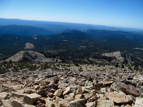
First, was Tahoe. After one day in the outback I was already feeling a withdrawal for civilization, but it’s a long drive from Death Valley to Reno, and it would only make sense to get another peak on the way. I initially had White Mountain Peak in mind, but a recent snowstorm had only flirted with the Sierras while dumping most of its load on its more barren neighbor to the east. This was apparent even from the summit of Telescope, and became more and more so along my drive north. I could maybe deal with the snow, depending on the depth, but I dreaded the shitty drive in, especially after a call to the forest service confirmed that the last stretch to the main trailhead would be rough and muddy after the storm.
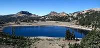
I decided to switch out White for Dana, a basic peak in Yosemite for a basic betch like me. But despite being a tourist draw, it still stood significant as a 13er and a P2K, and gave me an excuse to check out another national park. I had been to Yosemite before as a child, but this would be my first time back on my own.
I slept in Bishop spent and still recovering from Vegas. My only journey out from my motel room was a stop at the highly rated Holy Smoke Texas BBQ, where its simple yet strong menu lived up to every bit of its hype. I got my usual pulled pork sandwich, which nevertheless had the leanest, tastiest meat I’ve ever had in such a format, slathered in a delicious sauce, and found myself happy and adequately fueled for the next day.
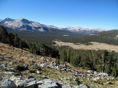
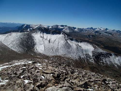
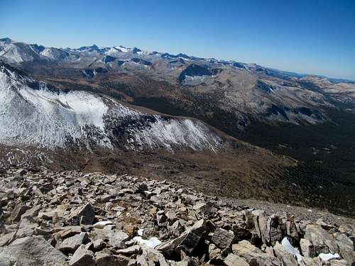
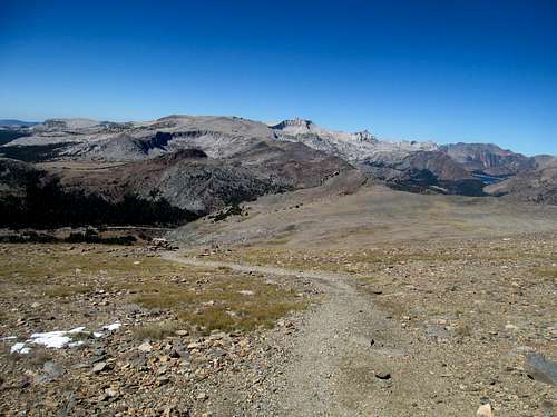
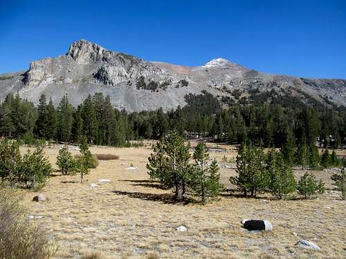
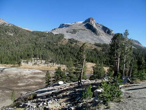
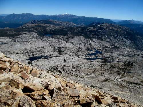
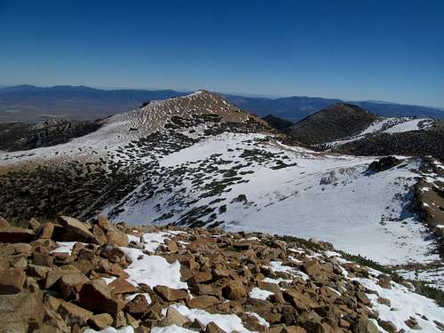
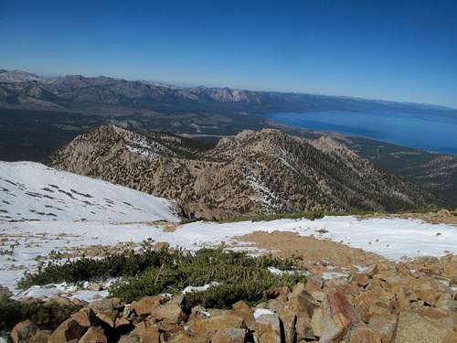
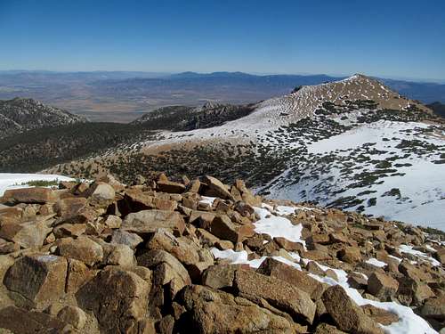
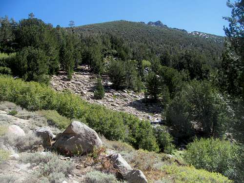
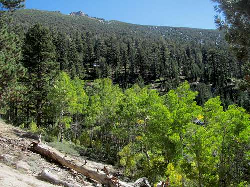
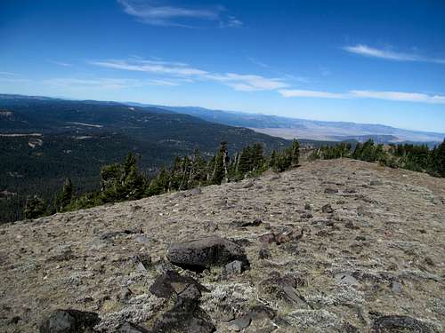
I had vague memories from my childhood about how the road to Yosemite magically transformed from a barren desert to wide open meadows and crisp evergreen forests. I relived this dream again the next morning, driving through the dramatic canyons up to Tioga Pass, where I parked just past the entrance station and backtracked the short approach to hit the slopes of Dana.
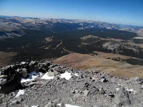
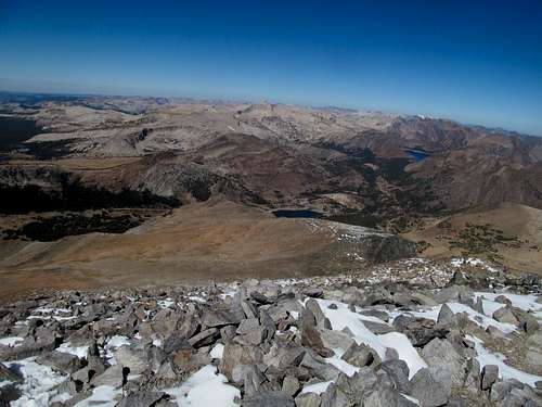
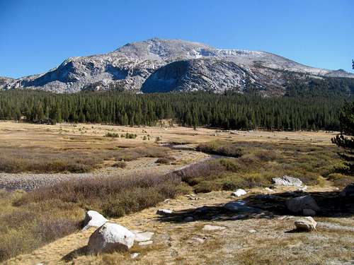
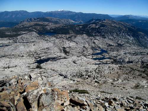
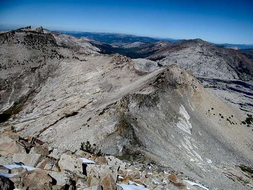
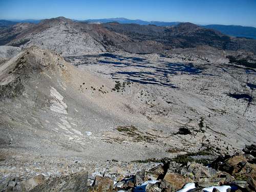
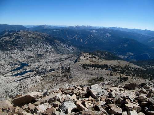
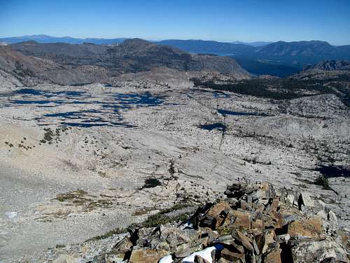
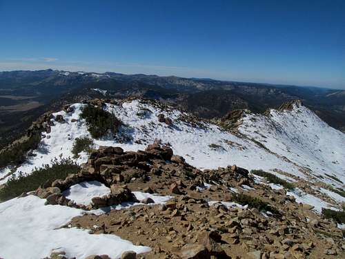
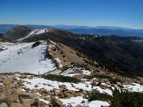
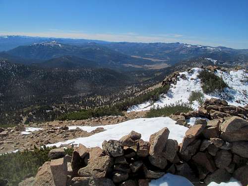
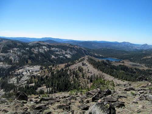
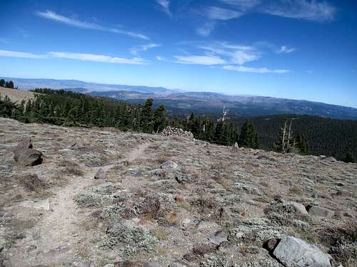
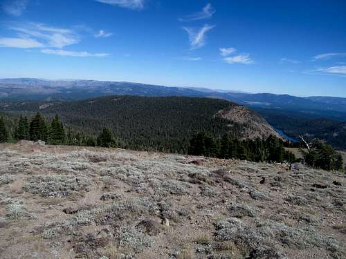
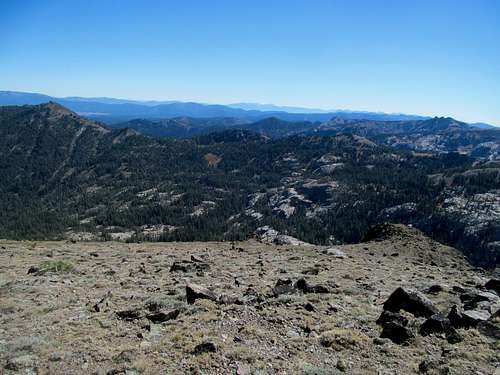
Despite the narrow trail causing me some discomfort the day before on Telescope, I felt fine this morning, cocky enough to get bored on the trail and start doing bicep and tricep reps with my one remaining crutch as the route made a quick and efficient ascent up to the Dana plateau. The hike across the plateau was long and mildly tedious but the views into the upper Tuolumne Valley and the high Yosemite Peaks of the Lyell area made up for it.
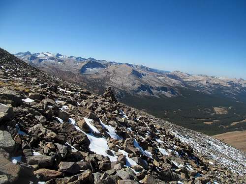
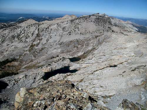
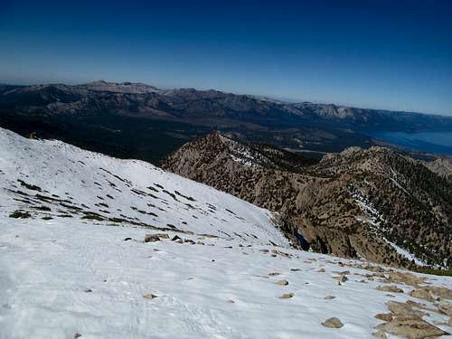
Though it was likely a lighter snowpack than White, I would not be avoiding snow on Dana especially considering that the standard route ascended the peak’s north face. Past the plateau the snow made the ascent a little more complicated, as the trail was super slippery from thin, well packed, and much traversed layer of snow. I found it easier in most instances to skip the trail and ascend directly up the boulders.
I felt good though, physically, and passed several parties up this last section, though one couple seemed to be making good time until the very end.
As a result, I only had the summit to myself for a few minutes before they popped up. They had a pretty cool story though. Of course they were from Great Britain, what with every girl we talked to in Vegas earlier in weekend and every person in the saloon in Beatty a few nights ago. But this couple was unique in that they had been on the road for a year now, travelling nonstop through every continent (except presumably Antarctica), trekking to Everest base camp and all sorts of cool shit. They had a similar agenda to me as well in that they were heading north and checking out the Oregon Coast in one last dash before returning home in more than a year. They reflected in front of me how odd it would be to suddenly, after all that travelling, come back home and be like, shit, what the hell do we do now? I could relate, only mildly.
Another dude who joined us on the summit left his truck and RV at Mono Lake, where his wife was working. I soon found out that he and his wife had been living the dream for over four years now, 100% on the road. But far from being vagrants, he was a computer software engineer and she a graphic designer, and both of their careers allowed them to work remotely from wherever they could get a phone signal. So in the summers they went north to Montana or Oregon, and then down to Arizona and the desert when it got cold. I was vocal in my envy, though I doubted I could stomach a life completely on the road. He said it was tough, especially those first few months, but once they got over that initial hump they never looked back and wouldn't trade it for the world. I believed him.
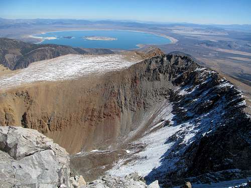
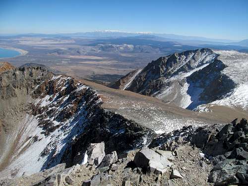
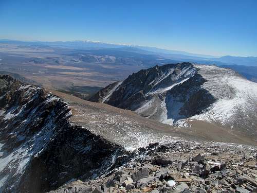
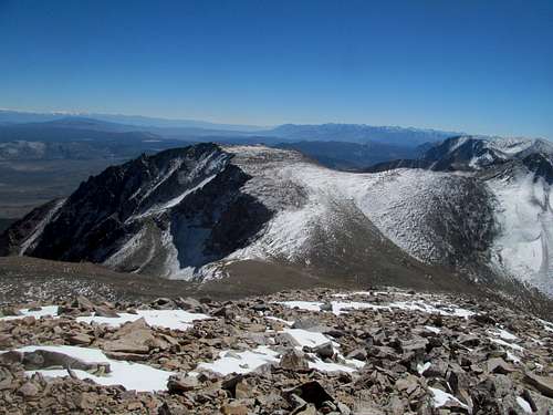
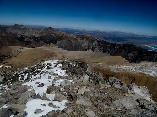
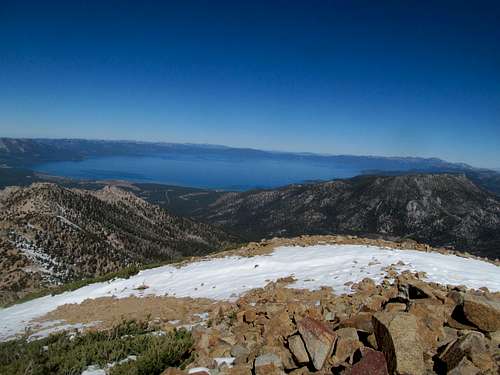
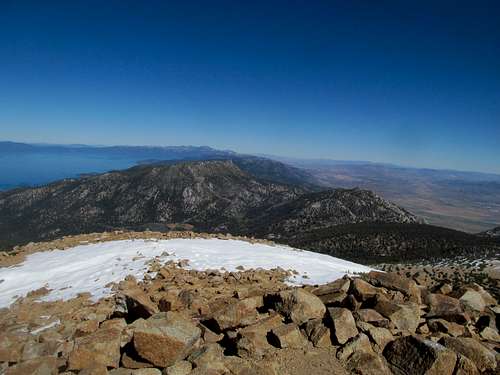
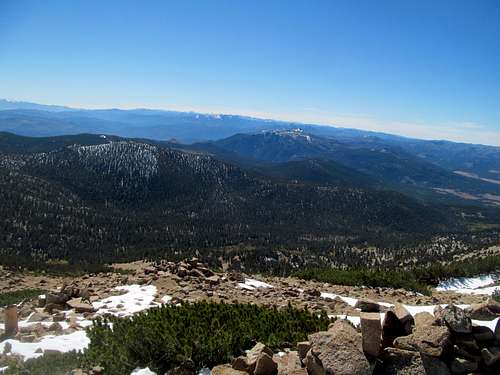
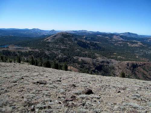
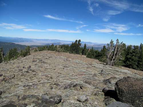
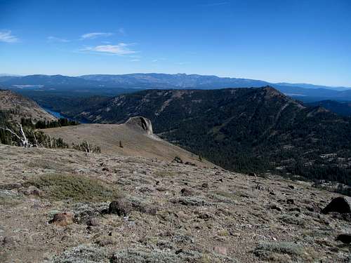
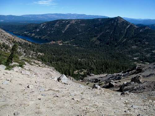
What a cool day on a peak. While I do and will forever love those remote and obscure peaks in Nevada and Idaho and shit, only on a popular national park hike could you find such a unique and chill group of people on a casual Wednesday afternoon. This included a group of Czechs, whose English was just good enough to join the conversation, and we all chatted away the day amidst tremendous views of Mono Lake, the White Mountains, and the surrounding Sierra peaks glazed with their first dusting of snow for the season, a perfect snapshot of Yosemite in transition.
I caught up with the Czechs on the downclimb and chatted with them a bit longer before running down. And yes, running down. I felt so fucking good physically, for the first time since Savannah and climbing Thompson Peak the week before that. I bounced down the talus and cruised down the plateau and back to the trailhead. My shoulders felt good, my legs felt good, my back felt good, my hip felt good. I was back, baby. And whatever else I concerned myself with for the rest of the last trip, at least I knew that I would no longer be held back by any lingering injuries from the Savannah accident.
De facto it was fall, but de jure this was springtime for Victor. With a little spring in my step I delighted in a gorgeous Yosemite day, a tableau so perfect it was making my decision harder and harder.
You see, the question was whether to stay another day (or two in Yosemite), or to continue up to Tahoe. Hoffman seemed like a nice, relaxing and enjoyable peak, and the sharp ridges of Conness had caught my attention from atop Dana. To postpone the decision I decided to embark on a scenic drive of Tuolumne all the way down to Tenaya Lake, trying to piece reconcile my childhood memories with those now before me. And the only certain reality was that that fall, belied by the dry high meadows suffering through the end of another drought season, had indeed arrived in the High Sierra.
*(Sidenote: while I normally abhor camping my family did do the camp around the national parks thing often on our road trips, probably since it was cheaper than motels. I do have two fond memories specific to camping, and one was waking up early camped in Tuolumne and wandering around the campsite playing around in the bubbly creeks and brooks that seemed more playground than wilderness; the other memory is a similar one in Zion Canyon).
But I was tired, and the timeline called for forward progress, especially if I were to get both Pyramid and Freel. Lola I suppose was optional, but it did seem appealing as a rest day peak and my schedule, complicated by a large slate of college games Saturday and the Pats playing Monday night, seemed to dictate an immediate arrival to Tahoe, especially since I wanted to get the Lassen area by the time the Pats Bengals kicked off and Lola was conveniently in the way.
Plus I yearned for the hubbub of Tahoe, and the small empty quarters of Bridgeport north of Yosemite only encouraged me to drive on. I would return another day for those peaks, but fatigue and a fervent desire to quench my basicness pushed me north.
It was tough not to constantly look back at the gorgeous Yosemite Sierras as I continued north, but I still had plenty of fantastic scenery ahead of me from the lush lower peaks of the mid-Sierras near Sonora Pass down to perfectly bubbly creek accompanying me into Nevada along with impossibly slow driving RV’s and trucks. The azure waters of Topaz Lake was a pleasant surprise, as were the already snowbound skylines of the Pine Nut and Sweetwater Ranges.
An unexpected traffic jam in Minden led to an unexpected and frustrating detour when I found out that Kingsbury Summit into South Tahoe was closed for construction. Exhausted and really craving the food, beer, and rest that Tahoe promised, I pushed further north to take US-50 in, somewhat placated by the comforting suburban presence that was slowly gathering around US-395. Reno would wait another day though.
I enjoyed sunset views of the lake driving past the rim and was surprised at the glitzy buzz of the casinos in Stateline. After finding a cheap motel to check in I stopped by a quiet and empty bar for some food. A fellow patron, upon finding out that this was my first time in Tahoe, surmised that I may never leave, since that was often the case with new arrivals. And I could see his point…this place combined surreal mountain beauty, a seemingly cool culture, and the hustle and bustle of civilization all in one small stretch of highway. Apparently the jobs were strongly seasonal though, and this kid was heavily dependent on the availability of construction jobs, which oddly enough had been the reason that my arrival via Kingsbury summit had been delayed.
The Crystal Pyramid - October 3rd, 2014
Having long seen spectacular pictures of Aloha Lake and the Desolation Wilderness on SP, my plan for Friday was Pyramid Peak. Although other routes provided elevation climbed, the attribute of most gain in Tahoe for the SE ridge off US-50 read to me like a challenge, and its short and steep approach would do much to get me into shape now that I felt almost fully recovered from the accident.
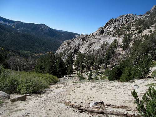
I caught up on sleep and got off to a very late start after making my way through breakfast and traffic and fighting the budding San Francisco weekender crowds. Upon parking at a small pullout on US-50 past a sharp left curve and before a dip in the road, I wandered back and forth trying to find the start of the trail. It was not very well marked, hidden by the steep dry dirt erosion lining the sides of most highways, but eventually I saw a small cairn placed upon a loose chute leading up the eroded roadside just east of the low point (Rocky Canyon’s stream) and followed it up (see pic end of TR for the start of the trail).
As described the first parts of the trail were steep and loose, typical shit for the backcountry but perhaps a bit more annoying than what you would expect in a popular tourist area like Tahoe. I started sweating pretty quickly, what with the post 10 AM start on yet another mild day. Soon after leaving the highway I encountered a couple of other faint criss-crossing trails, but they all eventually converged up and to the right of and above Rocky Canyon.
After the steep start I actually thought the trail meandered quite a bit through a gentler section as it crossed and curved west to ascend the left side of a broad circle marking the beginning of treeline. After several miles and thousands of feet in the deep woods my views finally opened up to pretty cake like layers of boulders leading up to the alpine upper reaches of the Desolation/Crystal Range…a tanner, more compact version of the scenery I enjoyed on Homer Youngs Peak a month before.
I started up the last thousand feet of boulder hopping to the summit, passing a local couple with a cute as fuck pit bull puppy making one of his first climbs. They were nice, and the puppy was delightful even as it was exasperated by the puzzle of the boulders, and his owners had to help and softly encourage him up steeper and steeper steps.
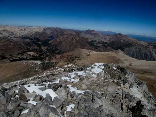
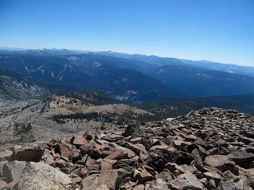
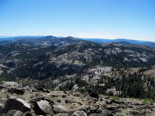
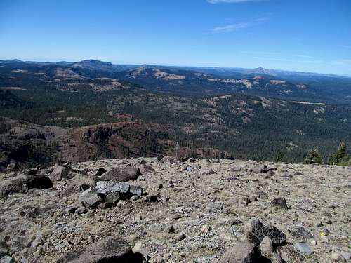
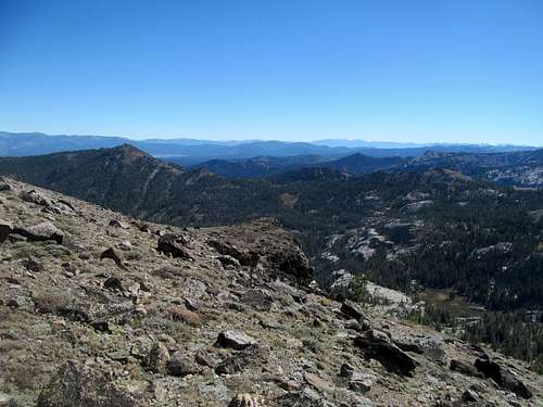
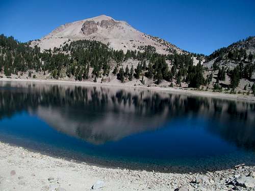
I passed them and had to do a little self-encouragement myself for the last few hundred feet, but enjoyed the splendid views from the summit a little over two hours after I left the car. Having long admired pictures of the exotically sublime Aloha Lake from Pyramid, I braced myself for disappointment at the end of a long, drought filled season. And while the lake was not at full capacity, it still managed to spread its cerulean fingers around a good amount of the granite expanses in the upper Desolation basin.
I could barely glimpse Tahoe, but saw good views of Union Valley Reservoir to the west and Valley Leaf Lake to the east. The peaks north were breathtaking as well, and behind me was a bittersweet view of the mid-high Sierras that I had left behind the day before.
The pit pup and his owners finally reached the summit, and to all of our delight he found a small patch of snow left over the past week’s storm. It was his first taste of snow, and despite his exhaustion he delighted in rolling around in it. I chatted with the other two hikers and enjoyed the breathtaking vistas combined with the innocence of such a delightful dog underserving of its reputation at the hands of usually negligent, if not outright malicious, owners.
The downclimb was steep and aggravating for my feet; my current boots were near the end of their second season after an inaugural trip up Smoky Dome the summer before. Despite getting Asolo’s, which I had always had a good relationship with, this pair been a nightmarish pair that constantly distorted and chapped every which way on every angle of my feet. It was wearing thin, with holes showing up in the exterior here and there, but I was determined to make it last through this last trip, after which I would move east and not give a shit for an extended period.
Otherwise the descent was unremarkable besides the scenery above the trees. I followed traffic back into town and picked Friday night as the one to take it easy. Saturday had a full slate of college football games, and I wanted to make sure to pick off Freel Peak, a quick ride just outside of town, in the early morning before the 3:30 EST games (12:30 local time) started.
Freel at Last - October 4th, 2014
Having mapped out the back roads to Freel’s Trout Creek approach, I nevertheless got lost soon after setting off. While Dean’s south side route on SP featured less elevation gain, I figured that what it lacked in stats it would make up for in both the driving time to get to the southern side of the peak as well as the 4WD driving required, something that, three years into this Utah experiment, I was damned tired of and hoped to not experience for the rest of my time out west hitting up basic peaks. So I followed the dirt road from my parking spot as described until hitting the meadow at Trout Creek, where I opted to take the cross country option towards the Tahoe Rim Trail. The bushwhacking was actually pretty horrid and bogged me down on a day when time was of the essence. The struggle seemed endless as I repeatedly check my GPS to see whether I was getting any closer to the trail.
Traversing along the TRT I was finally able to enjoy the views of the granite outcrops across the drainage from me as well as further over, where yesterday’s peak and views of Tahoe emerged as I got higher. Most of my time was spent in shade as the sun still dozed on the other side of my objective, and certainly parts of the trail were covered with a light and well-trod layer of snow.
Despite the long redundant switchback and the fact that I was traversing directly below and past the summit of Freel, my previous bushwhacking experience convinced me that xc would not be the most efficient option. Patience held to the Saddle, where I enjoyed views of the snow covered climb required to reach the summit.
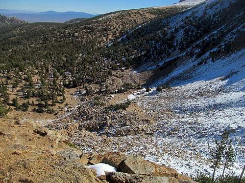
First the trail curved south and flirted along the right side of a small ridge, ascending in small switchbacks through various rocky ledges…easy class 1 in summer conditions but harder to stop under a thickening and softening layer of snow. Trying to follow and keep the trail became a more and more trying task, as did the lung capacity required to sustain myself for the last thousand or so feet of gain.
My progress and willpower wilted with each slushy posthole step and I focused on shutting my eyes and looking at trees or rocks in order to avoid getting snow blinded on this very crucial trip (something that had plagued me after Humphreys Peak many years ago).
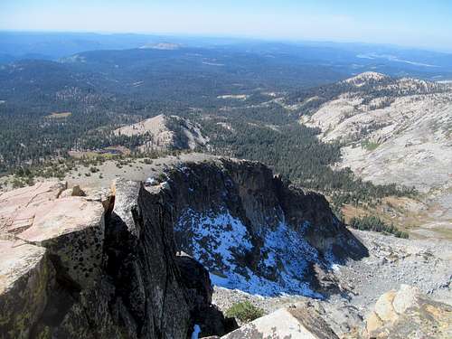
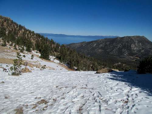
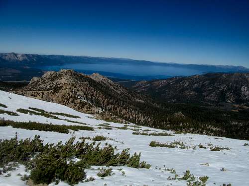
Once on top the melted out summit I enjoyed the remarkable views of crystal blue Lake Tahoe and snow dotted Job’s Sister next door.
On another day I'd think about traversing over to Job's Sister, but snow and sports today were good enough deterrents.
Pictures and a typical granola bar lunch were followed by a quick retreat down the mountain, which was made more difficult by my effort to descend as much of the top 1000 feet with my eyes closed as possible.
Once more I had a bit of trouble following exactly the trail as it interspersed a bit through rock and woods just above the saddle.
I opted to take the standard Trout Creek trail down and made very fast progress running down its delightfully sandy route all the way back down to the meadows and dirt road, enjoying the views of Freel’s west slopes basked in the glow of fall aspen and the midafternoon sun, and making it back to the car less than four hours after leaving it.
Still caked with sweat, I made my way to the casinos of Stateline in time to catch the second quarter between Bama and Ole Miss, and alongside a bunch of Rebel partisans, enjoyed their thrilling upset of evil Bama.
After a shower I returned to the hubbub at the Lucky Beaver bar, taking down burgers and beers alongside the fully amped up and amateurishly annoying San Fran/Cali crowd as they whooped, screamed and hollered at each minor pop up to second that they thought was a home run en route to an 18 inning Giants win over the Nationals in the NLDS.
La-la-la-la-Lola - October 5th, 2014
I was somewhat reluctant to leave Tahoe but all good things must come to an end. I took my time getting out of bed on Sunday, and the drive alongside the west rim of Tahoe took a little longer than anticipated due to the windy roads, slow driving cars, and traffic and lights through the resort towns along the way. Nevertheless the scenery was wonderful en route to Mt. Lola for my last peak during the Tahoe phase of this trip.
I have to admit that I felt a twinge of temptation crossing I-80….it had been almost a week now since I had last been in Interstate territory...pretty long for me and, still suffering from Vegas withdrawal, I felt the urge to track back east, return to civilization and check out Reno. But alas there was no time…Lola was a 10-11 mile day, and my goal was to make it up to Quincy for the night in time for the Pats Bengals Sunday game, which was an inconvenient 5:30 kickoff here in Pacific Time territory.
I characteristically missed a turnoff en route to the trailhead. Out of podcasts, I found myself listening to some Dan Brown audiobook just to pass the time on what would be an expected anti-climatic end to my Tahoe weekend. As belied by the stats and maps, most of the hike was pretty much a gentle walk in the woods on a rather humid fall day.
I passed a few groups on the way up and encountered one on the descent after finally emerging from the trees after a long switchback as apparent from the GPS. The last leg seemed to like a mental stall as well, though it was interspersed with the sight of a cool little volcanic like rock plug on some south-ish face of Lola as well as opening views to the colorful granite outcrops between the peak and its southerly neighbors.
The trail took a sharp right turn for the final few steps to the top, which finally rewarded me with grand views which more than made up for the dull trip up.
I traveled the maybe quarter mile distance to Lola’s the lower north summit to get the views in that direction, including nice ones towards the vast valley that looking at the map later, formed the western reaches of the Great Basin in NorCal past Susanville.
I needed to get north, so I hopped back down the summit ridge ramparts, cutting the switchback by use of GPS through easy gentle woods. Much of the rest of the hike was occupied by half paying attention to Robert Langston or whatever trollope around Florence in search of Dante or some whatever.
I was still on schedule for kickoff, though with less margin for error following the highway north through tree tunnels and rustic meadows, refreshing my phone every so often through this forgotten corner of Cali struggling to get enough reception for NFL scores and scoring updates for my fantasy players.
I had thought about relaxing and getting some drinks for the Pats game in Quincy, especially as its name seemed to be a harbinger for (an albeit unpleasant city back) home. The town however, despite its idyllic mid-90’s summer camp environs, seemed more rust belt than hippie dippie touristy, with only a couple motels in buttressing either end of the downtown. I ran some errands, gassed up, got a shitty subway sandwich for dinner and tuned in expecting a brawl as the Pats played their biggest game of 2014, season on the line. After many frantically exuberant text messages with friends back home I slept well with dreams of the primetime blowout win and the fact that my team and my quarterback TB12 were far from dead.
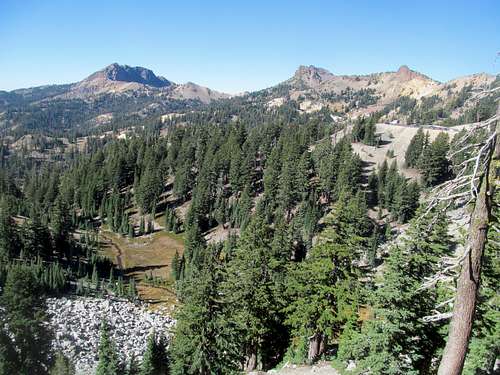
Lassen Boiling Over - October 5th, 2014
With my planned Sierra phase of the trip complete, I hoped to start off the final PNW portion of this journey with Lassen Peak, which would be my first Cascade Volcano. But after all the hustle and bustle of those final winding mountain roads up to Lassen, I found out that the trail was closed. Still.
Disclaimer: This following section may contain a high concentration of profanity...proceed at your own risk
I mean, SP did mention that the trail was under construction but hell, the page hadn’t been updated for years, and I assumed that work had long been completed. Additionally, as I usually do before going to nationals parks, I had checked the nps.gov home page for Lassen to see if there were any park alerts. There were none.
Alas, fucking government contractors, or whatever it was, regardless the result was that five years or so into this damn project I come crawling and can’t hike the peak I wanted. I thought about stealthing it but the route was pretty visible from the visitor’s center; plus I asked a worker who happened to be coming down the trail while I was pacing the parking lot and he said that they were actively working on the trail…which meant that I had no chance of stealthing.
Fucking a….all this time to drive here, with every remaining day so fucking precious and I can’t climb my fucking peak. While I do fault myself for not vetting my plans thoroughly, I had checked the fucking park website the night before…the park is named for fucking Lassen Peak, so you’d figure that if the fucking Lassen Peak trail was closed, there’d be a fucking warning or alert fucking telling you on the fucking front page of the website telling you it was fucking closed. I rechecked the webpage and yes, found it buried under the hiking section…which only added to my fucking rage. I called Greg to vent as I bounded down the Bumpass Hell trail and he suggested stealthing it from the north, which I ruled out due to my uncertainties about the route, plus my hesitation to deal with any scree or talus bullshit at this point.
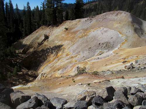
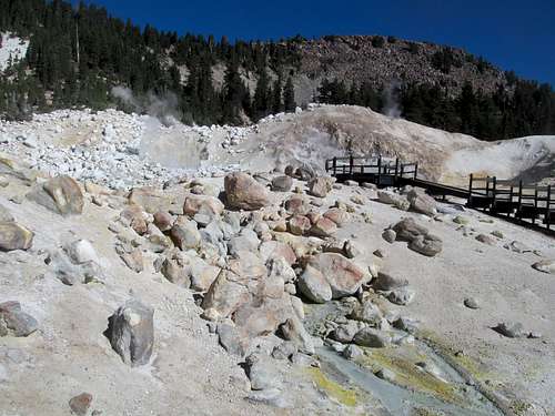
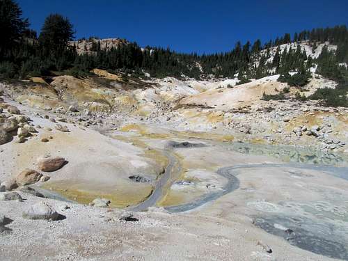
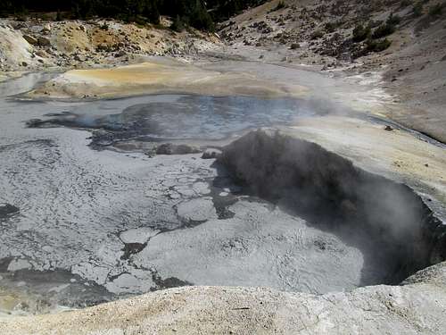
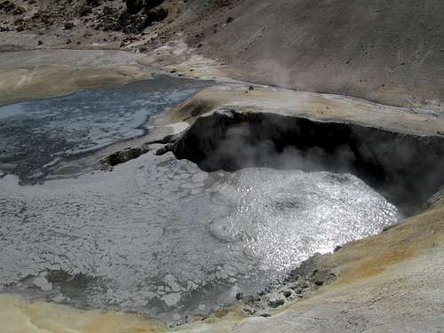
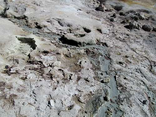
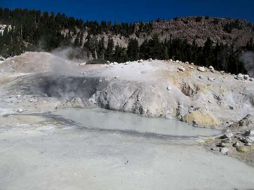
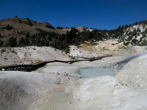
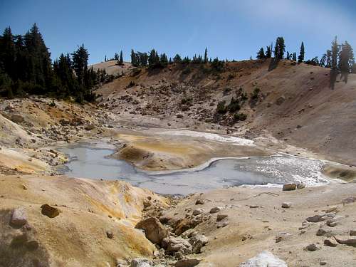
Bumpass Hell was admittedly cool as fuck, even better than the small Sulphur Works area just past the visitor’s center. I wandered the various boardwalks into the accessible nooks and crannies of this mini Yellowstone before jogging back up to the parking lot.
After reappraising crystal blue Helen Lake I reappraised my day. Already here, I figured I may as well play national park basic bitch early and check out some of the non summit oriented trails.
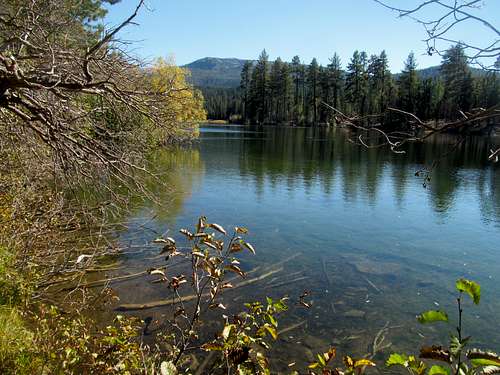
I drove to the Kings Creek trailhead and made the short hop to Cold Boiling Lake, which was pretty anticlimactic. Following that I took the trail further down the road to King Creek Falls, which offered some nice vistas early south out of the park before dropping into the woods.
The falls themselves weren’t anything spectacular either, but I got a decent workout hopping back up to the trailhead.
Sweaty amidst the humid Indian summer afternoon, I continued up the Park road to continue on my way towards Klamath Falls. I googled various P2K options along the way but at this point I wanted neither an arduous hike nor even an arduous 4WD drive, and as a result shunned most of the choices available en route to Mt. Shasta City and Weed.
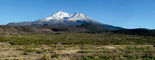
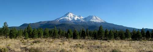
Obviously I was very impressed by my first sighting of Shasta, and relieved to return to an Interstate highway, even if only for a few miles. Having stocked up with some fast food for the drive, I marveled in the views of Shasta in my rearview along the beautiful open panoramas of US-97 en route to Oregon. As I tried to calculate an impossible timeline trying to decide whether to sacrifice a day on the Oregon Coast, the Redwoods, or the Ashland area peaks, I realized that I could potentially head back the following weekend, one of the periodic times throughout the year when they opened the trail.
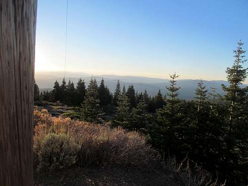
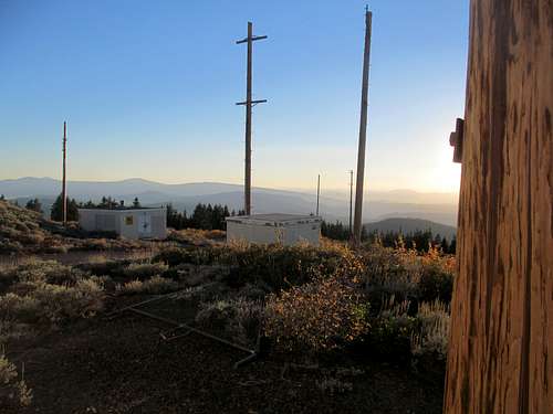
Throwing a Hamaker - October 6th, 2014
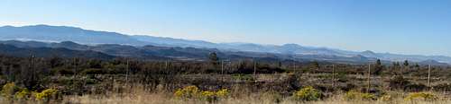
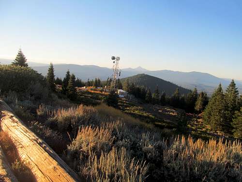
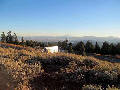
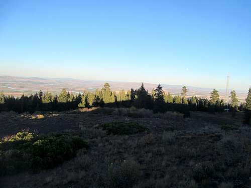
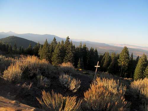
I finally knowticed Hamaker Mountain, an easy gravel road drive up P2K just past the Oregon border and before Klamath Falls, and figured it’d make sense to tag it as long as I could drive up before sunset. The road was pleasant and easy, although I had to pass some locals on what I’m sure was for them was a relaxing evening drive. Despite the summit structures, the twilight views from the top were satisfying, especially the golden tint of Shasta to the south, the sharp shadows of McLaughlin to the west, and the fading light above the Klamath River in the valley below.
Satisfied that I had at least gotten a peak in for the day, I drove into Klamath just before dark. The town didn’t do much for me and, exhausted from a more mentally trying day as opposed to any physical exertions, I got some fast food and gave myself my last early curfew of the trip. I had entered fully into the Pacific Northwest, my last frontier, and the next day had a full plate as the start of the after-end of the beginning of the end of my three years out west.
Comments
No comments posted yet.