An elevation-starved hiker from Northern Virginia spends a few days in more interesting terrain.
Two and a half days in the South Lake Tahoe area for one reason: hiking.
I'm fortunate enough to live an hour away from Shenandoah National Park in Virginia. So local hiking opportunities are never lacking. Lately however I feel myself more drawn to western terrain -- for tougher challenges, increased elevation gain (getting 3000ft out of a hike around here is pretty much best-case) and better visibility (trees often block the view around here -- I like being able to look up at a peak from thousands of feet below and realize that in a few hours I'll be at the top).
So off to Lake Tahoe I went for Labor Day weekend, arriving early Thursday afternoon and departing first thing Sunday morning. Two and a half days to squeeze in what I could.
Day 1: Round Top (10381 ft)
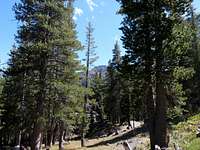
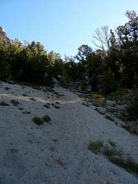
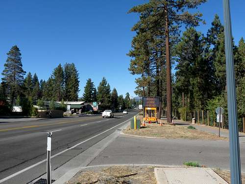
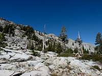
Knowing that it would be around 2pm by the time my flight landed and I made it to the hotel, I had to pick something reasonably short. Round Top fit the bill perfectly: a ~2100ft climb from Woods Lake Campground in about 3 miles (one-way).
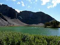
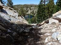
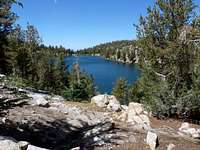
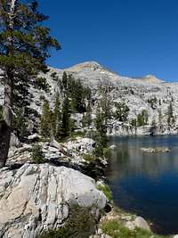
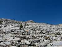
A pleasant stroll gets you to the base of the mountain, at Round Top Lake. This lake has a greenish color to it, in stark contrast to the deep blue of its close neighbor Winnemucca Lake.
![From Trail Start]() From Trail Start
From Trail Start |
| ![At Round Top Lake]() At Round Top Lake
At Round Top Lake |
| ![From Round Top Lake]() From Round Top Lake
From Round Top Lake |
|
|---|
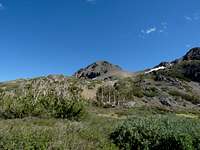
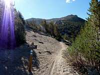
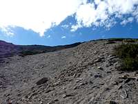
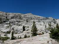
At this point, you just bear left and start walking up the northern side of the mountain.
![Heading up the trail]() Heading up the trail
Heading up the trail |
| ![Heading up the trail]() Heading up the trail
Heading up the trail |
| ![Heading up the trail]() Heading up the trail
Heading up the trail |
|
|---|
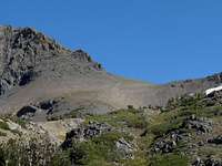
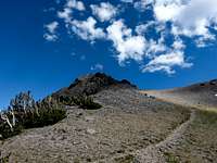
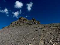
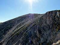
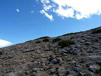
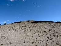
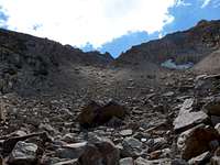
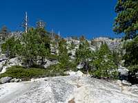
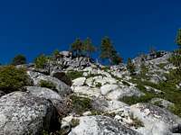
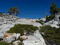
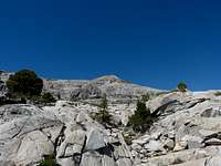
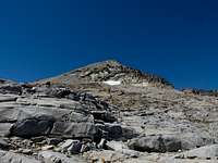
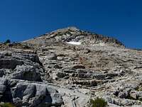
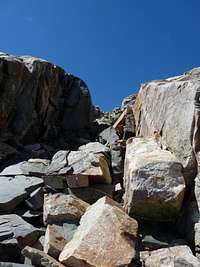
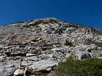
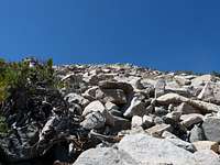
The trail eventually disappears and you're on your own to find a way to the top via fairly steep, sometimes-loose rock. On this day, a stiff wind from the south was coming over the mountain to make things more interesting.
![No more trail]() No more trail
No more trail |
| ![Almost there]() Almost there
Almost there |
|
|---|
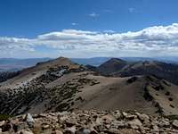
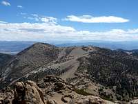
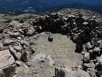
Once at the top, the views from one of the highest mountains in the Tahoe area do not disappoint.
![Looking north]() Looking north
Looking north |
| ![Northeast (Winnemucca Lake)]() Northeast (Winnemucca Lake)
Northeast (Winnemucca Lake) |
|
|---|
Day 2: Freel Peak (10881 ft), Jobs Sister (10823 ft), Star Lake
As luck would have it, three of Tahoe's highest peaks are adjacent to each other: Freel, Jobs, and Jobs Sister. They're accessible from a few spots, but being in a rental car (rather than a 4wd), I played it safe and started from the end of Oneidas Street (which is paved).
Continuing past the gate on foot, the trail is fairly flat for a bit. It then gets steep and quite narrow, even going through an area of dense greenery which I didn't expect. (I guess there's constant water flowing underground.)
Once you come out of this, you're faced with a steep uphill climb over deep sand. This turned out to be the first time in my hiking career that I wished I had trekking poles. Without them, it was one step back for every two steps forward. I couldn't believe how much energy it took out of me. Eventually I bushwacked off-trail (orockier terrain) just to avoid the sand, and finally reached the TRT where it intersects with the Freel Peak Trail, about 1000ft below the peak.
![Looking up from Trout Creek]() Looking up from Trout Creek
Looking up from Trout Creek |
| ![Steep and sandy]() Steep and sandy
Steep and sandy |
| ![TRT/Freel Intersection]() TRT/Freel Intersection
TRT/Freel Intersection |
| ![1000ft to go]() 1000ft to go
1000ft to go |
|
|---|
The Freel Peak Trail, while also being sandy, is nothing like what I had already gone through. Within a half hour I was at the top.
![Freel Peak Trail]() Freel Peak Trail
Freel Peak Trail |
| ![Freel Peak Trail]() Freel Peak Trail
Freel Peak Trail |
| ![Freel Peak Trail]() Freel Peak Trail
Freel Peak Trail |
| ![Freel Peak]() Freel Peak
Freel Peak |
|
|---|
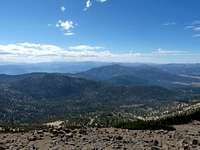
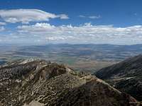
The views didn't disappoint, and I was all alone for upwards of a half hour before continuing on.
![Lake Tahoe from Freel]() Lake Tahoe from Freel
Lake Tahoe from Freel |
| ![The Jobs Siblings]() The Jobs Siblings
The Jobs Siblings |
| ![Looking south]() Looking south
Looking south |
|
|---|
Then it was off to Jobs Sister, heading east along the ridge. You drop around 500ft down Freel, then climb it again up Jobs Sister.
![Headed to Jobs Sister]() Headed to Jobs Sister
Headed to Jobs Sister |
| ![Headed to Jobs Sister]() Headed to Jobs Sister
Headed to Jobs Sister |
| ![Up Jobs Sister]() Up Jobs Sister
Up Jobs Sister |
|
|---|
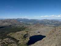
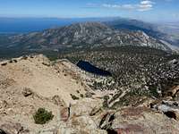
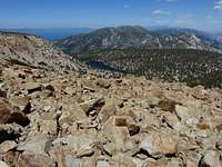
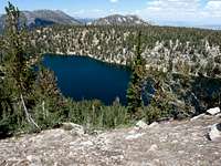
From Jobs Sister you get good views of Star Lake, as well as the valley to the east towards Reno. I had intended on also hitting up Jobs, but the steep sand took a lot out of me and I wanted to save energy for day 3.
![Star Lake]() Star Lake
Star Lake |
| ![Looking at Jobs]() Looking at Jobs
Looking at Jobs |
| ![The valley below]() The valley below
The valley below |
|
|---|
Rather than get back to the TRT by going back over Freel, I opted to head straight down to Star Lake. It was interesting to say the least. It was very steep, rocky, and sandy -- I ended up having to empty gravel out of my shoes several times. It was very slow going.
![Off trail to Star Lake]() Off trail to Star Lake
Off trail to Star Lake |
| ![Off trail to Star Lake]() Off trail to Star Lake
Off trail to Star Lake |
| ![Off trail to Star Lake]() Off trail to Star Lake
Off trail to Star Lake |
| ![Looking back up]() Looking back up
Looking back up |
|
|---|
Then when I got to the lake, to my dismay I couldn't walk around it at lake-level (to get to the TRT on the west side), so I had to slog back up a few hundred feet on the south side of the lake and bushwack across a steep slope. (Once I had already committed, I realized it would have been easier to go via the north side.)
![Off trail to Star Lake]() Off trail to Star Lake
Off trail to Star Lake |
| ![Star Lake]() Star Lake
Star Lake |
| ![Star Lake]() Star Lake
Star Lake |
|
|---|
I'm putting this Star Lake detour into the "mistake" category. It just wasn't worth the time and energy that it took. I would have been better off checking out Jobs and Trimmer instead.
But in any case, I finally reached the TRT, and it was time to head back to the car. I had also planned on visiting Trimmer, but this trip had taken enough out of me for one day. A huge dinner was all that I had on my mind.
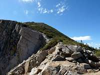
Day 3: Pyramid Peak (9983 ft) via Horsetail Falls
The finale for this trip was the impressive Pyramid Peak, viewable in the distance from 4000ft below from Lake Tahoe Blvd on the southeast side of the lake.
![Pyramid1]() Pyramid Peak from Lake Tahoe Blvd
Pyramid Peak from Lake Tahoe Blvd
From the Pyramid Creek trailhead, I followed the trail towards the first obstacle: Horsetail Falls. It became pretty obvious that the path of least resistance was to veer left before reaching the falls. This kept the climb in the vicinity of class-2.
![Horsetail Falls Trail]() Horsetail Falls Trail
Horsetail Falls Trail |
| ![Made a left to head up]() Made a left to head up
Made a left to head up |
| ![Up the left side of the falls]() Up the left side of the falls
Up the left side of the falls |
| ![Up the side of the falls]() Up the side of the falls
Up the side of the falls |
|
|---|
Once you wrap up this ~1500ft of steep climbing, it's cross-country for a bit towards the northwest to a cluster of lakes below Pyramid's east face.
![Pyramid Peak in sight]() Pyramid Peak in sight
Pyramid Peak in sight |
| ![Approaching the base]() Approaching the base
Approaching the base |
| ![Approaching the base]() Approaching the base
Approaching the base |
| ![Pyramid Peak base]() Pyramid Peak base
Pyramid Peak base |
|
|---|
The view from the base of the mountain is an impressive sight to behold. There's nothing but ~2000ft of rock between you and the peak. I opted to head directly up the east side rather than veer to the south or north as others have suggested.
![Climbing up]() Climbing up
Climbing up |
| ![Climbing up]() Climbing up
Climbing up |
| ![Climbing up]() Climbing up
Climbing up |
| ![Climbing up]() Climbing up
Climbing up |
|
|---|
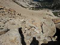
This ended up being mostly class-2, with perhaps some class-3 mixed in. I found it to be a fun challenge. Every 10 minutes or so I'd look up at the peak and it would seem just as far away as it was before.
![Climbing up]() Climbing up
Climbing up |
| ![Climbing up]() Climbing up
Climbing up |
| ![Climbing up]() Climbing up
Climbing up |
| ![Almost there]() Almost there
Almost there |
|
|---|
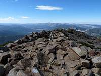
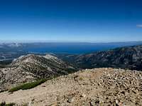
Finally 4 hours after leaving the car, I was at the summit, rewarded with the best views of the entire trip due to less hazy skies.
![Pyramid Peak]() Pyramid Peak
Pyramid Peak |
| ![View towards Round Top]() View towards Round Top
View towards Round Top |
| ![View towards Freel]() View towards Freel
View towards Freel |
| ![The road traveled]() The road traveled
The road traveled |
|
|---|
Rather than trying to go down via the rocky route that I climbed (which seemed a bit dangerous), I took the steep Rocky Canyon trail to the south back to the highway. I knew this would put me about a mile from the trailhead, with no clear way to get back (there's nowhere to walk along most of the road). I ended up having to cross the highway and dip down about a hundred feet to a cabin road below. This road ended after about a half mile, at which point it was an easy bushwhack to another small parking area, where it becomes possible to walk along the highway for the last 1/5th of a mile.
Conclusion
After 3 days of hiking it was time to head back east. I'm already looking forward to my next trip out west (whenever it may be), where plenty of even higher peaks await.
Comments
No comments posted yet.