
-
 5292 Hits
-
 0% Score
-
 0 Votes
|
|
Route |
|---|---|
|
|
58.27620°N / 134.51584°W |
|
|
Download GPX » View Route on Map |
|
|
Hiking, Scrambling |
|
|
Spring, Summer, Fall, Winter |
|
|
Half a day |
|
|
Class 3 |
|
|
Overview
Mt. Ben Stewart Standard Route is a non-technical 2.75 mile one way off trail climb. It is the highest point on Douglass Island at 3,415'. It starts at Eagle Crest Ski Area at an elevation of about 1000' so the summit is attainable with only 2,450' of elevation gain.
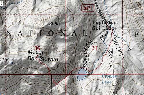
USFS maps show the summit .6 miles to the west of where I marked the summit. There is a plaque on the tallest rock that I have marked as the summit. If there is any elevation difference between the peak I have marked and the USFS denoted one on the map, its only maybe a few feet.
Getting There
From Downtown Juneau, head across the Juneau-Douglass bridge and take the first right on the roundabout headed north on Douglass Highway. From there continue 6.0 miles. Take a Left on Eagle Crest Rd. and drive to the end in approximately 5.2 miles.
Route Description
Start at the ski hill on City of Juneau land by walking up Log Jam ski run almost straight south from the parking lot.
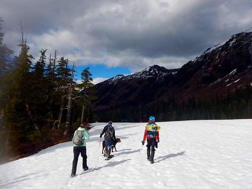
You'll see a metal pipe leading uphill. it generally heads towards Cropley Lake. The route crosses the North shore of the lake and from here enters State of Alaska land. There is a gully towards the South-West that leads to a pass.
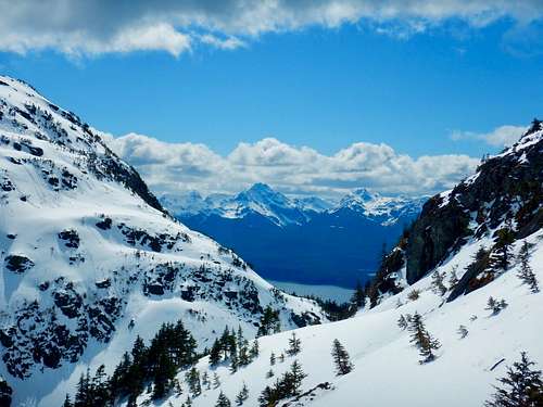
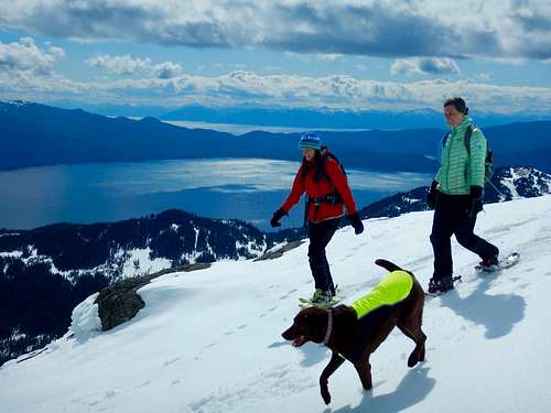
I will note that USFS maps show a trail to Cropley Lake, and I have yet to find it. Just before the pass take a sharp right and make your way up a prominent gully. This nearly puts you on the summit. Traverse to the Left on top of the gully and make your way to the summit. Its a pretty straight forward climb, and if done in the winter, the north side of the mountain could be some amazing skiing.
See attached .gpx for an exact route or check out the Juneau Hikes and Summits CalTopo page.
Essential Gear
In the summer hiking boots and rain gear. A gps is handy too. Having a SPOT or InReach is a great idea. Bring extra dry/warm stuff. Snowshoes in the wintertime.
External Links