
-
 3719 Hits
-
 71.93% Score
-
 3 Votes
|
|
Mountain/Rock |
|---|---|
|
|
38.95514°N / 111.82079°W |
|
|
Sevier |
|
|
Hiking |
|
|
Spring |
|
|
6597 ft / 2011 m |
|
|
Overview
Black Cap Mountain stands above the small town of Salina, Utah. Covered in scattered Juniper and tattooed with the initials "NS" for North Sevier, it dominates the view to the east from the town center.Getting There
From the main intersection in Salina, drive east then turn right onto 300 East. Continue straight on this road out of town as it travels along I-70. About 2 miles past the city park, the pavement ends. Before the road turns south under the freeway turn left onto a small 4WD dirt road into the canyon traveling north. About 2-3 miles, take the first left across a small valley onto a gray dirt road that will require some high clearance in your vehicle. Drive until you come to a fork in the road in a meadow on the northern shoulder of the mountain. Take the left fork onto an even fainter path to the edge of the trees.Route
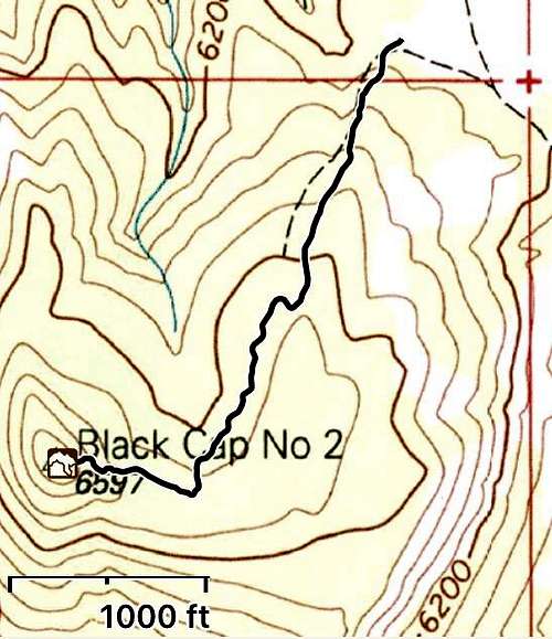
From the treeline off the meadow, follow the ATV tracks south. It meanders a bit but is not steep. At the end of the road, go straight up the slope.Round-trip Distance: 1.32 miles
Elevation gain: 337 feet![Gaia Trail Black Cap]()
Northern Route from the Dirt Road
Northern Route from the Dirt Road