
|
|
Mountain/Rock |
|---|---|
|
|
18.07694°N / 76.70262°W |
|
|
Summer |
|
|
4430 ft / 1350 m |
|
|
Summit: 18.076943, -76.702606
Trail-Head: 18.072928, -76.714488
Catherine’s Peak is situated in the Blue and John Crow national park in Jamaica. The peak is a local landmark, lending its name to the spring-water that is bottled at the nearby plant. The summit is often shrouded in cloud, but on a clear day is visible from miles around - easily spotted due to the radio mast on top.
The route starts in the Jamaican Defence Force army camp at Newcastle. The camp is circa a 50 minute drive from Kingston on the B1 road. From the end of Old Hope Road in Papine, Kingston it is only 21.5km, but still about 45mins from here. The road climbs constantly all the way, weaving its way up into the mountains. The drive is worth the journey in its own right - the views are spectacular.
The Hike is easily completed in around 40 minutes each way. It follows a concrete trail up through the army camp, becoming very steep towards the end on approach to the trig point.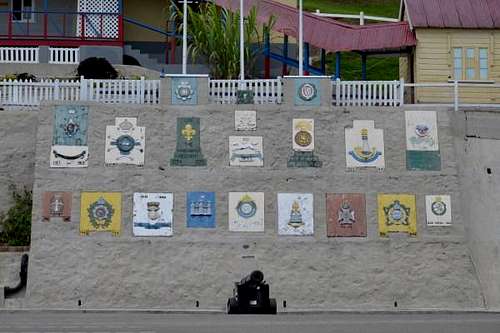
Newcastle army camp. Park here.
Getting There
Driving route: As stated,it will take about 50 minutes to cover the 21.5km to the trail-head at Newcastle. Take Old Hope Road towards Papine. At the main junction by the bus stop and gas station, follow the road around to the left, and then continue straight for 3km to the left turn at the Cooperage (noted by the yellow bus stop on the right). Turn left and continue a further 2.3km to the next junction - keep right here. The road will lead you the rest of the way, passing through the settlements of Irish Town and Redlight before reaching the camp. On arrival at the camp, the road passes right through the middle of the parade square. Drive to the far side of the square and park in one of the painted spaces adjacent to the little shop.
Trail-Head: Walk back across the parade square, past the wall of military emblems toward the point where you entered, but this time keep to the left and take the road that rises up into the camp. Ahead of you there will be a small guard post, just big enough for one person. Speak to the soldier. There will be a bit of back and fore as he phones a more senior person, who should arrive quickly. You will be given a verbal brief on the rules etc and made to sign a register. You will then be handed a small card authorising your presence on the route. The padlocked barrier is on the left (a single pole across the track, that is easily ducked under) - it will be opened for you, and off you go.
Guard hut at trail head
Route Description
The Trail: Unfortunately the trail is on an old concrete track laid some years ago by the army. It takes about 40mins at a leisurely pace to ascend to the 4,430 ft / 1,350 m summit. The trail can get very slippery due to moss when it rains - and it rains every day up here, so take suitable footwear and a waterproof Jacket.
Follow the trail all the way, if you accidentally turn off the track, you'll find yourself either in the upper reaches of the camp or in the Clifton Mount coffee plantation. There is only one route up/down.
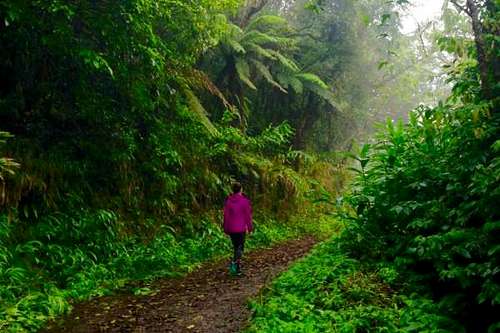
The Trail to Catherine's Peak, Jamaica
At the summit, there are a couple of radio masts and a small padlocked building (presumably related to the masts). There’s a lot of thick vegetation, but the path is clear to the trig point. I wrote a short blog post about my hike here.

Trig Point at the Summit of Catherine's Peak
Essential Gear
Tips:
You are not guaranteed access to the trail depending upon military activity. I had to persuade the soldier to allow me on the trail, so be prepared.
Wear footwear that won’t slip on wet mossy concrete if possible.
Take a waterproof - it is significantly cooler up there than down in Kingston, don’t be fooled by the weather in town.
If you drive on another 10 minutes after passing through the camp, you arrive at Holywell National Park, where there are picnic sites and nature trails to walk. It’s worth doing this too, if you’re going to Catherine’s Peak.
- On the drive there are a few good places to stop for coffee/lunch: Eits Cafe and Cafe Blue.
External Links
Blog Post about the hike: http://www.caribbeancables.com/blog-post/catherines-peak/Eits Cafe: https://www.facebook.com/17MilePost/
Cafe Blue: http://www.jamaicacafeblue.com