
|
|
Mountain/Rock |
|---|---|
|
|
45.59058°N / 123.647°W |
|
|
Tillmook |
|
|
Spring, Summer, Fall |
|
|
2907 ft / 886 m |
|
|
Overview
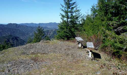
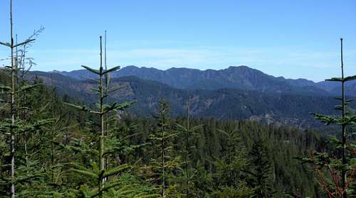
The benches on the summit
Funny thing is that I found this summit by fate. I was heading over to do Kings and Elks while have a cold and upon entering Tillamook State Forest I became very ill. With my illness I knew that hiking up both Kings and Elks was not an option. So I talked to the ranger for another option, which turned out to be Cedar Butte.
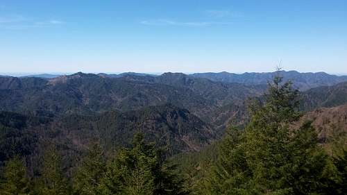
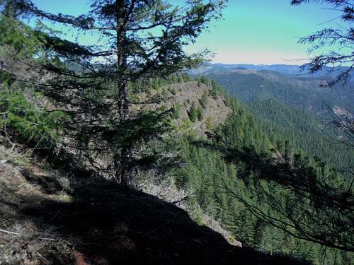
Great views of the Coast Range
Cedar Butte which is only a couple hundred feet smaller and actually more prominent (600 feet of prominence) that Kings Mountain turned out to be an excellent hiking alternative. The hike itself is only 1.5 miles and 750 feet of elevation gain of the views make this more than worthwhile. The view from the top of Cedar Butte is excellent towards the ocean as well as Tillamook and many other mountains in the Coast Range. This summit of home to a fire lookout that was around until a massive forest fire in 1939. Not only was the lookout burned but a lot of the surrounding area was burned as well. Today most of the forest in the region are actually new growth forest planted after the many forest fires that hit the region between the 1930s and the 1940s. Forestry is now very common in this area and today during the week you will encounter a lot of truck traffic on the forest roads.
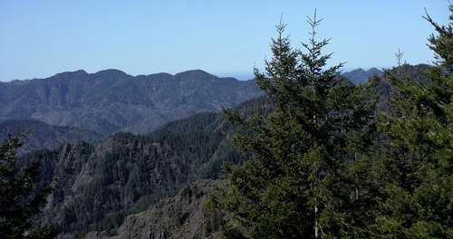
Pretty shot of the Coast Range
The Route
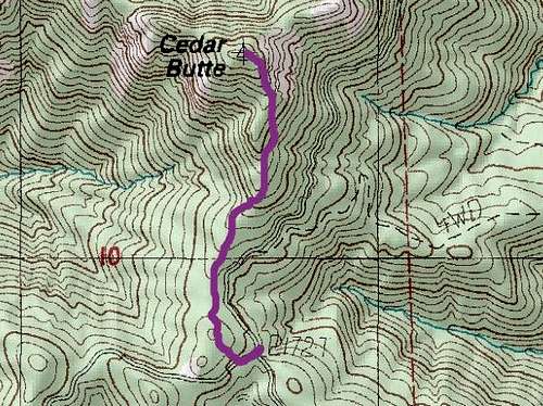
Map of the Route
This route begins in a harvested area. Within a little the trail than enters the forest. The trail than steepens as you go and the footing can get a little iffy in spots. There are switchbacks in the trail so the trail never steepens up too much. The trail continues getting steeper as you continue to go up. Once the trail reaches the summit area the actual true summit is only about 30 feet away from the former lookout area. There are park benches on the summit with excellent views off to the west toward the ocean.
This was taken 0.3 miles from the summit
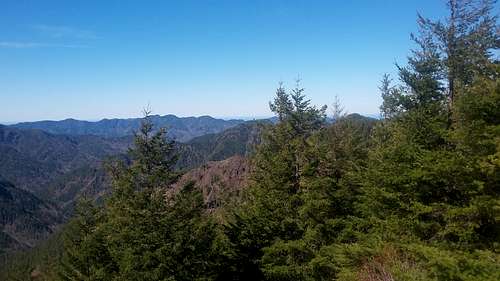
Looking north and west from the summit
Getting There
Shot from near the trailhead
Red Tape
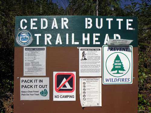
The trailhead sign
Camping
There is no camping at Cedar Butte. Camping is located nearby at Jones Creek Campground near the Tillamook State Forest.
External Links
Cedar Butte outdoorproject page