-
 9915 Hits
-
 72.08% Score
-
 2 Votes
|
|
Mountain/Rock |
|---|---|
|
|
0.02323°N / 78.45645°W |
|
|
San Antonio De Pichincha |
|
|
Hiking |
|
|
10115 ft / 3083 m |
|
|
Overview
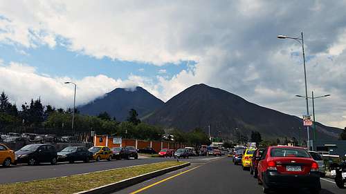
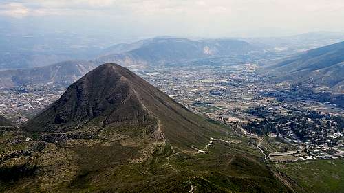
The Cerro La Marca (3,083 m / 10,112 ft) along with Cerro Sincholagua forms part of the active Volcan Pululagua crater rim located 15 minutes north of Ecuador's capital city Quito, and only five minutes northwest of the Mitad Del Mundo Monument. It is one of the easiest low elevation peaks within the Pululagua crater rim complex due to its proximity to the Monumento Mitad Del Mundo and its trails which are Class III.
The views from its summit of the nearby elevations on the Eastern Andean Cordillera and the volcanoes of Fuya Fuya and Cotacachi to the north are stunning as well as the surrounding neighborhoods of San Antonio De Pichincha and the city of Quito to the south.

Getting There
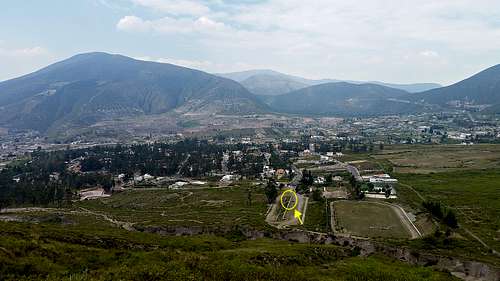
The Trail head starts at Urbanizacion La Marca neighborhood, which is located 5 minutes away from Monumento Mitad del Mundo at the Middle of the World in Quito. To get to the Monumento Mitad del Mundo you need to drive about 25 minutes north of Quito, then follow the road up to the town of Calacali, on the way to the coast. Stop at the Urbanizacion La Marca entrance, located 500 meters before the Mirador del Pululagua entrance. The entrance its located at your right side. You'll need to let the guard at the black door now that you're heading to climb Cerro Sincholagua and La Marca in order to gain access to the neighborhood.

Route
This is the safest, easiest and fastest routes to the summits of Sincholagua and La Marca mountains.
Once in the neighborhood head straight on Calle A all the way to the parking lot where the TH is located. The route continues all the way up to the saddle between Sincholagua (left) and La Marca (right) . From the saddle you'll be reaching any of the summits in 15 to 30 minutes depending on the trail conditions and your physical shape.

Red Tape
** Ecuador has a Level 2 Travel Advisory, which means you should exercise increased caution. This is due to civil unrest, crime and kidnapping. It is highly recommendable to hire profesional guiding services or at least reliable transportation
* You'll need to as for entry permission to the guard at Urbanizacion La Marca entrance in order to gain access.
* Starting the climb by the town of San Antonio De Pichincha which is located east of Pululagua is can be done too, but not recommended due to robberies reported in the past in the nearby neighborhoods.
When to Climb
All year round, preferably before noon to avoid afternoon clouds and enjoy of the views.
Camping
Camping is allowed at the summits and at the saddle, but I would recommend doing it inside Pululagua crater for safety.

