

-
 3178 Hits
-
 83.1% Score
-
 16 Votes
|
|
Mountain/Rock |
|---|---|
|
|
46.19926°N / 10.72992°E |
|
|
Trentino |
|
|
Mountaineering, Trad Climbing, Sport Climbing |
|
|
Summer |
|
|
7651 ft / 2332 m |
|
|
Overview
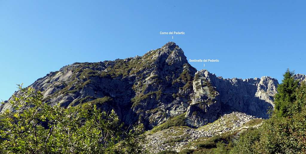
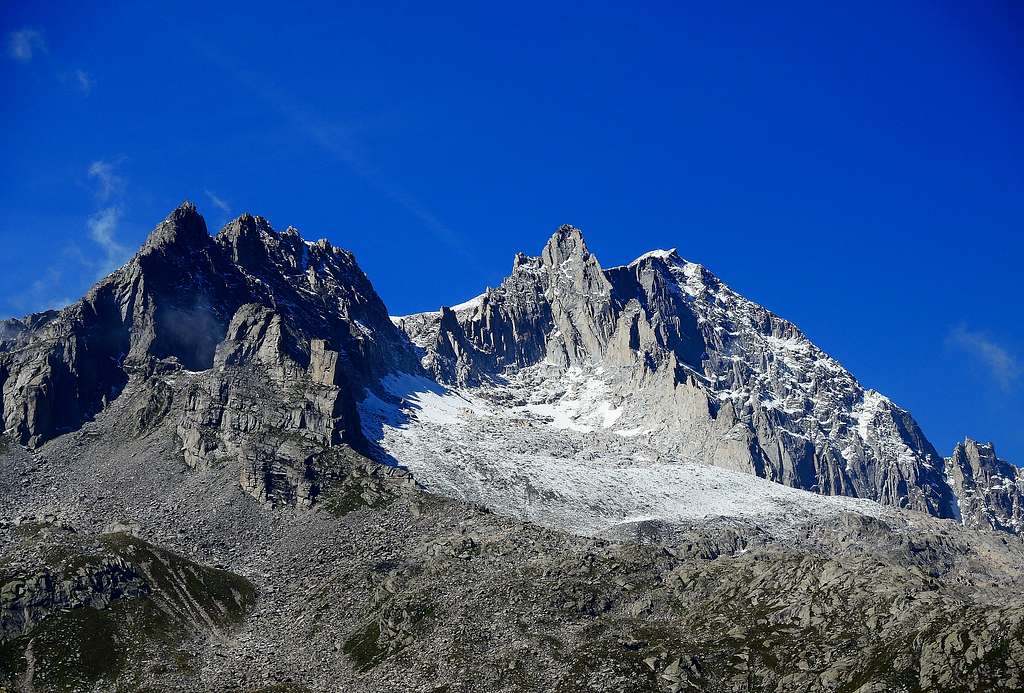
Corno del Pedertìc 2332 m
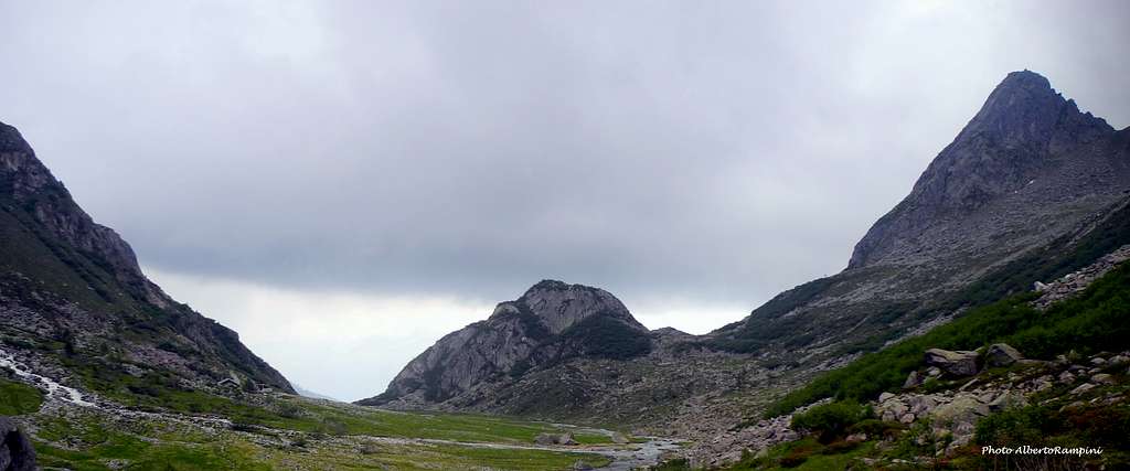
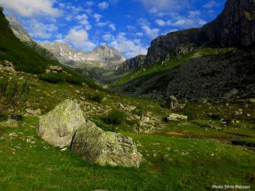
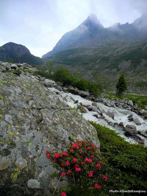
Corno del Pedertìc 2332 m - together with the adjacent and lower Sentinella del Pedertìc (Sentry of Pedertìc) - is a fine peak culminating in a true tiny summit surrounded by beautiful granite peaks. It's a minor summit, anyhow spectacular, belonging to the South-Estern sector of the Presanella Group and located in Val d'Amola, not far from Rifugio Segantini, just above the Malga Vallina d'Amola. The variety of climbs offered by this latter valley is remarkable and makes it one of the most interesting valleys of the Presanella group from the point of view of rock climbing. They range from the classic climbs on Campanile di San Giusto to the East wall of Cima Presanella and to the modern routes on Cima Piccolina and Corno di Pedertic. This latter routes are an excellent introduction to the particular environment of this area.

The interest of this area is due both to the wonderful alpine setting and the fine climbs on a good quality of rock, the "tonalite", the typical rock of the Presanella Group. The "tonalite" is an intrusive magmatic rock having a composition similar to granites and granodiorites. This kind of rock was named in this way by the German geologist Gerhard vom Rath, who found it for the first time in the year 1857 on the Tonale Pass.
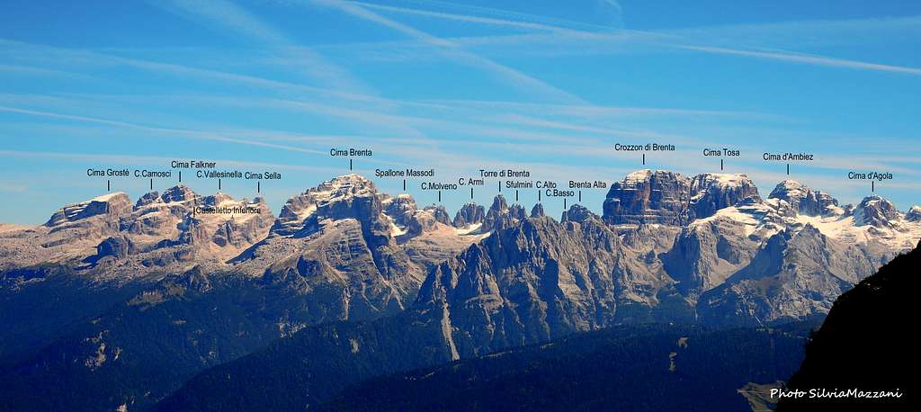
From the point of view of the scenery, the location of these two peaks is particularly strategic, right in front of the Val d'Amola with the majestic main peak of the Presanella and in the opposite direction a spectacular view of the Brenta Dolomites.
Getting There
Road access
The road access is from Val Rendena, where a turn-off road allows to reach by car up to more than 2000 m of altitude (Vallina d'Amola).
Getting to Val Rendena
Coming from Autobrennero exit Trento and take the road to Riva del Garda, reaching the village Le Sarche. Here continue straight toward Tione di Trento. In Tione turn to right and take the SS 239 Val Rendena route to Pinzolo. Pass Pinzolo and drive a few kilometers towards Madonna di Campiglio. After the village of Carisolo, leave the main road and turn to left, taking a narrow road rising along Val Nambrone towards Laghi di Cornisello. After driving about 9 km on this road with several hairpins we reach a fork. The main road leads to Laghi di Cornisello, we instead turn to left (Rif. Segantini signposts), omit the path n. 211 on our right hand side and continue driving for about 1 km, leaving the car in a good parking lot near the bridge over the river Sarca that leads to the Malga Vallina d'Amola 2020 m.
Walking approach
Go back for about fifty meters along the road to take a mule track on the right - partially invaded by vegetation - and follow it, getting a signpost "Passo della Nona". Continue on a path with some hairpins and at some point leave the main path to the Passo della Nona and take a track that forks to the left and leads under the wall of the Sentinella del Pedertica (about 20 minutes from the car park).
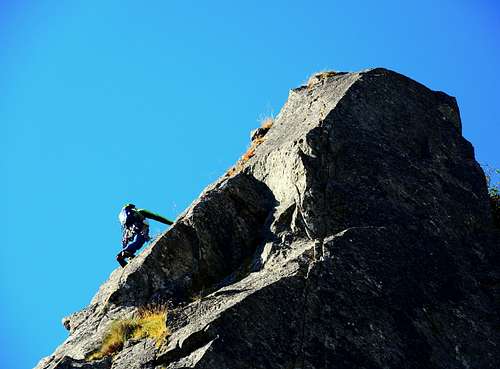
Route "Sentinella del Pedertic"
Difficulty: V/A0 or 6a+
Length: 160 m
First ascent: Francesco Salvaterra nov 2017
Funny route fully equipped with a short approach and a predominantly climb on slabs. The route reaches the thiny summit of the Sentinella del Pedertìc, a gendarme located north-east of the Corno di Pedertìc. From here you descend in rappel and you can then go down or continue on the Corno di Pedertic
L1 Slab and edge, V +, 30 m
L2 Easy connection length, 30 m
L3 Steep corner with one technical move and a slab on the right V+, 25 m
L4 Slab, IV+, 25 m
L5 Slab, V+, 30 m
L6 Crux pitch, a short move of 6a+ (or IV and A0), 20 m
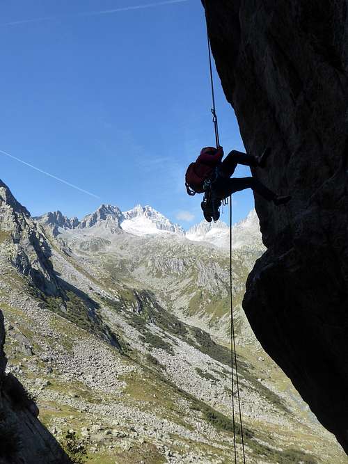
Descent: from the summit a 25 m abseil on the opposite side, then another abseil of 20 m
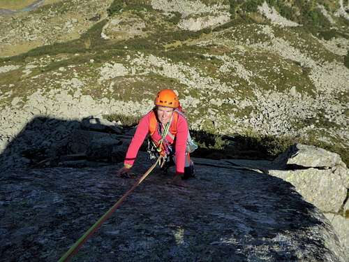
Corno del Pedertic
Via "Sacchi"
Difficulty: 6a
Length: 220 m
First ascent: R. Maestrelli, M.Polo, L. Quaini, P. Sacchi 11/05/1958
A varied route, on a slab, then a ridge cut by a thin crack. Equipped enough with easy possibility to integrate with mobile protection, except for the second pitch slab. All the belays are equipped.
Red Tape

There are no particular restriction in climbing and hiking. Cima Piccolina is located within Parco Naturale Adamello Brenta, the largest protected area in Trentino, established in the year 1967. It's located in Western Trentino and with its 620.51 square kilometers includes the mountain groups of Adamello, Presanella and Brenta Dolomites, separated by Val Rendena.
When to Climb
Best period to climb goes from middle June to middle September
Where to stay
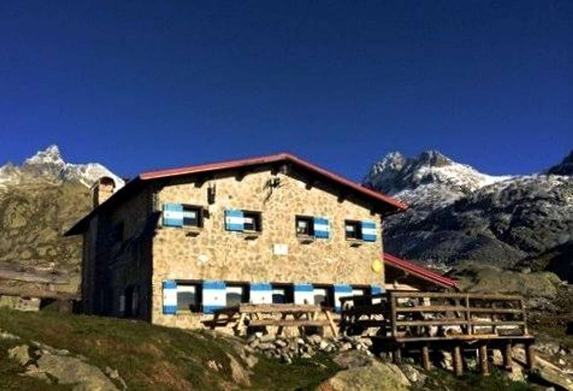
Several possibilities of accomodation in Val Rendena. Huts:
- Rifugio Nambrone
- Rifugio Segantini
Meteo
METEO TRENTINO
DOLOMITI METEO - TRENTINO
Guidebooks and maps
"Presanella" - Guida dei Monti d'Italia CAI-TCI - Dante Ongari, 1978
"110 Itinerari Alpinistici del Gruppo della Presanella" - Urbano Dell'Eva, Edizioni Manfrini 1985
Maps:
"Adamello - Presanella" - Tabacco scala 1:25000