
-
 11720 Hits
-
 84.26% Score
-
 18 Votes
|
|
Mountain/Rock |
|---|---|
|
|
45.95576°N / 10.45527°E |
|
|
Mountaineering, Trad Climbing |
|
|
Summer |
|
|
9327 ft / 2843 m |
|
|
Overview
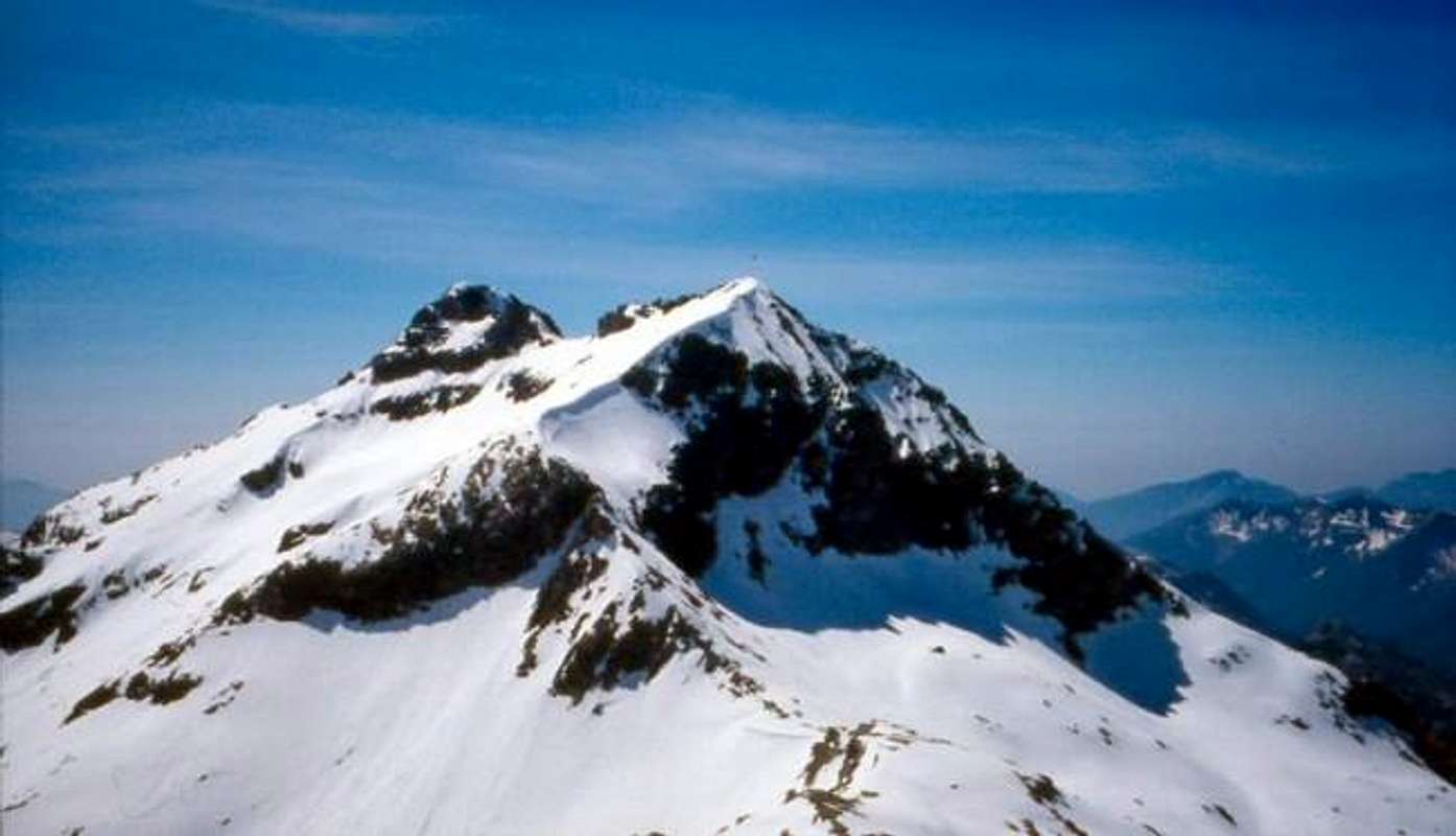
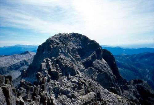
Cornone di Blumone 2843 m
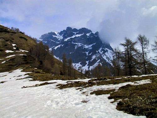
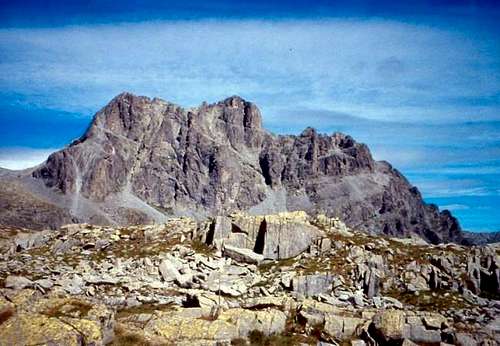
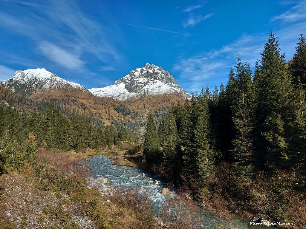
Cornone di Blumone 2843 m is an imposing rocky mountain and one of the Southernmost peaks in the Adamello Group. It is located nearby the border between the Adamello group and the Lombardy Prealps. Placed between Val Camonica and Val Sabbia, it's one of the most popular goal in the area in reason of the variety of situations it offers to the climber. The Cornone di Blumone has three main sides, from the easy North side to the East side which shows two gullies dividing the face into three sectors to the vertical rocky wall on the West side.
The Cornone di Blumone area was affected by fighting in the First World War. In the vicinity of the Passo di Blumone there are still the remains of the trenches, the walkways and the ruins of a barrack which are all part of the Italian position.
The first known ascent was made in 1878 by a group of Italian Alpine troops. Now it's fully included in the Adamello Natural Park.
Getting There
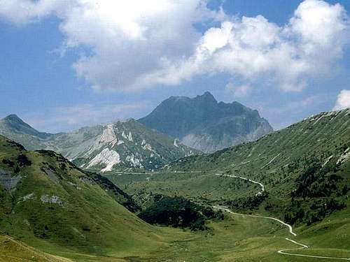
Cornone di Blumone is situated in the Brescia Province, Lombardy region. Can be reached from Milano (motorway until Bergamo-Seriate, then follow to Tonale Pass until Breno and turn right to Crocedomini Pass) or Brescia (follow for Bagolino and then turn left to Crocedomini).
Normal Route
North-West side
It's the side where it's located the Normal route to summit the mountain. It's a very interesting itinerary especially in the presence of snow, when it becomes a mountaineering ascent with steep sections requiring the use of an ice axe and crampons. In summer, without snow, it's an ascent for experienced hikers.
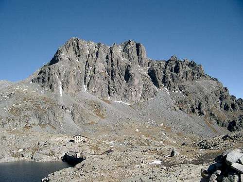
The reference point to climb is the Rifugio Tita Secchi 2362 m at Lago della Vacca (formerly Refuge Gabriele Rosa).
Road access
From Breno follow the direction to Passo Croce Domini and reach Bazena about 1 km before Passo Croce Domini (parking lot). Alternatively from Bagolino drive up along the Val Dorizzo in the direction of to the Malga Cadino (a farm on the left of the road). Leave the car in a parking lot on the side of the road, just before Malga Cadino.
Walking approach
There are two possible itineraries to reach the Rifugio Tita Secchi. Both starting point are placed at about 1 km from Passo Crocedomini, respectively in the Val Camonica and Val Sabbia sides. Remember, during the winter the pass is closed by snow and any of these points can be reached exclusively from the own side.
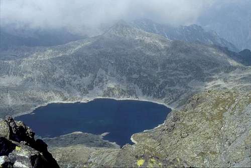
- the first, starting from Bazena 1798 m (useful for people coming from Breno and with an easier car park). To the right of the car park it starts the path 18 (path Adamello 1) which in practice is a dirt road up to the Malga Val Fredda, from which to continue up to the homonymous Pass at an altitude of 2338 m. The path continues descending slightly at the beginning, then on an almost flat path and then again with a moderate slope on a beautiful ex-military road reachs Passo della Vacca at an altitude of 2359 m. Its characteristic name is given by a large boulder that, from a distance, has the appearance of a cow. From here it is already possible to see the rocky bastion of Blumone looking towards the NW. Shortly to the Refuge Tita Secchi. Continue on the back of the refuge, always along the path between Lago della Vacca and the rocky bastion of Blumone, and climbing up moraine or snow-covered slopes, reach the Passo Blumone 2633 m where it starts the Via Normale.
- the second, starting 100 meters before Malga Cadino 1799 m, a farm, useful for people coming from Bagolino but with limited car park capability. Climb along the meadows just above the parking lot and you will come across a dirt track to follow to the left towards the Corna Bianca on a flat path. After Corna Bianca continue along a well-marked path and start climbing along a grassy ridge. Continue passing under the W side of the Cresta Laione, making a few bends, until you reach the Passo della Vacca, where the two different path converge. You will then soon reach the Rifugio Tita Secchi Refuge (formerly Gabriele and Rosa) along the path. From here continue as for the previous chapter.
The Normal route description
From the Passo di Blumone turn right and go up the rocky spur that descends from the Northern foresummit (I grade), with no obligatory route (marks) until you reach a summit plateau. On this stretch, until July, it is possible to encounter snow slopes up to 50° to climb which the use of specific equipment is required (ice axe and crampons). To the right, not far away, we can see the foresummit, while to its left, further away, the summit with a cross and a pylon. Traverse horizontally, on snow or scree and rocks, depending on the season, aiming for the top, up to another rocky prominence which with snow becomes a slope at 55°. After passing it, reach another short slope and a saddle. From here climb a rocky ramp (trail sign) with granite blocks, often free from snow already at the beginning of the season, to be overcome with easy climbing (I+). Turn right and climb the ridge, then turn left to reach the summit cross and a little further on the pylon with the trigonometric signal.
Climbing routes
The South West face of Cornone di Blumone has about thirty climbing routes. The most attended are:
- Via dei Pilastri Rossi V UIAA, 300 m
- Via dei Diedri VI / VI + UIAA, 300 m
- Spigolo Ovest (via Maffei) III and IV UIAA, 350 m
- Riti magici al Chiaro di Luna VII UIAA 250 m
- Sogno di Elena from III to VI, 350 m
Red Tape

No fees no permits needed and no particular restriction in climbing and hiking. Cornone di Blumone is located inside there is the Parco dell'Adamello, which extends for 510 square kilometers on the left orographic side of Valle Camonica, in the north-eastern portion of the Province of Brescia (Lombardy). In the Trentino side of the Adamello group there is the Adamello-Brenta Natural Park, the largest protected area in Trentino, established in the year 1967. It's located in Western Trentino and with its 620.51 square kilometers includes the mountain groups of Adamello, Presanella and Brenta Dolomites, separated by Val Rendena.
When To Climb
Climbing and mountaineering: best time is from June to October. In winter you need ice and snow gear.
Ski-mountaineering: from February to April-May
Hut
Phone: 00390365903001 - 0039337441650
The close Rifugio Gabriele Rosa is not managed and it may be useful in winter.
Camping
No free camping is allowed in the area.
Mountain Conditions
You can refer to the ref. Tita Secchi manager to obtain info about mountain condition.
Meteo forecast
Meteo ARPA Lombardia
Meteo Trentino
Guidebooks and maps
"Adamello" Vol. I - Pericle Sacchi - Collana Guide dei Monti d'Italia CAI-TCI