-
 10972 Hits
-
 83.69% Score
-
 17 Votes
|
|
Mountain/Rock |
|---|---|
|
|
46.73860°N / 12.67920°E |
|
|
8501 ft / 2591 m |
|
|
Overview
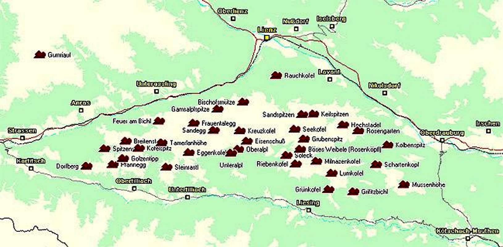
Geographical Classification: Eastern Alps > Gailtal Alps > Lienz Dolomites > Eggenkofel

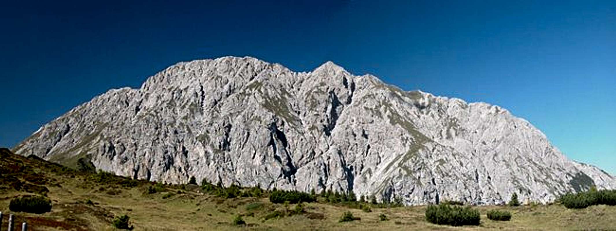
Eggenkofel is a massive, twin peaked and solitary mountain to the southwest of the Lienz Dolomites. In contrast to Lumkofel, which is located to the southeast, this is a real Dolomite Mountain, with large vertical limestone faces. The rock is already in an advanced state of erosion so that the two routes onto the mountain can be rather dangerous, especially in wet and foggy weather. Take extra care if you encounter snow or ice fields. Beneath the snow there is loose gravel, making the winter experience indeed really dangerous.
Apart from the scree, both ascent routes to the mountain are steep but relatively easy. The first heads for the large western summit, the second ends at the main summit to the east. In both cases the ascent follows a steep gully with short climbing stretches of UIAA grade II. The trails are not secured – there are only few places in the loose rock, where bolts could be fastened. Thus you are on our own – parties usually stretch out over large areas in order to prevent hurting anybody by rock fall.
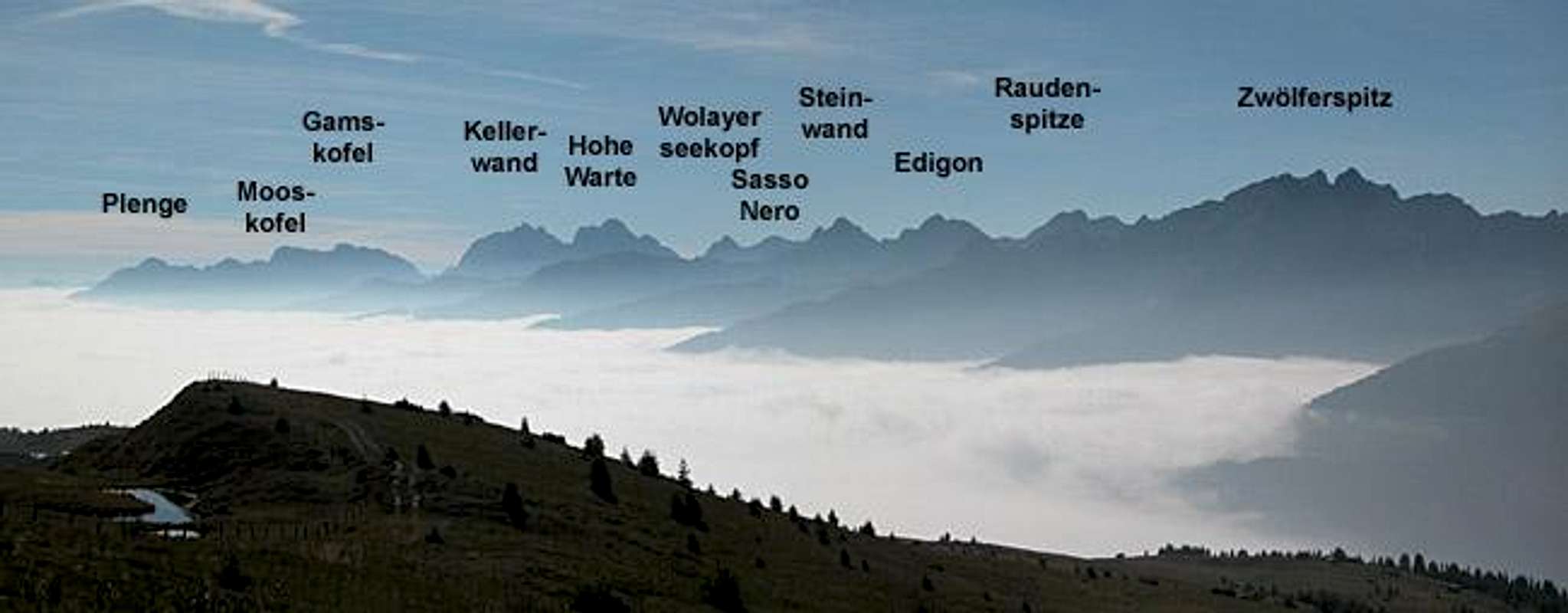
Once on top of the mountain you are rewarded with the greatest views the Lienz Dolomites have to offer. Only Hochstadel, which is also located solitarily on the opposite side of the group, can rival Eggenkofel in that respect. The whole western part of the Carnic Alps Main Ridge is on display and so are the Sexten Dolomites. The view deep into the neighbouring Lienz Dolomites shows the complexity of that small mountain range. To the west and north the mountains of Hohe Tauern can be seen with the Großglockner and Großvenediger Glaciers shimmering in the sunlight.
Both summits of Eggenkofel are connected by a narrow and very exposed trail. The trail follows the ridge on its southern side, often losing and gaining altitude. Since the main summit can be crowded during the main season, many climbers escape to the less frequented western summit. Often both routes are combined to form a loop, sometimes also followed by a hike to neighbouring Tamerlanhöhe (2376m) or Steinrastl (2181m). Unfortunately recent rockfalls have cut deep gullies into the otherwise smooth meadows to the south of Eggenkofel. Therefore the traverse to Tamerlan or Steinrastl is much more demanding than any map would reveal.
Summit views

Due to its isolated location southwest of the Lienz Dolomites Eggenkofel is a great summit for views. Seak a peek

Getting There

Eggenkofel is a rather large mountain, stretching for almost 10km on the northern slopes of the Lesachtal Valley. Therefore there are quite a number of trailheads. In the westernmost trailhead is in the village of Obertillach, there are three trailheads at Untertillach and an eastern trailhead at Eggen. All villages are located on B111, the road running through Lesachtal Valley. The valley is rather remote (it is said to be Europes most natural alpine valley) but getting there is far from complicated (though lengthy).
From the West (Brenner Motorway A22)
Leave the Brenner Motorway near Brixen / Bressanone and follow SS49 to the east through Pustertal / Val Pusteria. To the east of Innichen / San Candido you cross the Austrian - Italian border and follow the road (now B100) to Tassenbach. Turn right (south-east) here onto B111, which you follow to to either of the villages mentioned above.
From the North
There are two possible roads:
- From Kitzbühel over B108 through the Felbertauern Tunnel to Lienz, then southeast to Oberdrauburg and Kötschach-Mauthen (B110), where you turn on to B111 west into Lesachtal.
- From Salzburg along motorway A10 to Spittal. Turn west on B100 to Oberdrauburg, there south to Kötschach-Mauthen were you turn east on B111.
From the South (Udine)
Take Motorway A23 to the exit Camia Tolmezzo. Follow SS52 north to Tolmezzo where you turn onto SS52 bis. This leads to Plöckenpass, where it crosses the Austro-Italian border. In Austria the road turns into B100 and at Kötschach-Mauthen you have to turn east on B111 into Lesachtal Valley.
Red Tape
I'm not aware of any red tape in the area. Some of the flowers you encounter are protected so leave gentians and edelweiss where they belong. The meadows to the south of Lumkofel are used for extensive grazing of cattle. So please close any gates you come across.
When To Climb
The best time is late June through early September. Sometimes even October climbs are possible. Be careful in spring and early summer. Though both ascent routes run along the south face they climb narrow, scree covered gullies and ledges. with a snow cover you cannot be sure where you place your foot and security is almost impossible in the lose rock.
Accommodation
In most of the villages of the area there is a small campground, which in most cases is associated with an inn or hotel. If you are looking for hotel rooms or apartments follow one of the links below
- Lesachtal official site
- Lesachtal lodging (tiscover.at)
- Lienz Dolomites lodging (tiscover.at)
- Hochpustertal lodging (tiscover.at)
Weather Conditions
Weather in southeastern Austria (East Tyrol and Carinthia) is much better than in the rest of the country. The mostly western winds of Europe deposit their moisture in the western and northern Alps so that only little is left. Eggenkofel is located near the border between the two Austrian states, so for a weather report look at one of the pages below:.
Maps 'n'Books
Maps
I have been using a map by Kompass Verlag, which is very good for the hiking trails though it does not show ALL the relevant summits of the area.
- Lienzer Dolomiten / Lesachtal
1:50000
Kompass Map WK47
Kompass Verlag
ISBN: 3-85491-053-3
Books
You’ll probably not be able to find anything on the Lienz Dolomites in a language other than German. The books I used are (only the first describes the ascents of Eggenkofel ):
- Hiking and Trecking
Osttirol Süd
W. Mair
Rother Verlag
ISBN: 3-7633-4132-3 - German
ISBN: 3-7633-4307-5 - Italian
Good descriptions with maps covering: Defregger Berge, Villgrater Berge, Carnic Alps, Lienz Dolomites
- Gailtal – Lesachtal – Karnischer Höhenweg
Kompass Wanderbuch 982
Kompass Verlag
ISBN: 3-85491-500-4
Good Descriptions with maps and elevation profiles covering: Carnic Alps, Southern Lienz Dolomites, Gailtal Alps


