An Awfully Hazy Day on McGuire - August 18th, 2015
Very few things in my life have haunted me like Mt. McGuire, and it wasn’t just McGuire, but McGuire as the microcosm of a week of frustrations through some of the worst haze the west had ever experienced during the latter part of August 2015. I had a wide range of factors I could blame for the end result, from getting hit by a car in 2014 and as a result McGuire falling out of the timetable, to me getting complacent after a relatively haze free year in ’14 not realizing that it was due to an above average snowpack winter season, to failing to monitor drought conditions during the abnormally dry winter of 14/15 out west, to pushing my trip back by a week to attend a friend’s birthday BBQ, to opting to go for Snowshoe and Holland during the early part of my trip rather than swinging through towards McGuire, the peak I had thought about more than any other through my first year living back east, to the difficult but ultimately fatal decision not to punt McGuire forward another year after arriving in Salmon through ever increasing haze.
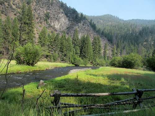
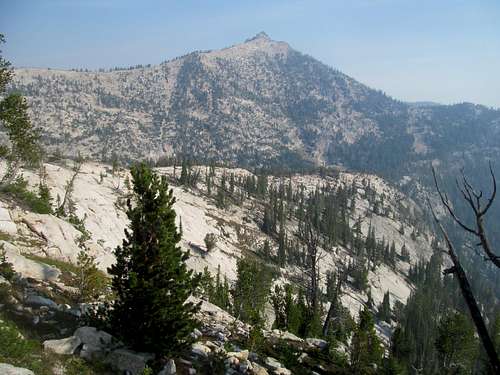
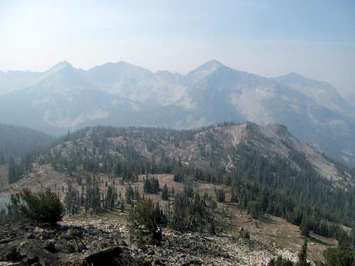
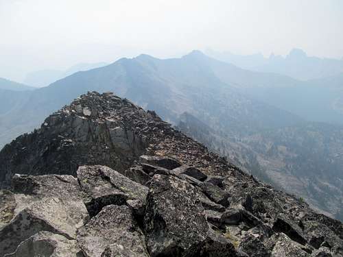
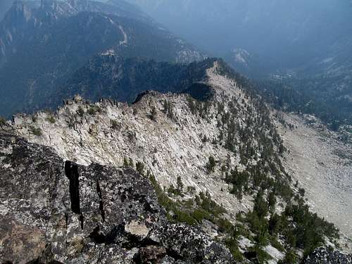
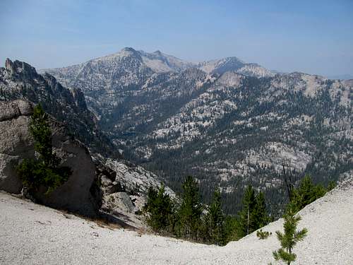
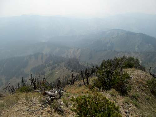
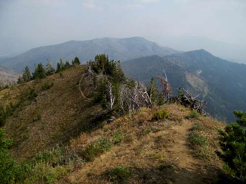
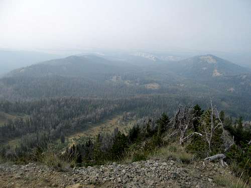
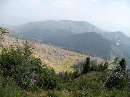
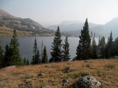
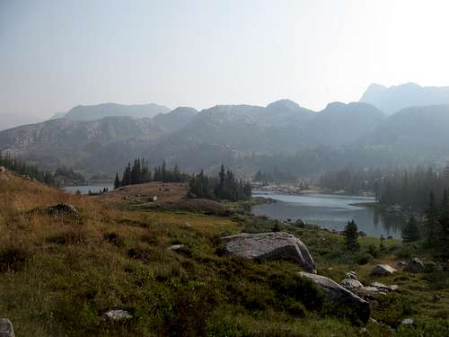
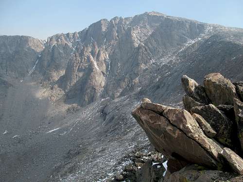
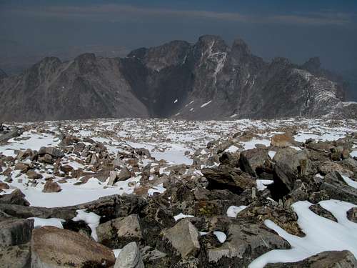
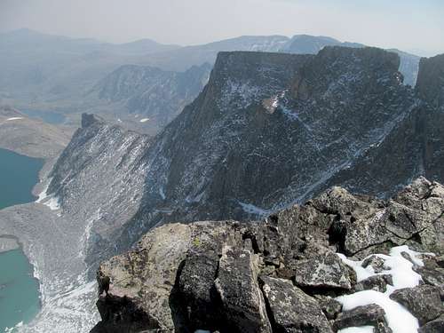
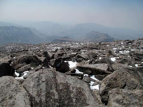
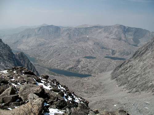
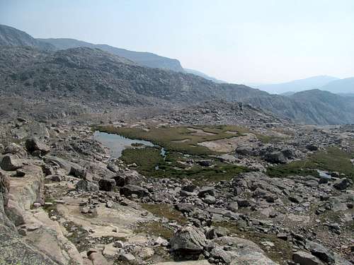
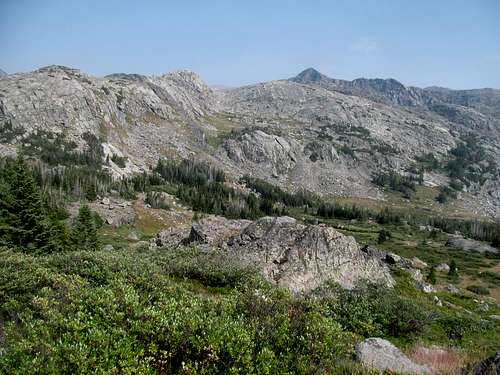
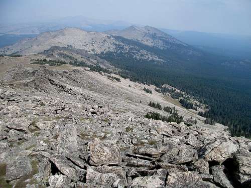
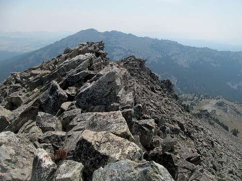
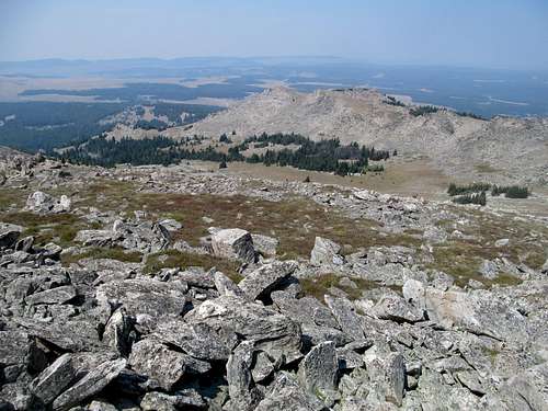
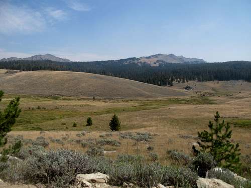
I still shudder with rage typing this now thinking about it: a wilderness the size of New Jersey, one of the largest river canyons in the country running through the middle, the Bighorn Crags sitting just as mightily above that as Yosemite does above its much more congested namesake valley, a long drive of four hours off the paved roads to get to the middle of one of the deepest wildernesses in the country, a long trudge 20 miles with five or six thousand feet of elevation gain (depending on whomever’s GPS readings) on albeitly good trails to the top of the mountain…the spot I had pined and yearned for a long year away from the mountains…and fucking nothing. No views, no panoramas, no sights of the Salmon River below, no vistas past it to Stripe Mountain and the Clearwaters beyond, no views to the other peaks of the Salmon Rivers such as Taylor, White (10,448), the General, Cottonwood Butte, Mormon, etc, barely any half assed views back towards the main crags, piss poor silhouettes of Aggipah, Sheepeater, and Fishfin Peaks across from the dull gray mass of Ship Valley Lake…fuck everything.
Backtrack a bit to the last TR…the fires were blazing and the haze bad but not awful in the Coeur d’Alene area…and virtually gone during a cool and cloudy day where Greg and I were scared off of Bennett Peak due to a wildfire immediately nearby, after which I opted out of Latour Peak after a couple of attempts due to exceedingly bad and slash or closed roads (Greg got the peak running up the long way). I wasn’t too dismayed though about what would be my only peakless day of this trip, as I was focused on not getting injured or wearing my leg muscles out too much for McGuire, and a rest day at this juncture wasn’t the worst thing in the world.
I camped alongside Greg and we drank our respective liquors one last time south of Lolo Montana, parting ways the next morning…he for St. Joseph’s Peak and me for a pre-McGuire rest day on Piquett. Though I’m used to solo attempts on peaks most of the time, much of this trip I’ve been accompanied by Greg and Sam (for the first 2-3 days), with leapfrogging days where we went to do our own things. Now I was completely alone out west for the first time in almost a year, and it felt unusually disconcerting.
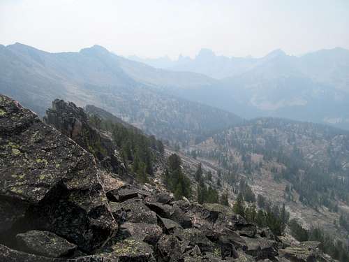
The haze was bad coming into Missoula, worse on Piquett, even worse crossing into Idaho and the town of Salmon, and worse on Taylor Mountain en route into the Bighorn Crags. I could have turned away in Salmon, started east towards Wyoming where the air quality was better (for a few days, anyhow), but I chose to listen to a forest ranger who had just taken a chopper ride over the crags and said, while hazy, they were still worth visiting. I told myself that I’d get Taylor, not a huge commitment, assess the situation, and proceed from there. If I could see the Crags from Taylor, then I was good to go. If not…well it turned out I was pretty much mentally pot committed at that point, and couldn’t bear the thought of deferring the peak and having to think about it constantly for another year.
My problem was hope. Fuck hope, it’s the worst thing in the world. I hoped that conditions would improve, I hoped that visibility would be adequate…my flawed assumption that to wait another year thinking about McGuire having not gotten the summit would be worse than waiting a whole year bemoaning the waste of a day (plus one with Taylor and the drive in) that I will never ever get back in this lifetime and wasting all the energy, stress (from planning the actual hike, to driving the shitty, bumpy road into the Crags, to having to camp without cell phone reception, to having to spend the larger part of two days without cell phone reception) for absolutely nothing, to the knowledge that I’d have to go back and fucking repeat (puke puke puke puke vomit puke) the peak (as well as Taylor, midas whale at this point)…that was my downfall that will probably take several lifetimes for me to get over.
So I retraced my progress from Iron Lake back up FR 20, where I made the fateful decision to turn left, deeper into the Frank Church down into Panther Creek. The air almost seemed clear after I descended the half dozen or so switchbacks to this, the main drainage between the Middle Fork, the North Fork, and the outside world. Most of the roads to the crags were pretty well marked except for the initial turnoff, but following each junction on my Benchmark Atlas allowed me to verify the road and all its subsequent bumps and bruises to a packed oasis of automobiles at the trailhead.
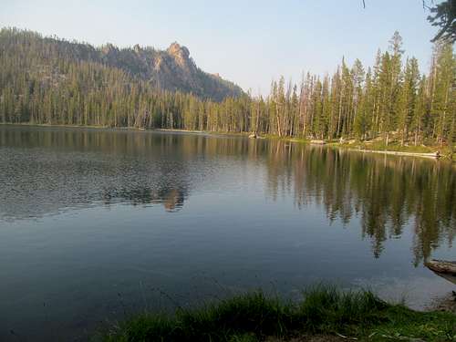
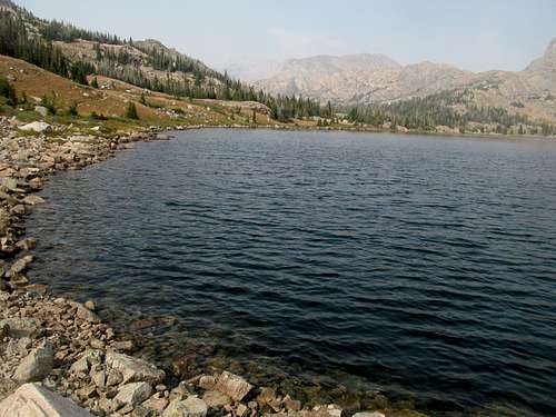
Apparently most of the visitors were backpackers, and I was astonished to see a good amount of passenger cars that had somehow survived the oftentimes steep and rocky road. I passed the outfitter camp nearby but spotted no signs of activity. The campground hosts, a delightful older couple who had been working the Crags each summer for decades, greeted me, and we chatted about the smog and my plans for McGuire the next day. They suggested I take a jaunt to Golden Trout Lake, a quick hike from the trailhead, and I followed the trail down in my sneakers. The trail kept descending and I hoped that it would neither wear out my leg muscles unduly or see its rockier ramparts do any damage to my ankles, unprotected as I was by thick hiking boots. The trip was worth it though and I enjoyed briefly the peace and stillness a remote mountain lake brings at dusk.
A father and son pulled up and asked the hosts some questions. I partook in the conversation and found that they were backpackers, of course, and obviously LDS by mannerism, timing (a backpacking trip midweek to be back home by Sunday), and background (coming from Eagle, ID). They were camping out for the night as well to start their trip the next day, and we wished each other luck on our respective trips. Take note of them though, as they will figure significantly in a postscript following my day on McGuire.
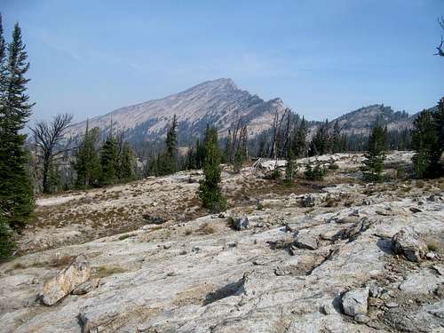
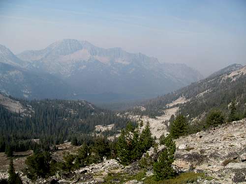
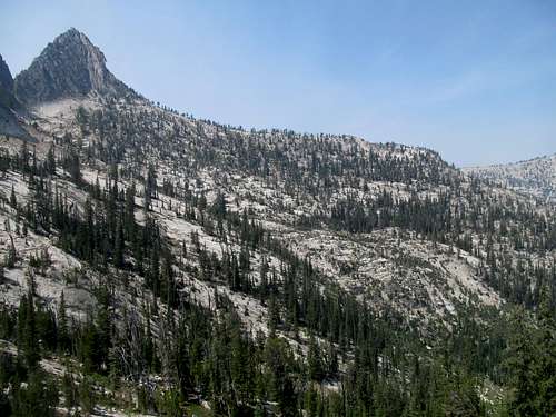
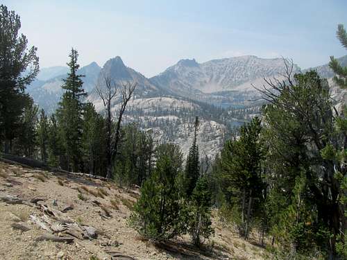
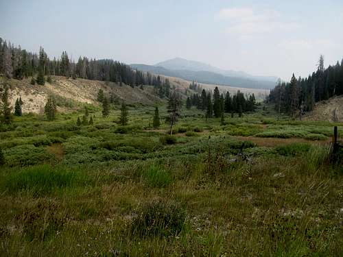
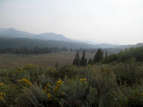
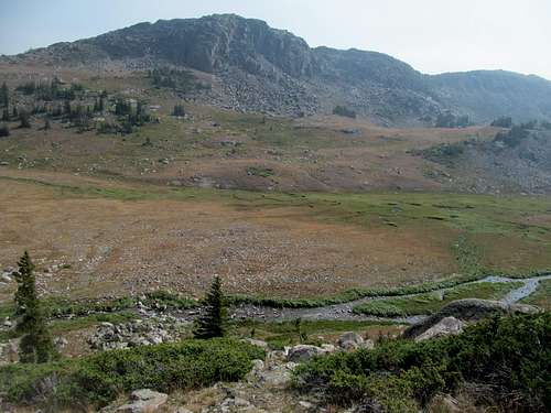
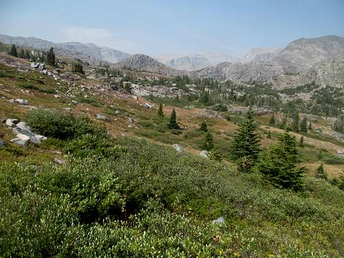
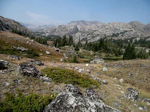
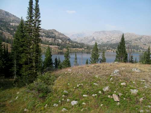
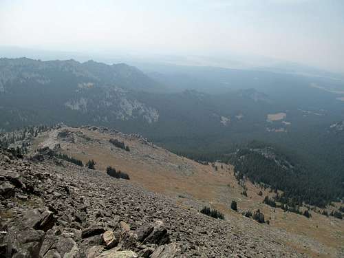
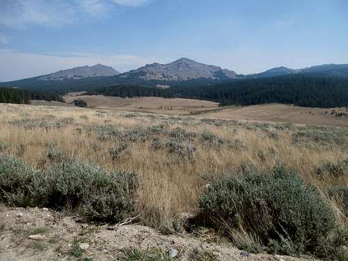
Prudence dictated an early start, and I was off and walking by seven-ish. The trailhead is over 8,600 feet, the peak is barely over 10,000, and yet the round trip requires between 4,000-6,000 feet of gain, which means you’ve got a lot of ups and downs to deal with. Lots of trail junctions too as well to keep track of, which necessitated downloading a GPS track, such as Ken Jones’ on peakbagger, was an invaluable effort. The initial mile ascends a ridge overlooking Golden Trout Lake on the right and beyond, shadows of ridges bathed behind the dull pink hues, the great haze cloud of 2015 perverting the phrase great smoky mountains. I tried counting each downhill section I encountered so that I could set my expectations for the degree of suckiness the return trip would bring; after the first initial climb and downclimb the trail meets the stock trail, then meandered slowly through a flat ridge where the first small crags came up and lined the trail immediately to its right.
Before one of the Cathedral Lake junctions a black bear came out of nowhere and sprinted across the trail maybe 10-20 ahead of me; I didn’t see where it came from but obviously its senses were sharper than mine, and it disappeared just as quickly.
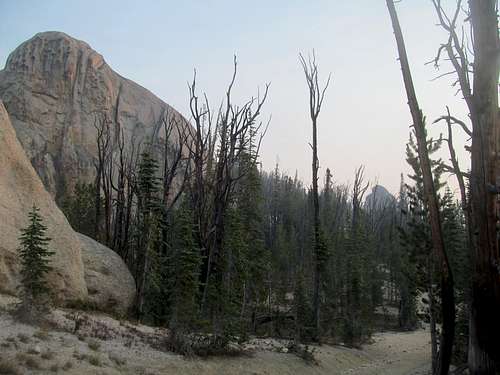
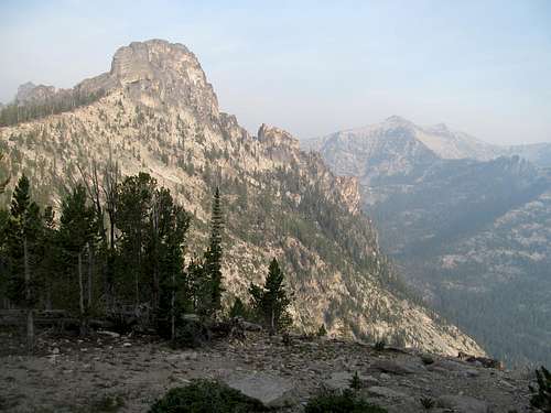
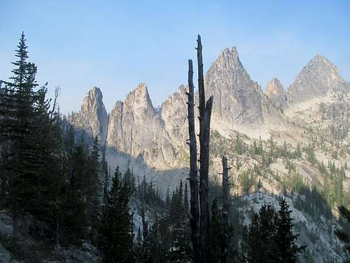
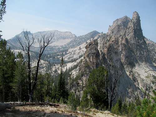
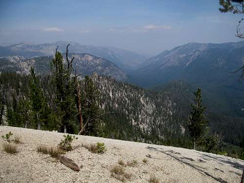
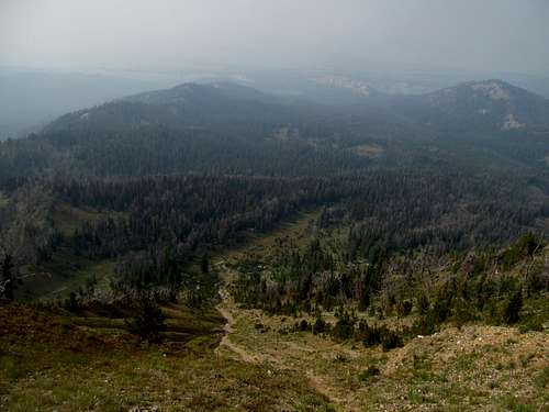
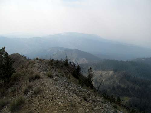
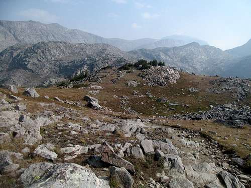
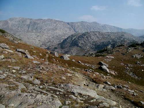
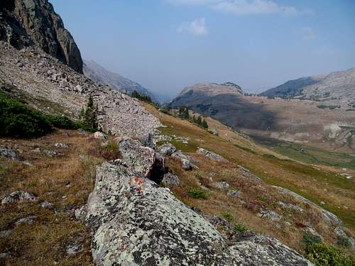
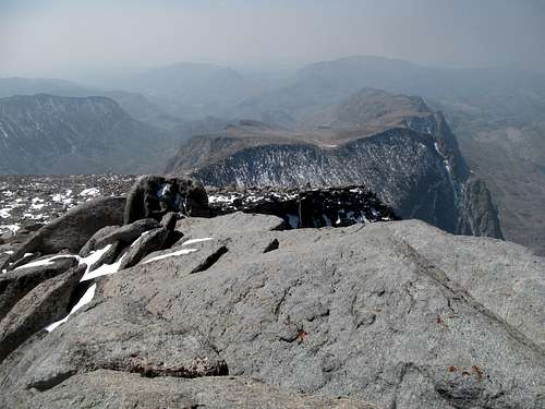
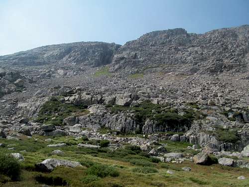
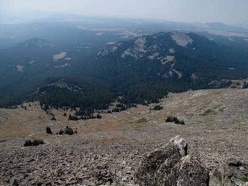
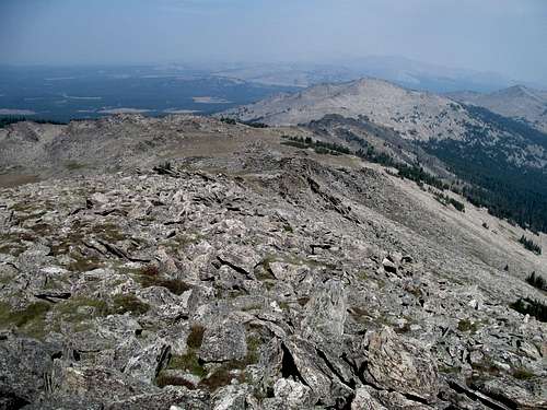
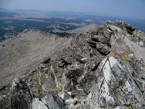
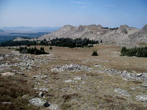
As much rage as I harbor for this day now in hindsight, the anger was slow to develop as the day progressed. Part of it was because I still had that goddamned parasite called hope taking up real estate in my head, but part of it was also how the sheer sublime scenery of thecrags, hazy as it was, blew me away, from the soft glow of the rocks intimately lining the trail, or the distant visage of needle-like gendarmes silhouetting the horizons. And really I had no problem with my views and experiences deep in the heart of the crags; they are an intimate area where much of the scenery is up close and in your face.
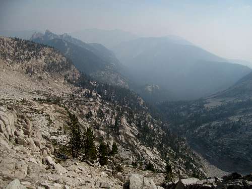
The problem, the heart of the matter, is that McGuire lies by itself past the heart of the Crags…and what I was missing out were views and an awareness of the Crags within the greater context of the Salmon Rivers, Bitterroots and the greater Frank Church ecosystem as a whole…that’s what’s driving me mad with rage and recriminations even to this day and I imagine for decades to come.
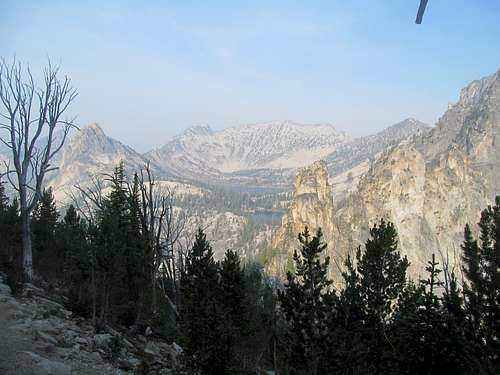
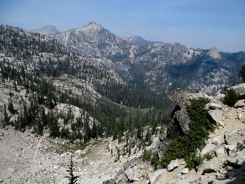
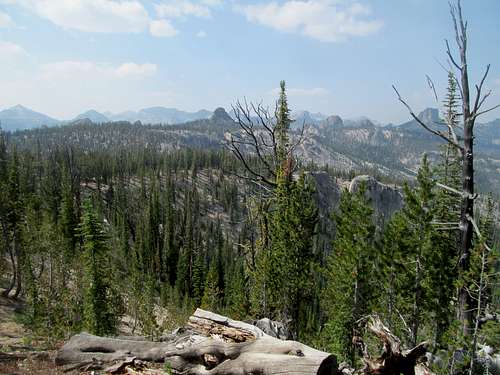
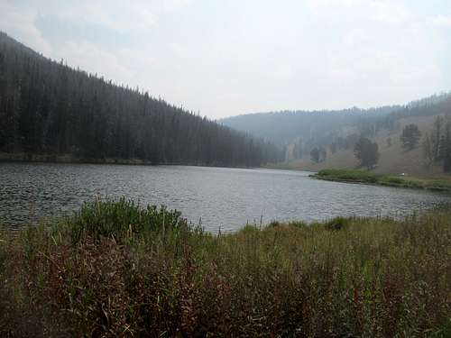
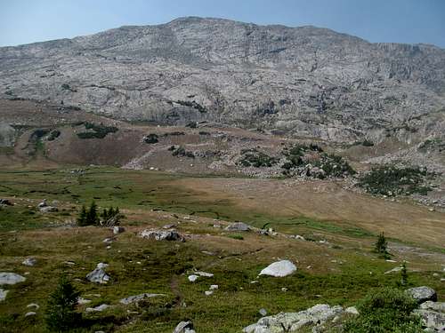
Back to the trail…some of the best views along the approach was past Cathedral Rock, where after another up and down or two the trail descends steeply along the left side of a steep granite slope towards a junction overlooking Harbor and Wilson Lakes as well as the Fishfin Ridge area. This shady stretch coupled with a calm morning breeze formed small moments of tranquil nostalgia for me amidst the overall context of this wasted, useless day.
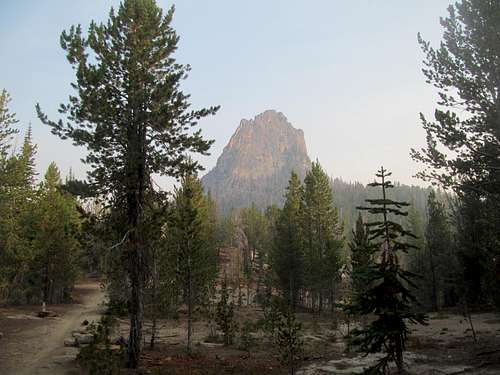
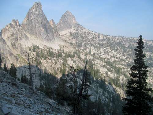
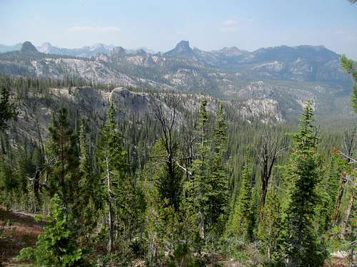
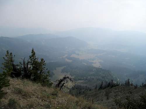
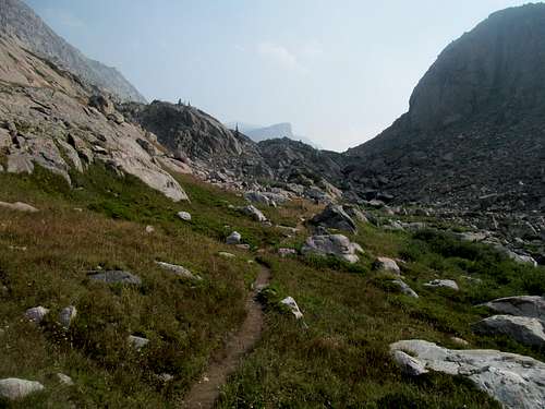
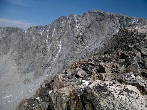
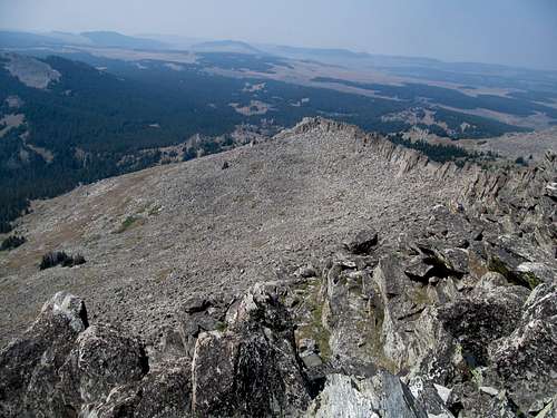
Views up to this point would be a challenge, even on a crystal clear day, due the fact that you never leave the trees. Past the junction towards Fishfin the trail takes a hard right and you embark down the big switchback beneath the shadow of three sharp sawtooth like gendarmes across the drainage. In the distance, those first views of the distinctly plain shaped McGuire (from this angle, at least, as it should be noted how steep the peak is from the north and east) reminded you how much further you had to go.
You descend a fair amount on the big switchback but it’s all good and gentle. It might have been possible to cut it, as Greg referenced describing the route to me, but focused as I was on leg muscle preservation on a long 21 mile day, keeping my quads fresh via a smooth trail reigned paramount over saving half a mile or so whilst wearing out my legs descending possibly loose boulders.
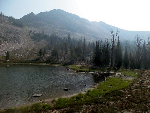
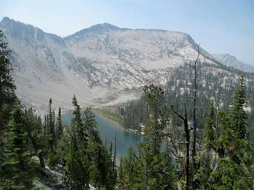
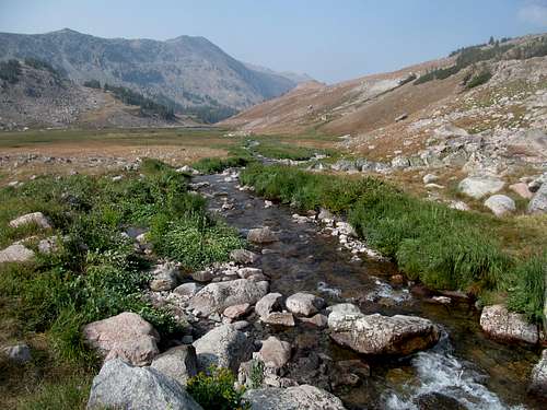
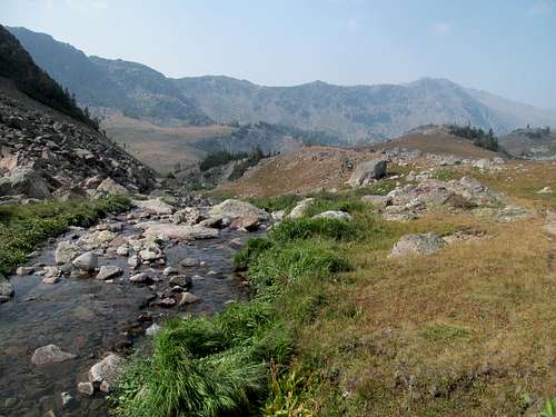
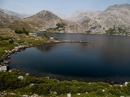
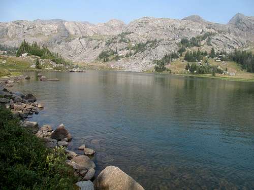
A few more switchbacks and downclimbs brought me as close up as I got to actual water during the trailed approach: Birdbill Lake. I strolled over and took a few pictures of the cliffs above it through the mid morning sun as nearby backpackers and campers awoke and enjoyed their morning coffee. They were the first people I had seen since embarking, and I would have no further company until I had already hit the summit and returned back to the trail.
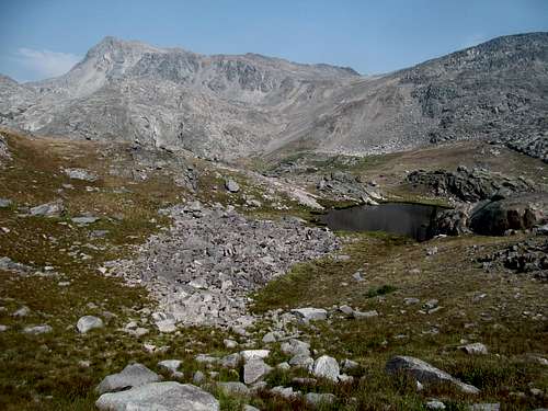
From here I ascended one last ridge to the high saddle between the Birdbill and Airplane Lake drainages, leaving the trail before I lost elevation along with it. From here I tried to keep it level for the most part to try and reach the unnamed tarn below McGuire at 9,150 feet. The off trail traverse, about a mile long, was a bit tiresome, especially seeing how far I had gotten and how close the peak was at this point.
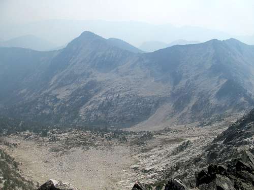
There was little serious bushwhacking for the most part, though you do cross a few small drainages. I ascended a hundred feet or so up one and scrambled up some granite ledges besides another, providing myself with a cool perch to salvage what views I could get of Aggipah across the other side of Ship Island Lake.
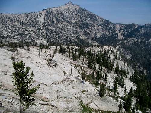
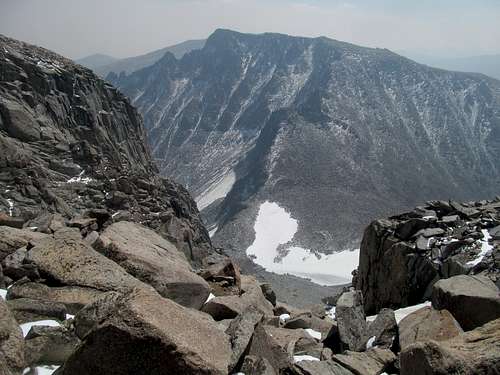
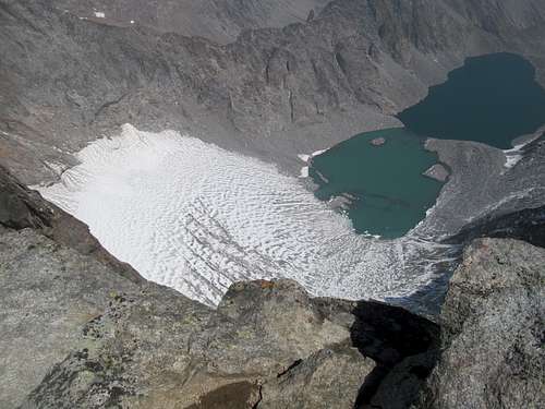
Several smooth granite slabs allowed for good aesthetic framing of McGuire and provided me the red carpet to the unnamed tarn; I was mostly home free at this point, but still had the last thousand feet to climb on reputedly uneven boulders.
The tarn sits directly below the saddle between McGuire and a lower subpeak to the southwest, and I contoured directly towards the summit from the lake to hit the southeast ridge a few hundred feet or so above the saddle.
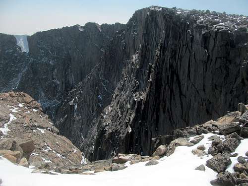
Having read accounts of how loose the south face proper of McGuire could be, I aimed to stay on the ridge all the way to the summit, and it was pretty basic: fairly tiresome, with a typs loose climbers trail at spots and endless spots where you see the top of ridge but know better to treat any illusions of topping out as merely illusions.
Hope kept me going; the air above seemed a bit clearer than the air below, and I wondered, just wondered, if whether beyond all realistic, credible and logical reason staring me right the face, if I could reach the summit, perhaps climb above all the haze, all the views would magically appear.
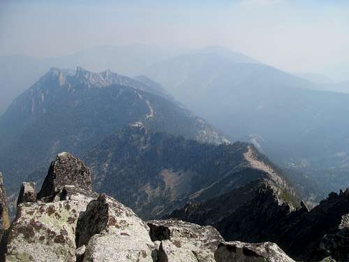
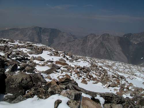
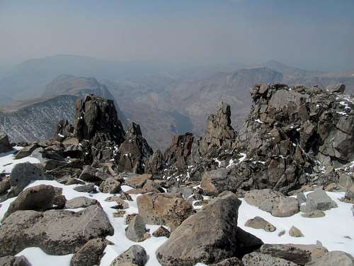
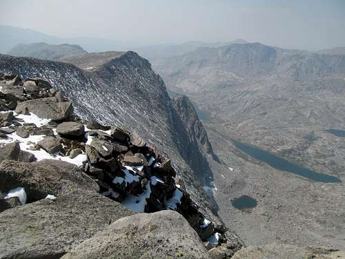
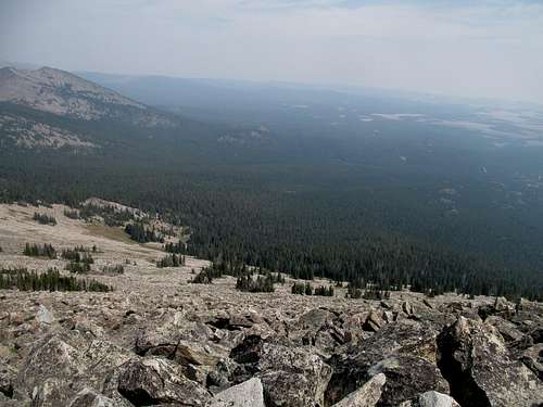
Nope, and as mentioned above, the summit left everything to the imagination. No views of the Salmon, no views further deep into the Frank, no views of Stripe and the Clearwaters, much less the Bitterroots, Lemhi’s, etc. Fucking a boatload of shit and nothings.
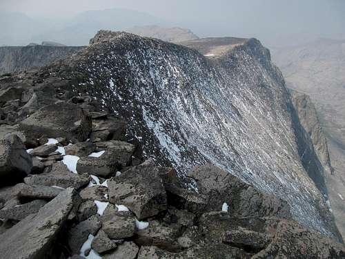
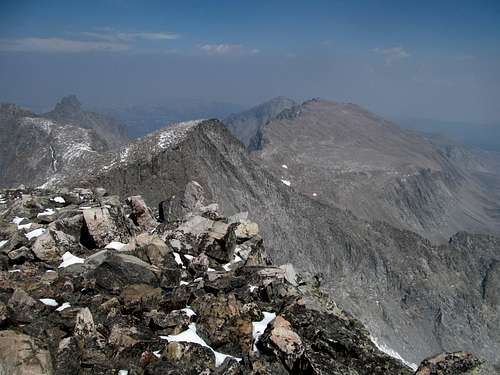
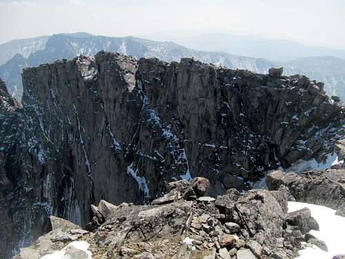
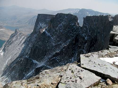
I wandered around the summit and down the northwest ridge a bit, checking out the immediate drainages, the immensity of McGuire’s sheer north face, and some remnants of ice. Then, back down the ridge, a mostly basic descent through mostly stable boulders back to the tarn.
I unsuccessfully fought the urge to descend too quickly on the traverse back to the trail, forcing myself to regain bits and pieces of elevation to counteract the effect.
Using my GPS I managed to hit the trail right around the saddle, avoiding a minor switchback further down but probably not the one Greg referred to.
The rest of the journey back was an exercise in rote and repetition: descend, ascend, descend, ascend, et all.
I tried my best to recite the descents I counted on the way to McGuire and match them in my memory to my present situation now, with some degrees of success. For the most parts though the reascents were short and gentle enough not to be all that painful.
I ran into a forest ranger trekking into the wilderness after returning to the top of the big switchback and talked to her for a bit. She continued on into the wild and likely had a busy few days ahead of her, which I’ll address in the postscript.
The air was muggier yet a bit clearer in the early afternoon, most of the haze having risen upwards to do their maximum damage on any poor schmucks stuck on a high summit as I was an hour or two ago.
On one of the many open sandy traverses I bumped into the father and son duo I had encountered the previous night. They had gotten off to a late start but backpacking in were obviously in no hurry themselves, though they were a bit surprised that I was already on my way back from McGuire. I wished them good luck on their trip, none of us knowing that they were in for the trip of a lifetime, which again, I’ll address in the postscript.
I realized that I had lost track of the reascent count, probably counting an extra upwards section that I didn’t notice or deign to tally on my way in. The length of the hike and the constant up and downs don’t really get to you until the very end, with a steep huff to gain the last junction between the horse and human trails.
From here the last mile back down to the trailhead seemed to last forever. I made it down having spent around 9 hours away from the trailhead. The campground hosts were surprised to see me so soon too, and I spent maybe an hour chatting with them and learning about their backgrounds after I had dismounted my weary hiking boots, more than eager to return civilization and the land of cell phone service. The wonderment of the Bighorn Crags served as a temporary balm to my viewless day, and the rage that would soon consume me only built itself up on my drive out as I logically assessed all the distant peaks, ridges and canyons I couldn’t see from McGuire, and Taylor the day before. Driving by the approach road for Taylor’s southern trailhead on my way out to Challis only reinforced the salt in the wounds, and I realized that I would likely have to plan for repeats on both, or at the very least a repeat of Taylor and a palatable alternative in the Crags that would offer similar views.
I stopped in Challis wanting to check out a brewery in town but it was closed. Exhausted, I trucked my way all the way to Idaho Falls, skipping what would have been a delicious meal at Pickles in Arco. All I wanted to do in town was to lick my wounds, pick up some local pub grub, and catch up on all the internets I had missed the last two days. Alas, I was shit outta luck, cause as much as they tout IF as a major city, fucking everything was closed by the time I checked in, showered, dressed, and left my motel near 10. Well, everything except for the fast food; I drove from bar to bar hoping to get a drink and support my local mom and pop watering holes, but the kitchens were closed for every single one until I made it to Buffalo Wild Wings. Sorely disappointed in the city of Idaho Falls, I nursed my sorrows in good beer and mediocre food as I read up on Barstool blogs from the prior two days.
Postscript: A father and son climbing duo had gotten in trouble near Ship Island Lake the day before, the former seriously injuring himself on a fall. The son made his way out the next day, the day of my climb, and eventually bumped into the father and son duo I had chatted with and on the trail. They would eventually notify rangers, presumably the young lady I bumped into on my way back to McGuire, and they all got search and rescue and thankfully everyone made it out safely.
Crags Accident News Link
Not so High & Leidy - August 19th, 2015
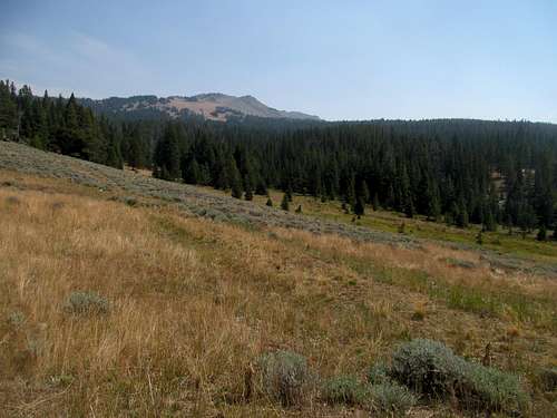
Wednesday brought more smog, a later wakeup, and a more leisurely agenda as I drove down the once familiar US-26 past the Palisade Reservoir, the Swan Valley and below a portentous Snake River Range that had already bitten me with awful luck and timing on haze, visibility, and/or long and tortuous routes in years past. I drove into Jackson Hole with the idea to play basic bitch there for the first time, stopping by the Snake River Brewery and drinking a sampler flight mere minutes past its opening time like the degenerate that I was. The beer was alright but the overpriced resort prices were not what I was used to after weeks of traversing off the beaten path towns like Libby, Bonners Ferry and Ponderay. I continued north into Grand Teton National Park and felt, despite my best efforts, the awe befitting these mighty behemoths even though they hid as best they could behind the thick veneer of burnt smog and debris. At least I saw blue sky when I stopped by the visitor center to do some requisite recycling, but by the time I drove up the park road to Signal Mountain the grey had overwhelmed the valley.
From there I proceeded to Moran Junction and east into the Leidy Highlands, where I had two potential targets: Mt. Leidy and Grouse Mountain. Grouse, the higher one, would make more sense for the day as it’s deeper within the Leidy Mountains and your main views would be of neighboring hills still discernible through the haze. I found the access road (FR 30100 on topos) gated, however, and it was too late in the day to mount a lengthier ascent, so I backtracked and proceeded west towards Leidy Lake and a peak whose merit depended way too much on awestriking views not realistic this day (month).
I drove past a lone fisherman at Leidy Lake and, considering the late hour, continued up the 4WD drive road to its end at a saddle overlooking the tetons, were they visible. Bob’s SP page says a passenger car could cautiously make this section of the road, and as of summer 2015, I’d say I’d mostly agree as long as they were uber careful…for my 4Runner though it was a breeze.
I expected Leidy to be a breeze, especially having shaved off a mile or so of dirt road walking.
My head swirled with different options as I ascended the steep climbers trail, but more and more it settled on the prospect of Cloud Peak the following day. The haze had beat me eastwards to Wyoming, but forest service webcams and a call to their offices indicated that Cloud was still in the clear, at least for today. My other options would have been sticking around the area, perhaps staying in Dubois, and getting Breccia Peak and then Ferris or Laramie on my way back east, but the cloudy conditions drove me further and further mentally towards Cloud.
And the higher I climbed, up upon the steep dirt gully the trail had devolved to the last few hundred, the more rage I felt in my heart.
It was apparently that I would not be seeing the Tetons, or much of anything, for the summit. No grand views to Yellowstone, the Gros Ventres, the heretofore unknown to me Absarokas, not even a view of Grouse a few miles east…just the surrounding ridges, meadows below, and haze, so much motherfucking goddamn haze.
I prowled the summit, rage building with every second compounded with thoughts of the last few days on McGuire, Taylor, Piquett…and as I headed down the steep trail I took care to watch my knees as my focus was sharpening ever more and more on Cloud Peak.
It wasn’t just that I hoped (that dirty cu** of a word again) that conditions would be better on Cloud, but I eyed the summit purely out of the rage inspired from my week. Fuck the west, fuck this vacation, fuck this haze…fuck the fact that it wasted my entire vacation, nay year. I’d get my revenge, I’d get my return on investment, I’d salvage something worthwhile from this useless trip…I’d fucking knock Cloud off the list, if only out of pure spite for events I could not control.
So I drove like a madman possessed or rather, as the madman possessed I was, leaving a trail of dust past Leidy Lake back to the highway, through the Absarokas though still noting despite everything the scenic qualities of its sheer highway-side breccia cliffs, and through the town of Dubois which I found unexpectedly small and rustic. Past Dubois the landscape became bleaker but yet a bit clearer, and I struggled to push down hopeful thoughts that my day on Cloud would be optically sound. I saw signs for casinos, hotels and bars down the highway towards Lander and Riverton but resisted the temptation, taking the smaller county roads on a straight shot towards Shoshoni. I continued my tour d'road-rage north through Thermopolis, passing slower cars and trucks in a trance like state. The sun set past Thermopolis and I reached the surprisingly lively seeming town of Worland, where I stocked up on dinner/breakfast with a bunch of burritos at either a Taco John’s or Taco Time (I always get them confused), and continued east in the dark, past Tensleep and up into the mountains where I hoped for a chill in the air that would allow my car to cool down quickfast. I found a dirt road pullout maybe 10-20 miles from the Tensleep turnoff and, 4-5 hours past leaving Leidy, slept a furious sleep anticipating the big day that could make (or at least make up for a little bit) or break my vacation/year/life.
Cloud out of Spite - August 20th, 2015
I pressed snooze only a few times on the alarm and was up and driving a bit past sunrise. The trailhead was chock full of cars but empty of humans when I arrived, indicating that, similar to the Bighorn Crags, most of its traffic came from backpackers. It was chilly enough still for me to don gloves, and I left the trailhead in an angry huff.
The core of my nerves were on the fact that this would be my second 20 mile plus day in three days…something I’ve never done before. I hoped my leg muscles would hold up for the day, but for once fears of the route and possible mishaps took a backburner to my enthusiasm to tackle what seemed like a fun and aesthetically pleasing, what with the giant ridge ramp and all, route. There was scrambling but seemingly nothing difficult, which meant I would get all of the glory and none of the fear. It would be a long day, and this low under treeline I could not tell whether or not the haze had finally caught up with me, but I swore to myself that I would be happy as long as I could see most of the lakes immediately visible en route to and around the peak.
The first few miles or so was a blur as the entire forest served merely as the brick by brick backdrop for the tunnel vision connecting my focus and the peak. I barely noticed the morning frost misting up over small meadows, a creek crossing or two, a few frozen over muddy sections along the trail, and mostly just a flat fast walk as the range gradually revealed itself to me.
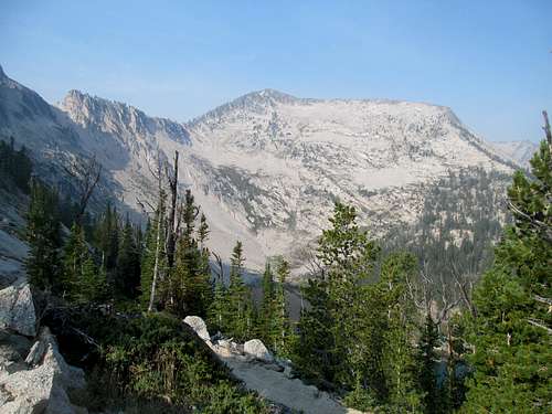
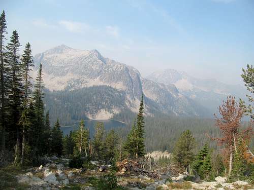
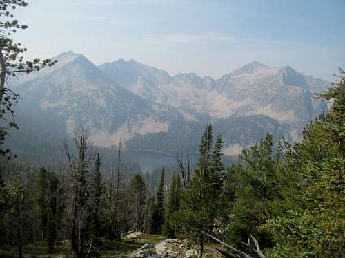
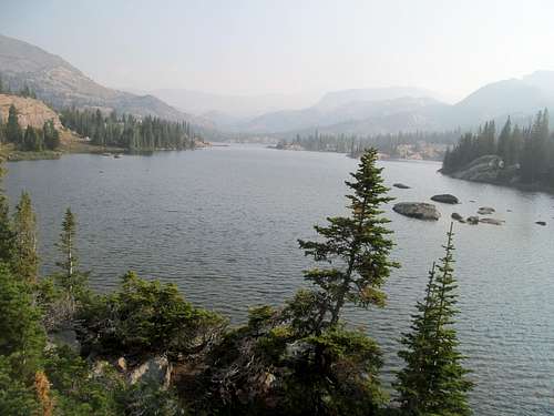
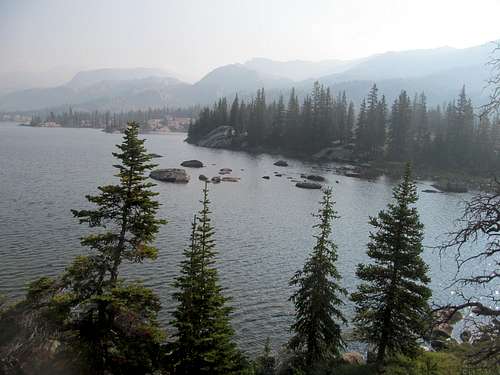
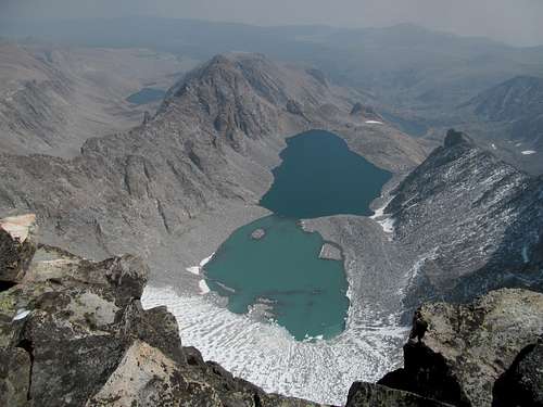
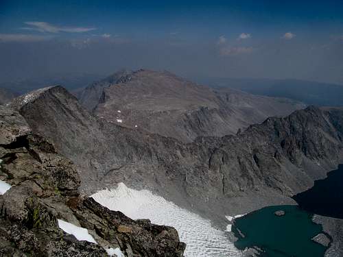
Nearby bare summits caught my attention here and there, but it was not until the trail reached the clearing before Lake Helen that I first realized the true grandeur of my setting. Ridge by ridge the mountains rose past each other, with the Cloud the highest bump impossibly far away. The haze, present as it was, for now served only to enhance the colors I was seeing, making the lake before me mystical in appearance. And the lake, oh the fucking lake…it was one of the most beautiful sights I had ever seen. Normally mountain lakes you see are small…they may be magical, wonderful, sublime in shape, scope, color, setting, etc, but they are usually tiny; the two amazing lakes I had already encountered this trip, Upper Rumble below Holland and Leigh Lake below Snowshoe, were larger than usual but still they seem dwarfed by Lake Helen. Its waves emanating from afar made the lake seem as expansive as any of the Great Lakes, or even a bay on the Maine Coast. The perfectly isosceles shaped pine trees dotting the shore enhanced even more the setting, making it seem like a tableau plucked out of northern New England or from the shores of Lake Superior that I had traversed eons ago as a child. The shape of this lake contoured perfectly here among the mountains, large enough to seem grand yet cozy enough to not appear endless.
With this moment my resentment and anger faded for the day, and every minute I spent the rest of the time in the Bighorns I counted as a transcendent moment, unforgettable and worthy of my time off despite the haze. I continued on to Marion Lake, smaller but just as splendid with its tendrils reaching into every crevice in the valley. I was already exhausting my camera trying to get every angle of this picturesque scene, with Cloud the penultimate sight gliding above all like the focal point of a painting, with me and everything around me a mere backdrop.
To my left were bare slopes that turned into minor peaks. To my right were pretty distinct glacier cut valleys forming boundaries between legitimate and major peaks of the Bighorn Range. As for myself, the scenery was beginning to wear on me as I ascended up and up through the tundra, impatient now to see Mistymoon Lake, the unofficial midway point of the approach (though less so in the sense that most of the elevation gain and practically most of the elevation loss of the route lay between here and Cloud).
And Mistymoon Lake was pretty but, with the lack of trees and vegetation at this juncture, easily the least scenic lake to grace the approach route. But now, with the glitz and glamour portion of the route out of the way, I looked forward to actually climbing the damn mountain. The SW ramp/ridge of Cloud looked so close but was an illusion, as past Mistymoon the trail dredged, curved and switchbacked up and around the barren tundra before curving left and down into the Paint Rock Creek drainage.
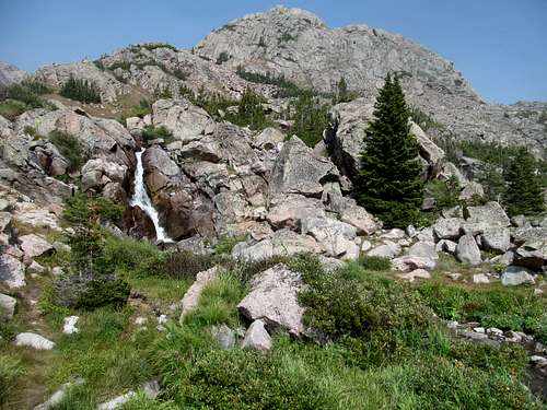
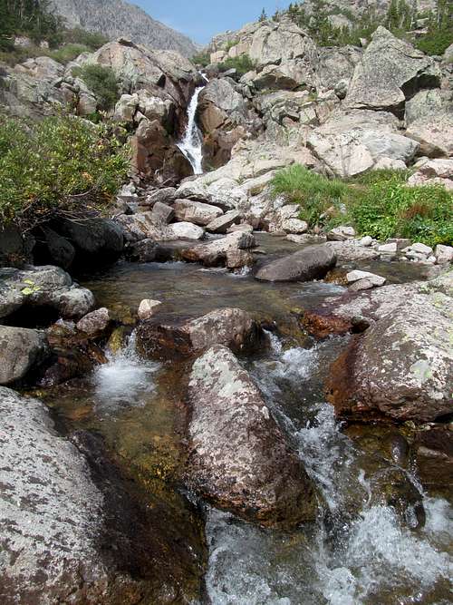
Here is where you must leave the trail, descend several hundred feet, and start anew and up. A faint climber’s trail departed right sharply down in the mildly brushy drainage, and I found my way to the falls marking the milestone of the route. Here I prepped and buckled my legs, knowing that the climbing was about to begin for the first time today.
I followed some cairns and made the first initial scrambles up above the very chill and scenic falls to the plateau above, where a rather nice trail reestablished itself as it continued below the massive SW ridge of Cloud to the left, meandering upwards through several slight meadows aiming for a cleft to gain the ridge north of where the ravine forms between Cloud and Bomber Mountain to the right (south).
There are two minor variations to reach the summit of Cloud from here. As you climb up and see the trail fading and giving way to more interspersed cairns, you see a broad U shaped gully between the SW ridge proper to the left, and a small ridge to the right rising over the Cloud/Bomber drainage. Both converge at the top of the ridge before it narrows into its namesake ramp and hits the summit, and both are very viable routes.
I personally however am a bit partial to the way I went, which was up on the higher ridge to the right, and down through the lower gully; the ridge route provided some incrementally more challenging and fun scrambling as you follow cairn after occasional cairn up great stepping stone ledges whilst gaining more elevation sooner than the lower route, whose pile of looser and smaller rocks made what I guessed would be a good downhill slop.
As I traversed this upper ridge I saw a couple appear to be making pretty fast progress in the gully below, and figured I may or may not catch up with them further up as my ridge joined the top of the gully to converge on Cloud, still hiding from my vantage point somewhere behind this endless talus ridge.
When I saw it I saw that it was big (that’s what she said). But truly, the enormity of the peak was something that the pictures I’ve seen of it don’t properly convey. The tendrils of haze I had cursed the past week now wisping around in the air enhanced the mystical nature of the peak (despite detracting from views afar, especially of nearby lakes) and, having never climbed Longs Peak in Colorado, I felt that it nevertheless reminded me of Longs.
I had caught up with the couple near the top of the gully where it met my ascent ridge and talked with them a bit, finding out that they had camped further down the drainage the previous night. I had thought that they were going faster than me, but perhaps the terrain up here was tougher because while I tried to keep the same pace as them for conversation, I found myself advancing ever further, so I bade them good luck and climbed up through the ramp-like portion of the route, which was perhaps the most aesthetically pleasing part of the approach, especially when photographed from above.
And as much as Cloud the real thing seemed so much more than it appeared in pictures, so it did in my impressions of how far I had yet to go. Whilst enjoying some high lakes to my left (north), I figured I was only three or four hundred feet or so below the summit, and that it would take a mere few minutes before I was on top. As the boulders got larger and larger with each foot of elevation gained I found either the landscape expanding with each step or my own pace slowing down. It didn’t help that I took a few detours, knowing the flat tabletop above me, to venture towards the edge of difference precipices near me to try and get a view and a pic. First were those upper Cloud Peak lakes to the left, and then as I criss crossed right after the ramp ended I ventured towards where unexpected cliffs led directly into the Cloud/Bomber drainage; I was first drawn to the edge by views of a small lake near a saddle below, but noticed once I was there I saw impressive granite cliffs and sheer ice sheets barreling vertically into the abyss below. Being someone who’s quite afraid of heights I found myself unnerved by the mostly harmless exposure, mercifully weaving back towards the center of the ridge but not before snapping a few pics below; the lake I was looking for however never truly materialized to mine own satisfaction.
I would’ve guessed that the summit was only a few minutes from here but as a small but slushy layer of recent snow made things a bit more different. I wandered around the sloped plateau for what seemed like forever, the summit always just out of sight amidst the now garage size boulders, which elevated the importance of locating the elusive especially with the trail often hidden below the slushy pow. With the context of the 20 mile day two days prior, my pace these last few hundred feet slowed considerably with each high hop of a boulder an untenable chore.
I wandered left from the edge of the ridge, then right again, then left again and so forth trying to find the past least resistance, ever wary of the exposure lying inevitably at either edge of the rather broad ridge (note: don’t let me scare you about this route…you’d only find it scary if you were an extreme coward of exposure like I). Eventually I saw the ridge flatten out and a large cairn posing as the summit. I made it, took a quick rest, glanced around my surroundings, and ended up doing a loop around the flat plateau to get the views: first north, descending about a hundred feet or so to get a better glimpse of Black Tooth to the north, then to the northeast edge where I caught my first glimpse of the peak’s namesake glacier and sublimely coloured lakes.
Again, the sheer exposure overwhelmed me with a sense of awe and fear with each edge of the summit plateau ending in a precipitous drop thousands of feet down in every oblique angle imaginable. The rock formations, as a result, were gnarly as fuck, with bricks, windows, notches and boulders comprising every shape and cut possible under the sun.
I made my whey to the southeast corner of the plateau, where the views of the Glacier and Sapphire lakes below differed so dramatically from the last despite the fact that I had only traveled a few hundred yards from my last vantage point. I couldn’t take my eyes off those lakes and took probably a gazillion pictures of them (as you can tell from this TR), examining with a rare clear eyed fervor each shade of color in the lake and each cut and angle of ice I could discern from the summit.
Near here was a cairn marking what was probably the actual highpoint as indicated by both my GPS as well as the other cairn on the opposite western end of the plateau looked obviously lower. I had my celebratory granola bar here and enjoyed my time here at this truly special spot in time and space, my palpitating fear and awe at the tableau notwithstanding. The day was as hazy as ever, but not even the haze was enough to take away from my experience here as, even though my views of far away peaks and even Lakes Helen and Marion ranged from limited to nonexistent, my immediate surroundings of the place packed more than enough of a punch to salvage what was left of my trip and by extension, summah.
My boots were wet and my feet were pretty cold from walking around the summit snow without much effort or elevation gain, so I was a bit relieved to get going on my descent. I encountered the couple near the narrow portion of the ramp and wished them luck on their trip, enjoying one last glimpse of the three alpine lakes to the north before leaving the horizon and welcoming myself back and fully immersing into the ridge and choosing this time to descend the middle gully.
The terrain looked like scree from afar but weren’t; rather, I’d describe it as hard-packed pebbles and talus that, though not as easy a descent as scree, was still far from unpleasant.
It had its own surprises too, such as the constant sound of invisible streams flowing under the rocks, occasionally making a delightful cameo amidst the rubble. Keeping me constant company were these small stream formed ponds formed at a flat spot at the bottom of the gully, glimmering magically in the light of the haze filtered afternoon sun.
They were as scenic in person as they were from afar. From here I bore left to try and rediscover and retrace my original route and surprisingly struggling to do so.
I kept bearing too left or too right, overshooting my original track at times and somehow unable to spot the cairns I had followed on my way up. Nevertheless it was open terrain and nothing too difficult to overcome as long as I could find the exit to the waterfalls it wasn’t a big deal.
This done, I enjoyed a quick snack at the waterfall before descending back down to Paint Rock Creek to start the dreaded uphill. Mentally prepared for the worst, I found the ascent back to the trail not to have been all that taxing, but the ascent along the trail back to the pass separating Paint Rock from the Mistymoon/Tensleep drainage drained whatever pep was left in my step.
I would be seriously delayed the rest of the way back to the trailhead by an expected problem; I had taken too many damn pictures and my camera’s memory chip was out of space!
This was exacerbated by irresistible scenes presented to me at every step, the sun and haze now materializing on each ridge, rock and lake different sublime colors and shadows than I had seen on the way up. I found myself wasting quite a bit of time slow walking or even standing still as I repeatedly squinted at my camera trying to find and delete bad/redundant pictures from earlier in the day.
Mistymoon was still Mistymoon, its cool pebble beach a relaxing balm to a long day immersed in talus, with each view of the range crest to the east resembling more a landscape painting than real life. Marion and Helen Lakes had a special pre-evening glimmer to them as I approached, the haze appearing to mist like an early morning Maine or Minnesota fog.
Somehow the distance between each lake seemed have increased from this morning; the sheer fatigue of the day, the combination of McGuire 2 days ago, the weariness of the muscle killing boulder hopping, and the delays from browsing and deleting those damn pictures all conspired to slow my progress.
The fact that I couldn’t resist taking endless pictures from each lake and stare back at Cloud with now a satisfying sense of accomplished didn’t help my pace either.
By the time I passed some oddly anti-social campers near Lake Helen and returned to easy portion of the trail I was completely drained physically and mentally. Being in such a rush still to get back to my car and civilization, I sadistically denied myself water and food in an effort to make up for lost time. Despite my rush I was still unable to not notice the enchantment of the late evening Bighorn aura; there was something special, even sacred to this range, and as the scenery disappeared in the denser tree cover I smiled inside with an inner, dare I say, spiritual satisfaction that temporarily balmed the rage and pain from the last few days.
But with the trip and my time in the mountains and wilderness pretty much hashtag done I was able to rage in a different way. I wanted to drink, and eat, and drink and eat some more. I drove the curving highway down what seemed to endless meadows and plains down into the actual plains; the town line of Buffalo seemed to never arrive, and when I got there I quickly found and checked into a nice and cheap motel/cabin complex, taking a much needed shower. I felt human afterwards once more, though starving as the few granola bars and banana I subsisted on in the last few hours did nothing to soothe my appetite, so I drove into what turned out to be a pretty bustling downtown to grab dinner and drinks.
I found a small Mexican cantina and made the mistake of ordering a giant burrito without reading the fine print about how spicy it was. It was good, but the spicyness made it tough for me to enjoy (I can’t really handle hot) and I agonized through the entire thing in a haze of sweat and tears. It was huge too, and I had to force myself to finish. Already full as fuck, I walked a few blocks down the street to the small brewery in town and ordered a flight. It was a dark and hipster joint, but what truly hurt me was the fact that most of its beers were of the dark and heavy variety. Having already force fed myself a giant burrito to a stomach already shrunken from the deprivations I had subjected it to today, by the middle of the flight I felt uncomfortably, unhealthily, and painfully full. I subscribe to the philosophy of no food or drink left behind, so I forced myself to Finnish the flight as well. Some plump girl near me seemed to be giving me a friendly look or too but I was feeling so painfully bloated I found myself in no mood for even friendly small talk, so I made my way back to my car and hotel with a minor degree of agony, lying down in some pain and discomfort as I forced myself finally succumb to my sheer exhaustion.
A Farewell to Haze(lton) - August 21th, 2015
I was pretty hashtag indecisive about what I wanted to do on my last non-travel day, wavering between taking off east a day early to check out the Black Hills, possibly do Harney Peak and slash or Wind Cave, or try and get one last western peak in with Hazelton Pyramid, the unofficial highpoint of the unofficial Southern Bighorn Range. As my exhaustion peaked I leaned more towards a relaxing day in the touristy Black Hills, but the magnificence of the range on my way out that evening gave me second thoughts. I calculated the timetables for a Harney/Dakota day and the distance from Buffalo further dissuaded me as it would require an early departure and result in a pretty rushed day whereas a climb of Hazelton would allow me a few extra drinks in town.
Obviously the burritos preempted that, but at least I was able to get to bed early and sleep in a bit the next morning, the fond memories of Cloud helping me make my final decision to fully milk one last day from this wondrous place. I retraced the highway back up into the Bighorns, finding the Hazelton Pyramid trailhead and starting off around 10 or 11 AM.
Much of the area reminded me of Sunset Peak in Montana back in late 2014, from the late season bleach blonde fields to the hoards of near-militant cows to the bareass round talus summits above. I plunged down the short dirt road and diverted into the woods, braving some mild bushwacking and above mild deadfall.
The stats indicated that the highpoint of the supposed Southern Bighorns and a P1K should be a relatively easy day, clocking in around 6 miles round trip and less than 2000 feet gain, should be an easy. Most of the route was off trail though, which wasn’t a big deal, but my legs, mostly recovered from Cloud’s privations but still weary overall from two plus weeks of hiking, felt heavier than usual.
Ambivalent about the deadfall, I was eager to emerge above treeline. I traversed through several open areas, pretty and colorful in its own dry way; the haze blocked any faraway views but I was in a mild mood and didn’t mind all that much. Not wanting much in distance I opted for the red variation on the SP route description, which translated in real life terms, meant aiming for a sharp rocky outcrop that stood out as the highest item in sight at the end of the final line of meadows leading up to Hazelton’s higher ramparts.
I would need round the right side of this rocky bump; I should have possibly climbed higher whilst traversing towards the bump to pass it above it and to its left but I was lazy, and I avoided traversing further right because the woods looked like more of the painful log dodging. As a result I clambered right along the large, rather unstable blocks of talus to emerge on the other side…nothing too difficult but mildly annoying and possibly ankle sprain inducing.
The route dropped into a rather pleasant gully between the ridge that I had just passed and the WSE ridge of Hazelton proper, basically the same grassy meadows from below but chocked with enough talus of varying shades to give it a more alpine look. It was a rather muggy day but the occasional breeze in one of the many open areas of the route made the sweat inducing parts of the ascent mostly pleasant. I followed the center of the gully to top out along Hazelton’s NW ridge, where views yield north and the summit rose only a few hundred feet of scrambling along irregular boulders away.
I savored what would likely be my last time above 10,000 feet and in alpine terrain for the next year, reflecting on what had been something of a failure of a trip.
While my day on Cloud Peak would indeed unforgettable, I was already planning and dreading the year’s wait before I’d get a crack at getting views out of McGuire and the Bighorn Crags, and when or if I’d need to return to either Piquett, Scotchman, Taylor and Leidy or nearby peaks to get the views stolen from me by the haze.
Oddly unfazed by the immediate haze, I lingered around the summit for a few extra minutes before descending down.
A long denouement starting from the summit of Hazelton took me back home.
I enjoyed these last few fleeting views and looked forward to getting back to the car, especially when hopping over fallen trees in the forested sections.
I drove through a downtown Buffalo filled with hub-bub, probably for some weekend festival. I would have loved to stayed to check it out but at the same time the west had overstayed its welcome in my head, and having not seen a real city for over half a month I was eager to return to the comforts of northeastern civilization (or even what passed for it in the Midwest along the way).
Pitstops in Laramie, where the haze accompanied me and ruined any views I would’ve had of its namesake range, then the backroads through southeast Wyoming into the twin towns of Scottsbluff and Gering Nebraska. I grabbed a quiet drink and burger on my last night out, and woke early to do a quick drive up to to scope out Scottsbluff National Monument, then continued to follow the back roads past Chimney Rock, taking a requisite picture before eventually making my way back to I-80. Nebraska was a particularly fertile state for those around me as I found out and celebrated the pregnancies of two of my friends driving from one end to the other.
An obscure motel by the state line housed me in Illinois that night, and the only excitement left for the trip were a few storms before Fort Wayne on a drive through the backroads of Indiana and racing through I-80 in Pennsylvania to try and get back to my apartment before 2 AM on the morning of the Monday I was due to return to work. I checked into the office the same way I had since starting the job in February: counting down the months and days before I’d get the opportunity to return west for another crack at McGuire, though this time honed and focused by endless sleepless nights overwhelmed by feelings of rage and thoughts of revenge.


Comments
Post a Comment