
|
|
Route |
|---|---|
|
|
38.46330°N / 109.2332°W |
|
|
Scramble or snow climb depending on the season |
|
|
Most of a day |
|
|
Class 2+ in summer, snow climb in winter |
|
|
Getting There
From the Burger King in Moab, drive SW along Hwy 191 7.4 miles to a junction with the La Sal Loop Road. Drive up the La Sal Loop road for 12 miles, then take a dirt road on the right towards Geyser Pass. In winter, the road is plowed to a plowed parking lot just before the junction with the Gold Basin Road. In summer the road is open all the way to Geyser Pass.
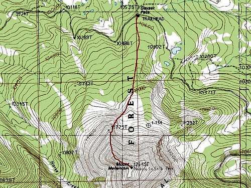 Geyser Pass Route to the summit of Mellenthin.
Route Description
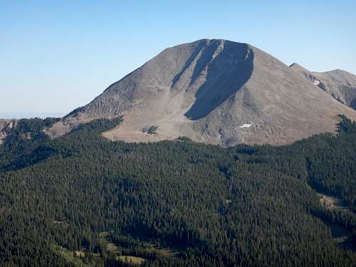
This is the easiest and shortest route to Menenthin in summer or winter. There is not a constructed trail, so bring a map and expect to do some routefinding. In winter, ski or snowshoe up the road to Geyser Pass. You can drive to this point in summer (June-September and into October). Once at Geyser Pass, head up the gentle slopes and minor ridge directly to the south. In summer, there is a faint trail on the northwest shoulder of Mellenthin. One can aim for the northwest shoulder once above treeline. It's fairly easy travel until you reach timberline, but expect to routefind around trees and logs. Once timberline is reached, scale the fairly steep north face while using switchbacks to avoid erosion. After climbing 2,000 feet from the pass, you will find yourself at the summit. Enjoy the view; it's beautiful at any time of year. You can also descend the Gold Basin Route for a loop trip.
Essential Gear
Ice axe, crampons, snowshoes or skiis in winter.
In summer take a good pair of boots.