
|
|
Route |
|---|---|
|
|
38.46330°N / 109.2332°W |
|
|
Basic Snow ~ Hike |
|
|
Most of a day |
|
|
Class 2 |
|
|
Getting There
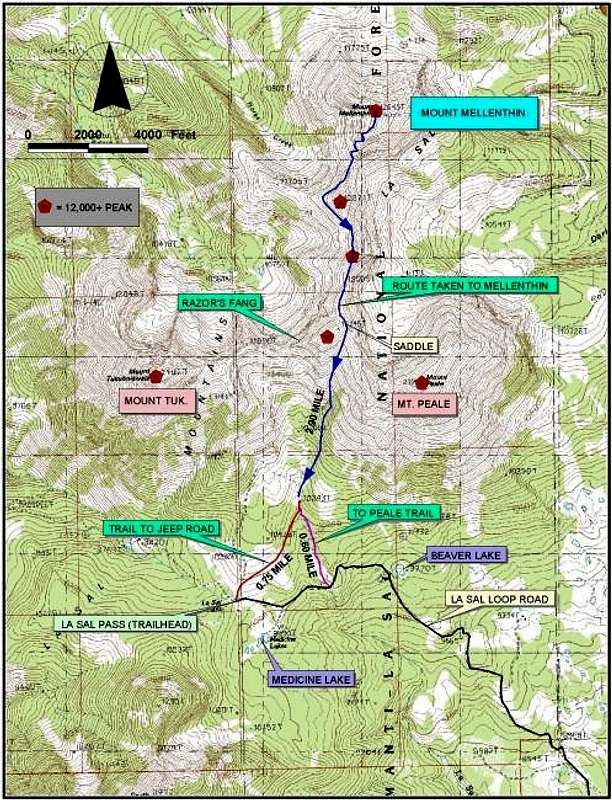
From Moab, UT drive 21.8 miles south on Utah highway 191 to the junction of Utah Highway 46 at La Sal Junction. Turn east (left) onto Utah 46, pass through the small town of La Sal, and drive 12.8 miles to the signed, gravel road stating, "La Sal Pass." Turn left onto this graded gravel road. Drive 2 miles and turn left (west) onto the La Sal Pass Road at a marked junction. Drive another 7.4 miles to La Sal Pass at 10,125 feet. Most 2WD vehictes will make it to this point, however, in late spring there is a creek crossing that may present a challenge during high run-off periods.
There are a couple of possible starting points for Mount Mellenthin (and Peale). One is to drive all the way to La Sal Pass near Medicine Lake and park. The other, is to park at the drainage just past the turnoff to Beaver Lake. Both options are viable and the difference in distance is negligable. Alternatively, La Sal Pass can be approached from the west side, but 4WD and high clearance is required.
Route Description
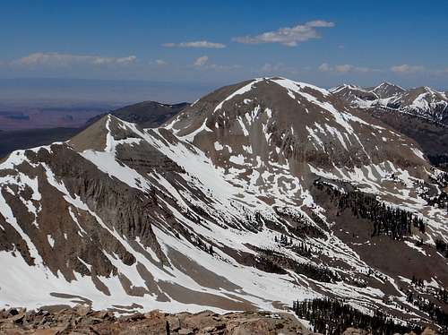
Approximately 3.5 miles one way with a total of 3,200’ of elevation gain, this includes all 12,000 peaks that are along the ridge to Mellenthin. There is also elevation gain while returning.
Personally, I find the route more enjoyable in snow, so if you know how to use an ice axe, this is a wonderful route in late May or early June.
First get a good bead on the location of Peale and the small valley to the west of Peale. From the La Sal pass (elevation 10,100±)(see map) head in a northeasterly direction through the field and continuing on into the trees until you hit a two-track road coming from La Sal Pass road. This road is also another option instead of starting at the La Sal Pass. At the end of the road; on a small knoll, is a good spot to camp. From the end of the road start heading towards the small gully, if confused make your way to the edge of the rocks and follow the tree line northerly to the base of the couloir.
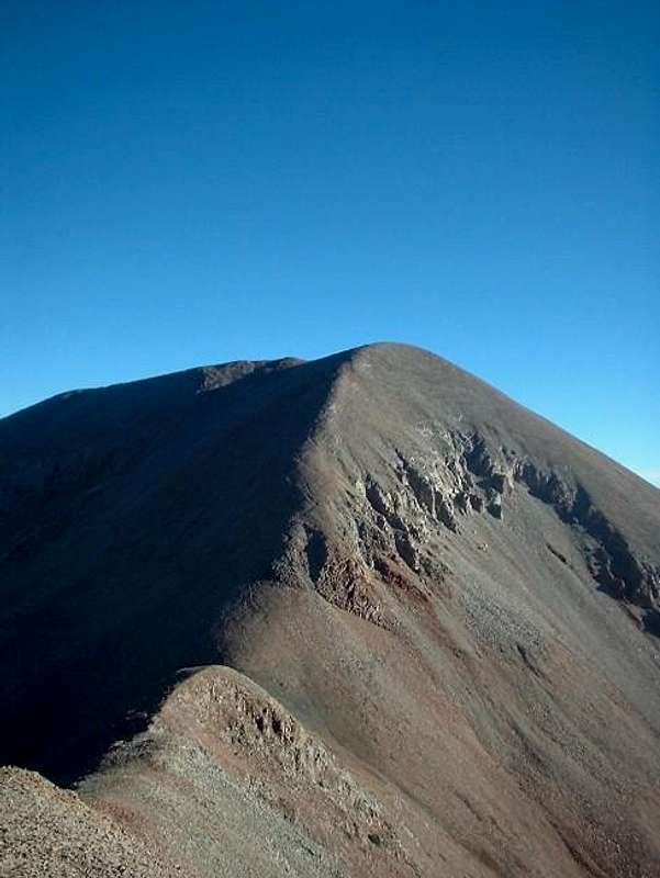
Keep heading in the same direction up the couloir (in starts getting steeper) to the saddle. At this point you are over 12,000 and Mellenthin has come into view to your North. Start following the ridge line north, if hitting all the 12,000’ peaks is your goal stay on the ridge and you will bag two on your way to Mellenthin. If this isn’t your goal the second peak “Laurel Peak “ can be detoured. Stay to your left or West of the peak and contour around; you will eventually hit a good trail that will lead you to the saddle before the ascent to Mellenthin. The last ascent is steep and has plenty of talus. Continue until hitting the plateau on top then continue the trek over to the summit
Remember to get a good visual before approaching Laurel Peak, the trail fades for a while and if you attempt to ascend instead of contouring, remember the talus is like a deck of cards on a hill.
Essential Gear
An ice axe (and often crampons) are needed if the couloir is filled with snow.