
|
|
Mountain/Rock |
|---|---|
|
|
54.48400°N / 3.165°W |
|
|
Hiking, Sport Climbing, Scrambling |
|
|
Spring, Summer, Fall, Winter |
|
|
2569 ft / 783 m |
|
|
Overview
Glaramara is a fell in the Borrowdale area in the Lake District. It forms the northern end of a long, wide, undulating ridge. To the SSW, the ridge drops to just over 660m at High House Tarn, a little more than a kilometer away, before rising again to Allen Crags (785m) another kilometer further.Arguably, the summit views to the north are the best. On a good day, you can see Derwent Water, Keswick and Skiddaw, the fourth highest summit in the Lake District.
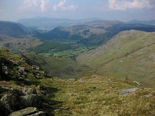
View to the north on a somewhat hazy day
At 783m, by elevation Glaramara is the 45th of the 214 Wainwrights, so named after Alfred Wainwright who wrote extensively about the Lake District.
The nearest trailhead is Seathwaite Farm, at around 130m. With only 650m to go to the summit, most hikers combine it with one or more other fells, especially Allen Crags.
On the northern slopes of Glaramara, 1km from the summit, Raven Crag offers a number of rock climbing routes, the best known being Corvus.
Getting There
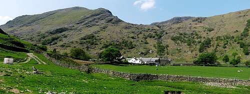
Seathwaite Farm
By Car
From Keswick, the largest village in the north of the Lake District, take road B5289, past Rosthwaite to Seatoller. Turn left to Seathwaite. If you use a route planner, note that there is another, larger Seathwaite in the southwestern part of the Lake District; make sure you go to the right one, very close to Seatoller. Alternatively, you can park in Seatoller or Rosthwaite.
By Public Transport
From Keswick, bus 78 serves Rosthwaite and Seatoller. From Seatoller it's 2km to Seathwaite, from Rosthwaite 4km (you can take the public footpath from Strands Bridge). Unfortunately, the first bus doesn't go very early and the last one isn't very late, so if you plan to do more than Glaramara and Allen Crags, you'll have to be fast or spend more than a day in the area.
Routes
Interactive Open Source map of Glaramara
Glaramara (left) and Seathwaite Fell from the trailhead at Seathwaite Farm. On the slopes of Glaramara, the trees in the gully betray the presence of a little mountain stream, the Hind Gill. That gully is also the direct route to Glaramara.

The Ordnance Survey map shows the direct route from Seathwaite
There are three popular routes to the summit.
- From Seathwaite Farm, the shortest and steepest route is via Hind Gill. With a few hundred meters distance left to go, it joins the route from the north. There is a rock step of about 6 meters in this final section of the route. It's not even a grade I scramble, but be prepared to use your hands. It's never really exposed.
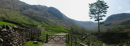
- A little bit longer is the route straight from the north. It starts at Strands Bridge, where the road between Rosthwaite and Seatoller crosses the Derwent River. There are a couple of route variations.
 Public footpath from Strands Bridge
 A short scramble north of Glaramara
 Approaching the summit from the north
- The third route comes from the south, following the wide ridge from Allen Crags. On a clear day, you'll have excellent views all around while walking the ridge. The direct distance between the two summits is just over 2km. Although no scrambling is required, the terrain goes up and down, with a few secondary summits along the way, and you have to go around a couple of tarns. And because you first have to ascend Allen Crags, that makes this the longest route. For a round trip from Seathwaite and using the easiest route up Allen Crags, count on half a day.
A much longer but interesting option is to start with Glaramara, continue to Allen Crags, and then keep going, over Great End and beyond to Scafell Pike, England's highest. There are several ways to get back without having to retrace your steps, for example via Styhead Pass.
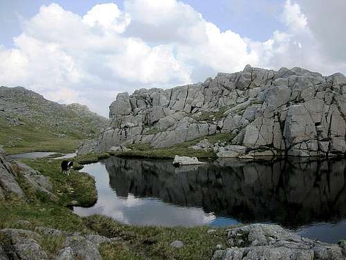
A tarn on the ridge between Allen Crags and Glaramara
Red Tape
Although the Lake District is a National Park, there is no red tape.When to Climb
Don't expect big crowds, but from spring through fall, if the weather is good, there will be a few other people. With snow cover or in poor weather, it can be a lot more serious. This area sees a lot of precipitation!Accommodation
The Lake District gets a lot of visitors and there are many places to stay, in all price ranges. A small selection:- Seathwaite Farm Camping Site
- YHA Borrowdale is just over 3km from Seathwaite Farm.
- Rosthwaite, 4km from Seathwaite, has several hotels and B&B's.
Officially, camping wild is not allowed in England. Unofficially it's fine, provided you stay well away from cultivated lands and leave no trace.
External Links
Keswick Tourist Associaton links to Glaramara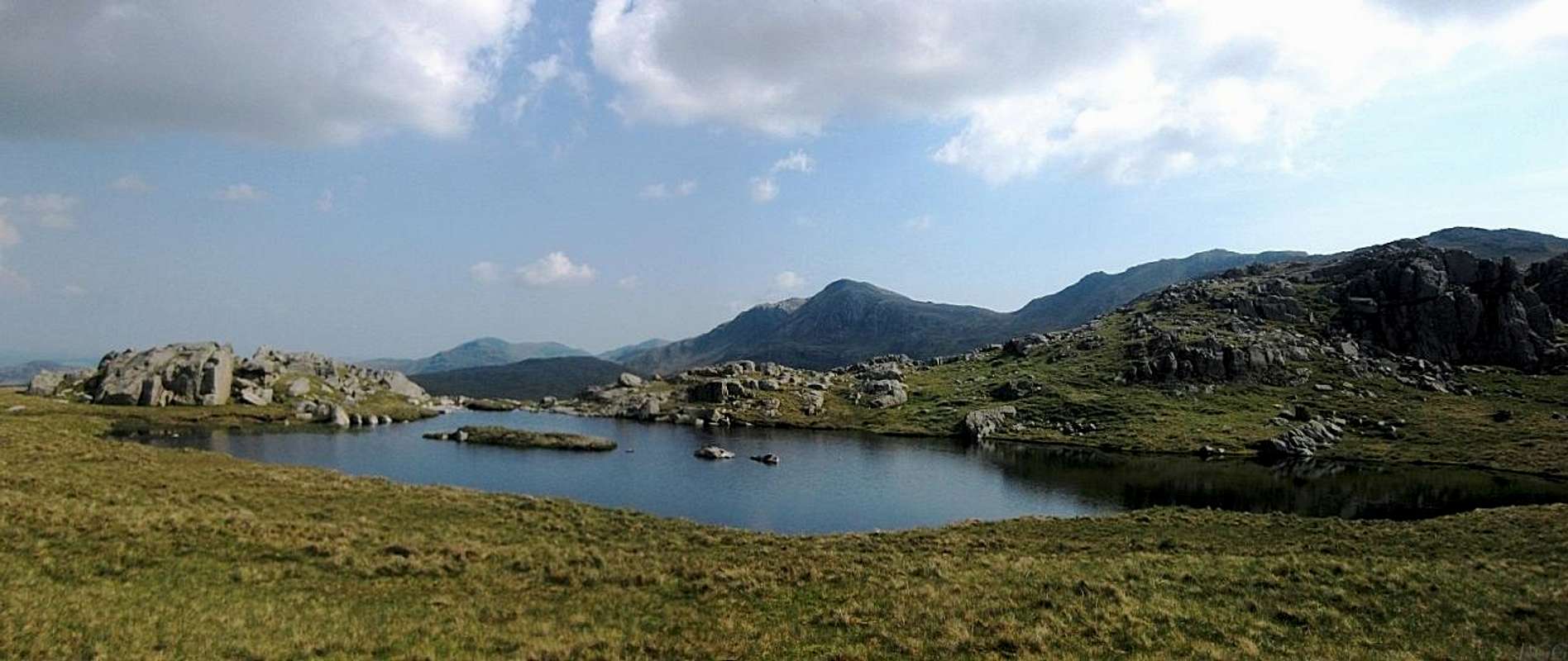 A small tarn on the ridge south of Glaramara